 | Polhov Gradec (Božna) - Polhograjska Grmada (via Setnica)
Polhograjska Grmada is an 898 m high peak located in the heart of the Polhograjski Dolomites. From the summit, where there is a registration box ...
1 h 30 min |
 | Belica - Polhograjska Grmada
Polhograjska Grmada is an 898 m high peak located in the heart of the Polhograjski Dolomites. From the summit, where there is a registration box ...
1 h 30 min |
 | Dvor - Polhograjska Grmada (Dvor - Grmada - Belica)
Polhograjska Grmada is an 898 m high peak located in the heart of the Polhograjski Dolomites. From the summit, where there is a registration box ...
2 h 10 min |
 | Polhov Gradec - Polhograjska Grmada (via Ravnek and Mala Grmada)
Polhograjska Grmada is an 898 m high peak located in the heart of the Polhograjski Dolomites. From the summit, where there is a registration box ...
1 h 30 min |
 | Polhov Gradec (Božna) - Polhograjska Grmada (via Mačkov graben)
Polhograjska Grmada is an 898 m high peak located in the heart of the Polhograjski Dolomites. From the summit, where there is a registration box ...
1 h 30 min |
| Dvor - Polhograjska Grmada (via Mala Grmada)
Polhograjska Grmada is an 898 m high peak located in the heart of the Polhograjski Dolomites. From the summit, where there is a registration box ...
1 h 45 min |
 | Polhov Gradec - Polhograjska Grmada (via Ravnek)
Polhograjska Grmada is an 898 m high peak located in the heart of the Polhograjski Dolomites. From the summit, where there is a registration box ...
1 h 30 min |
| Dvor - Polhograjska Grmada
Polhograjska Grmada is an 898 m high peak located in the heart of the Polhograjski Dolomites. From the summit, where there is a registration box ...
1 h 45 min |
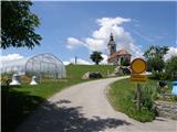
 | Povodje - Šmarna gora
Šmarna gora is a 669 m peak northwest of Slovenia's capital. From the summit, with its restaurant and church, there is a beautiful view over Gore...
1 h 30 min |
 | Povodje - Šmarna gora (via Sedlo)
Šmarna gora is a 669 m peak northwest of Slovenia's capital. From the summit, with its restaurant and church, there is a beautiful view over Gore...
1 h 35 min |
| Šmartno - Šmarna gora (path around Šmarna gora)
Šmarna gora is a 669 m peak northwest of Slovenia's capital. From the summit, with its restaurant and church, there is a beautiful view over Gore...
1 h 30 min |
 | Povodje - Šmarna gora (Partizanska steza)
Šmarna gora is a 669 m peak northwest of Slovenia's capital. From the summit, with its restaurant and church, there is a beautiful view over Gore...
1 h 45 min |
| Skaručna - Šmarna gora
Šmarna gora is a 669 m peak northwest of Slovenia's capital. From the summit, with its restaurant and church, there is a beautiful view over Gore...
1 h 30 min |
| Skaručna - Šmarna gora (via Sedlo)
Šmarna gora is a 669 m peak northwest of Slovenia's capital. From the summit, with its restaurant and church, there is a beautiful view over Gore...
1 h 35 min |
| Skaručna - Šmarna gora (Partizanska steza)
Šmarna gora is a 669 m peak northwest of Slovenia's capital. From the summit, with its restaurant and church, there is a beautiful view over Gore...
1 h 45 min |
 | Vikrče - Šmarna gora (Mazijeva steza)
Šmarna gora is a 669 m peak northwest of Slovenia's capital. From the summit, with its restaurant and church, there is a beautiful view over Gore...
1 h 35 min |
 | Vikrče - Šmarna gora (learning trail)
Šmarna gora is a 669 m peak northwest of Slovenia's capital. From the summit, with its restaurant and church, there is a beautiful view over Gore...
1 h 20 min |
 | Preska - Sveti Jakob
The Church of St. James is located on a scenic hill north of the village of Topol pri Medvodah. From the summit, which features a registration bo...
1 h 45 min |
| Sora - Sveti Jakob
The Church of St. James is located on a scenic hill north of the village of Topol pri Medvodah. From the summit, which features a registration bo...
1 h 45 min |
 | Gabrje - Sveti Jakob
The Church of St. James is located on a scenic hill north of the village of Topol pri Medvodah. From the summit, which features a registration bo...
1 h 30 min |
| Preval - Sveti Jakob
The Church of St. James is located on a scenic hill north of the village of Topol pri Medvodah. From the summit, which features a registration bo...
2 h 5 min |
 | Žlebe - Sveti Jakob (via Turnice)
The Church of St. James is located on a scenic hill north of the village of Topol pri Medvodah. From the summit, which features a registration bo...
2 h |
| Žlebe - Sveti Jakob (via Jeterbenk)
The Church of St. James is located on a scenic hill north of the village of Topol pri Medvodah. From the summit, which features a registration bo...
2 h 15 min |
 | Slavkov dom na Golem Brdu - Sveti Jakob
The Church of St. James is located on a scenic hill north of the village of Topol pri Medvodah. From the summit, which features a registration bo...
2 h 5 min |
 | Rakovica - Sveti Jošt above Kranj
Sveti Jošt above Kranj is a hill located west of the slightly lower Šmarjetna gora. From the summit, where the Church of St Jošt stands alongside...
1 h 20 min |
 | Tičnica - Sveti Jošt above Kranj (Pot prijateljev Sv. Jošta, on stairs)
Sveti Jošt above Kranj is a hill located west of the slightly lower Šmarjetna gora. From the summit, where the Church of St Jošt stands alongside...
1 h 15 min |
| Tičnica - Sveti Jošt above Kranj (Pot prijateljev Sv. Jošta, na klopca)
Sveti Jošt above Kranj is a hill located west of the slightly lower Šmarjetna gora. From the summit, where the Church of St Jošt stands alongside...
1 h 15 min |
| Tičnica - Sveti Jošt above Kranj (Pot prijateljev Sv. Jošta, past the chapel)
Sveti Jošt above Kranj is a hill located west of the slightly lower Šmarjetna gora. From the summit, where the Church of St Jošt stands alongside...
1 h 20 min |
 | Sora - Osolnik (by road)
Osolnik is an 858-metre-high mountain located south of Škofja Loka and west of Medvode. From the summit, where the Church of St Mohor and Fortuna...
1 h 40 min |
 | Sora - Osolnik (via Hom)
Osolnik is an 858-metre-high mountain located south of Škofja Loka and west of Medvode. From the summit, where the Church of St Mohor and Fortuna...
1 h 50 min |
| Trnovec - Osolnik (by road)
Osolnik is an 858-metre-high mountain located south of Škofja Loka and west of Medvode. From the summit, where the Church of St Mohor and Fortuna...
1 h 20 min |
 | Puštal - Osolnik
Osolnik is an 858-metre-high mountain located south of Škofja Loka and west of Medvode. From the summit, where the Church of St Mohor and Fortuna...
2 h 15 min |
 | Sora - Osolnik (on footpath)
Osolnik is an 858-metre-high mountain located south of Škofja Loka and west of Medvode. From the summit, where the Church of St Mohor and Fortuna...
1 h 35 min |
 | Trnovec - Osolnik (via Mavški graben)
Osolnik is an 858-metre-high mountain located south of Škofja Loka and west of Medvode. From the summit, where the Church of St Mohor and Fortuna...
1 h 15 min |
| Trnovec - Osolnik (via Govejski graben)
Osolnik is an 858-metre-high mountain located south of Škofja Loka and west of Medvode. From the summit, where the Church of St Mohor and Fortuna...
1 h 15 min |
| Puštal (Na Dobravi) - Osolnik
Osolnik is an 858-metre-high mountain located south of Škofja Loka and west of Medvode. From the summit, where the Church of St Mohor and Fortuna...
2 h |
 | Krače - Zasavska Sveta gora
Zasavska Sveta Gora is a popular excursion destination located between Litija and Izlake. From the summit, where the parish church of the Nativit...
1 h 15 min |
 | Slavkov dom na Golem brdu - Jeterbenk
Jeterbenk is a 774-meter-high peak located between the Slavkov dom hut on Golo Brdo and Katarina (the village of Topol). From the summit, where t...
1 h 15 min |
 | Gabrje - Jeterbenk
Jeterbenk is a 774-meter-high peak located between the Slavkov dom hut on Golo Brdo and Katarina (the village of Topol). From the summit, where t...
1 h 30 min |
| Preval - Jeterbenk
Jeterbenk is a 774-meter-high peak located between the Slavkov dom hut on Golo Brdo and Katarina (the village of Topol). From the summit, where t...
2 h 5 min |
 | Preska - Jeterbenk (via Turnice)
Jeterbenk is a 774-meter-high peak located between the Slavkov dom hut on Golo Brdo and Katarina (the village of Topol). From the summit, where t...
2 h 15 min |
 | Preska - Jeterbenk (on ridge)
Jeterbenk is a 774-meter-high peak located between the Slavkov dom hut on Golo Brdo and Katarina (the village of Topol). From the summit, where t...
2 h 15 min |
 | Legastja - Jeterbenk
Jeterbenk is a 774-meter-high peak located between the Slavkov dom hut on Golo Brdo and Katarina (the village of Topol). From the summit, where t...
1 h 40 min |
 | Briše - Polhograjska Gora (Sveti Lovrenc) (gentle path)
Polhograjska Gora, also known simply as Gora or Sveti Lovrenc, is an 824 m high hill northwest of Polhov Gradec. The summit, topped by the Church...
1 h 35 min |
 | Zalog - Polhograjska Gora (Sveti Lovrenc) (gentle path)
Polhograjska Gora, also known simply as Gora or Sveti Lovrenc, is an 824 m high hill northwest of Polhov Gradec. The summit, topped by the Church...
1 h 30 min |
 | Polhov Gradec (Blagaj Castle) - Polhograjska Gora (Sveti Lovrenc) (by cart track)
Polhograjska Gora, also known simply as Gora or Sveti Lovrenc, is an 824 m high hill northwest of Polhov Gradec. The summit, topped by the Church...
1 h 15 min |
 | Vrzdenec - Koreno (via Samotorica)
Koreno (also known as Korena) is a 729 m high hill located north of Horjul. From the summit, which features a large cross, the church of St. Moho...
1 h 45 min |
 | Polhov Gradec - Koreno
Koreno (also known as Korena) is a 729 m high hill located north of Horjul. From the summit, which features a large cross, the church of St. Moho...
1 h 45 min |
 | Zaklanec - Koreno
Koreno (also known as Korena) is a 729 m high hill located north of Horjul. From the summit, which features a large cross, the church of St. Moho...
1 h 15 min |
 | Srednja vas - Koreno
Koreno (also known as Korena) is a 729 m high hill located north of Horjul. From the summit, which features a large cross, the church of St. Moho...
1 h 20 min |
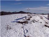
 | Loke - Krvavica (via Zajčeva koča)
Krvavica is a 909-metre-high peak located east of Čemšeniška planina. From the summit, which drops steeply on all sides, there is a beautiful vie...
2 h 10 min |
 | Grgar - Sveta Gora (via Frančiškov hrib)
Sveta Gora is known mainly among believers and locals. It is a well-known pilgrimage center above Nova Gorica. Believers come here from all over ...
1 h 25 min |
 | Grgar - Sveta Gora (via Po sredi)
Sveta Gora is known mainly among believers and locals. It is a well-known pilgrimage center above Nova Gorica. Believers come here from all over ...
1 h 15 min |
| Grgar - Sveta Gora (via Ranjeke)
Sveta Gora is known mainly among believers and locals. It is a well-known pilgrimage center above Nova Gorica. Believers come here from all over ...
1 h 30 min |
 | Grgar - Sveta Gora (via Križce)
Sveta Gora is known mainly among believers and locals. It is a well-known pilgrimage center above Nova Gorica. Believers come here from all over ...
1 h 30 min |
 | Povodje - Grmada
Grmada is a 676-meter-high mountain located west of the much more visited Šmarna gora. From the summit, which has a small takeoff area, a beautif...
1 h 50 min |
| Vikrče - Grmada (via Zatrep)
Grmada is a 676-meter-high mountain located west of the much more visited Šmarna gora. From the summit, which has a small takeoff area, a beautif...
1 h 15 min |
| Skaručna - Grmada
Grmada is a 676-meter-high mountain located west of the much more visited Šmarna gora. From the summit, which has a small takeoff area, a beautif...
1 h 50 min |
| Vikrče - Grmada (on Kovačeva steza and over Sedlo)
Grmada is a 676-meter-high mountain located west of the much more visited Šmarna gora. From the summit, which has a small takeoff area, a beautif...
1 h 15 min |
| Vikrče - Grmada (learning trail)
Grmada is a 676-meter-high mountain located west of the much more visited Šmarna gora. From the summit, which has a small takeoff area, a beautif...
1 h 20 min |
| Spodnje Pirniče - Grmada (learning trail)
Grmada is a 676-meter-high mountain located west of the much more visited Šmarna gora. From the summit, which has a small takeoff area, a beautif...
1 h 15 min |
| Spodnje Pirniče - Grmada (on Kovačeva steza and over Sedlo)
Grmada is a 676-meter-high mountain located west of the much more visited Šmarna gora. From the summit, which has a small takeoff area, a beautif...
1 h 15 min |
 | Polhov Gradec (Blagaj Castle) - Mali vrh
West of Polhov Gradec, between the rivers Mala voda and Velika Božna, lies the 708-meter-high hill known as Mali vrh. From the grassy summit, whi...
1 h 20 min |
 | Krašnja - Limbarska gora
Limbarska gora is located northeast of Moravče. From the summit, there is a beautiful view of the surrounding peaks, and in good weather, the Kam...
1 h 15 min |
 | Moravče - Limbarska gora (via Serjuče)
Limbarska gora is located northeast of Moravče. From the summit, there is a beautiful view of the surrounding peaks, and in good weather, the Kam...
1 h 25 min |
 | Moravče - Limbarska gora (via Gabrje)
Limbarska gora is located northeast of Moravče. From the summit, there is a beautiful view of the surrounding peaks, and in good weather, the Kam...
1 h 35 min |
 | Blagovica - Limbarska gora
Limbarska gora is located northeast of Moravče. From the summit, there is a beautiful view of the surrounding peaks, and in good weather, the Kam...
1 h 30 min |
| Lake Gradišče - Limbarska gora
Limbarska gora is located northeast of Moravče. From the summit, there is a beautiful view of the surrounding peaks, and in good weather, the Kam...
1 h 55 min |
| Blagovica - Limbarska gora (Blagovica - Limbarska gora - Blagovica)
Limbarska gora is located northeast of Moravče. From the summit, there is a beautiful view of the surrounding peaks, and in good weather, the Kam...
2 h 9 min |
 | Puštal (Na Dobravi) - Sveti Ožbolt (above Zminec)
Sveti Ožbolt is situated on a panoramic rise in the north of the Polhograjski Dolomiti. There is a beautiful view toward the Škofjeloško hribovje...
2 h 15 min |
 | Crngrob - Archangel Gabriel (Planica)
Planica is an 824-meter-high peak located north of Škofja Loka, more precisely between Križna gora and Planica. From the summit, where the church...
1 h 30 min |
 | Moškrin - Archangel Gabriel (Planica)
Planica is an 824-meter-high peak located north of Škofja Loka, more precisely between Križna gora and Planica. From the summit, where the church...
1 h 30 min |
 | Praprotno - Archangel Gabriel (Planica)
Planica is an 824-meter-high peak located north of Škofja Loka, more precisely between Križna gora and Planica. From the summit, where the church...
1 h 20 min |
 | Pevno - Archangel Gabriel (Planica)
Planica is an 824-meter-high peak located north of Škofja Loka, more precisely between Križna gora and Planica. From the summit, where the church...
1 h 30 min |
| Škofja Loka - Archangel Gabriel (Planica)
Planica is an 824-meter-high peak located north of Škofja Loka, more precisely between Križna gora and Planica. From the summit, where the church...
2 h 5 min |
 | Stara Vrhnika - Koča na Planini nad Vrhniko (via Kuren)
Planina nad Vrhniko is for Vrhnika locals something like Šmarna gora for those from Ljubljana. It is 733 m high, reachable by several paths from ...
1 h 15 min |
| Stara Vrhnika - Koča na Planini nad Vrhniko (via Špica)
Planina nad Vrhniko is for Vrhnika locals something like Šmarna gora for those from Ljubljana. It is 733 m high, reachable by several paths from ...
1 h 15 min |
 | Besnica - Janče
Janče is a 792-meter-high peak situated between the Sava River and the Besnica stream valley. From the summit, where a mountain hut stands and th...
2 h 15 min |
 | Jevnica - Janče
Janče is a 792-meter-high peak situated between the Sava River and the Besnica stream valley. From the summit, where a mountain hut stands and th...
1 h 45 min |
 | Laze pri Dolskem - Janče
Janče is a 792-meter-high peak situated between the Sava River and the Besnica stream valley. From the summit, where a mountain hut stands and th...
2 h 15 min |
 | Senožeti - Sveti Miklavž above Sava (footpath)
The Church of St. Miklavž is situated on a panoramic hill south of Moravče. From the summit, there is a beautiful view toward the nearby Limbarsk...
1 h 20 min |
 | Kamnica - Sveti Miklavž above Sava (via Velika vas)
The Church of St. Miklavž is situated on a panoramic hill south of Moravče. From the summit, there is a beautiful view toward the nearby Limbarsk...
2 h 5 min |
| Moravče - Sveti Miklavž above Sava
The Church of St. Miklavž is situated on a panoramic hill south of Moravče. From the summit, there is a beautiful view toward the nearby Limbarsk...
1 h 25 min |
 | Senožeti - Cicelj
Cicelj is a forest-covered peak located between Moravče and the village of Senožeti. From the summit, which has a bench and a logbook box, there ...
1 h 30 min |
 | Kamnica - Cicelj (via farm Buven)
Cicelj is a forest-covered peak located between Moravče and the village of Senožeti. From the summit, which has a bench and a logbook box, there ...
1 h 45 min |
 | Kamnica - Cicelj
Cicelj is a forest-covered peak located between Moravče and the village of Senožeti. From the summit, which has a bench and a logbook box, there ...
1 h 40 min |
 | Senožeti - Cicelj (hunting path)
Cicelj is a forest-covered peak located between Moravče and the village of Senožeti. From the summit, which has a bench and a logbook box, there ...
1 h 30 min |
 | Zazid - Kojnik
Kojnik is a partly forested peak located in the southern part of Podgorski Kras near the Slovenian-Croatian border. From the summit, which has a ...
1 h 20 min |
 | Širje - Dom v Gorah
The Dom v Gorah mountain hut is located east of Hrastnik, just a few meters below the 786 m high peak where the church of St. Jurij stands. From ...
1 h 20 min |
 | Hrastnik - Dom v Gorah
The Dom v Gorah mountain hut is located east of Hrastnik, just a few meters below the 786 m high peak where the church of St. Jurij stands. From ...
1 h 30 min |
 | Marno - Dom v Gorah
The Dom v Gorah mountain hut is located east of Hrastnik, just a few meters below the 786 m high peak where the church of St. Jurij stands. From ...
1 h 15 min |
 | Jablanica - Srednji vrh at Kozlek
Srednji vrh pri Kozleku is a panoramic peak located west of Ilirska Bistrica, near the better-known Kozlek. From the summit, there is a beautiful...
1 h 25 min |
 | Idrija - Hleviška planina (hunting path)
Hleviška planina (also Hleviške planine) is a slightly vegetated but still very panoramic peak. From the summit, the home mountain of Idrija, the...
1 h 45 min |
 | Idrija - Hleviška planina (via Kodrov rovt)
Hleviška planina (also Hleviške planine) is a slightly vegetated but still very panoramic peak. From the summit, the home mountain of Idrija, the...
2 h |
 | Brzika - Donačka gora
Donačka gora is a peak located north of Rogatec. From the summit, which geographically belongs to the Karawanks, there is a nice view of the near...
1 h 45 min |
| Stoperce - Donačka gora
Donačka gora is a peak located north of Rogatec. From the summit, which geographically belongs to the Karawanks, there is a nice view of the near...
2 h 5 min |
| Sveti Jurij - Donačka gora (western path)
Donačka gora is a peak located north of Rogatec. From the summit, which geographically belongs to the Karawanks, there is a nice view of the near...
1 h 35 min |
 | Rečica ob Paki - Gora Oljka
Gora Oljka is a hill located east of Šmartno ob Paki. On the summit stands the Church of the Holy Cross, built in the mid-18th century. Just a fe...
1 h 15 min |
 | Podgora - Gora Oljka (Martin way)
Gora Oljka is a hill located east of Šmartno ob Paki. On the summit stands the Church of the Holy Cross, built in the mid-18th century. Just a fe...
1 h 20 min |
 | Polzela - Gora Oljka (via Vimperk)
Gora Oljka is a hill located east of Šmartno ob Paki. On the summit stands the Church of the Holy Cross, built in the mid-18th century. Just a fe...
2 h 15 min |
| Podvin pri Polzeli - Gora Oljka (upper path)
Gora Oljka is a hill located east of Šmartno ob Paki. On the summit stands the Church of the Holy Cross, built in the mid-18th century. Just a fe...
1 h 35 min |
| Podvin pri Polzeli - Gora Oljka (lower path)
Gora Oljka is a hill located east of Šmartno ob Paki. On the summit stands the Church of the Holy Cross, built in the mid-18th century. Just a fe...
1 h 30 min |
 | Matke - Golava
Golava is a peak located north of Mrzlica. From the summit, where there is a small bivouac (Blažev bivak), there is a fine view toward the aforem...
1 h 15 min |
| Prebold - Golava
Golava is a peak located north of Mrzlica. From the summit, where there is a small bivouac (Blažev bivak), there is a fine view toward the aforem...
1 h 45 min |
 | Zabukovica - Kotečnik
Kotečnik is a peak in the Posavsko hribovje, located north of Šmohor. It is a summit with two logboxes: the first on the western subpeak, offerin...
1 h 30 min |
 | Spodnja Rečica - Dom na Šmohorju (via Tolsto)
The mountain hut Dom na Šmohorju is located between Laško, Liboje, and Zabukovica. From the hut, or from the church of St. Mohor just a few minut...
1 h 35 min |
 | Liboje - Dom na Šmohorju (via organic farm Kralj)
The mountain hut Dom na Šmohorju is located between Laško, Liboje, and Zabukovica. From the hut, or from the church of St. Mohor just a few minut...
1 h 30 min |
| Zgornja Rečica (church of Blessed Anton Martin Slomšek) - Dom na Šmohorju
The mountain hut Dom na Šmohorju is located between Laško, Liboje, and Zabukovica. From the hut, or from the church of St. Mohor just a few minut...
1 h 40 min |
 | Zvodno - Grmada above Celje (via Suhi potok)
What Šmarna gora is to people from Ljubljana, Grmada is to those from Celje. Celje's local mountain lies south of the town above Zagrad village. ...
1 h 15 min |
 | Hayrack (Laška vas - Pečovje) - Tolsti vrh above Celjska koča (via chapel at Mary and on CPP)
Tolsti vrh (also recorded as Tovsti vrh in some sources) is situated above the Celjska koča ski area. The summit has a logbook box and stamp, but...
1 h 35 min |
 | Zvodno - Tolsti vrh above Celjska koča (via Suhi potok)
Tolsti vrh (also recorded as Tovsti vrh in some sources) is situated above the Celjska koča ski area. The summit has a logbook box and stamp, but...
1 h 30 min |
 | Zvodno - Tolsti vrh above Celjska koča (via Marija)
Tolsti vrh (also recorded as Tovsti vrh in some sources) is situated above the Celjska koča ski area. The summit has a logbook box and stamp, but...
1 h 40 min |
 | Zvodno - Tolsti vrh above Celjska koča (via Suhi potok and on ski slope)
Tolsti vrh (also recorded as Tovsti vrh in some sources) is situated above the Celjska koča ski area. The summit has a logbook box and stamp, but...
1 h 30 min |
 | Zvodno - Srebotnik (on Celje mountain trail)
Srebotnik is a slightly vegetated peak located south of Celje and Štore in the Posavsko hribovje. The summit, which has a logbook box and a small...
1 h 15 min |
 | Slovenske Konjice - Skala (gentle path)
Skala is a viewpoint on the eastern part of Konjiška gora. From this vantage point, equipped with a table, bench, and logbook box, there is a nic...
1 h 30 min |
 | Lašče - Sveti Peter
Sveti Peter is a partly forested peak in Suha Krajina above the village of Dvor. On the summit stands a small shelter (usually open on Sundays) a...
1 h 45 min |
 | Gabrje - Rog
Rog is an 798-meter peak above the village of Topol, just 10 minutes from St. Katarina's Church. From the summit, where a large cross once stood,...
1 h 20 min |
| Preval - Rog
Rog is an 798-meter peak above the village of Topol, just 10 minutes from St. Katarina's Church. From the summit, where a large cross once stood,...
1 h 55 min |
 | Žlebe - Rog (via Turnice)
Rog is an 798-meter peak above the village of Topol, just 10 minutes from St. Katarina's Church. From the summit, where a large cross once stood,...
1 h 30 min |
| Žlebe - Rog (via Jeterbenk)
Rog is an 798-meter peak above the village of Topol, just 10 minutes from St. Katarina's Church. From the summit, where a large cross once stood,...
1 h 40 min |
 | Legastja - Rog
Rog is an 798-meter peak above the village of Topol, just 10 minutes from St. Katarina's Church. From the summit, where a large cross once stood,...
1 h 15 min |
 | Selca - Miklavška gora (footpath)
Miklavška gora is a panoramic hill situated south of Železniki and Selca. From the summit, where the Church of St. Nicholas stands, a beautiful v...
1 h 25 min |
 | Podgora - Grmada on Mala gora
Grmada (also Grmada above Ortnek) is an 887-meter-high peak located above the village of Vrh pri Poljanah in the Mala Gora range. Just a few mete...
1 h 20 min |
 | Hunting cottage Budanje - Kovk
Kovk is a panoramic peak west of Col on an elongated ridge rising steeply above the Vipava Valley. From the summit cross, beautiful views extend ...
1 h 30 min |
 | Kočevje - Fridrihštajn Castle (Grajska way)
Fridrihštajn Castle, built in the 15th century, is located south of Kočevje on a 970 m high hill. Today only ruins remain, which have been renova...
1 h 30 min |
 | Hrastnik - Klobuk (via Jelenca)
Klobuk is a scenic peak located northeast of Hrastnik. From the summit, which has a logbox and stamp, there are fine views of the valley and surr...
1 h 30 min |
| Dol pri Hrastniku - Klobuk
Klobuk is a scenic peak located northeast of Hrastnik. From the summit, which has a logbox and stamp, there are fine views of the valley and surr...
2 h 10 min |
 | Bresternica (spodnji Rušnik) - Žavcarjev vrh
Žavcarjev vrh is a 915 m high mountain located north of the Drava River on the slopes of Kozjak. Since the summit is completely forested, there i...
1 h 40 min |
 | Bresternica (Šoberjev dvor) - Tojzlov vrh
Tojzlov vrh is a forested hill on the eastern part of Kozjak. On the summit stands a small stone NOB monument and, more recently, also a summit l...
1 h 15 min |
 | Kozjak nad Pesnico - Tojzlov vrh
Tojzlov vrh is a forested hill on the eastern part of Kozjak. On the summit stands a small stone NOB monument and, more recently, also a summit l...
2 h 5 min |
 | Kamnica - Murovica
Murovica is a popular excursion point, accessible from the Posavje side, Domžale, or the Moravška Valley. On the summit there is a bench and a lo...
1 h 20 min |
| Senožeti - Murovica (via Vrh pri Dolskem)
Murovica is a popular excursion point, accessible from the Posavje side, Domžale, or the Moravška Valley. On the summit there is a bench and a lo...
2 h 5 min |
| Senožeti - Murovica (via farm Buven)
Murovica is a popular excursion point, accessible from the Posavje side, Domžale, or the Moravška Valley. On the summit there is a bench and a lo...
1 h 55 min |
 | Zgornja Rečica (church of Blessed Anton Martin Slomšek) - Govško brdo
Govško brdo is an 811-meter-high hill located west of the village of Huda Jama above Laško. From the summit, which features a logbook box and sta...
1 h 15 min |
 | Zgornja Rečica (Maček) - Govško brdo
Govško brdo is an 811-meter-high hill located west of the village of Huda Jama above Laško. From the summit, which features a logbook box and sta...
1 h 35 min |
 | Borovnica - Mali Trebelnik
Mali Trebelnik is an 807-meter-high hill rising above the southwestern part of the Ljubljana Marshes. From the partly grassy summit, which is par...
1 h 30 min |
 | Bistra - Mali Trebelnik
Mali Trebelnik is an 807-meter-high hill rising above the southwestern part of the Ljubljana Marshes. From the partly grassy summit, which is par...
1 h 45 min |
 | Pristavlja vas - Pristava above Stična
Pristava nad Stično is a small village on a scenic rise north of Stična. Slightly above the village near the Partizanski dom lies a broad, panora...
1 h 45 min |
 | Dvor - Mala Grmada
Mala Grmada is an 853-meter-high peak located southwest of the slightly higher Polhograjska Grmada. From the summit, a beautiful view opens up ov...
1 h 30 min |
 | Polhov Gradec (Božna) - Mala Grmada (via Setnica)
Mala Grmada is an 853-meter-high peak located southwest of the slightly higher Polhograjska Grmada. From the summit, a beautiful view opens up ov...
1 h 15 min |
 | Trnovec - Gontarska planina
Gontarska Planina is a 894-meter-high hill located between Osolnik and Tošč. From the summit, which features two benches, a splendid view opens t...
1 h 30 min |
 | Preska - Sveti Florijan (Tehovec)
The Church of St. Florijan is a subsidiary church located in the village of Tehovec above Medvode. From the church, first mentioned in 1548, a ni...
1 h 15 min |
| Sora - Sveti Florijan (Tehovec)
The Church of St. Florijan is a subsidiary church located in the village of Tehovec above Medvode. From the church, first mentioned in 1548, a ni...
1 h 15 min |
 | Gabrje - Goljek
Goljek is an 809 m high peak located east of Polhograjska Grmada. From the summit, where remains of a former guard tower on the Italian-German bo...
1 h 40 min |
 | Blagovica - Špilk
Špilk is a 956 m high peak located north of Blagovica. At the mostly forested summit, PD Blagovica has set up a small bivouac with a bench and ta...
1 h 30 min |
 | Zazid - Golič
Golič is a grassy ridge extending from Kojnik to the Slovenian-Croatian border and continuing as the Žbevnica ridge on the Croatian side. Due to ...
1 h 30 min |
 | Zgornja Besnica (Podrovnik) - Sveti Mohor (Zabrekve)
The Church of St. Mohor is located on a 952 m high hill between Zgornja Besnica and Selci. From the church or its nearby surroundings, there is a...
1 h 45 min |
 | Zgornja Besnica (Podrovnik) - Špičasti hrib
Špičasti hrib (known as Špičasti vrh on maps) is an 837-meter-high hill located west of Sveti Jošt above Kranj. The summit, which has a few bench...
1 h 30 min |
 | Spodnja Besnica (fish farm) - Špičasti hrib
Špičasti hrib (known as Špičasti vrh on maps) is an 837-meter-high hill located west of Sveti Jošt above Kranj. The summit, which has a few bench...
1 h 30 min |
 | Zazid - Lipnik
Lipnik is an 804-meter-high peak located above the village Rakitovec on the Slovenian-Croatian border. From the summit, where a cross stands with...
1 h 40 min |
 | Zazid - Nadglavinjak (via Lipnik)
Nadglavinjak is a lesser-known peak located southeast of Golič. From its indistinct grassy summit, nice views open up on Slavnik, Čičarija, Žbevn...
2 h 10 min |
 | Sveti Mavricij - Sveti Socerb (Artviže)
The Church of St. Socerb is located on a panoramic hill above the village of Artviže, which at 817 meters is the highest peak of the Brkini. From...
2 h 15 min |
 | Cerkno - Veliki vrh (Lajše)
Veliki vrh is an almost 900-meter-high elevation rising south of Cerkno. From the summit, which features several television and radio transmitter...
2 h |
 | Cerkno - Škofje
Škofje is a 973-meter-high peak located above the villages of Čeplez, Planina pri Cerknem, and Podpleče. The summit itself, marked by a small con...
1 h 45 min |
 | Spodnja Rečica - Tolsto
Tolsto is a 780-meter-high hill between Huda Jama and Šmohor. The summit has a logbook and stamp box, but offers no view due to the forest....
1 h 15 min |
 | Vinska Gora - Radojč (easy path)
Radojč is a 937 m high peak located north of Vinska gora. From the summit, which has a stamp box with logbook and stamp, there is no view due to ...
1 h 30 min |
 | Vinska Gora - Ramšakov vrh (easy path)
Ramšakov vrh is the highest point of the circular path around Vinska Gora. At the 970 m high summit, next to the benches, there is also a stamp b...
2 h |
 | Vinska Gora - Ramšakov vrh (via farm Vodošek)
Ramšakov vrh is the highest point of the circular path around Vinska Gora. At the 970 m high summit, next to the benches, there is also a stamp b...
2 h |
 | Prelska - Vinska gora
Vinska gora (marked as the neighboring Temnjak on some maps) is an 806 m high hill located northwest of Dobrna and northeast of Vinska Gora. From...
1 h 20 min |
 | Renke - Ostrež
Ostrež is an 856 m high hill in the Posavje Hills. It rises south of the Sava River valley, above the main LitijaZagorje ob Savi road....
1 h 30 min |
 | Krače - Roviškovec (west path)
Roviškovec (also known as Roviški vrh) is a 930-meter-high peak located southeast of Zasavska Sveta gora. From the summit, which features a woode...
1 h 30 min |
 | Krače - Roviškovec (east path)
Roviškovec (also known as Roviški vrh) is a 930-meter-high peak located southeast of Zasavska Sveta gora. From the summit, which features a woode...
1 h 30 min |
 | Krače - Pleše
Pleše is an 866-meter-high peak situated between the Marela ski slope and Zasavska Sveta gora. From the summit, which features a NOB monument, th...
1 h 45 min |
 | Izlake - Pleše (via Grobovščica)
Pleše is an 866-meter-high peak situated between the Marela ski slope and Zasavska Sveta gora. From the summit, which features a NOB monument, th...
2 h 15 min |
 | Izlake - Pleše (via Vežnica)
Pleše is an 866-meter-high peak situated between the Marela ski slope and Zasavska Sveta gora. From the summit, which features a NOB monument, th...
1 h 45 min |
 | Reka - Rodne
Rodne is a 698-meter-high peak situated west of Orehovška Grapa. From the grassy summit, a nice view opens up towards the Cerkljansko-Idrijsko hi...
1 h 20 min |
 | Braslovško jezero - Bezovec (Dobrovlje) (via hunting cottage)
Bezovec (Brezovec on some maps) is an 857-meter-high peak located west of Braslovško Lake, more precisely on the eastern part of the Dobrovlje Pl...
1 h 30 min |
 | Braslovško jezero - Bezovec (Dobrovlje) (via Covnikov križ)
Bezovec (Brezovec on some maps) is an 857-meter-high peak located west of Braslovško Lake, more precisely on the eastern part of the Dobrovlje Pl...
1 h 30 min |
| Letuš - Bezovec (Dobrovlje) (via hunting cottage)
Bezovec (Brezovec on some maps) is an 857-meter-high peak located west of Braslovško Lake, more precisely on the eastern part of the Dobrovlje Pl...
1 h 30 min |
| Letuš - Bezovec (Dobrovlje) (via Covnikov križ)
Bezovec (Brezovec on some maps) is an 857-meter-high peak located west of Braslovško Lake, more precisely on the eastern part of the Dobrovlje Pl...
1 h 30 min |
 | Žovneško jezero - Grmada (Dobrovlje)
Grmada is a 898 m high, forest-covered peak located on the southeastern part of the Dobroveljska planota plateau. From the summit, where there is...
2 h 5 min |
 | Divje jezero - Zagrebenc
Zagrebenc (also Čekovnik on some maps) is a 763 m high peak located between Hleviška planina and the valley of the Idrijca River. From the grassy...
1 h 30 min |
 | Gorenja vas - Javorč (via Jermanca)
Javorč is a 901-meter-high peak located northeast of Žiri. The summit, featuring a logbox with a logbook, lies at the edge of a larger clearing, ...
2 h |
| Dolenja Dobrava - Javorč
Javorč is a 901-meter-high peak located northeast of Žiri. The summit, featuring a logbox with a logbook, lies at the edge of a larger clearing, ...
1 h 30 min |
 | Lesično - Oslica (Bohor)
Oslica is one of Bohor's peaks, located in the eastern part of the range. Unlike some higher Bohor peaks such as Veliki Javornik, Koprivnik, Debe...
1 h 45 min |
 | Kozje - Oslica (Bohor) (via Vetrnik)
Oslica is one of Bohor's peaks, located in the eastern part of the range. Unlike some higher Bohor peaks such as Veliki Javornik, Koprivnik, Debe...
2 h 10 min |
 | Lesično - Debeli vrh (Bohor)
Debeli vrh is a 921-meter-high peak on Bohor between Veliki Koprivnik and Oslica. Covered in dense forest, it offers no views. A marked hiking tr...
1 h 45 min |
 | Lesično - Brest (Bohor)
Brest is a peak on Bohor, though it resembles more of a saddle. It is an important trail junction on Bohor, lying between more easterly Oslica an...
1 h 30 min |
 | Kozje - Brest (Bohor) (via Vetrnik)
Brest is a peak on Bohor, though it resembles more of a saddle. It is an important trail junction on Bohor, lying between more easterly Oslica an...
2 h |
 | Kozje - Pokojni vrh (Bohor) (via Vetrnik)
Pokojni vrh is on the eastern part of Bohor. The western part features a pasture, the rest mostly forest. There is no summit logbook. From the to...
1 h 30 min |
| Tourist farm Žurej - Žusem (Panoramska pot - old route)
Žusem is a 669-meter-high hill with a rich history and great potential for the future. It forms the northern edge of Kozjansko, and its name deri...
1 h 40 min |
 | Tourist farm Žurej - Žusem (Panoramska pot)
Žusem is a 669-meter-high hill with a rich history and great potential for the future. It forms the northern edge of Kozjansko, and its name deri...
1 h 40 min |
 | Loka pri Žusmu (Žamerk) - Žusem
Žusem is a 669-meter-high hill with a rich history and great potential for the future. It forms the northern edge of Kozjansko, and its name deri...
1 h 20 min |
 | Loka pri Žusmu (Žamerk) - Žusem (via Dobrina)
Žusem is a 669-meter-high hill with a rich history and great potential for the future. It forms the northern edge of Kozjansko, and its name deri...
1 h 30 min |
| Krka - Ciganov vrh (Korinjski hrib) (part of circular path Prijetno domače)
Ciganov vrh (Korinjski hrib) is a smaller hill rising above the Krka River valley, from which opens a view (occasionally obscured by vegetation) ...
1 h 45 min |
 | Studenice - Plešivec (at Boč)
Peace, silence, varied terrain... these are characteristics of the peak at the crossroads of numerous paths between the Maribor, Celje, and Ptuj ...
2 h |
 | Studenice - Plešivec (at Boč) (final part on forest road)
Peace, silence, varied terrain... these are characteristics of the peak at the crossroads of numerous paths between the Maribor, Celje, and Ptuj ...
2 h |
 | Lovrenc na Pohorju - Hlebov vrh (Rdeči Breg)
Rdeči breg stretches between the Radoljna gorge to the east, the Drava to the north, and the Velka stream to the east. It is separated from the m...
2 h 10 min |
 | Podvelka - Hlebov vrh (Rdeči Breg) (via Viltužnik)
Rdeči breg stretches between the Radoljna gorge to the east, the Drava to the north, and the Velka stream to the east. It is separated from the m...
2 h |
 | Janževski Vrh (Uran) - Hlebov vrh (Rdeči Breg)
Rdeči breg stretches between the Radoljna gorge to the east, the Drava to the north, and the Velka stream to the east. It is separated from the m...
1 h 30 min |
| Janževski Vrh (Uran) - Hlebov vrh (Rdeči Breg) (via Brabar)
Rdeči breg stretches between the Radoljna gorge to the east, the Drava to the north, and the Velka stream to the east. It is separated from the m...
1 h 40 min |
 | Planinski dom Milana Šinkovca - Šenturška Gora
Šenturška Gora is a settlement located between Tunjiško gričevje and Krvavec. From the church, the village, or nearby agritourism, nice views ope...
2 h 15 min |
| Planinski dom Milana Šinkovca - Šenturška Gora (via Zaloški rob)
Šenturška Gora is a settlement located between Tunjiško gričevje and Krvavec. From the church, the village, or nearby agritourism, nice views ope...
2 h 15 min |
 | Hunting cottage Budanje - Podrta gora above Ajdovščina
Podrta gora above Ajdovščina, also Podrta gora above Šturje, is a mountain rising above the Vipava Valley. Some time ago, a large piece of wall b...
1 h 35 min |
 | Hunting cottage Budanje - Kraguljc
Kraguljc is a mountain situated between Podrta gora and Sončnica. On the panoramic summit, from which nice views open towards the Vipava Valley a...
1 h 25 min |
 | Terme Topolšica - Lomek (Lom)
Lom, with its highest peak Lomek (884 m), is a karst hill located above the tourist and health resort of Topolšica. From the summit there is an e...
1 h 50 min |
 | Terme Topolšica - Lomek (Lom) (hunting path)
Lom, with its highest peak Lomek (884 m), is a karst hill located above the tourist and health resort of Topolšica. From the summit there is an e...
1 h 50 min |
 | Poljana - Volinjak (via Stovčnik)
Volinjak (wrongly named Volinjek on some maps) is an 886-meter-high peak located between Mežica and Prevalje. From the summit, which has a summit...
1 h 15 min |
| Poljana - Volinjak (via Leše churches and Prapar)
Volinjak (wrongly named Volinjek on some maps) is an 886-meter-high peak located between Mežica and Prevalje. From the summit, which has a summit...
1 h 25 min |
| Poljana - Volinjak (via Leše churches and Hermanko)
Volinjak (wrongly named Volinjek on some maps) is an 886-meter-high peak located between Mežica and Prevalje. From the summit, which has a summit...
1 h 25 min |
 | Paka pri Velenju - Visoko
Visoko is an easily accessible grassy plateau located south of Paški Kozjak. The summit features a monument to the fallen fighters of the 14th Di...
1 h 45 min |
 | Radlje ob Dravi - Sveti Trije Kralji (above Radlje ob Dravi)
The Church of the Holy Three Kings is located on an 820-meter-high hill rising above the right bank of the Radeljski Stream. From the church, a n...
1 h 40 min |
| Dolina Radeljskega potoka (Razdevšek) - Sveti Trije Kralji (above Radlje ob Dravi)
The Church of the Holy Three Kings is located on an 820-meter-high hill rising above the right bank of the Radeljski Stream. From the church, a n...
1 h 30 min |
 | Janževski Vrh (Uran) - Janževski vrh
Janževski Vrh is a 915-meter-high mountain situated above the right bank of the Drava River and the left bank of the Velka Stream. At the summit ...
1 h 30 min |
 | Radlje ob Dravi - Sveti Anton na MP Radelj / St. Anton am Radlpaß (via old castle)
The Church of St. Anton at the Radelj border crossing / St. Anton am Radlpaß is located on the Austrian side of Kozjak on a 720-meter-high hill r...
2 h 15 min |
 | Dravograd (Meža) - Golarjev vrh
Golarjev vrh is an 843-meter-high forested peak located south to southeast of Cvitrško sedlo, which lies between Otiški vrh and Sveti Danijel....
1 h 50 min |
 | Škale - Lubela (via hunting lodge)
Lubela is a hill near Velenje that rises to the north above the Šaleška Valley and belongs to the Šentviško Hills or the broader Graška Gora area...
1 h 15 min |
 | Trebija - Vrhovski grič
Vrhovski Grič is a panoramic hill along the marked trail from Trebija to Ermanovec. From the grassy summit there is a fine view of the surroundin...
1 h 35 min |
 | Trebija - Vrhovski grič (via Sveti Pavel)
Vrhovski Grič is a panoramic hill along the marked trail from Trebija to Ermanovec. From the grassy summit there is a fine view of the surroundin...
1 h 45 min |
 | Zia - Dikeos (Kos)
Dikeos (846 m) is the highest mountain on Kos Island, the third-largest island in the Dodecanese in the southeastern Aegean Sea in Greece (after ...
1 h 50 min |
 | Predgrad - Kozice
Kozice is a 741-meter-high peak with an RTV transmitter located above the left bank of the Kolpa River. From the viewpoint on the southern subpea...
1 h 15 min |
| Predgrad - Kozice (by road)
Kozice is a 741-meter-high peak with an RTV transmitter located above the left bank of the Kolpa River. From the viewpoint on the southern subpea...
1 h 30 min |
 | Hotavlje - Špik (Vranškov grič)
Špik (also marked as Vranškov grič on maps) is a 908 m high mountain west of Hotavlje. The summit lies in forest, but a grassy subpeak offers fin...
1 h 35 min |
 | Puščava - Klančnik (Glančnik)
Klančnik (Glančnik on some maps) is an 877-meter-high peak situated above the right bank of the Drava River, just a few minutes' walk from the Hu...
2 h 15 min |
| Lovrenc na Pohorju - Klančnik (Glančnik) (via Kapus)
Klančnik (Glančnik on some maps) is an 877-meter-high peak situated above the right bank of the Drava River, just a few minutes' walk from the Hu...
2 h |
 | Janževski Vrh (Uran) - Klančnik (Glančnik) (via Brabar and Hudej)
Klančnik (Glančnik on some maps) is an 877-meter-high peak situated above the right bank of the Drava River, just a few minutes' walk from the Hu...
1 h 35 min |
| Janževski Vrh (Uran) - Klančnik (Glančnik) (via Sveti Ignacij)
Klančnik (Glančnik on some maps) is an 877-meter-high peak situated above the right bank of the Drava River, just a few minutes' walk from the Hu...
2 h |
| HE Ožbalt - Klančnik (Glančnik)
Klančnik (Glančnik on some maps) is an 877-meter-high peak situated above the right bank of the Drava River, just a few minutes' walk from the Hu...
2 h 10 min |
 | Oplotnica - Kebelj castle (Castle Zajec)
Kebeljski Castle or Zajčev Castle is situated on the eastern summit of Zajčev hrib, the hill above Kebelj....
1 h 25 min |
 | Brezno - Sveti Jurij (Remšnik) (along Remšniški potok)
The Church of St. Jurij is located on a panoramic hill in the Remšnik settlement, which lies on the slopes of Kozjak. Opposite the church, next t...
1 h 35 min |
 | Zreče (Terme Zreče) - Golek
Golek is a 769-meter-high peak located northwest of Zreče. The summit has a logbook box with book and stamp, plus a bench; a short distance (a fe...
1 h 25 min |
| Zreče (Terme Zreče) - Golek (via Bork)
Golek is a 769-meter-high peak located northwest of Zreče. The summit has a logbook box with book and stamp, plus a bench; a short distance (a fe...
1 h 30 min |
| Zreče (Terme Zreče) - Golek (via Tourist farm Ančka)
Golek is a 769-meter-high peak located northwest of Zreče. The summit has a logbook box with book and stamp, plus a bench; a short distance (a fe...
1 h 35 min |
| Zreče (cemetery) - Golek
Golek is a 769-meter-high peak located northwest of Zreče. The summit has a logbook box with book and stamp, plus a bench; a short distance (a fe...
1 h 15 min |
 | Rein - Hochstein (Jägersteig)
Hochstein is a 925-meter-high mountain in the western part of the Graz Mountains in Styria. It is located northwest of the town Gratwein. A hunti...
1 h 30 min |
 | Deutschfeistritz - Gamskogel
Gamskogel is an 859-meter-high hill above the town of Deutschfeistritz (Nemška Bistrica) in Styria. A cross stands on the summit. There is no vie...
1 h 30 min |
 | Deutschfeistritz - Schartnerkogel (on road)
Schartnerkogel is a 931-meter-high hill above the town Deutschfeistritz (Nemška Bistrica) in the western part of the Graz Mountains. A cross stan...
2 h |
 | Center Vintgar - Lookout point at Ančnikovo gradišče (via Bistriški vintgar)
The lookout platform is located near Ančnikovo gradišče. It offers a nice view. You can see the settlement of Slovenska Bistrica and its surroun...
1 h 30 min |
 | Radoboj - Sekolje (Strahinjčica)
Sekolje is the easternmost peak of Strahinjčica. It appears as an interesting cone shape from the surrounding areas. The view from the peak is li...
1 h 30 min |
 | Stubenbergsee - Kulmkögerl (Kulmgipfel)
Kulmkögerl is an 866-meter-high peak located above Lake Stubenbergsee. A wooden cross stands on the summit, along with a summit logbook....
1 h 20 min |
 | Stubenbergsee - Kulm (via Kulmkögerl)
Kulm is a 975-meter-high panoramic peak located west of the town of Weiz. From the summit, where several sacred structures stand, a beautiful vie...
2 h |
 | Prelaz Vrhe - Maceljska gora (via source of Sotla)
Maceljska gora is the highest peak of Macelj, a range located south of the settlement of Žetale along the border with Croatia....
1 h 50 min |
 | Marno - Vrhe (at Gore)
Vrhe is a forested 781-meter-high peak located northwest of the Planinski dom hut in Gore....
1 h 25 min |
 | Kirchdorf - Predigtstuhl
Predigtstuhl is an 853 m high hill above the settlement of Kirchdorf in the northern part of the Grazer Bergland. At the summit, there is a cross...
1 h 30 min |
 | Rein - Pfaffenkogel
Pfaffenkogel is a 734 m high hill in the western part of the Grazer Bergland in Austrian Styria. The summit is located north of the town of Gratw...
1 h 30 min |
 | Rechnitz (Badesee) - Großer Hirschenstein
Großer Hirschenstein is an 862-meter-high peak located west of the slightly higher Geschriebenstein / Írott-kő, the highest point in the Austrian...
2 h |
 | Vuzenica - Sveti Primož (Sveti Primož na Pohorju)
The Church of St. Primož is situated on a panoramic part of the settlement Sveti Primož na Pohorju. Slightly below the church there is a larger N...
1 h 30 min |
 | Straßengel - Generalkogel
Generalkogel (in the 19th century still called Brennkogel) is a 713-meter-high hill in the western part of the Graz Mountains in Styria.It is loc...
1 h 30 min |
 | Olimje - Plešivec (Rudnica) (past lake Zmajevo jezero)
Plešivec is a forest-covered peak on Rudnica, its highest point. The summit has a summit register box, a bench, and a table....
1 h 50 min |
| Olimje - Plešivec (Rudnica)
Plešivec is a forest-covered peak on Rudnica, its highest point. The summit has a summit register box, a bench, and a table....
1 h 30 min |
 | Loka pri Žusmu (Žamerk) - Plešivec (Rudnica)
Plešivec is a forest-covered peak on Rudnica, its highest point. The summit has a summit register box, a bench, and a table....
2 h |
| Loka pri Žusmu (Hudi graben) - Plešivec (Rudnica)
Plešivec is a forest-covered peak on Rudnica, its highest point. The summit has a summit register box, a bench, and a table....
1 h 40 min |
 | Prebold - Tolsti vrh (above Prebold)
Tolsti vrh is a 756-meter-high mountain located southwest of Prebold. From the summit, where a logbook is located, there are partial views toward...
1 h 25 min |
 | Prebold - Strtnik (Strnik) (via Tolsti vrh)
Strtnik or Strnik is an 845-meter-high mountain situated between Reška planina and Tolsti vrh. The peak is a point on the Prebold mountain trail....
1 h 55 min |
 | Podgorje ob Sevnični (Kurja vas) - Zaloška gora
Zaloška gora is a 930-meter-high panoramic peak on Bohor, from which a beautiful view opens up towards the east, south and partly west, while to ...
1 h 55 min |
 | Rukavac - Orjak (above Opatija) (direct way)
Orjak is a 722-meter-high peak above Opatija. The rocky summit features two stamps and a logbook. From the top, there are views of Opatija and pa...
1 h 30 min |