Starting point: Zazid (390 m)
| Latitude/Longitude: | 45,4994°N 13,9315°E |
| |
Walking time: 1 h 40 min
Difficulty: easy marked way
Elevation gain: 414 m
Elevation difference along the route: 414 m
Map: Slovenska Istra - Čičarija, Brkini in Kras 1:50.000
Recommended equipment (summer):
Recommended equipment (winter):
Views: 15.630
 | 1 person like this post |
Access to starting point:
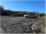
From the highway Ljubljana - Koper, we take the exit Črni Kal. From Črni Kal, we continue driving on the old road towards the coast, but we drive along it only to the next somewhat larger crossroads, where we turn left in the direction of the border crossing Sočerga. We drive on the mentioned road for a short time, and then signs for Predloka, Loka, Bezovica, Podpeč, Zanigrad, Zazid and Rakitovec direct us left onto a somewhat narrower local road. We then drive to the village of Bezovica, where at the smaller crossroads in the middle of the village we continue left in the direction of Podpeč. We then drive through Podpeč (the road through the mentioned place is very narrow) to the village of Zazid, where we park on the parking lot by the sports field.
Route description:
From the sports field we walk to the village, where we come to an unmarked crossroads, beside which there is a bench and a water tap. Here we continue right and follow the slightly ascending road to the upper part of the village, where we notice the first signs for Golič and Lipnik. We again continue right and continue the ascent on the asphalt road that leads to the nearby water catchment. Already some 10 m before the water catchment, we come to the next unmarked crossroads, where we continue on the right macadam road. The macadam road then brings us to a smaller crossroads, beside which there is the next water trough. This time we continue on the left wider road, beside which we quickly notice the blaze. We continue on the poorer road for a short time, after which a marked shortcut branches off to the right. The path quickly returns to the road and already after a few steps splits again into two parts. Wherever we continue, the path will quickly bring us to the railway track and the dilapidated railway station Zazid. We carefully cross the railway track that leads towards Pula, and on the other side of it we arrive at a marked junction (to here we need approximately 20 minutes).
We continue right in the direction of Lipnik and Golič (left Brežec and Kraški rob) and continue on a gentle cart track that ascends transversely to the right. Higher up, beautiful views towards the sea and Istria begin to open, and we continue on the gentle path that returns to the forest and brings us to a marked junction.
We continue right in the direction of Lipnik (left Golič and Kraški rob) and continue through a belt of scrub. When we step out of the scrub, the path brings us to an extensive grassy "plain", from which a nice view of Lipnik opens up. We walk across the "plain" for quite some time, then the signpost for Lipnik directs us left into the forest. The path ahead gradually ascends more steeply, then turns slightly to the right, where it climbs in a moderate ascent over the steep step of the Kraški rob. Behind the edge, the path levels out and brings us to a marked junction, where we continue left in the direction of the summit of Lipnik (straight to the memorial monument, right Kavčič and Golič). We continue on a gentle and very scenic path, along which after 5 minutes of further walking we arrive at the summit.

Photos:
 1
1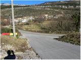 2
2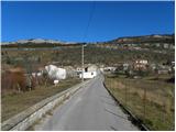 3
3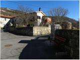 4
4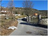 5
5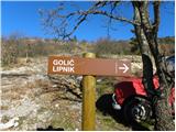 6
6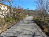 7
7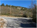 8
8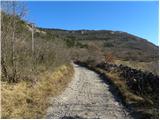 9
9 10
10 11
11 12
12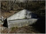 13
13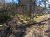 14
14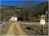 15
15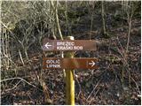 16
16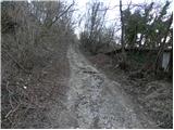 17
17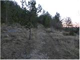 18
18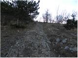 19
19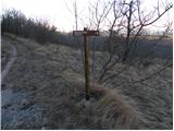 20
20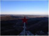 21
21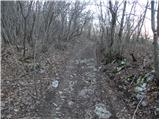 22
22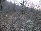 23
23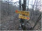 24
24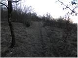 25
25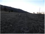 26
26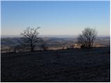 27
27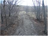 28
28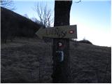 29
29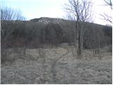 30
30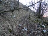 31
31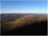 32
32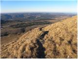 33
33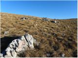 34
34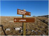 35
35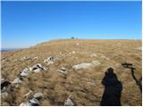 36
36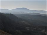 37
37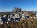 38
38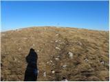 39
39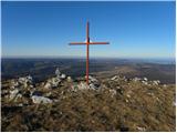 40
40 41
41
Discussion about the trip Zazid - Lipnik
|
| klavdipo18. 04. 2012 |
Is there also a stamp at the summit?
|
|
|
|
| B218. 04. 2012 |
No stamp anywhere, except on Kojnik... At least during my visit last year, there wasn't one on Kojnik either!
|
|
|
|
| B218. 04. 2012 |
The path and nature are wonderful, especially at the end of May and beginning of June, when everything blooms here - including lots of narcissi...
|
|
|
|
| gdbl4. 11. 2012 |
One of the nicer hikes in this area. There's a stamp at the top. Thanks for the excellent route description, as the path is poorly marked - signposted
From the top we returned along the ridge to the west until we reached the path leading to Golič. But this path is "uncomfortable" due to the sharp stones.
|
|
|
|
| grega_p14. 11. 2014 |
We can also make a nice circular tour if we start in the village of Rakitovec. First we go gently uphill on a nice forest road above the village towards Zazid and higher up join the mentioned trail. From the top we can continue towards Kavčič and return via Ubred to the starting point (see map).
Interesting areas, very remote and unique...
|
|
|
|
| Dejan321. 07. 2016 |
There is a stamp and logbook at the top, if there was no stamp during your visit it is because it was stolen. In spring 2015 the stamp was brought back to the top.
The residents of Zazid have also newly marked the path with signposts.
We definitely recommend this trip, especially in spring when it is full of flowers and the linden forest turns green.
|
|
|
|
| serafina197421. 05. 2019 |
Are the meadows around Rakitovec still/already blooming?
|
|
|
To post a comment you must log in:
If you do not yet have a username, you must first
register.