Bresternica (spodnji Rušnik) - Žavcarjev vrh
Starting point: Bresternica (spodnji Rušnik) (350 m)
| Latitude/Longitude: | 46,5918°N 15,5554°E |
| |
Walking time: 1 h 40 min
Difficulty: easy marked way
Elevation gain: 565 m
Elevation difference along the route: 565 m
Map: Pohorje 1:50.000
Recommended equipment (summer):
Recommended equipment (winter):
Views: 49.533
 | 4 people like this post |
Access to starting point:
From the road Maribor - Dravograd, in the settlement Bresternica (on maps Brestrnica), we will notice signs for the village Gaj, which direct us to the right (from the direction of Dravograd, left). After a few meters, at a poorly marked intersection, we continue left and follow the road that leads us through the village to the chapel, at which we continue left. The mostly ascending road brings us higher to an intersection beside which we notice mountain signposts for Tojzlov vrh. Here, we continue left and follow the road for approximately 1 km to the next mountain signposts (this time for Žavcarjev vrh) beside which we park on one of the smaller parking lots beside the road.
Route description:
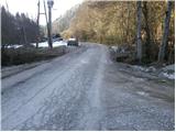
From the starting point, we head onto the macadam road in the direction of Žavcarjev vrh. The road first leads along the stream, then turns right and ascends more steeply. We follow this road, which mainly runs through the forest, to a smaller hamlet, where it changes into a wide cart track. We continue the ascent along the mentioned cart track, which higher leads past an isolated homestead and then brings us to a forest road, which we merely cross.
We continue the ascent along the cart track that ascends transversely through the forest, following it only to the place where the blazes direct us right onto the footpath.
The path higher widens into a cart track and later into a road, which we quickly leave as the blazes again lead us onto the footpath. Higher, the path joins the road, along which we continue the ascent for the next few minutes.
Soon we will notice the next signs for Žavcarjev vrh, which direct us onto a cart track, along which we ascend to the mountain hut in a few minutes.
From the mountain hut, we continue past the chapel along the marked path in the direction of Žavcarjev vrh. The path goes immediately into the forest and begins to ascend moderately. We follow this path, which runs through the forest the whole time, to the top.

Photos:
 1
1 2
2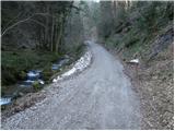 3
3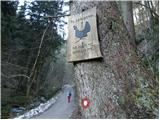 4
4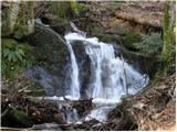 5
5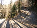 6
6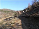 7
7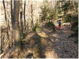 8
8 9
9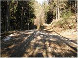 10
10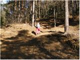 11
11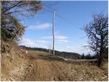 12
12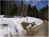 13
13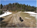 14
14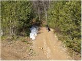 15
15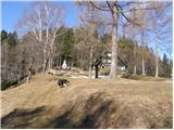 16
16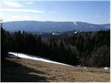 17
17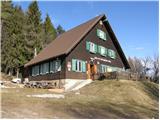 18
18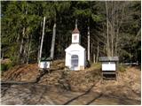 19
19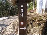 20
20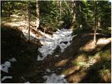 21
21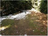 22
22 23
23
Discussion about the trip Bresternica (spodnji Rušnik) - Žavcarjev vrh
|
| Romanica8. 02. 2011 |
Yesterday my boyfriend and I went to this summit. Excellent excursion. The only thing that bothered us was that we couldn't find the stamp anywhere. The hut was closed, there was no stamp outside either, nor on the summit.
|
|
|
|
| kozo8. 05. 2011 |
Hello, yesterday my friend and I were at Žavcerjev vrh. The weather was sunny and warm. We also stopped at the hut where we got a stamp (the real transversal one was stolen, as the hut keeper told us) and of course also the hut keeper's signature, whom I must say is very accommodating and friendly and many could take an example from him. So I must say it was great.
Best, Bojan
|
|
|
|
| ROMAK18. 10. 2011 |
Hello, I was at Žavcarjev dom for the first time and was pleasantly surprised by the surroundings and the staff in the hut as well as the food. Since it's autumn and there are plenty of chestnuts around, we collected them along the path and then roasted them at the hut. I was with PD Radgona, which organized an intergenerational hike. About 70 members participated. They took the 88-year-old member by personal car and brought her to the hut. She was very happy among us and glad to be with us. We got the stamp at the hut, so it's back in place. Nice greetings and lots of nice stamps to those planning to go to this hut, you won't regret it. I was there 16.10.2011
|
|
|
|
| Kokta24. 03. 2012 |
Really nice hiking trail. Excellently marked. No stamp at the top, but it's in the hut.
|
|
|
|
| TJ1236. 02. 2015 |
When the hut is closed, the stamp can be obtained from the caretaker at the Namestnik homestead (about 5 min from the hut).
|
|
|
|
| meowtain30. 10. 2016 |
There are still plenty of chestnuts, really nice path. 
|
|
|
|
| Suriljana26. 04. 2019 |
Last week on this path, a bit my own way. At the first right bend of the road, I continued straight along the stream to the steep pasture and further along the stream to a somewhat overgrown cart track, which turns left above the stream and then climbs steeply. The path passes a hunting stand, where it turns right and joins the described path at the abandoned house (picture no. 9). Surprisingly, the cart track is also entered in Google Maps. This way I avoided the loose sheepdogs in the mentioned ''hamlet'', it wasn't pleasant to pass by with my furry one.
|
|
|
|
| ribic30. 09. 2019 |
The sheep pens are now locked, or maybe they only lock them on weekends when more hikers pass by. But it's good to know about the mentioned path, I watched how some continued along the stream and wondered where they come out...
Otherwise, the hut has new caretakers who are excellent and really make an effort for hikers. The offer is varied and during yesterday's visit there were plenty of hikers. Especially many young ones.
I hope the tenants succeed and continue to do such a good job.
|
|
|
|
| Falcon8412. 08. 2020 |
Nice, well-maintained trail, after a couple of steep ascents the trail rewards and increasingly beautiful views of forested slopes and vistas back to the valley open up. I recommend sticking to the hiking trail -> at the first junction by the stream sharply right uphill, not further along the stream. It has become a bit unclear because the forest owners have scratched off all official markers from the trees in this bend  . I don't recommend continuing along the stream, it's overgrown, slippery rocks, lots of logging spurs, even dead ends. Without a map or terrain knowledge, definitely not. And no views either. . I don't recommend continuing along the stream, it's overgrown, slippery rocks, lots of logging spurs, even dead ends. Without a map or terrain knowledge, definitely not. And no views either.
|
|
|
|
| nejcf1. 05. 2023 22:03:17 |
Today we went on this path to Žavcarjev vrh, continued to Tojzlov vrh and descended back via various tracks. There was a lot of visitors at both huts, with music they were grilling čevapčiči and hamburgers. All paths are now very well marked, only the sign in picture 2 is no longer there. The stated walking time is a bit exaggerated as you reach the summit at normal speed in 1h 15min.
|
|
|
|
| Minagawa13. 02. 2026 18:14:48 |
Very nice trail, but like some users before me, I also had problems with dogs. At the farm in photo No. 7, two fairly large and aggressive dogs are unleashed, next to it a warning-passage at your own risk. Another large unleashed dog was watching us from afar at the farm in photo No. 14, so we rather avoided it by taking a wide detour. Also on the alternative path mentioned by Suriljana, there is a fence at the end and it seems that hikers are not very welcome there.
|
|
|
To post a comment you must log in:
If you do not yet have a username, you must first
register.