Trnovec - Gontarska planina
Starting point: Trnovec (390 m)
| Latitude/Longitude: | 46,1237°N 14,3536°E |
| |
Walking time: 1 h 30 min
Difficulty: easy marked way
Elevation gain: 504 m
Elevation difference along the route: 504 m
Map: Ljubljana - okolica 1:50.000
Recommended equipment (summer):
Recommended equipment (winter):
Views: 19.312
 | 1 person like this post |
Access to starting point:
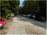
From Medvode we drive to the village Sora, where we go towards the village Topol (Katarina). Soon after the village Sora we come to the village Trnovec (rarely inhabited area). When on the right side of the road we notice a macadam road and next to it signposts, we park. The parking lot is on the left side of the road.
Route description:
From the parking lot, we carefully cross the road and then we start ascending on a macadam road in the direction of log cabin Osovnik.
After approximately ten minutes of walking, a footpath to Govejek branches off to the left, and we continue on the road, which after half an hour of walking from the starting point brings us to a smaller hamlet. Here the road makes a left turn and after a few steps it brings us to a crossroad of two paths. We go on the right path (road) in the direction of the hunting cottage (we can also continue on the road, but we then bypass the hunting cottage), which we reach after a minute of walking from the crossroad.
We continue ahead past the cottage and the path soon brings us to the road which we left. A little further, the road brings us to a somewhat bigger crossroad, where we continue left in the direction of Gontarska planina and Tošč (sharply left Dom na Govejku, right Osolnik). The path ahead from the road passes to a footpath, which starts ascending diagonally on a somewhat steeper slope. Higher, the footpath for some time entirely flattens, and then in a moderate ascent through the forest brings us to the panoramic peak of Gontarska planina.

Photos:
 1
1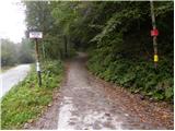 2
2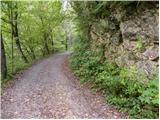 3
3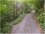 4
4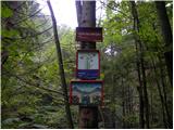 5
5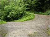 6
6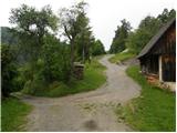 7
7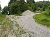 8
8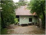 9
9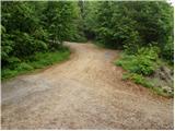 10
10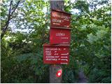 11
11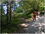 12
12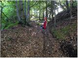 13
13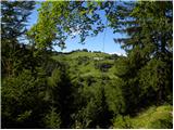 14
14 15
15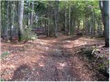 16
16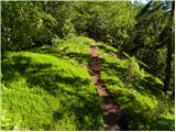 17
17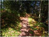 18
18 19
19 20
20
Discussion about the trip Trnovec - Gontarska planina
|
| zlatica4. 03. 2019 |
At Gontarska planina near the benches there is a trail junction, one goes downhill, the other straight along the ridge ahead. For hikers who are here for the first time, there are very much missing signs where each path leads. That's why passers-by were all the more welcome so that my colleague and I could properly orient ourselves. That's why passers-by were all the more welcome so that my colleague and I could properly orient ourselves.
|
|
|
To post a comment you must log in:
If you do not yet have a username, you must first
register.