Spodnja Besnica (Ribogojnica) - Špičasti hrib
Starting point: Spodnja Besnica (Ribogojnica) (410 m)
| Latitude/Longitude: | 46,2544°N 14,288°E |
| |
Walking time: 1 h 30 min
Difficulty: easy marked way
Elevation gain: 427 m
Elevation difference along the route: 445 m
Map: Škofjeloško in Cerkljansko hribovje 1:50.000
Recommended equipment (summer):
Recommended equipment (winter):
Views: 10.483
 | 1 person like this post |
Access to starting point:
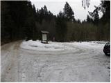
A) From Ljubljana, we drive on the old road towards Kranj, and there we stick to the main road, which we follow to the bridge over the river Sava. Just before the bridge we leave the main road and continue driving straight in the direction of Besnica. Further, we drive through the settlements Rakovica and Spodnja Besnica, and then at the sign for the end of Spodnja Besnica we turn left in the direction of fish farm (Ribogojnica). Ahead we follow the signs for fish farm (Ribogojnica), and we follow the road to the healing well Zdravilni studenec, where we park in an appropriate place by the information board.
B) From Jesenice or Bled, we drive on the highway towards Ljubljana, and we follow it to exit Kranj - west. We continue driving on the old regional road towards Ljubljana, and we drive along it to Kranj, where immediately after the bridge over the river Sava we turn right in the direction of Besnica. Further, we drive through the settlements Rakovica and Spodnja Besnica, and then at the sign for the end of Spodnja Besnica we turn left in the direction of fish farm (Ribogojnica). Ahead we follow the signs for fish farm (Ribogojnica), and we follow the road to the healing well Zdravilni studenec, where we park in an appropriate place by the information board.
Route description:
From the starting point, we continue on the macadam road which is gently ascending through the forest. We soon come to a smaller crossing, where the marked path branches off to the right towards Sveti Mohor, and we walk a few more minutes on the road, which at the crossroads we follow in the direction of Špičasti hrib. And even a little further, the road brings us to a smaller wooden cottage, which is situated on the left side of the road.
At this spot, on the right side we notice a sign for Špičasti hrib, which points us to the right uphill. The path ahead at first steeply ascends, and then already after a few meters flattens and continues in a gentle ascent. After a few minutes of gentle ascent we step on the forest road which we only cross and on the other side of it we look for the continuation of the marked path. The path which continues through the forest, for some time leads us on an indistinct ridge and then turns a little to the right, where for a short time it flattens. Next follows a short crossing, and then the path starts ascending steeply. Higher, we cross the cart track, and the path passes on to an even a little steeper forested ridge. The path which almost all the time runs through the forest, higher brings us to a marked crossing, where we continue straight upwards (left Sveti Jošt, right Sveti Mohor).
We continue in the direction of Špičasti hrib, which we reach after a good 5 minutes of additional walking.

Photos:
 1
1 2
2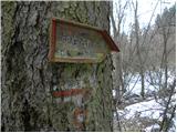 3
3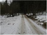 4
4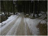 5
5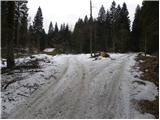 6
6 7
7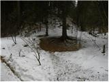 8
8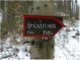 9
9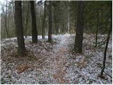 10
10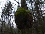 11
11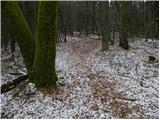 12
12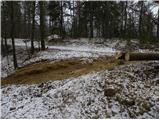 13
13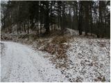 14
14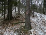 15
15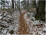 16
16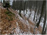 17
17 18
18 19
19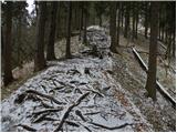 20
20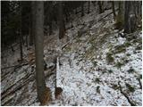 21
21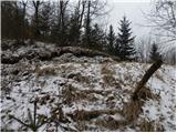 22
22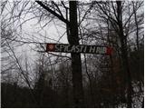 23
23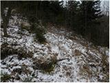 24
24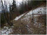 25
25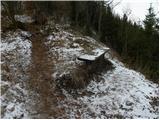 26
26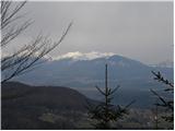 27
27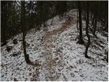 28
28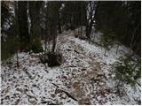 29
29 30
30
Discussion about the trip Spodnja Besnica (Ribogojnica) - Špičasti hrib
|
| vencelj13. 02. 2011 |
In this area you can do many beautiful few-hour hikes and quite a few of them have been very nicely presented in the last days.
Bravo!
LP
|
|
|
To post a comment you must log in:
If you do not yet have a username, you must first
register.