Selca - Miklavška gora (footpath)
Starting point: Selca (430 m)
| Latitude/Longitude: | 46,222°N 14,1934°E |
| |
Route name: footpath
Walking time: 1 h 25 min
Difficulty: easy marked way
Elevation gain: 525 m
Elevation difference along the route: 525 m
Map: Škofjeloško in Cerkljansko hribovje 1:50.000
Recommended equipment (summer):
Recommended equipment (winter): ice axe, crampons
Views: 11.516
 | 3 people like this post |
Access to starting point:
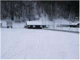
From Škofja Loka we drive towards Železniki or vice versa. Only about 500 meters after (or before, if we come from the direction of Železniki) village Selca we notice the sign with the caption "športni park Rovn" (sports park Rovn), which points us to the left (from Železniki right). We park on a parking lot near the mentioned sports park.
Route description:
From the parking lot, we at first walk to the hut of Kennel Club (it is situated on the left - eastern side of the park). Here we will notice a steep cart track which goes sharply right upwards. Already after a few steps of ascent, we notice the first green-yellow blaze. The cart track is then ascending diagonally and higher brings us to a crossing, where we continue on the right marked but a little worse cart track. For some time well-marked path then leads us past a few smaller crossings and a little higher brings us to a larger clearing which the path bypasses on the left side. After that, the path crosses a shorter lane of forest after which we step on the next grassy slope on which we ascend to the saddle between Zavrnik (762m) on the left and Miklavška gora on the right.
On the saddle, the path turns right and steeply ascends through a dense forest. Higher, the path crosses a cart track (badly marked) and is then still steeply ascending. The steepness of the path decreases only at the transmitter, where we also step out of the forest. There follows only a less-than-5-minute ascent on the more and more panoramic slope to the top of Miklavška gora.

Photos:
 1
1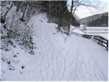 2
2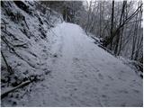 3
3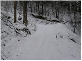 4
4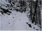 5
5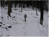 6
6 7
7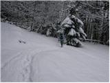 8
8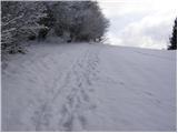 9
9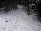 10
10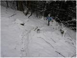 11
11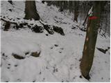 12
12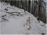 13
13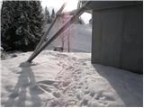 14
14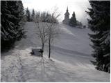 15
15 16
16
Discussion about the trip Selca - Miklavška gora (footpath)
|
| firekate9. 02. 2011 |
on some sections the trail is poorly marked, you have to find your way a bit
|
|
|
|
| Lj26. 02. 2011 |
Today walked a very nice loop along the Hunter's path to Miklavška gora (one of the thematic paths in Loški, very useful map I got at TD Radovljica). Ascent along the above described path, descent to the other side to Zg. Golico, some time along the road to the big hayrack above Sp. Golico, marked turnoff right to Dolenja vas. Pleasant path to Dolenja vas, there we missed the cart track along Selška Sora back to start. We went along the road, less than 3 km. Total approx. 4 pleasant hours.
|
|
|
|
| nevica31. 03. 2020 |
in peace and quiet on 28.3.2020
|
|
|
To post a comment you must log in:
If you do not yet have a username, you must first
register.