Rakovica - Sveti Jošt above Kranj
Starting point: Rakovica (370 m)
| Latitude/Longitude: | 46,2504°N 14,3226°E |
| |
Walking time: 1 h 20 min
Difficulty: easy marked way
Elevation gain: 475 m
Elevation difference along the route: 475 m
Map: Škofjeloško in Cerkljansko hribovje 1:50.000
Recommended equipment (summer):
Recommended equipment (winter):
Views: 35.771
 | 3 people like this post |
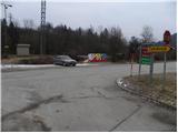
Access to starting point:
A) From Ljubljana, we drive on the old road towards Kranj, and there we stick to the main road, which we follow to the bridge over the Sava River. Just before the bridge, we leave the main road and continue driving straight in the direction of Besnica. We then drive to the village of Rakovica, where we park at an appropriate place by the bus stop.
B) From Jesenice or Bled, we drive on the highway towards Ljubljana, which we follow to the Kranj - west exit. We continue driving on the old regional road towards Ljubljana to Kranj, where immediately after the bridge over the Sava River we turn right in the direction of Besnica. We then drive to the village of Rakovica, where we park at an appropriate place by the bus stop.
Route description:
From the parking lot by the bus stop, we head onto the asphalt road in the direction of the village Zabukovje. The road soon turns right into the forest, where it moderately ascends and brings us to a smaller crossroads, where we continue left in the direction of Sveti Jošt. We continue on the road for some time, along which we notice a few individual blazes, then it takes us past a few houses and a spring to an unmarked crossroads. Here we continue on the left "main" road, which brings us just a few dozen steps higher to a smaller hamlet, where the blazes direct us right between two houses. Behind the houses, we leave the road and continue the ascent left on the marked footpath, which first ascends across a meadow, then transitions into the forest, through which it ascends for quite some time on a cart track. The cart track higher changes into a steeper path, which brings us to a marked junction, where the path from the village Stražišče joins from the left.
Here we continue right in the direction of Sveti Jošt and continue the path in a traversing ascent to the right. Somewhat higher, we reach a larger chapel and above it the Dom Puščava (Društvo Rod zelenega Jošta).
Near the mentioned cottage there is another chapel, by which stands a mountaineering signpost, which informs us that for the ascent to Jošt we can choose the left gentle or right steep path. Regardless of which path we choose, we arrive at the summit in a few minutes.

Photos:
 1
1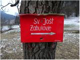 2
2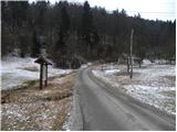 3
3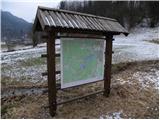 4
4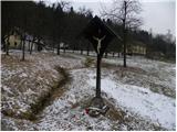 5
5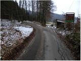 6
6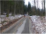 7
7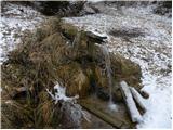 8
8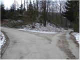 9
9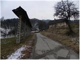 10
10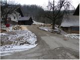 11
11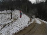 12
12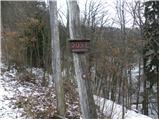 13
13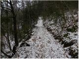 14
14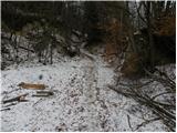 15
15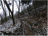 16
16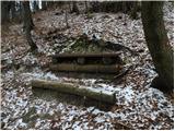 17
17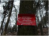 18
18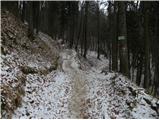 19
19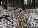 20
20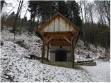 21
21 22
22 23
23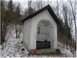 24
24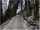 25
25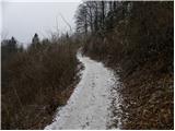 26
26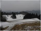 27
27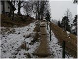 28
28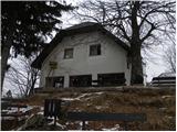 29
29 30
30
Discussion about the trip Rakovica - Sveti Jošt above Kranj
|
| vencelj131. 01. 2011 |
Nice hike. Judging by the photos, it was yesterday morning (30.1.)... I was just up there. Well, I came from the church of St. Jedrt above Lajše via Mohorja...
|
|
|
|
| Tadej1. 02. 2011 |
The photos are indeed from Sunday 30.1. Too bad there was low cloud cover and no view. Otherwise it was still nice.
|
|
|
|
| Lisica10. 02. 2011 |
I went up alone from Zabukovje and walked slowly 40 min. For those who want a longer trip I would recommend this one from Rakovica-leave the car by the main road before turning towards Zabukovje and then another approx. 10-15 min on a nice traffic-free road through the village. Parking is quite a problem because the road is narrow and steep and there aren't many spaces along it.
In my opinion this path is max 1 h normal walking, by no means 1.20 h. The stamp is obtained at the oštarija on top-you have to ask for it.
|
|
|
|
| EUGEN11. 02. 2011 |
Our team (wife, little dog and me) went:
Spod.Besnica(fish farm)-Špičasti hrib-Sv.Jošt-Ribogojnica. Day (weather) was wonderful, views fantastic. Recommended.
|
|
|
|
| J.P.27. 03. 2021 |
Very nice circular trail: Rakovica-Jošt-Špičasti hrib-Besnica-Rakovica. Best regards
|
|
|
|
| Kranj27. 03. 2021 |
Do you then go from the fish farm to Rakovica along the road???
|
|
|
|
| J.P.27. 03. 2021 |
Yes, that's right. You cover that part faster and it's less strenuous 
|
|
|
To post a comment you must log in:
If you do not yet have a username, you must first
register.