Rečica ob Paki - Gora Oljka
Starting point: Rečica ob Paki (310 m)
| Latitude/Longitude: | 46,3274°N 15,0453°E |
| |
Walking time: 1 h 15 min
Difficulty: easy marked way
Elevation gain: 423 m
Elevation difference along the route: 423 m
Map: Zgornja Savinjska dolina 1:50.000
Recommended equipment (summer):
Recommended equipment (winter):
Views: 31.066
 | 2 people like this post |
Access to starting point:
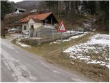
From the highway Ljubljana - Celje, take the exit Šempeter and follow the road ahead in the direction of Polzela. In Polzela, signs for Gora Oljka point us to the right. The road then brings us into the village Podvin pri Polzeli, where we notice the next sign for Gora Oljka. Here we continue straight (even though it says Gora Oljka right) and follow the road across the railway crossing at the end of the village Podgora. Only a few meters after the crossing we arrive in the village Rečica ob Paki, where we also notice signs Podgora, Mali and Veliki vrh right. Here we turn right and drive on the road again across the railway track and then park somewhere by the road so that we don't hinder traffic (there aren't any appropriate parking spots).
Route description:
By the road, we soon notice blazes, which bring us into the village. A marked path runs through the village, which partly follows the road and partly a footpath. When the road ends, we continue past the last house in the village onto a cart track which ascends transversely. After a short ascent, the path brings us onto a poor macadam road, which we follow left uphill. After a few minutes of ascent along this road, we come to a junction of three cart tracks. The first ends after a few steps, the second correct one is marked and the third turns sharply right. We continue the ascent on the marked cart track, which soon changes into a pleasant footpath. There follows 10 minutes of ascent and the path brings us to a junction, where we continue right in the direction of Gora Oljka. Further we ascend moderately through the forest on a cart track, which a little higher brings us to a forest road. Here we go right and continue the path along the road, which brings us to the mountain hut on Gora Oljka in two minutes of further walking.

Photos:
 1
1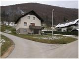 2
2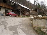 3
3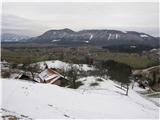 4
4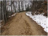 5
5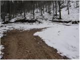 6
6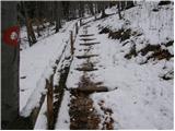 7
7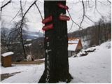 8
8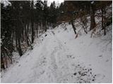 9
9 10
10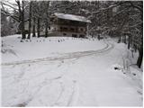 11
11 12
12
Discussion about the trip Rečica ob Paki - Gora Oljka
To post a comment you must log in:
If you do not yet have a username, you must first
register.