Jablanica - Srednji vrh at Kozlek
Starting point: Jablanica (428 m)
| Latitude/Longitude: | 45,5429°N 14,2921°E |
| |
Walking time: 1 h 25 min
Difficulty: easy marked way
Elevation gain: 495 m
Elevation difference along the route: 495 m
Map: Snežnik 1:50.000
Recommended equipment (summer):
Recommended equipment (winter):
Views: 4.398
 | 1 person like this post |
Access to starting point:
From the Ljubljana - Koper highway take the Postojna exit and follow the road ahead in the direction of Reka and Ilirska Bistrica. At the end of Ilirska Bistrica turn left towards the villages Vrbovo, Jablanica and Trpčane. Further we drive past the villages Jasen, Vrbovo and Vrbica. Immediately after the village Vrbica turn left onto a macadam road, which after 30 meters brings us to the village road, where we continue right. Further we drive only a few dozen meters to the parking lot by the road, which is located before a small bridge.
Route description:
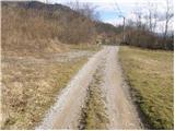
From the parking lot we cross the small bridge and by the road notice the hiking signs for the castle and Kozlek. The blazes direct us left onto a cart track which soon has an unmarked junction, where we continue right into the forest. The path along which we soon notice blazes leads us past the ruins of the former church, where we again notice signs for the castle and Kozlek. Further we continue on a poorer footpath which a little higher brings us to a cart track, which we follow to the ruins of the former castle. Further the cart track soon changes into a footpath which ascends more steeply on partly panoramic slopes. A little higher we join the path from Vrbiški dol. Here we continue right on the path which moderately ascends along a forest-covered ridge. Soon we come to panoramic slopes from which a beautiful view opens towards the south, and towards the east we already see the scenic Srednji vrh, which is the forepeak of Kozjek. Here the path descends for a short time, then in a moderate ascent through the forest brings us to Srednji vrh.

Along the route: Stari grad (575m)
Photos:
 1
1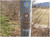 2
2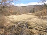 3
3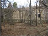 4
4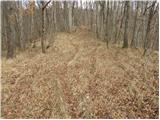 5
5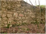 6
6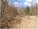 7
7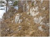 8
8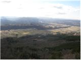 9
9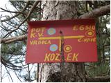 10
10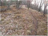 11
11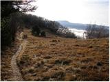 12
12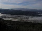 13
13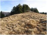 14
14 15
15
Discussion about the trip Jablanica - Srednji vrh at Kozlek
To post a comment you must log in:
If you do not yet have a username, you must first
register.