Senožeti - Sveti Miklavž above Sava (footpath)
Starting point: Senožeti (275 m)
| Latitude/Longitude: | 46,0905°N 14,7336°E |
| |
Route name: footpath
Walking time: 1 h 20 min
Difficulty: easy marked way
Elevation gain: 466 m
Elevation difference along the route: 466 m
Map: Ljubljana - okolica 1:50.000
Recommended equipment (summer):
Recommended equipment (winter):
Views: 24.052
 | 2 people like this post |
Access to starting point:
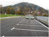
A) From the highway Ljubljana - Celje, we take the exit Šentjakob and follow the road ahead towards Litija. A few kilometers after Dolsko, the road brings us to the roundabout, where we go towards the village Senožeti. The road then immediately brings us to the village, where at the crossroad we turn right and drive approximately 100 m to a larger parking lot near the school playgrounds.
B) From Litija we drive towards Ljubljana but only to the roundabout, where the signs direct us towards the village Senožeti. The road then immediately brings us to the village, where at the crossroad we turn right and drive approximately 100 m to a larger parking lot near the school playgrounds.
Route description:
From the parking lot, we continue on the road which takes us across a stream to a crossroad where we continue left. The road then already after a few meters brings us to the next crossroad, where the blazes direct us left from the chapel onto a footpath. The path is short since already after a few meters we step back onto the road. We continue walking on the road for only a few minutes, since the signs for Miklavž then direct us left steeply uphill. Further, we follow the path which ascends through the forest and a little higher brings us to a larger clearing behind which we join the road. The road then brings us to a crossroad in Velika vas, where the signs direct us right. The road then in a few minutes brings us above the village. Here the signs direct us left onto a cart track which soon turns into a footpath. Further we follow the path which ascends diagonally and a little higher brings us to a junction, where we continue straight (left Cicelj). Only a little further, the path brings us out of the forest onto expansive meadows. The path through the meadow turns a little left towards the last house in the village on which we notice a logbook box.
From the last house, we continue uphill on a cart track which climbs across the meadow and after a few minutes brings us to the church of St. Miklavž, which is located on a scenic hill.

Along the route: Velika vas (510m)
Photos:
 1
1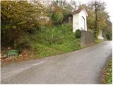 2
2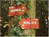 3
3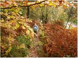 4
4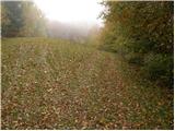 5
5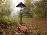 6
6 7
7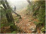 8
8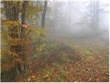 9
9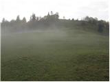 10
10 11
11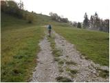 12
12 13
13
Discussion about the trip Senožeti - Sveti Miklavž above Sava (footpath)
|
| kroki29. 01. 2008 |
Past Vegova homestead we can make a nice little tour.
|
|
|
|
| darh2. 05. 2010 |
Yesterday we incorporated the ascent to Sv. Miklavž into our circular path via Sv. Miklavž, Cicelj and Murovica starting from Križevska vas.
|
|
|
|
| janezz29. 11. 2011 |
From the road above Senožeti, turn left up the hill before the water intake to avoid the slope, which slips even in dry weather. When you reach the intake, look back and you will see the markings.
|
|
|
|
| navrhu14. 09. 2014 |
Was there yesterday. They could paint some markers in the forest. Otherwise, the condition of markings on most hills I've hiked this year is poor (I'm talking about hills, not mountains).
|
|
|
|
| alyas21. 04. 2020 |
I'm interested in who is maintaining the climbing area under St. Miklavž?
… if it's not a secret or public secret, you can also write to ZS, alias.
|
|
|
To post a comment you must log in:
If you do not yet have a username, you must first
register.