Starting point: Puštal (340 m)
| Latitude/Longitude: | 46,1636°N 14,3099°E |
| |
Walking time: 2 h 15 min
Difficulty: easy marked way
Elevation gain: 518 m
Elevation difference along the route: 600 m
Map: Škofjeloško in Cerkljansko hribovje 1:50.000
Recommended equipment (summer):
Recommended equipment (winter):
Views: 18.811
 | 4 people like this post |
Access to starting point:
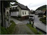
First, we drive to Škofja Loka, and then we continue driving in the direction of Gorenje vasi. Further, we drive through the old part of the town, but only to a crossroad, where a road branches off to the right towards Loški grad. At the mentioned crossroad, we continue left (direction Puštal), and the road then brings us over the Poljanščica river to Puštal. Here a road branches off to the right, which runs into the Hrastnica valley, and we continue left towards the village Sora. Here we will notice on the right side a narrow and steep cart-track road, by which there are mountain signposts for Osolnik, Tošč and Črni Vrh. At the starting point, there are no appropriate parking spots, so it is better to park on one of the organized parking lots in Škofja Loka. This extends the path for approximately 10 to 15 minutes.
Route description:
From the spot where we have parked, we first walk to the starting point, then head onto a wide and steep cart track in the direction of Osolnik, Tošč and Črni Vrh. The path ahead ascends past numerous Stations of the Cross, which lead towards the church of the Holy Cross on Hribec, and we soon notice signposts for Osolnik, which direct us left, at first slightly downhill. After a few steps of descent we come into a smaller valley, and continue on a steep grassy slope, where we ascend along the edge of a grazing fence. The path, from which beautiful views first open up on Škofja Loka and the Kamnik-Savinja Alps in the background, quickly enters the forest, where it then gradually flattens.
The path ahead leads us through dense forest for quite some time, and we walk on the path, which descends more steeply a few times. After a while we step out of the forest onto a panoramic grassy hayfield, where the path temporarily fades slightly. Only a little higher we step onto a cart track and follow it to the right; it quickly brings us to a smaller shrine and NOB monument, where we continue slightly left. Behind the monument the path turns slightly right and brings us a little higher into a strip of forest.
When we step out of the forest again, we will notice a lonely homestead on the left side and a fenced pasture on the right. We continue straight on the path that enters the forest, and it soon brings us to a macadam road, which we follow to the right. There follows a few minutes' walk along the road, then we arrive at an intersection, where we continue straight onto a cart track. We continue on the marked cart track, which soon has several junctions, and we always stick to the blazes. Higher up the cart track turns into a footpath, which begins to ascend steeply along the grazing fence. A little further, a path from the village Sora joins from the left, and we continue right, arriving at the top of Osolnik after a few dozen more steps, where the church of St. Mohor and Fortunat stands.

Photos:
 1
1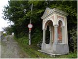 2
2 3
3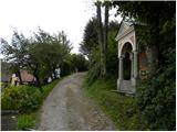 4
4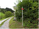 5
5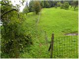 6
6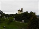 7
7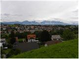 8
8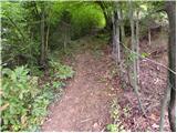 9
9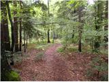 10
10 11
11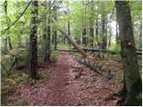 12
12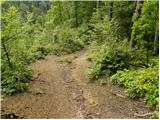 13
13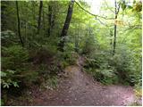 14
14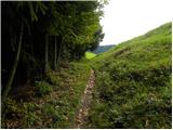 15
15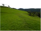 16
16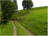 17
17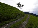 18
18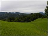 19
19 20
20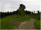 21
21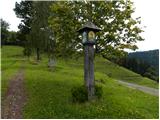 22
22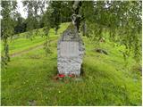 23
23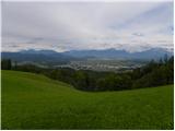 24
24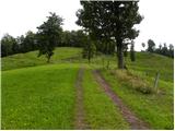 25
25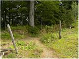 26
26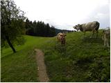 27
27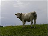 28
28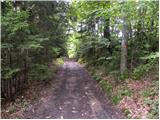 29
29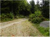 30
30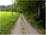 31
31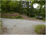 32
32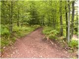 33
33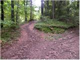 34
34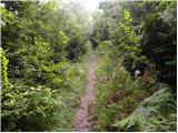 35
35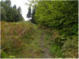 36
36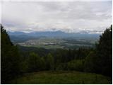 37
37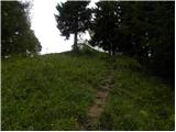 38
38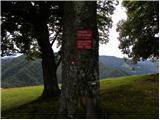 39
39 40
40
Discussion about the trip Puštal - Osolnik
|
| katty3. 09. 2011 |
Today again after a good year on Osolnik , but not on any of the paths-tracks described here. Still really nice, the only thing bothering me is the "rutted" road , but not on any of the paths-tracks described here. Still really nice, the only thing bothering me is the "rutted" road  , even before you reach the first weekend house. It looks like they widened the track for some mountain bikers or weekend owners , even before you reach the first weekend house. It looks like they widened the track for some mountain bikers or weekend owners . The path is really wonderful, in really nice and clear weather our eyes rest . The path is really wonderful, in really nice and clear weather our eyes rest  on the Kamnik-Savinja Alps (Kočna, Grintovec, Krvavec and Velika planina) on the Kamnik-Savinja Alps (Kočna, Grintovec, Krvavec and Velika planina) and on the Škofjeloško hills (Lubnik and Ratitovec); that luck I didn't have to say that the Julian Alps are visible. and on the Škofjeloško hills (Lubnik and Ratitovec); that luck I didn't have to say that the Julian Alps are visible.
I'll send pictures and describe the path tomorrow afternoon.
Best regards, Katy
|
|
|
|
| tol4. 09. 2011 |
What's wrong with you? You guys are already messing with mountain bikers enough.
Let me tell you, for real mountain bikers, riding on a wide cart track is no fun.
Especially the idea that something would be arranged for cyclists in our nature is like wishing to hit the lottery. And I have even better chances of hitting the 7th!
Anyway, paths usually widen due to timber hauling.
|
|
|
|
| katty4. 09. 2011 |
Listen, the path is definitely not so wide that you could drive a tractor on it, well, maybe a small tractor maybe. Otherwise, there were only tracks from bikes and hikers, none from anyone else. True, it's not as pleasant to walk on a rutted path as on a normal trail.
Oh, and don't get mad now, it's not that bad . .
|
|
|
|
| Darxta4. 02. 2013 |
Today I went down the described path, but I can confirm that the photos (and path description) are still up-to-date and quite accurately describe the path. Markings are fine. The only novelty is the asphalted road to the church in Puštal
I was about to say that 2h 15min might be a bit too much, but if you get over the first two hillocks at the start of the path (Sten and Mrtancova planina) and have a light pace, then I can say it will take maximally that much time
I went up a bit around, along the road through Puštal towards Hrastnica and after approx. 1.5km left behind the houses and into the forest, but there are no markings. However, this path is easier, as it avoids the first hillocks, thus saving about 100m of elevation.
And I also met a cyclist
|
|
|
|
| Darxta4. 02. 2013 |
Oh, let me correct myself a bit.
The easier path at the beginning has no markings, but once you reach the forest behind the houses, the marked path starts after about 100m
|
|
|
|
| colinbrooks18. 07. 2014 |
This is quite a long walk, nearly all in the forest, but with spectacular views at the beginning, middle, and end. The forest is a maze of paths, and because of recent storms and deteriorating markings it is easy to lose your way. Having a GPS navigation device would be advisable especially in bad weather [although for some strange reason the path at the start is not shown on some versions of Google Maps]. A good place to park is at a free public car park on the left after you cross the bridge over the Sora on the road from Skofja Loka to Pustal [there is also a smaller parking area just a little further along the road at the bus stop on the left]. If you choose to do the ascent from Hrastnica [see below] you could drive to where the path starts in Hrastnica, saving about 1.5 km of walking and ~100 m of climbing. This path is not signposted but it is the cart-track that begins near house 163.
The direct ascent from Pustal begins at a signpost about 100 m further along the road from the above mentioned parking areas, which directs you up a rough road [a Kalvarija] towards the church at Pustal [which is worth visiting as a detour and for the views of Skofja Loka]. The signpost says 2 h to Osolnik but this assumes you walk briskly and continuously and do not have any problems finding the way! Unfortunately, the markings and path-finding problems begin almost immediately, the start of the path to Osolnik being easily missed. It begins at the 7th station of the cross, and is indicated by a now rusty signpost that is in the wrong place, several metres further up the Kalvarija. The path descends a few metres to a dry stream, then ascends steeply up the hill, running SE along a fence that borders a pasture. At various positions along this path there are excellent views over Skofja Loka and to the Kamniske Alpe [even better views can be obtained from the field on the other side of the pasture if you have the energy and time to climb it].
After ~200 m the path enters the forest, bends to the S, and after another ~300 m of steep climbing reaches the top of the hill Sten [20 min/489 m]. The path then continues S roughly level along the crest of a ridge for ~1 km before ascending again to the top of Mrtancova Planina [45 min/545 m]. It then descends to the SE before switching S and continuing to descend to a col ~1 km S of Mrtancova Planina [55 min]. THIS IS THE MOST CRITICAL POINT IN THE WALK AS MANY PATHS MEET HERE AND IT IS NOT CLEAR WHICH TO FOLLOW. [One descends steeply W to Hrastnica, and is a good alternative route to or from Pustal]. The path to Osolnik is actually invisible, being up a step just to the right of a tree marked E7 in red letters. It then climbs SSE directly up to Vrh Rebra [75 min/682 m], one of the most scenic open pastures in Slovenia with spectacular views of Kranj and the Kamniske Alpe to the NE, and Skofja Loka and the mountains to the NW, including Triglav on a clear day.
Follow the winding cart-track up through the pasture to a war memorial. Here you have two choices. If you take the path to the left, keep right after ~100 m where the path branches, then keep left as the path enters a channel, and after ~500 m you meet a road where you should turn right. The path on the right of the war memorial follows a road past a farm before ascending the hill. Both paths from the war memorial converge after ~1 km at a crossroads where there are large wood piles and a large wood shed. Here again you have two choices. A path behind the large wood shed climbs steeply through the forest. When the path splits after ~100 m keep left, and do the same at each subsequent junction, and you will reach the top of Osolnik where the well-preserved church overlooks large open meadows with extensive views to the E, S, and W [857 m/40 min from Vrh Rebra]. The road to the left that heads off SE is an easier and much more scenic but much longer route to the top.
When returning it is best to use the alternate routes to the ones you took during the ascent. If you choose to begin your descent on the road, the steep meadow that descends E towards Kamniske Alpe between trees provides a shortcut that saves almost 1 km of walking. When you get to the large woodshed, the two alternatives are a road heading downhill NW to the farm, or a road that runs initially level in a more N direction. Both bring you to the meadow at Vrh Rubra. If you did not ascend Osolnik via this route you will have a major problem locating the path from the meadow down to Skofja Loka. The best way is to follow the cart track as it zig-zags down the meadow. The last section runs next to a fence at the top of the forest and just before the cart-track ends at the corner of the forest turn sharp right along the fence where you should see a fence post with a yellow arrow. Follow the fence ~100 m downhill then as it begins to climb again you will see the path to Skofja Loka marked with a signpost.
When you get to the tree marked E7 you have two choices, the rather longer up and down path through the forest to Pustal, with the benefit of excellent views at the end, or the route down to Hrastnica and then along the road to Pustal, the main advantages being no more climbing and saving ~1.5 km of walking if you parked the car at Hrastnica.
A map of the various paths described above can be viewed at:
http://www.everytrail.com/view_trip.php?trip_id=2873444
|
|
|
|
| KARAMELICA24. 01. 2016 |
Usually we go to Osolnik from Ločnica, but today we chose this path. At the start of the path, before entering the forest, there is a magnificent view of Škofja Loka, the church on Hribec with the cross path, Lubnik, the confluence of both Sore rivers, Kamnik Alps... on a clear day even Triglav was visible. The path is very well marked, all praise to PD. Recommended.
|
|
|
|
| Jačme22. 08. 2019 |
On 20.8.2019 my girlfriend and I went up at 17:30. Quite hot day, but most of the path is in the shade. Excellent view of the Kamnik Alps from the pasture (picture 24) and also towards Škofja Loka hills and Triglav summit. It can also be a nice sunset. From the top there is also a view of most of Ljubljana. We are not regular hikers, but we reached the top in 1 hour and 20 minutes.
For parking I recommend 2 free parking lots 4 minutes walk away:
1. by the football field,
2. by Škofja Loka swimming pool - in summer you can cool off in Poljanska Sora after descent and treat yourself to a cold drink and food in the local bar http://rajbar.si/ Tried and good
|
|
|
To post a comment you must log in:
If you do not yet have a username, you must first
register.