Loke - Krvavica (via Zajčeva koča)
Starting point: Loke (380 m)
| Latitude/Longitude: | 46,2139°N 15,0077°E |
| |
Route name: via Zajčeva koča
Walking time: 2 h 10 min
Difficulty: easy marked way
Elevation gain: 529 m
Elevation difference along the route: 630 m
Map: Posavsko hribovje - zahodni del 1:50.000
Recommended equipment (summer):
Recommended equipment (winter): ice axe, crampons
Views: 23.664
 | 3 people like this post |
Access to starting point:
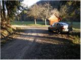
A) From the highway Ljubljana - Maribor, we take the exit Vransko and continue driving on the parallel old road towards Celje. We drive on the main road for a few kilometers, then signs for Tabor and Ojstriška vas direct us to the right. Further, we drive through Ojstriška vas to the place Tabor, and from there we continue in the direction of the village Loke. In Loke, we arrive at a crossroads, where we continue left in the direction of Zajčeva koča (straight to Krvavica) on the road that soon brings us to the next crossroads. Here, we continue right in the direction of "Zajčeva koča - footpath" (straight to Zajčeva koča by road) on the road that crosses a bridge and then brings us to a small parking lot by the road on the other side of the meadow.
B) From the highway Maribor - Ljubljana, we take the exit Šentrupert, then continue driving on the parallel old road towards Trojane. We drive on the main road for a few kilometers, then signs for Tabor and Ojstriška vas direct us to the left. Further, we drive through Ojstriška vas to the place Tabor, and from there we continue in the direction of the village Loke. In Loke, we arrive at a crossroads, where we continue left in the direction of Zajčeva koča (straight to Krvavica) on the road that soon brings us to the next crossroads. Here, we continue right in the direction of "Zajčeva koča - footpath" (straight to Zajčeva koča by road) on the road that crosses a bridge and then brings us to a small parking lot by the road on the other side of the meadow.
Route description:
Near the parking lot, we leave the road and continue the ascent on a cart track which branches off to the left from the road. The cart track after a few meters of walking descends to a stream, crosses it and on the other side changes into a steep footpath which higher ascends parallel to another cart track. The path, which runs through the forest, brings us higher to a partly overgrown clearing behind which it turns slightly to the right and brings us to a decaying house.
Here we continue on the right side of the house on a cart track which ascends diagonally (this part of the path is poorly marked) and a little higher makes a left turn. The moderately steep cart track then slowly turns right and brings us higher to the grassy meadows above which we cross a poor forest road.
We continue on a poorly marked cart track which after a while starts to descend and then joins a macadam road which we follow to the right to the next crossroads. At the crossroads, which is located in the middle of a bend, we continue right and follow it for about 100 m to the place where the sign for Zajčeva koča directs us right onto a wide cart track (poorer road), which starts to descend gently. We follow this cart track, which runs through the forest, to Zajčeva koča.
From the hut, we continue in the direction of Krvavica on the path which after an initial gentle ascent descends, then crosses the slopes to the west. A little further ahead we come to an orientation loop, where the marked path turns slightly right (poorly marked). Here we leave the cart track and continue walking on a pleasant mountain path surrounded by dense forest. After a short descent the path brings us to a forest road which we follow left to a junction.
Here we leave the road and continue straight on a footpath in the direction of Krvavica (sharply left to Čemšeniška planina). After a few meters of gentle ascent the path steeply ascends and brings us in a few minutes below the rocky walls of Krvavica which the path bypasses on the left side with fine views. A steep ascent on a slightly exposed traverse follows after which the path quickly brings us to the summit of Krvavica.

Photos:
 1
1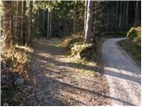 2
2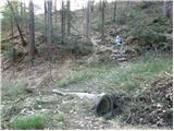 3
3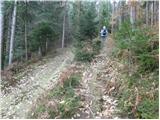 4
4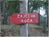 5
5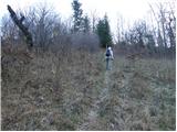 6
6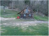 7
7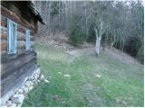 8
8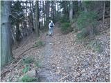 9
9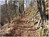 10
10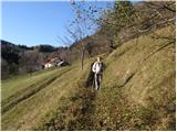 11
11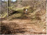 12
12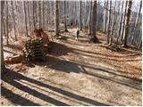 13
13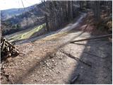 14
14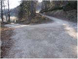 15
15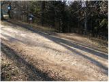 16
16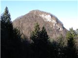 17
17 18
18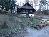 19
19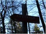 20
20 21
21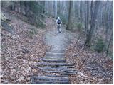 22
22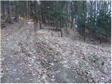 23
23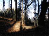 24
24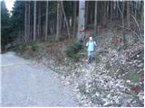 25
25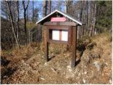 26
26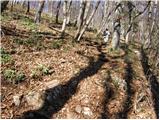 27
27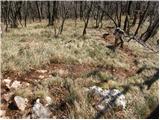 28
28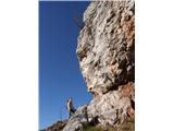 29
29 30
30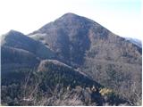 31
31 32
32
Discussion about the trip Loke - Krvavica (via Zajčeva koča)
|
| vespuci17. 11. 2011 |
This path follows the road or alongside it, but there is another one which I do not recommend, as it is abandoned, although faded markings can still be followed. Personally, I walked it downhill and it runs along an unnamed stream between Krvavica and the neighboring Brložno. I recommend to the caretaker of Zajčeva koča to post a notice on the mentioned path that it is no longer passable.
|
|
|
|
| Rudi2626. 04. 2013 |
I was up there on Wednesday 24.4.2013, I went from Zajčeva koča, parked next to the barrier, and I'm wondering what that hill to the right of Krvavica is, which is a bit lower and where the rocks are nicely visible, does anyone know?
|
|
|
|
| Rudi2627. 04. 2013 |
Thanks for the answer 
|
|
|
|
| kamenko3. 07. 2019 |
On 29.6.2018 we visited Krvavica, on the return we stopped at Zajčeva koča. Sincere thanks to caretaker Peter for the friendly service and information on the path condition to the parking lot.
|
|
|
|
| navdušena27. 06. 2025 19:38:24 |
I agree with vespucij, the path through "Tesen" to Zajčeva koča - there's even an arrow on the main road directing us to this path, is almost impassable in places, hard to follow and I advise against it. It's a shame it's not maintained, it's really a good option for a circular path to Krvavica through the window, descent to Zajčeva koča and to the valley. But better to find some other path...
|
|
|
|
| rinča14. 11. 2025 09:18:11 |
Last week I went to Krvavica through the window and returned through Tesen to nicely round off the tour. This path doesn't seem scary to me, you just need to be careful at a few exposed spots. The stream is crossed several times, so the path is not suitable after heavy rain when the stream swells.
If we want to take this path without going to Zajčeva koča, on the forest road below Krvavica, where the turn-off to Zajčeva koča is, we continue along the road, which after a few bends brings us to the hunting stand and markers that direct us left along the stream. The markers are a bit faded, but still easy to follow. At the end, there's another 100 m walk on asphalt to the parking lot.
|
|
|
|
| geppo14. 11. 2025 10:02:59 |
Through Tesen it's easy to follow, because you have no choice but to go along the gully anyway. On both sides of the Tesen stream there are such steep slopes that no one forces into them. In winter, if there's more snow, avalanches do their job, coming from the slopes of Krvavica and Brložna. You just need to make a little effort if you've chosen this variant and climb over or under a fallen trunk. Otherwise, you can go along the macadam road past the Slaničar farm and reach the road to Presedlje and along the way visit Stari grad. Here are the remains of Ojstrica castle (legend of Veronika Deseniška) and along the bed of the Suhi stream after approx. 5km you return to the starting point. And you've made a loop. I wouldn't comment on other variants if the Tesen stream gorge is already a problem.
best regards
|
|
|
|
| rinča15. 11. 2025 16:05:32 |
If anyone knows these parts, it's you geppo. I read your descriptions of the paths to Brložen... it makes one's soles itch.
|
|
|
|
| geppo15. 11. 2025 18:08:05 |
Thanks, I'm glad if my pictorial and descriptive contribution helps someone
lp
|
|
|
To post a comment you must log in:
If you do not yet have a username, you must first
register.