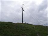
 | Pod Luknjo - Črna prst
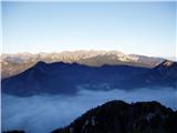
On the northern slope of the summit ridge of Črna prst, black soil is visible the feature after which the mountain is named. Črna prst is renown...
2 h 30 min |
 | Gozd - Tolsti vrh (via Ježa)
Tolsti vrh, located west of Storžič, is at 1715 metres also the highest peak of the Kriška gora range, which rises steeply above central Gorenjsk...
2 h 15 min |
 | Gozd - Tolsti vrh (easier path over Kriška gora)
Tolsti vrh, located west of Storžič, is at 1715 metres also the highest peak of the Kriška gora range, which rises steeply above central Gorenjsk...
2 h 30 min |
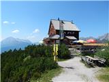
 | Dom pod Storžičem - Tolsti vrh
Tolsti vrh, located west of Storžič, is at 1715 metres also the highest peak of the Kriška gora range, which rises steeply above central Gorenjsk...
2 h |
 | Gozd - Tolsti vrh (steep path over Kriška gora)
Tolsti vrh, located west of Storžič, is at 1715 metres also the highest peak of the Kriška gora range, which rises steeply above central Gorenjsk...
2 h 30 min |
 | Povlje - Tolsti vrh
Tolsti vrh, located west of Storžič, is at 1715 metres also the highest peak of the Kriška gora range, which rises steeply above central Gorenjsk...
2 h 45 min |
 | Brezje pri Tržiču - Dobrča (on path Po robu and via Lešanska planina)
Dobrča is a 1634-metre mountain located between Begunje and Tržič. From the summit, which has a registration box with a stamp, the view opens onl...
2 h 35 min |
 | Brezje pri Tržiču - Dobrča (via koča na Dobrči)
Dobrča is a 1634-metre mountain located between Begunje and Tržič. From the summit, which has a registration box with a stamp, the view opens onl...
3 h |
 | Hibje - Dobrča (by road)
Dobrča is a 1634-metre mountain located between Begunje and Tržič. From the summit, which has a registration box with a stamp, the view opens onl...
1 h 45 min |
| Brezje pri Tržiču - Dobrča (Po robu)
Dobrča is a 1634-metre mountain located between Begunje and Tržič. From the summit, which has a registration box with a stamp, the view opens onl...
2 h 30 min |
| Hudi Graben - Dobrča (via Koča na Dobrči)
Dobrča is a 1634-metre mountain located between Begunje and Tržič. From the summit, which has a registration box with a stamp, the view opens onl...
3 h |
| Slatna - Dobrča
Dobrča is a 1634-metre mountain located between Begunje and Tržič. From the summit, which has a registration box with a stamp, the view opens onl...
3 h |
 | Begunje (Preska) - Dobrča
Dobrča is a 1634-metre mountain located between Begunje and Tržič. From the summit, which has a registration box with a stamp, the view opens onl...
3 h |
 | Brezje pri Tržiču - Dobrča (by road)
Dobrča is a 1634-metre mountain located between Begunje and Tržič. From the summit, which has a registration box with a stamp, the view opens onl...
2 h 45 min |
 | Leskovica - Blegoš
Blegoš is a 1,562-metre-high mountain located between the Selška Sora and Poljanska Sora rivers. From the grassy summit, where there is a stamp a...
2 h 5 min |
 | Čabrače - Blegoš
Blegoš is a 1,562-metre-high mountain located between the Selška Sora and Poljanska Sora rivers. From the grassy summit, where there is a stamp a...
2 h |
 | Tuškov Grič - Blegoš (via Črni vrh)
Blegoš is a 1,562-metre-high mountain located between the Selška Sora and Poljanska Sora rivers. From the grassy summit, where there is a stamp a...
2 h 45 min |
 | Laze - Blegoš
Blegoš is a 1,562-metre-high mountain located between the Selška Sora and Poljanska Sora rivers. From the grassy summit, where there is a stamp a...
2 h |
 | Rute (Zavrh) / Bärental - Barentaler Kotschna/Struška (via Bärensattel)
Struška is a smaller mountain range located between Stol (or Belščica) and Golica. From its highest peak, Veliki vrh, there is a beautiful view o...
2 h 45 min |
 | Petrovo Brdo - Možic (via Vrh Bače)
Možic is a 1,602 m high peak located west of Soriška Planina. At the very summit there is an old military bunker bearing the name of the peak and...
2 h 30 min |
| Petrovo Brdo - Možic (via Lajnar)
Možic is a 1,602 m high peak located west of Soriška Planina. At the very summit there is an old military bunker bearing the name of the peak and...
2 h 30 min |
 | Petrovo Brdo - Porezen
Porezen is a 1,630 m high mountain situated between Davča and Baška Grapa. From the summit, where a large Partisan monument stands, a beautiful v...
2 h 30 min |
 | Hunting cottage (Davča) - Porezen
Porezen is a 1,630 m high mountain situated between Davča and Baška Grapa. From the summit, where a large Partisan monument stands, a beautiful v...
1 h 45 min |
 | Tuškov Grič - Porezen (by road)
Porezen is a 1,630 m high mountain situated between Davča and Baška Grapa. From the summit, where a large Partisan monument stands, a beautiful v...
3 h 5 min |
 | Raspet - Porezen (on ridge of Cimprovka)
Porezen is a 1,630 m high mountain situated between Davča and Baška Grapa. From the summit, where a large Partisan monument stands, a beautiful v...
2 h 45 min |
 | Poče - Porezen (steep path)
Porezen is a 1,630 m high mountain situated between Davča and Baška Grapa. From the summit, where a large Partisan monument stands, a beautiful v...
2 h 30 min |
| Poče - Porezen (gentle path)
Porezen is a 1,630 m high mountain situated between Davča and Baška Grapa. From the summit, where a large Partisan monument stands, a beautiful v...
2 h 45 min |
 | Jesenica - Porezen
Porezen is a 1,630 m high mountain situated between Davča and Baška Grapa. From the summit, where a large Partisan monument stands, a beautiful v...
2 h 55 min |
 | Jesenica - Porezen (via Dom na Poreznu)
Porezen is a 1,630 m high mountain situated between Davča and Baška Grapa. From the summit, where a large Partisan monument stands, a beautiful v...
3 h |
| Preval Vrh Ravni - Porezen
Porezen is a 1,630 m high mountain situated between Davča and Baška Grapa. From the summit, where a large Partisan monument stands, a beautiful v...
2 h 30 min |
| Preval Vrh Ravni - Porezen (via Dom na Poreznu)
Porezen is a 1,630 m high mountain situated between Davča and Baška Grapa. From the summit, where a large Partisan monument stands, a beautiful v...
2 h 35 min |
 | Planina pod Golico - Kahlkogel/Golica
Golica is a treeless peak located north of Jesenice. The summit features a registration box and offers a beautiful view of the western Karawanks ...
2 h 10 min |
| Planina pod Golico - Kahlkogel/Golica (via Suha saddle)
Golica is a treeless peak located north of Jesenice. The summit features a registration box and offers a beautiful view of the western Karawanks ...
3 h |
 | Dom Pristava in Javorniški Rovt - Kahlkogel/Golica (via mountain hut)
Golica is a treeless peak located north of Jesenice. The summit features a registration box and offers a beautiful view of the western Karawanks ...
2 h 45 min |
 | Laško (obračališče nad vasjo) - Bašeljski vrh
Bašeljski vrh is a 1744-meter-high mountain located between Mali Grintovec and Storžič. From the summit, where there is a bench and a registratio...
2 h 35 min |
 | Jekarica - Bašeljski vrh
Bašeljski vrh is a 1744-meter-high mountain located between Mali Grintovec and Storžič. From the summit, where there is a bench and a registratio...
2 h 5 min |
| MHE Zabukovec - Bašeljski vrh
Bašeljski vrh is a 1744-meter-high mountain located between Mali Grintovec and Storžič. From the summit, where there is a bench and a registratio...
3 h 5 min |
 | Erjavčev rovt - Frauenkogel/Dovška Baba (via Brvog)
Dovška Baba is a 1891-meter-high peak located on the border ridge between Slovenia and Austria. From the summit, which has a registration box and...
2 h 45 min |
 | Tinčkova koča - Srednji vrh (above Završnica) (via Smokuška planina)
Srednji vrh is a panoramic mountain covered in dwarf pine, located between Stol, Vrtača and Begunjščica. From the summit, which drops steeply to ...
2 h |
| Ljubelj - Srednji vrh (above Završnica) (via source of Završnica)
Srednji vrh is a panoramic mountain covered in dwarf pine, located between Stol, Vrtača and Begunjščica. From the summit, which drops steeply to ...
2 h 40 min |
 | Ljubelj - Srednji vrh (above Završnica) (on the slope of Vrtača)
Srednji vrh is a panoramic mountain covered in dwarf pine, located between Stol, Vrtača and Begunjščica. From the summit, which drops steeply to ...
3 h |
 | Ljubelj - Srednji vrh (above Završnica) (on a slope of Vrtača)
Srednji vrh is a panoramic mountain covered in dwarf pine, located between Stol, Vrtača and Begunjščica. From the summit, which drops steeply to ...
2 h 40 min |
 | Petrovo Brdo - Slatnik (northwestern peak) (via Lajnar)
Slatnik is a panoramic mountain located west of the Soriška Planina ski resort. From its grassy summit there is a beautiful view of the Škofjeloš...
2 h 15 min |
 | Makekova Kočna - Veliki vrh
Veliki Vrh lies on the northwestern ridge of Kočna. The summit is unvegetated, offering a very fine view of neighbouring Kočna. Storžič and the K...
2 h 15 min |
 | Rateče - Ofen/Peč (by road)
Peč (also known as Tromeja; in Italian Monte Forno, in German Dreiländereck or Ofen) is a 1508 m high peak located at the tripoint between Sloven...
2 h |
 | Fusine Laghi - Ofen/Peč
Peč (also known as Tromeja; in Italian Monte Forno, in German Dreiländereck or Ofen) is a 1508 m high peak located at the tripoint between Sloven...
2 h 15 min |
 | Rateče - Ofen/Peč (eastern path, past bivouac and on footpath)
Peč (also known as Tromeja; in Italian Monte Forno, in German Dreiländereck or Ofen) is a 1508 m high peak located at the tripoint between Sloven...
1 h 45 min |
| Rateče - Ofen/Peč (eastern path, past bivouac and on mule track)
Peč (also known as Tromeja; in Italian Monte Forno, in German Dreiländereck or Ofen) is a 1508 m high peak located at the tripoint between Sloven...
1 h 50 min |
 | Javorje - Rodica (marked way)
The mountain Rodica is located above Bohinj in the Lower Bohinj Mountains. From the summit there is a beautiful view over the Julian Alps and the...
2 h 45 min |
| Rutarski gozd - Rodica
The mountain Rodica is located above Bohinj in the Lower Bohinj Mountains. From the summit there is a beautiful view over the Julian Alps and the...
2 h 30 min |
 | Zgornje Jezersko - Virnikov Grintovec
Virnikov Grintovec is a 1654 m high mountain located north of Jezersko on the border ridge between Slovenia and Austria. From the summit, which h...
2 h 15 min |
| Trögern - Virnikov Grintovec
Virnikov Grintovec is a 1654 m high mountain located north of Jezersko on the border ridge between Slovenia and Austria. From the summit, which h...
2 h 15 min |
 | Grahovše - Bela peč (via Boršt)
The mountain, known mainly among climbers, is located north of Storžič on the slopes of Konjščica. From the summit there is a beautiful view of t...
2 h 30 min |
 | Grahovše - Bela peč (via rot)
The mountain, known mainly among climbers, is located north of Storžič on the slopes of Konjščica. From the summit there is a beautiful view of t...
2 h 30 min |
 | Dom pod Storžičem - Bela peč (via Javorniški preval)
The mountain, known mainly among climbers, is located north of Storžič on the slopes of Konjščica. From the summit there is a beautiful view of t...
2 h 5 min |
 | Grahovše - Bela peč (via Rekar)
The mountain, known mainly among climbers, is located north of Storžič on the slopes of Konjščica. From the summit there is a beautiful view of t...
2 h 30 min |
 | Na kopiš - Bela peč (via Spodnja and Zgornja Konjščica)
The mountain, known mainly among climbers, is located north of Storžič on the slopes of Konjščica. From the summit there is a beautiful view of t...
2 h |
 | Črnivec - Lepenatka
Lepenatka is a grassy peak located south of the 1557-metre-high Rogatec. From the summit, which has a summit register box and stamp, there is a b...
3 h 15 min |
 | Jekarica - Mali Grintovec
Mali Grintovec is a panoramic mountain located east of Storžič. From the summit, which has a summit register box, stamp, and a pleasant bench, th...
2 h 50 min |
 | Planina pod Golico - Rosenkogel/Hruški vrh
Hruški vrh is a 1776-metre-high mountain located between Dovška Baba and the lesser-known Klek. From the summit, where there is a small chapel de...
2 h 30 min |
 | Ravenska Kočna - Goli vrh (slovenian way)
Goli vrh is a 1787 m high mountain situated between the Ravenska Kočna and Belska Kočna valleys. From the bare summit, which has a registration b...
2 h 15 min |
 | Ravenska Kočna - Goli vrh (austrian way)
Goli vrh is a 1787 m high mountain situated between the Ravenska Kočna and Belska Kočna valleys. From the bare summit, which has a registration b...
2 h 30 min |
| Velacher Kotschna/Belska Kočna - Goli vrh
Goli vrh is a 1787 m high mountain situated between the Ravenska Kočna and Belska Kočna valleys. From the bare summit, which has a registration b...
2 h 45 min |
 | Baumgartnerhof - Kresišče
Kresišče is an 1839 m high peak in the main ridge of the Karawanks, specifically between Kepa and Trupejevo poldne. From the summit, where a wood...
3 h |
 | Petrovo Brdo - Kobla
The summit is located in the Lower Bohinj Mountains between Črna prst and Soriška planina. Directly below it is a railway tunnel connecting Bohin...
2 h 15 min |
 | Mojstrana - Jerebikovec
The panoramic, slightly overgrown peak is located above Mojstrana and Radovna. From the summit, there is a beautiful view towards the Karawanks a...
2 h 20 min |
 | Koča pri izviru Soče - Vršič vrh
Vršič is a 1,737-metre-high mountain situated between the Poštarski dom hut and the Vršič pass. From the summit, where there is a registration bo...
2 h 40 min |
 | Petrovo Brdo - Lajnar
Lajnar is a 1,549-metre-high mountain located north of Soriška Planina. From the summit, which is also the highest point of the ski resort, a bea...
2 h |
 | Petrovo Brdo - Šavnik
Šavnik is a grassy peak situated between the ski resorts of Soriška Planina and Kobla. From the summit, which has a registration box with a stamp...
2 h 15 min |
 | Preval - Koprivnik
Koprivnik is a 1393-meter-high mountain located between Blegoš and Mladi vrh. From the summit, which has a registration box and a stamp, the view...
3 h 15 min |
| Javorje - Koprivnik (via Brdo)
Koprivnik is a 1393-meter-high mountain located between Blegoš and Mladi vrh. From the summit, which has a registration box and a stamp, the view...
2 h 20 min |
 | Javorje - Šija (via Zadnja Suha)
Šija is located above the Vogel ski resort in the Lower Bohinj Mountains. From the summit, there is a nice view of the neighboring peaks in the s...
2 h 30 min |
 | Koča pri izviru Soče - Sovna glava
Sovna Glava is a 1750-meter-high grassy peak situated between Prisank and the Vršič Pass. From the summit, there is a nice view of the peaks risi...
2 h 40 min |
 | Baumgartnerhof - Mallestiger Mittagskogel
Ostra peč, known in German as Mallestiger Mittagskogel, is an 1801 m high mountain located on the northern side of the main Karawanks ridge. From...
3 h 15 min |
 | Bele Vode (Rebršak) - Smrekovec
Smrekovec is a mountain of volcanic origin on the eastern edge of the Smrekovec mountain range. The wide grassy summit features a pyramid with a ...
2 h 5 min |
 | Ljubenske Rastke (Vrnivšek) - Smrekovec
Smrekovec is a mountain of volcanic origin on the eastern edge of the Smrekovec mountain range. The wide grassy summit features a pyramid with a ...
2 h |
| Ljubenske Rastke (Kumprej) - Smrekovec
Smrekovec is a mountain of volcanic origin on the eastern edge of the Smrekovec mountain range. The wide grassy summit features a pyramid with a ...
2 h 10 min |
 | Javorje (Mala Črna) - Smrekovec (via Bukov stan)
Smrekovec is a mountain of volcanic origin on the eastern edge of the Smrekovec mountain range. The wide grassy summit features a pyramid with a ...
3 h 15 min |
| Javorje (Mala Črna) - Smrekovec (po cesti)
Smrekovec is a mountain of volcanic origin on the eastern edge of the Smrekovec mountain range. The wide grassy summit features a pyramid with a ...
3 h 15 min |
 | Valley of stream Žep - Veliki Travnik (Turnovka)
Veliki Travnik, also known as Turnovka by the locals, is located on the western edge of the Smrekovec mountain range. From the summit, which has ...
2 h 45 min |
 | Predmeja (tunnels) - Veliki Modrasovec
Veliki Modrasovec is located on the southern part of the Trnovski Forest near Predmeja. On the summit stands an old military building, which we m...
1 h 55 min |
 | Koča Edmunda Čibeja v Tihi dolini - Mali Golak
Mali Golak is the highest of the Golaki. It did not get its name because it is supposed to be the smallest, but because it had the smallest mount...
2 h |
| Predmeja (Gorjanka) - Mali Golak
Mali Golak is the highest of the Golaki. It did not get its name because it is supposed to be the smallest, but because it had the smallest mount...
2 h 25 min |
 | Gorenje pri Zrečah - Rogla
Rogla is a peak in the middle of the eponymous ski resort. The peak is forested with a small clearing on which stands a lookout tower. The tower ...
2 h 35 min |
 | Mislinja - Mali Črni vrh
Mali Črni vrh is located above the Ribniška koča mountain hut. At the top, there is an artificial lake intended for snowmaking. From the top, the...
2 h 55 min |
 | Mislinja - Črni vrh
Črni vrh is the highest peak of Pohorje. Because it is partly unvegetated, it offers a nice view toward Velika Kopa, Uršlja gora, and in the back...
2 h 30 min |
 | Brneško sedlo - Velika Kopa
Velika Kopa is a 1542-meter-high peak located between Grmovškov dom and the nearby Mala Kopa. From the top, which is only 1 meter lower than the ...
1 h 50 min |
| Koča Planinc - Velika Kopa
Velika Kopa is a 1542-meter-high peak located between Grmovškov dom and the nearby Mala Kopa. From the top, which is only 1 meter lower than the ...
1 h 50 min |
 | Kozarnice - Srednji Golak (via Mali Golak)
Srednji Golak is located between Mali and Veliki Golak on the plateau of Trnovski gozd above Predmeja. The peak is covered with dwarf pines, and ...
1 h 50 min |
 | Poštarski dom pod Plešivcem - Uršlja gora (Plešivec) (via Kozarnica)
Uršlja gora, or Plešivec, is a panoramic mountain between Slovenj Gradec and Črna na Koroškem. At or just below the summit stands the Church of S...
2 h 30 min |
| Poštarski dom pod Plešivcem - Uršlja gora (Plešivec) (via Kal)
Uršlja gora, or Plešivec, is a panoramic mountain between Slovenj Gradec and Črna na Koroškem. At or just below the summit stands the Church of S...
2 h 45 min |
 | Ciganija - Uršlja gora (Plešivec) (winter way)
Uršlja gora, or Plešivec, is a panoramic mountain between Slovenj Gradec and Črna na Koroškem. At or just below the summit stands the Church of S...
2 h 30 min |
 | Koča na Naravskih ledinah - Uršlja gora (Plešivec)
Uršlja gora, or Plešivec, is a panoramic mountain between Slovenj Gradec and Črna na Koroškem. At or just below the summit stands the Church of S...
1 h 45 min |
 | Ciganija - Uršlja gora (Plešivec)
Uršlja gora, or Plešivec, is a panoramic mountain between Slovenj Gradec and Črna na Koroškem. At or just below the summit stands the Church of S...
2 h 15 min |
 | Andrejev dom na Slemenu - Uršlja gora (Plešivec)
Uršlja gora, or Plešivec, is a panoramic mountain between Slovenj Gradec and Črna na Koroškem. At or just below the summit stands the Church of S...
2 h 45 min |
 | Sveti Danijel (Zgornji Razbor) - Uršlja gora (Plešivec)
Uršlja gora, or Plešivec, is a panoramic mountain between Slovenj Gradec and Črna na Koroškem. At or just below the summit stands the Church of S...
3 h 15 min |
 | Coot Parking Lot - Monte Guarda/Skutnik
Skutnik is a peak situated north of the Učja River on the border with Italy. From the top, there is a beautiful view of the Kanin mountain group,...
2 h |
 | Drežniške Ravne - Krasji vrh (via snežna jama)
Krasji vrh is situated between Bovec and Kobarid on the Polovnik mountain ridge. At 1773 m it is also the highest peak of the mentioned ridge, so...
3 h |
 | Valbruna/Ovčja vas - Svete Višarje / Monte Lussari
Svete Višarje / Monte Lussari is a pilgrimage site for Slavs, Germans, and Romance peoples. Already in the 16th century, the mountain was called ...
2 h 30 min |
 | Žabnice / Camporosso in Valcanale - Svete Višarje / Monte Lussari
Svete Višarje / Monte Lussari is a pilgrimage site for Slavs, Germans, and Romance peoples. Already in the 16th century, the mountain was called ...
2 h 30 min |
 | Rudnik v Topli - Mala Peca
Mala Peca is the peak above the Dom na Peci mountain hut on its eastern slopes. From the summit, where a panoramic sign stands, there is a nice v...
2 h 10 min |
 | Topla (Burjak) - Mala Peca
Mala Peca is the peak above the Dom na Peci mountain hut on its eastern slopes. From the summit, where a panoramic sign stands, there is a nice v...
2 h 30 min |
 | Trögern - Kärntner Storschitz / Pristovški Storžič
Pristovški Storžič (Kärntner Storschitz) is an exceptionally panoramic peak above Jezersko. From it, there are fine views of the northern walls o...
2 h |
| Bad Vellach - Kärntner Storschitz / Pristovški Storžič
Pristovški Storžič (Kärntner Storschitz) is an exceptionally panoramic peak above Jezersko. From it, there are fine views of the northern walls o...
2 h 30 min |
 | Jasna - Ciprnik (via Mojčin dom)
A hidden yet scenic peak above the Kranjska Gora ski slopes. To the east are the Martuljek Mountains; on the other side, Jalovec, Ponce, and Mojs...
3 h |
| Kranjska Gora - Ciprnik (via Bedančev dom)
A hidden yet scenic peak above the Kranjska Gora ski slopes. To the east are the Martuljek Mountains; on the other side, Jalovec, Ponce, and Mojs...
2 h 55 min |
 | Zell-Pharre - Freiberg/Setiče
Setiče/Freiberg (also Z'če or Žetiče) is a panoramic mountain on the Austrian side of the Karawanks. From the summit, which has a cross, there is...
2 h 30 min |
 | Franzbauer - Ferlacher Horn / Grlovec
Grlovec/Ferlacher Horn is a panoramic mountain on which a large cross stands. From the top, there is a beautiful view of the Karawanks, parts of ...
2 h 15 min |
 | Petrovo Brdo - Krevl
Krevl is a 1515-meter-high peak situated south of the Kobla ski area, more precisely between the Kobla peak and Kravja Črna gora. From the summit...
2 h 30 min |
 | Ravne - Krevl
Krevl is a 1515-meter-high peak situated south of the Kobla ski area, more precisely between the Kobla peak and Kravja Črna gora. From the summit...
2 h 20 min |
 | St. John the Baptist on Ojstrica - Huhnerkogel/Košenjak (via Bivak Piramida)
Košenjak is located north of Dravograd and the Drava River on the border with neighbouring Austria. Access to Košenjak is possible on foot or by ...
2 h |
 | Jezero Sobote / Stausee Soboth - Huhnerkogel/Košenjak (on marked path)
Košenjak is located north of Dravograd and the Drava River on the border with neighbouring Austria. Access to Košenjak is possible on foot or by ...
2 h |
 | Windisch Bleiberg / Slovenji Plajberk - Singerberg / Žingarica
Žingarica / Singerberg is a peak on the Austrian side of the Karawanks above the village of Slovenji Plajberk / Windisch Bleiberg. From the summi...
2 h |
 | Slovenji Plajberk / Windisch Bleiberg - Singerberg / Žingarica (via saddle Albink / Halbingsattel)
Žingarica / Singerberg is a peak on the Austrian side of the Karawanks above the village of Slovenji Plajberk / Windisch Bleiberg. From the summi...
2 h 20 min |
| Plajberški graben / Bleiberger Graben - Singerberg / Žingarica
Žingarica / Singerberg is a peak on the Austrian side of the Karawanks above the village of Slovenji Plajberk / Windisch Bleiberg. From the summi...
2 h 20 min |
 | Šmartno na Pohorju - Žigartov vrh (via Bojtina)
Žigartov vrh, at 1,346 meters, is the highest peak in the eastern part of Pohorje. An "observation" tower once stood on the summit, erected solel...
3 h 15 min |
 | Hudi Graben - Šentanski vrh (via Koča na Dobrči)
Šentanski vrh, located in the Dobrča range just five minutes from the main peak, offers a nice view of the central Karawanks, the Storžič group, ...
3 h 5 min |
| Slatna - Šentanski vrh
Šentanski vrh, located in the Dobrča range just five minutes from the main peak, offers a nice view of the central Karawanks, the Storžič group, ...
3 h 5 min |
 | Brezje pri Tržiču - Šentanski vrh (by road)
Šentanski vrh, located in the Dobrča range just five minutes from the main peak, offers a nice view of the central Karawanks, the Storžič group, ...
2 h 50 min |
 | Brezje pri Tržiču - Šentanski vrh (Po robu)
Šentanski vrh, located in the Dobrča range just five minutes from the main peak, offers a nice view of the central Karawanks, the Storžič group, ...
2 h 35 min |
| Brezje pri Tržiču - Šentanski vrh (on path Po robu and via Lešanska planina)
Šentanski vrh, located in the Dobrča range just five minutes from the main peak, offers a nice view of the central Karawanks, the Storžič group, ...
2 h 40 min |
 | Windische Hohe - Kobesnock
Kobesnock is a lesser-known peak west of the massive Dobrač range. From its summit, which features a cross, there are fine views of Dobrač, the l...
2 h 45 min |
 | Windische Hohe - Tschekelnock
Čegla gora (German: Tschekelnock) rises steeply above the idyllic mountain village Venetski hrib/Windische Hohe. From its summit, with a cross, t...
2 h 30 min |
 | Črni Kal - Mladi vrh (via Koprivnik)
Mladi vrh is the higher neighbor of the better-known Stari vrh, separated from it by a saddle. Covered in sparse beech forest, the summit offers ...
2 h 15 min |
| Javorje - Mladi vrh (via Prehodi)
Mladi vrh is the higher neighbor of the better-known Stari vrh, separated from it by a saddle. Covered in sparse beech forest, the summit offers ...
1 h 45 min |
| Preval - Mladi vrh
Mladi vrh is the higher neighbor of the better-known Stari vrh, separated from it by a saddle. Covered in sparse beech forest, the summit offers ...
2 h |
 | Javorje - Mladi vrh (western path)
Mladi vrh is the higher neighbor of the better-known Stari vrh, separated from it by a saddle. Covered in sparse beech forest, the summit offers ...
2 h 5 min |
 | Korensko sedlo - Kamnati vrh/Steinberg (by road)
Kamnati vrh is a 1621 m high mountain located north of Kranjska Gora. From the grassy summit, where a bench stands, there is no view due to the n...
2 h |
 | Planina Kosmačeve Rastke - Lanež (via Durce)
Lanež is a less distinct peak on the eastern part of Raduha. From the spacious summit a nice view opens on nearby Mala Raduha, Olševa, Peca, Uršl...
2 h 25 min |
| Planina Kosmačeve Rastke - Lanež (east path)
Lanež is a less distinct peak on the eastern part of Raduha. From the spacious summit a nice view opens on nearby Mala Raduha, Olševa, Peca, Uršl...
2 h 25 min |
 | Cave del Predil - Šober / Monte Sciober Grande
Šober / Monte Sciober Grande is a 1,845 m high peak located between the Remšendol Valley and Jezerska Valley. From the summit there is a fine vie...
2 h 45 min |
 | Bitenjska planina - Gladki vrh (Ratitovec)
Gladki vrh (Ratitovec), at 1,667 meters, is the most visited peak in the Ratitovec range. From its bare summit, which features a panorama board, ...
2 h 25 min |
 | Prtovč - Altemaver (Ratitovec) (via Razor)
Altemaver (Ratitovec), at 1,678 meters, is the highest peak of Ratitovec. From its grassy summit, there is a beautiful view of the Julian Alps, J...
1 h 50 min |
| Prtovč - Altemaver (Ratitovec) (via Po(v)den)
Altemaver (Ratitovec), at 1,678 meters, is the highest peak of Ratitovec. From its grassy summit, there is a beautiful view of the Julian Alps, J...
1 h 50 min |
 | Zgornje Danje - Altemaver (Ratitovec)
Altemaver (Ratitovec), at 1,678 meters, is the highest peak of Ratitovec. From its grassy summit, there is a beautiful view of the Julian Alps, J...
1 h 45 min |
| Bitenjska planina - Altemaver (Ratitovec)
Altemaver (Ratitovec), at 1,678 meters, is the highest peak of Ratitovec. From its grassy summit, there is a beautiful view of the Julian Alps, J...
2 h 30 min |
| Rotek - Altemaver (Ratitovec)
Altemaver (Ratitovec), at 1,678 meters, is the highest peak of Ratitovec. From its grassy summit, there is a beautiful view of the Julian Alps, J...
2 h 30 min |
 | Montemaggiore - Punta di Montemaggiore
Breški Jalovec, or Punta di Montemaggiore in Italian, is a 1613-meter-high mountain located above the source of the Nadiža River, specifically on...
3 h |
 | Zrmanja Railway Station - Poštak
Poštak (also "Kečina kosa") is a scenic mountain at the junction of Lika and Dalmatia. It belongs to the Lička Plješivica range as an extension, ...
2 h 30 min |
 | Baumgartnerhof - Maloško poldne / Mallestiger Mittagskogel
Maloško poldne, or Mallestiger Mittagskogel in German, is a 1,823-meter-high peak on the border between Slovenia and Austria, precisely between T...
2 h 45 min |
 | Zgornje Danje - Kremant (Ratitovec)
Kremant is a 1,654 m high peak located on the western part of Ratitovec. From the summit, where a stamp is attached to a metal pole, a nice view ...
1 h 45 min |
| Rotek - Kremant (Ratitovec)
Kremant is a 1,654 m high peak located on the western part of Ratitovec. From the summit, where a stamp is attached to a metal pole, a nice view ...
2 h 30 min |
 | Forni di Sopra - Clap Varmost
Clap Varmost is a panoramic peak situated north to northwest of Forni di Sopra. From the top, where a cross with a register box stands, a nice vi...
2 h |
 | Poče - Medrce (steep path)
Medrce is a 1,410-meter-high peak located between Porezen and Hum. From the summit, which features an old bunker, there are nice views of Kojca, ...
2 h |
| Poče - Medrce (winter way)
Medrce is a 1,410-meter-high peak located between Porezen and Hum. From the summit, which features an old bunker, there are nice views of Kojca, ...
2 h 40 min |
| Poče - Medrce (via Labinjske lehe)
Medrce is a 1,410-meter-high peak located between Porezen and Hum. From the summit, which features an old bunker, there are nice views of Kojca, ...
2 h 30 min |
 | Poče - Kopa (Cimprovka) (winter way)
Kopa is a 1360 m high peak or panoramic promontory from which a nice view opens up on Cerkno, the hills surrounding it, Ratitovec, Trnovski gozd,...
2 h 25 min |
 | Fusine Laghi - Monte Coppa
Kopa (Kopje on some maps), or Monte Coppa in Italian, is a 1496-meter-high peak on the Italian side of the Karawanks. The old Rapallo border once...
2 h |
 | Bachwinkl - Peter Wiechenthaler Hütte
The Peter Wiechenthaler Hütte mountain hut is situated on the Kienalkopf summit in the Berchtesgaden Alps at 1752 meters. A cargo cableway serves...
2 h 30 min |
 | Petrovo Brdo - Slatnik (southeastern peak) (via Lajnar)
Slatnik (southeastern peak) is a panoramic mountain that rises steeply above Baška grapa on one side and descends more gently toward Soriška plan...
2 h 5 min |
 | Pod Peco (Koželj) / Koprein-Petzen (Koschiel) - Špičasti vrh / Spitzberg
Špičasti vrh / Spitzberg is a 1,551-meter-high peak located above the Maroldčeva planina / Maroldalm mountain pasture. Because the peak is locate...
2 h 30 min |
 | Žabnice / Camporosso in Valcanale - Florjanka / Monte Florianca
Florjanka is a 1,653-meter-high mountain on the Italian side of the Julian Alps. At or just below the summit is a reservoir for snowmaking on the...
2 h 30 min |
 | Rute (Zavrh) / Bärental - Mačenski vrh / Matschacher Gupf (via 668)
Mačenski vrh / Matschacher Gupf is a panoramic peak above Rož / Rosental. The peak has a summit register box with a logbook....
2 h 15 min |
| Rute (Zavrh) / Bärental - Mačenski vrh / Matschacher Gupf (over saddle Mrzla raven / Gipssattel)
Mačenski vrh / Matschacher Gupf is a panoramic peak above Rož / Rosental. The peak has a summit register box with a logbook....
2 h 15 min |
 | Poden / Bodental - Kosmatica / Kosmatitza
Kosmatica / Kosmatitza is a 1,659-meter-high peak entirely on the Austrian side of the Karawanks, north of Vrtača. From the summit, which is part...
2 h 40 min |
| Bodenbauer - Kosmatica / Kosmatitza
Kosmatica / Kosmatitza is a 1,659-meter-high peak entirely on the Austrian side of the Karawanks, north of Vrtača. From the summit, which is part...
1 h 45 min |
 | Rehabilitation center St. Radegund at Graz - Schöckl (hiking path)
Schöckl, often also spelled Schöckel, is a 1,445-meter-high hill above St. Radegund near Graz and the southernmost of the popular peaks in the Gr...
2 h 15 min |
 | Veliko Tinje - Veliki vrh (on Pohorje)
Veliki vrh is a 1344-meter-high peak located above the RTC Jakec - Trije kralji ski slope. The highest point of the peak is in the forest, but ju...
2 h 30 min |
| Kebelj - Veliki vrh (on Pohorje)
Veliki vrh is a 1344-meter-high peak located above the RTC Jakec - Trije kralji ski slope. The highest point of the peak is in the forest, but ju...
2 h 10 min |
| Šmartno na Pohorju - Veliki vrh (on Pohorje)
Veliki vrh is a 1344-meter-high peak located above the RTC Jakec - Trije kralji ski slope. The highest point of the peak is in the forest, but ju...
2 h 45 min |
 | Planina Zajzera - Krniška glavica / Jof di Sompdogna
Krniška glavica (Jof di Sompdogna) is a 1,889-meter-high peak in the Western Julian Alps, north of Montaž. A cross stands on the panoramic summit...
2 h 30 min |
 | Planina Zajzera - Krniška glavica / Jof di Sompdogna (path 639 and 652)
Krniška glavica (Jof di Sompdogna) is a 1,889-meter-high peak in the Western Julian Alps, north of Montaž. A cross stands on the panoramic summit...
3 h 10 min |
 | Parking Rote Wand (Tyrnau) - Rote Wand (via saddle Bucheben)
Rote Wand is a 1,505-meter-high mountain in the Graz Mountains in Styria, Austria. The name "Rote Wand" (red wall) comes from its southeast-facin...
2 h |
 | Pass Lius above Ligosullo - Tersadia (from Ligosullo)
Tersadia is a mountain in the heart of the Carnic Alps, just far enough from its higher neighbors to serve as an excellent vantage point, especia...
3 h |
 | Mariensee - Steinerne Stiege (red trail)
Steinerne Stiege is a less prominent peak in the Wechsel range....
2 h 25 min |
 | Mönichkirchen - Niederwechsel (via Steinerne Stiege)
Niederwechsel is a panoramic peak in the Wechsel massif. From the summit, fine views extend far in all directions, since there are no higher peak...
2 h 25 min |
| Mariensee - Niederwechsel (red trail)
Niederwechsel is a panoramic peak in the Wechsel massif. From the summit, fine views extend far in all directions, since there are no higher peak...
3 h 15 min |
 | Rettenegg - Grazer Stuhleck (past Roseggerhaus)
Grazer Stuhleck is a 1,635-meter-high peak located southwest of Stuhleck, the highest summit of the Fischbacher Alpen mountain group. Numerous wi...
2 h 40 min |
| Rettenegg - Grazer Stuhleck (via Schwarzriegel)
Grazer Stuhleck is a 1,635-meter-high peak located southwest of Stuhleck, the highest summit of the Fischbacher Alpen mountain group. Numerous wi...
2 h 40 min |
 | Rettenegg - Geiereck (past Roseggerhaus)
Geiereck is a panoramic peak located northeast of the Roseggerhaus hut and southeast of the Geiereckalm alpine pasture....
2 h 25 min |
| Rettenegg - Geiereck (via Schwarzriegel)
Geiereck is a panoramic peak located northeast of the Roseggerhaus hut and southeast of the Geiereckalm alpine pasture....
2 h 55 min |
 | Rettenegg - Peter-Bergner-Warte (Pretul) (past Roseggerhaus)
The Peter-Bergner-Warte viewpoint is located on the 1,656-meter-high Pretul summit above the settlement of Rettenegg....
2 h 15 min |
| Rettenegg - Peter-Bergner-Warte (Pretul) (via Schwarzriegel)
The Peter-Bergner-Warte viewpoint is located on the 1,656-meter-high Pretul summit above the settlement of Rettenegg....
3 h 5 min |
 | Rettenegg - Amundsenhöhe (past Roseggerhaus)
Amundsenhöhe is a 1,666-meter-high panoramic peak in the Fischbacher Alpen mountain group. From the summit there is a nice view of the hill count...
2 h 25 min |
 | Hirschegg - Hirschegger Alm (southern peak) (via Saureishütte)
The southern peak in the Hirschegger Alm ridge is located west of the settlement of Hirschegg. From the summit, where a cross stands, a beautiful...
3 h 5 min |
 | Hirschegg - Hirschegger Alm (southern peak) (via Bernsteinhütte)
The southern peak in the Hirschegger Alm ridge is located west of the settlement of Hirschegg. From the summit, where a cross stands, a beautiful...
3 h |
 | Hirschegg - Hirschegger Alm (northern peak) (via Seinerkreuz)
Hirschegger Alm (northern peak) is a 1,871-meter-high peak in the Packalpe mountain group. From the grassy summit, a beautiful view opens up all ...
3 h |
 | Hirschegg - Seinerkreuz
Seinerkreuz is a panoramic peak located above the Saureishütte hut and the settlement of Hirschegg. From the summit, a beautiful view opens up of...
2 h 35 min |
 | Sankt Ilgen (Der Bodenbauer) - Buchbergkogel
Buchbergkogel is a 1,700-meter panoramic mountain above the Häuslalmhütte hut and the Joseralm and Heinzleralm pastures. A cross stands on the su...
2 h 30 min |
 | Zelovo - Svilaja (past Umac)
Svilaja is a 1509-meter grassy peak above Peručko Lake, north of the town of Sinj. The summit features a cross and a concrete pillar. From the to...
3 h |
 | Seetal - Voisthalerhütte
The Voisthalerhütte mountain hut is situated on a scenic rise at the beginning of the Obere Dullwitz valley. From the hut, beautiful views open u...
2 h 50 min |
 | St. Corona am Wechsel - Arabichl
Arabichl is a panoramic peak situated above the eponymous ski lift. From the summit, a splendid view opens up of the Wechsel group, Stuhleck, and...
3 h 15 min |
 | Alpl (Waldschulle Alpl) - Teufelstein
Teufelstein is a 1,498-meter-high mountain in the Fischbacher Alpen group. At the summit there is a cross with a summit logbook, and slightly bel...
2 h 30 min |
 | Gasen - Plankogel (by learning trail)
Plankogel is a 1531-meter-high mountain situated in the Almenland nature park. From the panoramic summit, where a cross stands, a beautiful view ...
2 h 35 min |
 | Laufnitzgraben - Bei den drei Pfarren
Bei den drei Pfarren ("At the Three Parishes") is a crossroads from which a stunning panoramic view opens towards the south and west, all the way...
2 h 30 min |
 | Niklasdorfgraben (parking lot Mugel) - Mugel
Mugel is a 1630 m high mountain on the Gleinalpe (Glinska planina) above the village of Niklasdorf in Styria.A cross stands on the summit, and th...
2 h |
 | Niklasdorfgraben (parking lot Mugel) - Rosseck (via Mugel)
Roßeck (or Rosseck) is a 1664 m high peak on the Gleinalpe, not far from the slightly lower Mugel (1640 m).Both peaks are linked by a saddle at 1...
2 h 30 min |
 | Mazinski preval - Kremen
Kremen is a scenic peak in Lika, located north of Gračac. It is the highest peak in Zadar County. The summit features a geodetic pillar, along wi...
2 h 30 min |
 | Alpl (Zisleranger Weg) - Steinriegel
Steinriegel is a panoramic peak with a cross and a wind power plant, located in the hills east of the Mur....
2 h 40 min |
| Alpl (Waldschulle Alpl) - Steinriegel
Steinriegel is a panoramic peak with a cross and a wind power plant, located in the hills east of the Mur....
3 h 10 min |
 | Ferienheim - Leobner Mauer
Leobner Mauer is a 1,870-meter peak located west to southwest of the higher and better-known Hochturm peak. From the summit, there is a fine view...
3 h 10 min |
 | Preiner Gscheid - Preiner Wand (Rax) (Göbl-Kühn-Steig)
Preiner Wand is a panoramic peak in the Rax mountain group, where a large cross stands....
2 h 40 min |
 | Preiner Gscheid - Raxgmoahütte (Rax) (via Karl-Ludwig-Haus, Schlangenweg)
Raxgmoahütte is a hut owned by the Austrian mountain rescue service, open year-round as a bivouac or shelter. From the hut on top of a panoramic ...
3 h 5 min |
 | Unternberg - Kampstein
Kampstein is a 1,467-meter-high mountain situated above the settlement of St. Corona am Wechsel. At the summit there is a cross and a few benches...
2 h |
 | St. Corona am Wechsel - Kampstein (mimo Kampsteiner Schwaig)
Kampstein is a 1,467-meter-high mountain situated above the settlement of St. Corona am Wechsel. At the summit there is a cross and a few benches...
2 h 5 min |