Erjavčev rovt - Frauenkogel/Dovška Baba (via Brvog)
Starting point: Erjavčev rovt (1065 m)
| Latitude/Longitude: | 46,4792°N 13,9636°E |
| |
Route name: via Brvog
Walking time: 2 h 45 min
Difficulty: easy marked way
Elevation gain: 826 m
Elevation difference along the route: 880 m
Map: Kranjska Gora 1:30.000
Recommended equipment (summer):
Recommended equipment (winter): ice axe, crampons
Views: 19.123
 | 1 person like this post |
Access to starting point:
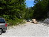
From the Gorenjska motorway, we take the Jesenice - west exit and continue along the road towards Kranjska Gora. Soon we will notice the signs for Dovje, which direct us right onto an ascending road, along which we quickly climb to the upper part of the village. Through the village, we follow the road in the direction of Kepa and Dovška Baba, then we arrive at a somewhat larger intersection, where we turn sharply left towards Kepa. We continue driving for quite some time along a well-maintained forest road, then we reach the next intersection. We continue slightly right (left Brinje, Rovt Vrse and Požarnica) along the road, which levels out a bit further ahead and then begins to descend towards the confluence of Žaklja and Mlinca (near the confluence there is also a small artificial lake). We park at a suitable spot near the confluence, or a little further back at one of the suitable spots along the road.
Route description:
From the confluence we head towards the left stream (Žakelj) and cross it immediately. A wide path continues along the right side of the stream; we follow it for only a few metres, then the sign "Kepa" on the pasture fence directs us right onto an ascending footpath, along which we arrive above the hut in Erjavčev rovt in a few minutes.
We continue along the marked path, which enters the forest and begins to ascend steeply. Higher up, the path turns slightly right and leads us to a relatively level cart track, along which we continue the ascent. The path then quickly brings us to a water trough; behind it, it turns left and leads us out of the forest onto the Brvog pasture, across which we quickly climb to the nearby hunting hut.
From the hut, we continue right and proceed with the ascent along the marked path, which enters the forest. The path ahead quickly brings us to an indistinct partly grassy ridge, but soon turns right to avoid it onto somewhat steeper slopes. The pleasant little path higher up levels out completely, then leads us across increasingly panoramic slopes to a small scree slope, across which runs the marked path. With some caution, we cross the mentioned slope, then a still relatively gentle path brings us to the Koritec spring, beside which there is a marked junction.
We continue right in the direction of the Mlinca saddle and proceed along the wide path, beside which we notice a fence that prevents livestock from going onto the steep slopes.
The marked path soon turns slightly left from the fence and enters a belt of dense forest. The path crosses the slopes briefly towards the east, then brings us to the Mlinca saddle, where the trail disappears briefly, after which several parallel trails appear. We continue the ascent along or slightly below the border ridge; then, on the left side of the hunting observation post, we notice a well-trodden little path that begins to turn increasingly right. The increasingly panoramic path continues traversing upwards towards the south, crossing the western slopes of Dovška Baba. The path then levels out and brings us in a few minutes of further walking to the expansive grassy slopes of the Dovška Rožca pasture. Here we continue left (right shepherd hut on the Dovška Rožca pasture - 2 minutes) and proceed with the ascent along a somewhat steeper path that climbs along the broad southwest ridge of Dovška Baba. The less well-marked but orientationally straightforward and increasingly panoramic path levels out higher up and turns slightly right, where we step onto the main Karavanke ridge. Here ahead of us we see the not very compact summit of Dovška Baba, which we reach after less than 5 minutes of further walking.

Photos:
 1
1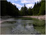 2
2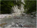 3
3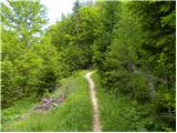 4
4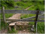 5
5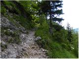 6
6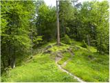 7
7 8
8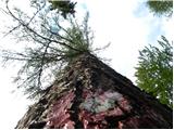 9
9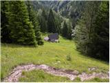 10
10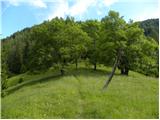 11
11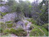 12
12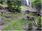 13
13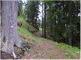 14
14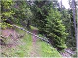 15
15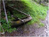 16
16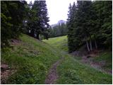 17
17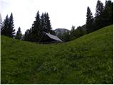 18
18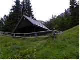 19
19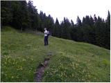 20
20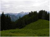 21
21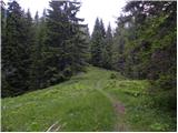 22
22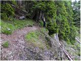 23
23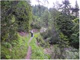 24
24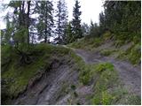 25
25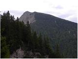 26
26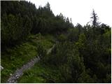 27
27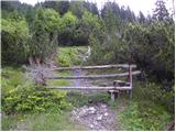 28
28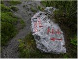 29
29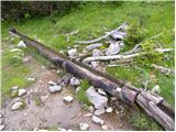 30
30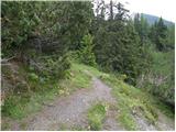 31
31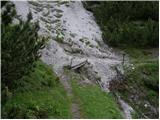 32
32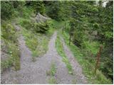 33
33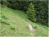 34
34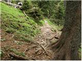 35
35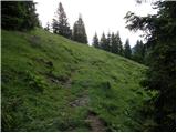 36
36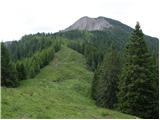 37
37 38
38 39
39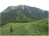 40
40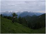 41
41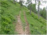 42
42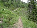 43
43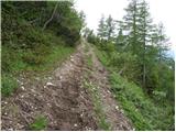 44
44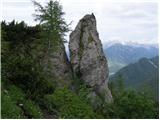 45
45 46
46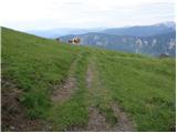 47
47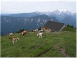 48
48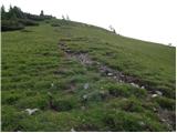 49
49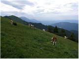 50
50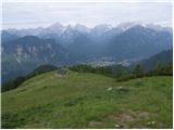 51
51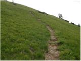 52
52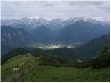 53
53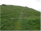 54
54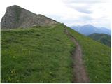 55
55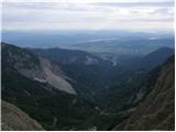 56
56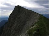 57
57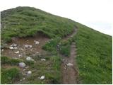 58
58 59
59
Discussion about the trip Erjavčev rovt - Frauenkogel/Dovška Baba (via Brvog)
|
| janat11. 08. 2015 |
Beautiful path, especially because not many hikers walk it. Except for the beginning and end, the path rises nicely so that anyone can walk it without problems. Once you come out of the forest, a view for big boys, as you have all the Julians at your fingertips. Strongly recommended!
|
|
|
|
| malimiha4. 05. 2016 |
I'm wondering about the conditions on the trail. Is there still a lot of snow? Regards
|
|
|
|
| tango28. 10. 2020 |
Beautiful autumn day, colors still vivid and no one around.
From the Koritec spring to the Mlinca saddle, the trail was quite muddy, and the continuation was muddy for us too, as we headed towards Dovška Rožca along the lower part of the "alpine pasture", i.e. below the hunting observation post. The summit of Dovška Baba above the hut was also quite wet, but the view made up for everything. On the way back, we took the proper trail towards the Mlnca saddle and it is indeed much better than our lower variant. In Žakelj we had a cleaning action for pants and shoes. Unforgettable day!
|
|
|
|
| tango15. 02. 2021 |
Start at Dovje, along the road and shortcuts to the water intake, then past the hut in Erjavčev rovt to planina Brvog and to the spring Koritca. The continuation didn't work out for us as we went all the way, ahead of us up and down only one ski tourer, which made the approach even more difficult. Otherwise a beautiful day, down by the intake quite cold then warmer and warmer, at the hut on Brvog I could easily have been in short sleeves. Great day!
|
|
|
To post a comment you must log in:
If you do not yet have a username, you must first
register.