Pod Peco (Koželj) / Koprein-Petzen (Koschiel) - Špičasti vrh / Spitzberg
Starting point: Pod Peco (Koželj) / Koprein-Petzen (Koschiel) (1040 m)
| Latitude/Longitude: | 46,5032°N 14,6884°E |
| |
Walking time: 2 h 30 min
Difficulty: easy marked way
Elevation gain: 511 m
Elevation difference along the route: 580 m
Map: Kamniške in Savinjske Alpe 1:50.000
Recommended equipment (summer):
Recommended equipment (winter): ice axe, crampons
Views: 551
 | 1 person like this post |
Access to starting point:
A) Via the border crossing Jezerski vrh or Pavličev vrh we drive to Bela / Bad Vellach, and from there we continue driving towards Železna Kapla / Bad Eisenkappel. At the beginning of Železna Kapla we notice signs for Lepena / Leppen, which direct us to the right. Further on, we drive on a somewhat narrower asphalt road, which first leads us along the bottom of the valley, then near the hamlet Koprivna / Koprein - Sonnseite it starts to ascend more steeply. Continuing on, we arrive at the hamlet Pod Peco / Koprein - Petzen, and a few hundred meters past the homestead Koželj / Koschiel we arrive at a marked intersection, where the marked path branches off to the right towards Bela / Vellach. We park at a suitable place at the intersection.
B) From Dravograd or Slovenj Gradec we drive to Ravne na Koroškem, then we continue driving in the direction of the border crossing Holmec. When we enter Austria, we first drive towards Pliberk / Bleiburg, then we follow the signs for Globasnica / Globasnitz. After approximately 13 km from the border crossing Holmec we arrive in Globasnica, from where we continue driving left towards the upper part of the place. From Globasnica we continue on a narrower and ascending road in the direction of the hamlet Pod Peco / Koprein - Petzen. Continuing on, we ascend alongside Globaška grapa for quite some time, then the road brings us to an indistinct pass (sedlo Luža / Luschasattel), where we arrive at a smaller intersection. We continue slightly right (left to mountain pasture Luža) and past the church of all faiths we arrive at the inn Riepel, behind which the road starts to descend steeply. Lower down, when we have already reached the stream Mošenik / Muschenigbach, on the left we notice signs for Bela / Vellach, and we park at a suitable place at the intersection beside the sign.
Route description:
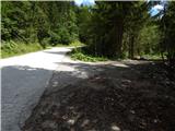
From the starting point we continue in the direction of Bela / Vellach and walk along an ascending macadam road, which is closed to public traffic by a traffic sign and a gate. In a few longer serpentines we ascend to the saddle east of the peak Gorelca / Gorelza, where there is a religious symbol (cross). Further on, a few smaller intersections follow, where we follow the blazes, then behind the next gate we descend to a wider road, which we follow left uphill.
Further on, the road leads us above the farm Zgornji Mozgan / Obermosgan, then we continue past yet another gate. Here a beautiful view opens up, mainly on the Austrian part of the Karawanks, and we continue along the marked road. Higher up, the road leads us past several hunting observation posts, then after a somewhat longer traverse to the right it brings us to another road, which we follow left uphill. On this section a beautiful view opens up again, and we leave the road and ascend diagonally above the road on a marked path. A little higher, somewhat above the nearby intersection we cross the road once more, then we ascend to the border ridge, where we reach the cart track that arrives from the Slovenian side. Along the cart track we walk only a few steps, then we continue slightly right onto the marked path, which continues along a somewhat overgrown ridge. Here a beautiful view opens up once again, then the ridge becomes more overgrown. A little further on, the marked path withdraws slightly to the right from the ridge, thus bypassing the summit of Snežnik itself (we can ascend to the summit in a few dozen steps). A few minutes of traversing follow, then we reach another forest road, along which we continue westwards. The road leads us along the ridge for a short time, then gradually transitions to the northern slopes of Špičasti vrh. On this section we will notice a blaze on the left, which directs us left from the road onto an initially overgrown path, along which in a few dozen steps we ascend to the forested Špičasti vrh.
Description and pictures refer to the situation in 2016 (August).

Along the route: Snežnik (1543m)
Photos:
 1
1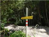 2
2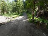 3
3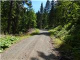 4
4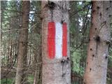 5
5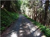 6
6 7
7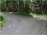 8
8 9
9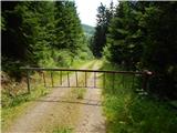 10
10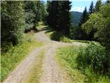 11
11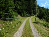 12
12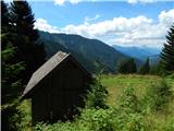 13
13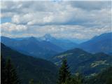 14
14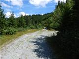 15
15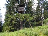 16
16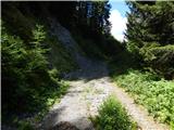 17
17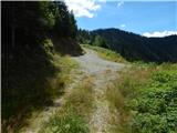 18
18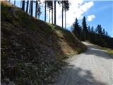 19
19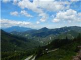 20
20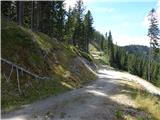 21
21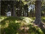 22
22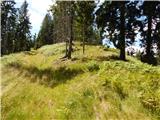 23
23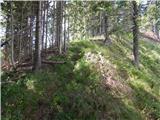 24
24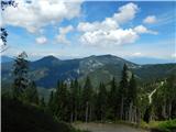 25
25 26
26 27
27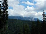 28
28 29
29 30
30 31
31 32
32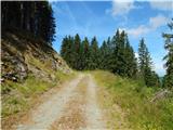 33
33 34
34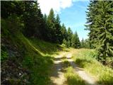 35
35 36
3637
Discussion about the trip Pod Peco (Koželj) / Koprein-Petzen (Koschiel) - Špičasti vrh / Spitzberg
To post a comment you must log in:
If you do not yet have a username, you must first
register.