Koča na Naravskih ledinah - Uršlja gora (Plešivec)
Starting point: Koča na Naravskih ledinah (1072 m)
| Latitude/Longitude: | 46,4861°N 14,9386°E |
| |
Walking time: 1 h 45 min
Difficulty: easy marked way
Elevation gain: 627 m
Elevation difference along the route: 627 m
Map: Kamniške in Savinjske Alpe 1:50.000
Recommended equipment (summer):
Recommended equipment (winter): ice axe, crampons
Views: 149.108
 | 6 people like this post |
Access to starting point:
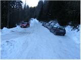
A) From Slovenj Gradec or Ravne na Koroškem we drive to Kotlje, and from there we continue driving on a local road which leads past the parish church (if we come from the direction of Slovenj Gradec in the main crossroad in Kotlje we continue straight, and if we come from the direction of Ravne na Koroškem we continue right). After the church, the road slowly starts ascending, and after approximately a kilometer of driving brings us to a crossroad at the church of St. Mohor and Fortunat, where we continue left. When a little ahead the road brings us to the edge of the forest, where we continue right (straight Ivarčko Lake). Further, the ascending road leads past some more crossroads, where we continue in the direction of Naravske Ledine. When we get to Naravske Ledine we park on one of the many parking lots near the mountain hut.
B) From Črna na Koroškem or Mežica we drive to Žerjav, and from there we continue driving through the valley of the Jazbinski Stream. Higher, we gradually leave the valley and ascend between individual homesteads of the dispersed settlement Uršlja Gora. Still before we get to the homestead Križan we continue left in the direction of Naravske Ledine. Further, during the slight traverse ascent to the right, a road branches off which leads towards the summit of Uršlja gora, and here we continue straight and follow the road to the Koča na Naravskih Ledinah mountain hut, where on a suitable spot near the hut we also park.
C) First, we drive to Šoštanj (to here from Velenje or Savinjska Valley), and then we continue driving towards Črna na Koroškem. Further, the road starts ascending towards the mountain pass Spodnje Sleme (1081 m), which after a few kilometers of winding road we also reach. Here the road branches off to the left towards Andrejev dom na Slemenu mountain hut, and we continue driving towards Črna na Koroškem. From the mountain pass ahead we drive a few hundred meters more, and then signs for Uršlja gora direct us to the right onto an ascending road, which only a little higher loses its asphalt surface. We continue on a wider macadam road (the road is in winter usually plowed and salted), and we follow it approximately 1500 meters, or to the crossroad, where to the right branches off a poorer macadam road towards Križan and Uršlja gora. We continue in the mentioned direction, on the road which after a small saddle starts steeply descending towards the homestead Križan. At the homestead we continue left, and then in the following crossroads we follow the signs for Naravske Ledine. When we get to Naravske Ledine we park on one of the many parking lots near the mountain hut.
Route description:
From the parking lot near the hut we continue another 10 meters or so along the road, then a signpost for Uršlja gora directs us left onto a footpath. After 10 minutes of ascent the path brings us to the next parking lot (possible starting point) at which it turns slightly left and through a short strip of forest brings us to a larger grassy slope, over which a pleasant footpath leads us in a gentle ascent. On the other side of the meadow a wide path enters the forest, where it then continues in a traverse ascent. Higher the path brings us to a panoramic clearing, beside which we notice a pleasant spring. Ahead the path goes into dense forest and starts to ascend ever more steeply.
Higher from the left the path over Kozji hrbet joins us, and we continue straight ahead on an even somewhat steeper path. A little higher the steepness eases and the path brings us from the dense forest onto ever more panoramic slopes. A little below the summit of Uršlja gora the path forks into two parts (summer and winter path). The summer path leads directly to the summit, which we reach in a few minutes, the winter path (right path) first withdraws somewhat to the right from the summit, then forks once more. The fork is located near a wayside shrine, from which a nice view opens, and we continue on the left path (straight to Dom na Uršlji gori and church of St. Ursula 5 minutes) and in a minute or two ascend to the summit of Uršlja gora.

Photos:
 1
1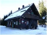 2
2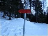 3
3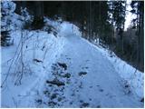 4
4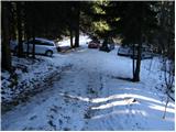 5
5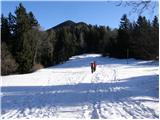 6
6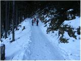 7
7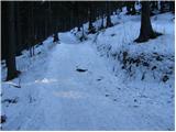 8
8 9
9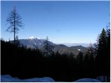 10
10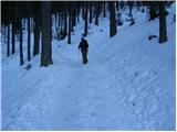 11
11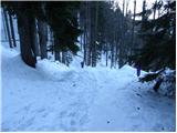 12
12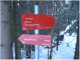 13
13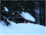 14
14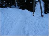 15
15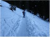 16
16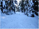 17
17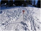 18
18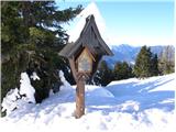 19
19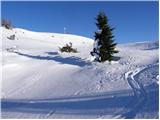 20
20 21
21 22
22 23
23
Discussion about the trip Koča na Naravskih ledinah - Uršlja gora (Plešivec)
|
| EUGEN19. 05. 2010 |
Has anyone been to Uršlja recently from
Naravskih ledin (how much snow is left?).
Thanks l.p.
|
|
|
|
| monca20. 05. 2010 |
about 3 weeks ago there was a little snow from the bench onwards. but still quite nice to hike. going again these days, really missing Urška ... 
|
|
|
|
| divjipetelin20. 05. 2010 |
When I look out the window, I don't see snow on Uršlja gora anymore. Otherwise, I hike from Ivarček Lake via Železarska or Grofovska.
|
|
|
|
| Marko8322. 07. 2011 |
The path isn't great, because you're basically walking on a road and there's no view either.
|
|
|
|
| joža x22. 07. 2011 |
It depends on the person; I've hiked this trail in all seasons and it was always "nice" for me. Of course, it depends on what one is looking for in the mountains.
|
|
|
|
| neph22. 07. 2011 |
Marko83 - what you've written is of course just your subjective opinion, which you haven't backed up with any arguments, and moreover you're spreading disinformation... The trail at the beginning (to the wooden hut at Luze) follows a wide forest path, then it becomes somewhat narrower, and at the top we cross grassy southern slopes. So definitely not a road in the true sense of the word. There are no views in the first part, but at Luze a view opens to the northern slopes. And at the top we can enjoy nice views of the surrounding hills and places...
|
|
|
|
| nadka6. 08. 2012 |
Neph... you're something else... last time we talked about Mangart, now about Peca...
I plan to combine Uršlja gora with Peca in one day (I hear it's doable if we start early), overnight at Koča Peca, second day Olševa... opinion?? Thanks in advance..
|
|
|
|
| nadka6. 08. 2012 |
Neph... you're something else... last time we talked about Mangart, now about Peca...
I plan to combine Uršlja gora with Peca in one day (I hear it's doable if we start early), overnight at Koča Peca, second day Olševa... opinion?? Thanks in advance..
|
|
|
|
| nadka6. 08. 2012 |
Neph... you're something else... last time we talked about Mangart, now about Peca...
I plan to combine Uršlja gora with Peca in one day (I hear it's doable if we start early), overnight at Koča Peca, second day Olševa... opinion?? Thanks in advance..
|
|
|
|
| neph6. 08. 2012 |
The mentioned tours are feasible in one day via the shortest approaches (Uršlja from Naravskih ledin, Peca from the upper parking lot - Jakobe) without major difficulties or excessively early rising. If you are in good shape, you can appropriately extend the tour, for example by approaching Uršlja via Ivarčko jezero (Železarska or Grofovska (unmarked) trail). Of course, there are much longer approaches to Peca as well, so as desired...
|
|
|
|
| artur25. 06. 2015 |
New caretaker at Naravskih ledin to praise. Friendly, smiling, and even treated us to medico.
Hats off.
Otherwise we walked the path with one stop in 1 hour and 20 minutes.lp
|
|
|
|
| bzorko24. 09. 2017 |
Super hostess with excellent food, hospitality. All praise. We even come all the way from Celje.
|
|
|
|
| Janezs24. 09. 2017 |
Yes, this lady is not there just for money, let her be an example to others. Deserves recognition. Lp.
|
|
|
|
| andrejazg23. 08. 2018 |
At the beginning of the path there is a bit of slalom and climbing over fallen trees, higher up the path is OK
|
|
|
|
| Hribolazec812. 12. 2022 17:39:41 |
What's the road like now to Naravskih ledin?
|
|
|
|
| Hribolazec813. 12. 2022 17:51:54 |
Road normally drivable with winter equipment, trail excellently marked, trodden, hut is open, lots of snow
|
|
|
|
| tadejz26. 09. 2023 09:10:32 |
Can you get to the hut with a normal car, considering the August floods and avalanches?
Thanks in advance
|
|
|
|
| tadejz12. 10. 2023 09:24:10 |
The hut is confirmed accessible, the path to it repaired, reachable even with a smaller car.
The trip was great, during the week really quiet at the top; the view still wonderful.
The proposal succeeded too, she said yes <3
|
|
|
|
| PodSmrekco13. 07. 2025 09:40:35 |
The road to the trailhead is being renovated, they occasionally close it. So maybe only in bad weather, recommend a higher vehicle. Otherwise the road is nicely and normally drivable. 
|
|
|
To post a comment you must log in:
If you do not yet have a username, you must first
register.