Tinčkova koča - Srednji vrh (above Završnica) (via Smokuška planina)
Starting point: Tinčkova koča (1070 m)
| Latitude/Longitude: | 46,4228°N 14,1991°E |
| |
Route name: via Smokuška planina
Walking time: 2 h
Difficulty: easy marked way
Elevation gain: 726 m
Elevation difference along the route: 726 m
Map: Karavanke - osrednji del 1:50.000
Recommended equipment (summer):
Recommended equipment (winter): ice axe, crampons
Views: 21.658
 | 2 people like this post |
Access to starting point:
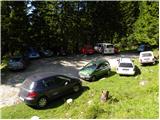
From the Ljubljana - Jesenice highway we take the Lesce exit and follow the road ahead in the direction of Žirovnica and Jesenice. After a few km of driving, we will get to a crossroad, where the road to Žirovnica and Moste branches off to the right (from the direction of Jesenice left). Only a few meters ahead in the next crossroad, we turn left to Moste (right Žirovnica). Further, we drive past a monument to fallen soldiers, where the road starts ascending up a hill below the railway track. On top of the slope, we turn right (at the sign Vila Karin), and then drive towards Završniško jezero and Valvasorjev dom. The road then flattens and brings us to a crossroad, where the road towards the mountain hut Valvasorjev dom branches off to the left, and we continue straight on the initially still asphalted road. The road soon becomes macadam, and we follow it to a parking lot near the mountain hut Tinčkova koča. The road in the upper part is often in quite bad condition.
Route description:
From the parking lot at the mountain hut Tinčkova koča we continue on a wide rocky cart track in the direction of the mountain hut Koča pri izviru Završnice. Already after a few steps of walking blazes point us slightly right, on a somewhat steeper footpath which ascends over a panoramic grassy slope, and then it returns to the before-mentioned cart track which we follow to the right. Cart track, which is relatively steeply ascending through the forest, after a few minutes of additional walking brings us to a grazing fence, behind which we come to the marked crossing.
We continue straight (slightly right Roblekov dom) on still rocky cart track which higher out of the forest brings us on ample grassy slopes of Smokuška planina. Here the steepness decreases and the increasingly panoramic path in 15 minutes of additional walking brings us to the hut Koča pri izviru Završnice.
From the mountain hut, we continue left on a marked footpath in the direction of Stol. The path already after a few minutes leaves the cart track and passes into a smaller valley between Srednji vrh on the left and Vrtača on the right. A moderately steep path which runs through a thin forest, higher for a short time steeply ascends and after a few minutes of additional walking brings us to saddle Šija, where there is a marked crossing.
We continue left (straight Stol lower path, right Vrtača and Stol upper path) on an unmarked path which starts steeply ascending on and by the ridge. The path which runs among a dense belt of dwarf pines, after 20 minutes of walking from the saddle Šija brings us to Srednji vrh.
Starting point - Koča pri izviru Završnice 1:00, Koča pri izviru Završnice - Srednji vrh 1:00.

Photos:
 1
1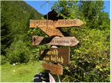 2
2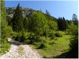 3
3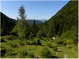 4
4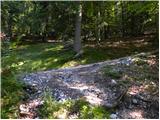 5
5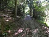 6
6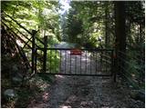 7
7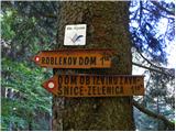 8
8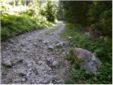 9
9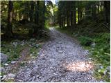 10
10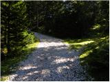 11
11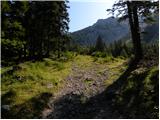 12
12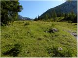 13
13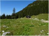 14
14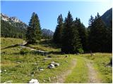 15
15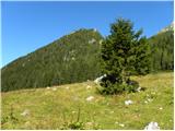 16
16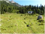 17
17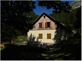 18
18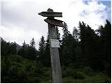 19
19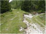 20
20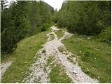 21
21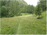 22
22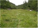 23
23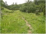 24
24 25
25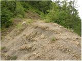 26
26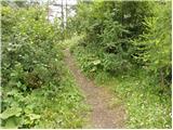 27
27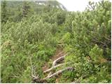 28
28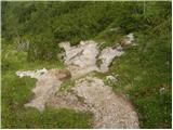 29
29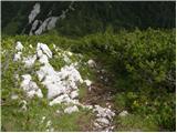 30
30 31
31
Discussion about the trip Tinčkova koča - Srednji vrh (above Završnica) (via Smokuška planina)
|
| klavdy67. 07. 2010 |
Beautiful path, very easy to follow even though unmarked. From the saddle to the summit very quickly.
|
|
|
|
| Parkeljc20. 04. 2011 |
Today started from Tinčkova koča past the koča at the source of Završnica, then to sedlo Šija and to Srednji vrh summit, reached in under an hour. A little below sedlo Šija there is snow on the path, practically to the summit, which is windblown and breaks through very unpleasantly almost to the knees, sometimes sinking to the butt, so great care is needed where to step. I was in shorts and had no major issues. Nice views from the top to nearby Stol, Begunjščica, Vrtača,.. Short but nice afternoon hike..
|
|
|
|
| jewel21. 04. 2011 |
Nice tour, what about photos??
|
|
|
|
| iomejc13. 10. 2014 |
Really nice circular tour! From Tinčkova koča past the koča at the source of Završnica, then to Šija saddle and to the summit of Srednji vrh. Completely newly marked and very nicely maintained path.
Descent via the lower path to "Stol", also marked. The second part of the path is not marked (or we just went a bit off trail), but it's well trodden and logical 
Super and safe even with children, just better to sit on the bench at the top than jump around.
Recommended!
|
|
|
|
| viharnica21. 08. 2016 |
I'm interested how long it takes to walk to Tinčkova koča if I leave the car at the parking lot in Završnica?
|
|
|
|
| Jusk15. 09. 2019 |
On Thursday I was up here, super views all around I was a bit watchful for that snake that's supposed to live up there but didn't see it
|
|
|
|
| tango29. 09. 2020 |
Today the views from the summit are excellent. From sedlo Šija towards the summit little snow, hardly worth mentioning, definitely more mud. But from the summit it was nice to observe small avalanches flying from Vrtače even across the path to Vrtača and the upper path from Šije to Stol. Above the hut at the source of Završnica there were reliably more edible mushrooms than snow! Nice, keep the path under your feet!
|
|
|
|
| lubadar29. 09. 2020 |
What's the condition of the road to Tinčkova koča?
|
|
|
|
| Majdag29. 09. 2020 |
The road was awful 14 days ago. It climbs steeply straight to Srednji vrh.
|
|
|
|
| tango30. 09. 2020 |
Yesterday, except at two spots, quite okay. The upper section towards the hut has been newly filled and reinforced.
|
|
|
|
| Anka TM12. 09. 2021 23:11:12 |
Hello. Does anyone know what's the condition of the road to Tinčkova koča this year? Thanks for reply and best regards.
|
|
|
|
| funnyboy13. 09. 2021 06:08:06 |
The last part of the road from the sawmill onwards is a bit bumpier  with some ditches, otherwise not bad. On Saturday it was full of cars up there, even those without high ground clearance. with some ditches, otherwise not bad. On Saturday it was full of cars up there, even those without high ground clearance.
|
|
|
|
| orchigu5. 07. 2022 21:00:19 |
Last weekend I went up the path past the hut at the source of Završnica (there's a new caretaker, pleasant, he also warned about vipers at the top). Coming back I returned to Sija saddle and then along the slopes of Vrtača to Zelenica and back. Excellent hike, on top you're alone and watch the queue on Vrtača :P
|
|
|
|
| Vrhovka21. 10. 2025 17:23:12 |
Hello. What is the current condition of the road, if anyone knows?
|
|
|
|
| capraibex21. 10. 2025 18:51:28 |
The road is maintained and normally drivable.
|
|
|
To post a comment you must log in:
If you do not yet have a username, you must first
register.