Ljubelj - Srednji vrh (above Završnica) (via source of Završnica)
Starting point: Ljubelj (1058 m)
| Latitude/Longitude: | 46,4324°N 14,2602°E |
| |
Route name: via source of Završnica
Walking time: 2 h 40 min
Difficulty: easy marked way
Elevation gain: 738 m
Elevation difference along the route: 860 m
Map: Karavanke - osredji del 1:50.000
Recommended equipment (summer):
Recommended equipment (winter): ice axe, crampons
Views: 26.195
 | 2 people like this post |
Access to starting point:
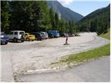
From the Ljubljana–Jesenice motorway, at the Podtabor junction we continue in the direction of Ljubelj and Tržič. We continue driving first on the fast road, then on the regional road, which we follow all the way to the Ljubelj border crossing. Just before the border crossing we turn left (direction Zelenica) and then after a few tens of metres of additional driving, we park on a large parking lot.
Route description:
From the parking lot, we head onto the footpath in the direction of Zelenica, Vrtača and Stol. The cart track, which runs along the left side of the ski slope, brings us after approximately 15 minutes of moderate ascent through the forest to the aforementioned slope, along which we then ascend. The path, which offers nice views of the extensive screes of Begunjščica on the left and the ridge of Ljubeljščica on the right, then brings us in a gentle ascent to the hut on Vrtača. From the hut we continue straight on the marked path, which slowly turns slightly to the left and brings us after a shorter traverse ascent into the belt of dwarf pines. Further on, the path ascends more steeply for a short time and then brings us to the cart track (transport rescue road), which we follow in a moderate ascent to the mountain hut on Zelenica.
From the mountain hut on Zelenica we continue right in the direction of Stol and Vrtača (left Begunjščica) on the path which immediately behind the hut turns left and ascends beside the children's ski lift. Somewhere halfway along the ski lift we come to a less noticeable junction, where the path to Vrtača branches off to the right. We continue straight on the path, which quickly brings us to the top of the children's ski lift. Further, we continue on the wide path, which starts to descend moderately, first along the edge of the second ski lift and then through the forest. After approximately 20 minutes of walking from the mountain hut on Zelenica, the path brings us to the hut at the source of Završnica.
Here we continue right in the direction of Vrtača and Stol on the path, which quickly passes from Smokuška planina into a smaller initially indistinct valley between Srednji vrh on the left and Vrtača on the right. The moderately steep path then brings us after a good half hour of walking from Smokuška planina to the saddle Šija, where the next junction is.
From the saddle we continue left upwards (straight Stol, right Vrtača) on an occasionally poorly traceable path, which in the middle section runs along a somewhat steeper ridge (in winter danger of slipping). Higher up the path turns slightly left and ascends over the belt of dwarf pines to the panoramic summit.
Ljubelj - Zelenica 1:20, Zelenica - Koča pri izviru Završnice 20 minutes, Koča pri izviru Završnice - Srednji vrh 1:00.

Photos:
 1
1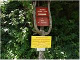 2
2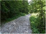 3
3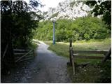 4
4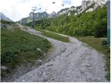 5
5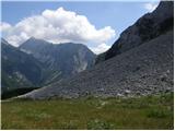 6
6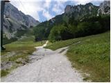 7
7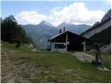 8
8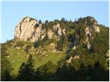 9
9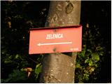 10
10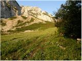 11
11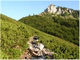 12
12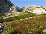 13
13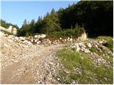 14
14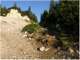 15
15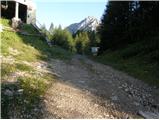 16
16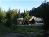 17
17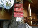 18
18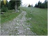 19
19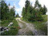 20
20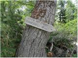 21
21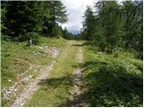 22
22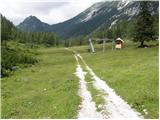 23
23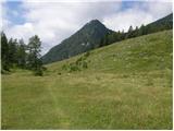 24
24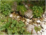 25
25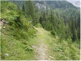 26
26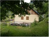 27
27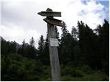 28
28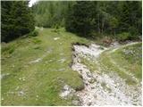 29
29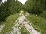 30
30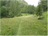 31
31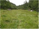 32
32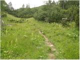 33
33 34
34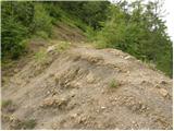 35
35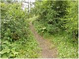 36
36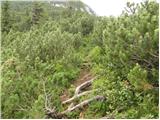 37
37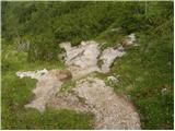 38
38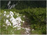 39
39 40
40
Discussion about the trip Ljubelj - Srednji vrh (above Završnica) (via source of Završnica)
|
| Kriška19. 08. 2008 |
This tour is behind me today. I'd note that you'll easily miss the path leading to Šija saddle if you're not careful, even though it's marked as a marked path on maps. The junction is namely nowhere marked, and the trail at the very beginning is so to speak invisible. Even further on, the trail is minimally marked (some old, faded marks), sometimes wide and clearly visible, sometimes almost completely disappears. The path to the saddle branches off from the forest road towards the hut at the Završnica spring at the bend above the hut, so you turn before reaching the hut.
The path from Šija saddle to Srednji vrh ascends moderately in places, quite steeply in a few sections. Today it was slightly wet, so you had to be careful in a couple of places not to slip and land in the mud.
The views from the top are very nice!
|
|
|
|
| lynx16. 11. 2008 |
Regarding the junction to Šija (the previous comment is quite cryptic): it is indeed not marked, but from the bend you can see one marking low on the rock about 20m ahead.
So, first to the hut, next to which there is a signpost, the cart track goes left. Follow it and instead of going into the first bend after a few meters, step off the cart track and keep the same direction.
|
|
|
|
| heinz17. 11. 2008 |
Worth a visit, although the summit is not among the higher ones in that part of the Karawanks. The reason is the beautiful views in all directions.
I think it's much less than 30 min from the Šija saddle, but I would add that I wouldn't call this part of the path "easy or undemanding", as during descent in winter conditions on the slightly exposed section you need to be careful, or have winter gear.
Everything else is completely undemanding.
|
|
|
|
| _d_10. 12. 2014 |
The path is signposted and marked. From Dom pri izviru Završnice to Šija saddle and onwards to the summit. The path running along the slope below Vrtača to Šija saddle is also marked.
|
|
|
|
| pohodnica5312. 09. 2016 |
Full marks for the exemplary well-maintained (cleared scree from the saddle) and freshly marked path, with nice signposts; early in the morning a bit slippery though, views beautiful; we also encountered a viper, so a bit of caution is not amiss, as according to a visitor encounters with them are quite frequent here; regards
|
|
|
|
| Pelca13. 09. 2016 |
We too encountered a young viper on the path from Zelenica to the Koča pri izviru Završnice right before the stream spring. We stopped and it diligently slowly moved away 
|
|
|
To post a comment you must log in:
If you do not yet have a username, you must first
register.