Starting point: Belska Kočna (968 m)
| Latitude/Longitude: | 46,4023°N 14,5664°E |
| |
Walking time: 2 h 45 min
Difficulty: easy marked way
Elevation gain: 819 m
Elevation difference along the route: 819 m
Map: Kamniške in Savinjske Alpe 1:50.000
Recommended equipment (summer):
Recommended equipment (winter): ice axe, crampons
Views: 15.123
 | 1 person like this post |
Access to starting point:
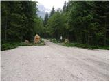
First, we drive to Jezersko, and then we continue driving in the direction of Austria. The road from Jezersko in a few hairpin turns ascends to the border crossing Jezerski vrh, and from there in numerous hairpin turns starts descending more steeply. Lower at the settlement Bela / Bad Velach, we come to the marked crossroad, where we continue right in the direction of Belska Kočna / Velacher Kotschna. The road ahead crosses the stream Bela and only a few meters ahead brings us to the next crossroad. Here we continue straight on the right road and we continue driving by the already mentioned stream. We follow this road to the arranged parking lot by the gate, which prevents further driving.
Access is also possible over the saddle Pavličevo sedlo. In this case, at the settlement Bela we continue left. Further, we follow the description above.
Because of the construction of a new forest road (data from the year 2009) on the mountain pasture Jenkova planina, the parking lot by the gate can be full of timber, therefore we park already a little lower on an appropriate place by the road.
Route description:
From the parking lot, we continue on the road, and after 3 minutes of walking, it brings us to a crossroad, where we continue on the right road in the direction of the summit "Goli" (in Slovene Goli vrh, straight Savinjsko sedlo). We continue the ascent on a macadam road, from which soon quite overgrown marked path branches off to the left, which leads towards the saddle Jenkovo sedlo. At first gently sloping path soon steeply ascends and then it brings us to a forest road which we follow to the right. The ascent on the road lasts only a few steps, and then blazes point us to a poorly beaten footpath which higher a few more times crosses relatively new forest road. Higher marked path finally leaves the forest road and then it ascends even steeper. The steepness then gradually decreases and quite overgrown path quickly brings us to the mountain pasture Jenkova planina, where there stands a smaller unsupplied cottage.
Near the cottage on the mountain pasture Jenkova planina we will notice Austrian signpost with the caption "Goli 615", which points us on at first gentle footpath. The path already after a few steps goes into the forest, where in light ascent crosses some steep and in wet for slipping dangerous slopes. A little further, the path passes on an indistinct eastern ridge of Goli vrh, where it starts ascending steeper and steeper. Higher, the path gradually passes out of the forest on the more and more panoramic slopes of Goli vrh. When we already think that we have to the top only a few steps, a view opens up on "main" peak to which we have a little less than 5 minutes of walking.
Described mountain path is until further notice CLOSED (July 2009).

Photos:
 1
1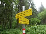 2
2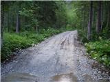 3
3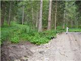 4
4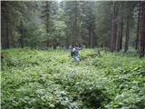 5
5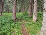 6
6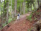 7
7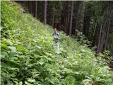 8
8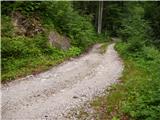 9
9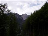 10
10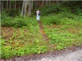 11
11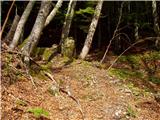 12
12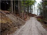 13
13 14
14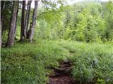 15
15 16
16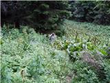 17
17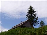 18
18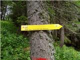 19
19 20
20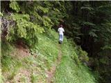 21
21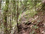 22
22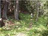 23
23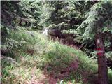 24
24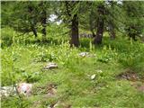 25
25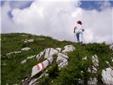 26
26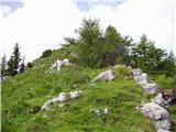 27
27 28
28 29
29
Discussion about the trip Belska Kočna - Goli vrh
|
| Koroški hams29. 09. 2018 |
Today I went from Belska Kočna to Jenkovo planina. The path is still extremely overgrown, additionally partially devastated by the winter storm of 2017, which swept trees across the 'path', and partly the 'path' has disappeared due to logging work. The continuation of the marked path at picture number 9 could not be found. Because of this, I left the road and went straight up, and higher up found the forest road again. Continued on the road until the marked path joined from the right. Continued on the forest road to the next bend (should have gone much further on the forest road). Since there were no markings anywhere, I returned to the previous junction of the marked path and forest road. There I decided to try my luck straight up again. I found paths straight up the steep slope. I only stumbled upon the marked path a few dozen meters below Jenkovo planina. On the descent, I tried to follow the marked path again. Although I followed the markings mostly, I didn't know where the path was. On the descent, I saw that I should have stuck to the forest road much longer (especially at the place where I looked for the path the second time). On the descent, with extra care near picture no. 9, I followed the marked path and still couldn't find the entrance or junction from the forest road. Probably the path has disappeared over the years under tall grass and bushes.
I enjoyed the tour from the first to the last meter, as on my variant the path was 60% pathless and 40% marked pathless and 100% boletus.
At critical points (always when the path joins the forest road) markings are missing. Overall, the path in the lower part is sparsely marked. The most helpful were the two cairns placed at the junctions of the marked path from the forest road.
Driving on the road to the parking lot in Belska Kočna is permitted from 1.4 to 2.11 from 5.00 - 18.00 (status 29.9.2018).
|
|
|
|
| zokipoki19. 08. 2024 16:24:26 |
Has anyone recently walked somewhere from Belska Kočna? I'm interested in the passability of the road to the ramp?
|
|
|
|
| sla19. 08. 2024 19:38:12 |
14 days ago the road was fine.
|
|
|
|
| Hribolazec8115. 04. 2025 20:28:27 |
How is it with this path, is it open?
Is there a parking lot at the starting point?
Thanks
|
|
|
|
| zokipoki17. 04. 2025 09:56:51 |
In January the path was unremarkable, parking was free.
|
|
|
To post a comment you must log in:
If you do not yet have a username, you must first
register.