Prtovč - Altemaver (Ratitovec) (via Razor)
Starting point: Prtovč (1011 m)
| Latitude/Longitude: | 46,2275°N 14,1135°E |
| |
Route name: via Razor
Walking time: 1 h 50 min
Difficulty: easy marked way
Elevation gain: 667 m
Elevation difference along the route: 690 m
Map: Škofjeloško in Cerkljansko hribovje 1:50.000
Recommended equipment (summer):
Recommended equipment (winter): ice axe, crampons
Views: 77.620
 | 5 people like this post |
Access to starting point:
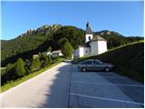
First, we drive to Škofja Loka, and then we continue driving towards Železniki. In Železniki, we come to a crossroad, where a road towards Kropa branches off to the right. Here we continue straight and follow the main road only about 100 meters, and then signs for Prtovč point us to the right on an ascending road, which we follow to a large parking lot near the church in the mentioned village.
Route description:
From the parking lot, we walk past the church and NOB monument to the beginning of the village, where we come to a well-marked crossroad. We continue slightly right in the direction of Ratitovec over Razor (left Ratitovec over Poden) on the road which takes us past houses to a wide and well-beaten path.
The marked path goes immediately into the forest and starts ascending diagonally over relatively steep slopes. Higher up, the path crosses a poor forest road, only a little after that a marked path from the hunting cottage joins us from the right. We continue in the direction of Ratitovec on a gently sloping path, which further crosses steep and in snow dangerous-for-avalanche slopes. Next, the path turns a little towards the left and starts ascending steeper. The steepness soon decreases and the path brings us to a smaller plain named Razor, where there is also a junction.
We continue straight (right Kosmati vrh, mountain pasture Klom and Krekova koča over Vratca) on a wide path, which soon turns to the left and starts ascending steeply. The path ahead crosses a short stretch of forest, then brings us to panoramic grassy slopes of Ratitovec. Here the path flattens, turns a little towards the right and with nice views brings us to Krekova koča on Ratitovec.
From the hut, we continue on a marked path in the direction of Soriška planina. The path first slightly descends to the winter bivouac, where from the right side the path from mountain pasture Pečana joins, and we continue straight to the watering place for animals, where the path stops descending. The path ahead starts ascending steeper along the grazing fence and after a few minutes of ascent brings us to the eastern secondary peak of Altemaver. A short descent follows, then the marked path turns a little towards the right. Right at the spot where the marked path, which leads towards Soriška planina, turns a little towards the right, we leave it and continue the ascent on a well-visible path in the direction of summit Altemaver, which continues along the ridge of Ratitovec. We then follow this panoramic path to the highest peak of Ratitovec, which we reach after a few dozen steps of further walking.

Photos:
 1
1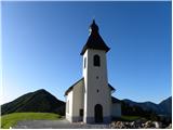 2
2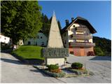 3
3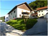 4
4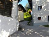 5
5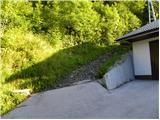 6
6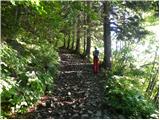 7
7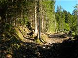 8
8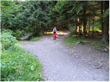 9
9 10
10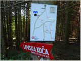 11
11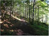 12
12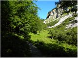 13
13 14
14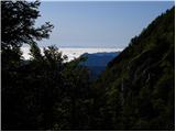 15
15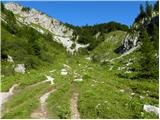 16
16 17
17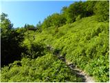 18
18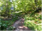 19
19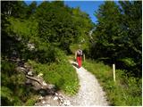 20
20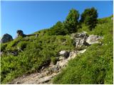 21
21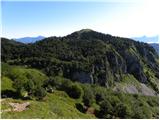 22
22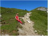 23
23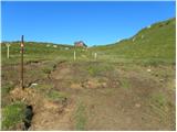 24
24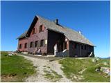 25
25 26
26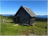 27
27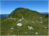 28
28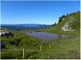 29
29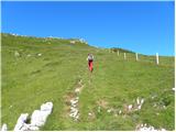 30
30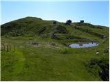 31
31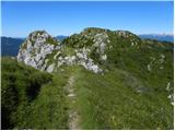 32
32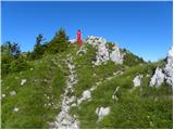 33
33 34
34 35
35
Discussion about the trip Prtovč - Altemaver (Ratitovec) (via Razor)
|
| kofram7. 01. 2012 |
Hi, tomorrow I'd like to go to Ratitovec, can anyone tell me about the weather conditions, thanks and have nice trips to the mountains
|
|
|
|
| GregorC7. 01. 2012 |
The weather will be nice, but the path right from Prtovč and at the top towards the hut is very icy, so microspikes are highly recommended! In general, be careful and take it slow. LP
|
|
|
|
| tinky7. 01. 2012 |
I think it won't be easy, because the wind in Železniki caused devastation and I think the road to Prtovč won't be in the best condition.
|
|
|
|
| main7. 01. 2012 |
The road to Prtovč was normally drivable today at half past eleven in the morning. Fallen trees have already been removed.
|
|
|
|
| katty7. 01. 2012 |
And does anyone know how the path from Zaleč Log towards Davča is?? Maybe some blockage due to fallen trees??
|
|
|
|
| GregorC8. 01. 2012 |
The road towards Davča was cleared yesterday.
|
|
|
|
| namor29. 03. 2012 |
I'm interested in the snow conditions and whether the hut on Ratitovec is open. Best regards.
|
|
|
|
| GregorC9. 03. 2012 |
The hut is open over the weekend, little snow, the path is well trodden and icy in some parts. Small crampons are not superfluous.
|
|
|
|
| Šuška26. 07. 2015 |
Yesterday I was on Ratitovec. On arrival at Krekova koča there was fog, which cleared up after a while. I'm interested if anyone can tell how much walking there is between Gladki vrh, Altemaver and Kosmati vrh? Thanks
|
|
|
|
| link_26. 07. 2015 |
A bit dependent on your fitness, but roughly from the hut to Gladki vrh 5 min. To Altemaver from the hut about 15-20 min, to Kosmati vrh from the hut roughly 45-60 min walking.
|
|
|
|
| Šuška26. 07. 2015 |
Great, many thanks.
|
|
|
|
| skledica2. 01. 2017 |
Currently the path in the upper part is quite icy and it's good if you have those small crampons with you.
|
|
|
|
| ermate29. 03. 2019 |
Is the path already passable without crampons? How is the snow situation?
|
|
|
|
| KrEden30. 03. 2019 |
On this path there is still quite some snow on the last section.
Snow starts a bit further from the point where the direct path from the village and the path past the hunting hut join.
|
|
|
|
| KrEden30. 03. 2019 |
If you go via Poden instead of via Razor, there's no snow problem.
Otherwise there's some on the path, but very little and it can be crossed without issues.
|
|
|
|
| jaka1313. 02. 2020 |
How much snow is on the trail. Are crampons necessary or are microspikes ok?
|
|
|
|
| georgia14. 02. 2020 |
I'm waiting for someone to answer... But no one...
There's little snow up there, as there has been all winter. I don't know the current condition on the trail, I only see Ratitovec from the valley.
Given that some people go up there in sneakers even on snow,  regular microspikes and of course mountain boots will be quite enough. I always carry microspikes with me in winter on such trails and use them as needed. regular microspikes and of course mountain boots will be quite enough. I always carry microspikes with me in winter on such trails and use them as needed.
Good luck!
|
|
|
|
| Mavmar 4. 03. 2021 |
Has anyone been up there in the last few days? What are the conditions like on the trail?
|
|
|
|
| mirank4. 03. 2021 |
We were there on 21.2. and I think the conditions haven't changed much. We went from Soriška planina, walking was really enjoyable as nothing needed to be kicked through. It's wind-packed from the starting point to the hut; I recommend crampons, at least the small ones.
|
|
|
|
| Mavmar 5. 03. 2021 |
Excellent, thanks for the reply!
|
|
|
|
| Mavmar 5. 03. 2021 |
Excellent, thanks for the reply!
|
|
|
|
| MiaB.17. 03. 2021 |
Which is the best trail if coming from Primorska to Ratitovec and Krekova hut? Thanks.
|
|
|
|
| miri19. 03. 2021 |
Cerkno-Novaki- Davča-Železniki.
|
|
|
|
| lubadar19. 03. 2021 |
miri, Primorska is also in the Bovec area
|
|
|
|
| miri19. 03. 2021 |
In that case, you'll need to turn left in Modrej.
|
|
|
|
| MiaB.20. 03. 2021 |
Thanks everyone... I chose the starting point Torka. It was nice
|
|
|
|
| orchigu12. 09. 2021 22:11:42 |
Hiked yesterday, circular from Prtovč - up via Razor and down via Povden. Both paths very nice, well-maintained and nicely marked. Via Povden is really more scenic, it was great for me for descending to enjoy the views. Nice to detour to Gladki vrh (5min from the hut), from both peaks there are wonderful views in good weather practically on all our mountains. At Prtovč there is a fairly large and nicely arranged parking, parking fee 2€ for the whole day, paid by SMS or app (that pink thing that's now common at trailheads - easypay or easypark or whatever). Great food at the hut, quite crowded but in my opinion they deserve the title of best hut.
|
|
|
|
| BorStenar7. 01. 2023 19:17:58 |
Today I went to Altemaver. There was no snow on the summit, some in the Razor cirque. No snow on the ridge, so no issues with that. If you want to go to Gladki Vrh as well, there is (snow) on the ridge, but crampons are not needed.
|
|
|
|
| J.P.24. 03. 2024 17:26:38 |
Went yesterday after a long time from Prtovč - up via Razor, down via Povden. Almost all clear. Some snow patches still persist at Jelovica and below the summit.
LP
|
|
|
|
| skiro1234. 06. 2024 15:10:30 |
For all who don't go to Ratitovec regularly: payment is only possible via EasyPark app and SMS if the operator allows it. But since the signal at Prtovč itself is very weak, it's better to arrange everything in the valley so there's no trouble finding signal at the parking lot.
|
|
|
|
| andraja4. 06. 2024 19:41:31 |
I think it's better to pay on the spot, because in the valley you don't know which parking lot is free. On weekends, it's usually always full by the church (461), but by the hunting hut at Tola (462) there's still plenty of space. From 1.6. full-day parking is 4 Eur. Signal at Prtovč is good.
|
|
|
To post a comment you must log in:
If you do not yet have a username, you must first
register.