Grahovše - Bela peč (via Boršt)
Starting point: Grahovše (800 m)
| Latitude/Longitude: | 46,3664°N 14,3518°E |
| |
Route name: via Boršt
Walking time: 2 h 30 min
Difficulty: easy marked way
Elevation gain: 793 m
Elevation difference along the route: 795 m
Map: Karavanke - osrednji del 1:50.000
Recommended equipment (summer):
Recommended equipment (winter): ice axe, crampons
Views: 17.678
 | 1 person like this post |
Access to starting point:
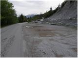
From the Ljubljana - Jesenice motorway, take the Ljubelj (Tržič) exit, then continue driving towards Ljubelj. Just before the petrol station in Bistrica pri Tržiču, leave the main road and continue right towards Tržič. Continue through Tržič towards Dolžanove soteske, then at the end of the town continue right towards Lom pod Storžičem and Grahovše. When you arrive in Grahovše, drive along the road to the nearby quarry, where there is a marked parking lot.
Route description:
From the parking lot, continue along the road where we parked and after a few steps we reach two junctions. At the first junction, continue straight ahead (right over the bridge is the village), at the second we come to mountain signposts. Here, turn left onto the upper path marked Javornik, Stegovnik and Bela peč.
The road starts to ascend moderately here and takes us through scenic meadows at times. The road then brings us to the next junction, where we go left again (right farm Rekar). After that, the road crosses private land with timber and soon reaches the next junction. Turn left onto the road and follow it to the point where the marked path to planina Spodnja Konjščica branches right.
The path ahead goes into the forest, ascends steeply and after a good 20 minutes of further walking brings us to a road. When we step onto the road, the marked path to the viewpoint "na Boštu" (5 minutes) branches left, we continue right along the road, which after a short ascent brings us out of the forest onto the vast planina Spodnja Konjščica, where there are two small shepherd huts.
From the hut, continue slightly uphill across the planina and the path brings us back into the forest. After a short ascent through the forest, we reach planina Zgornja Konjščica.
Here the path descends a few meters and then ascends slightly again. The path brings us to a junction, where we go right to the scenic point of Bela peč (straight to the hut on Javornik). It's just three minutes of easy walking.
Grahovše - Spodnja Konjščica 1:45, Spodnja Konjščica - Bela peč 45 minutes.

Photos:
 1
1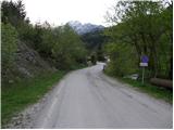 2
2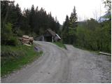 3
3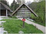 4
4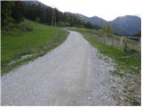 5
5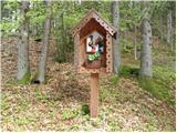 6
6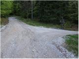 7
7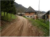 8
8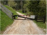 9
9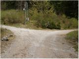 10
10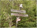 11
11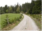 12
12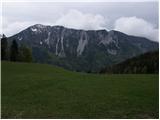 13
13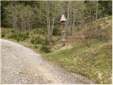 14
14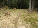 15
15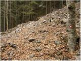 16
16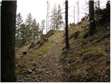 17
17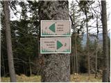 18
18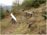 19
19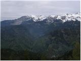 20
20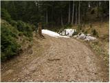 21
21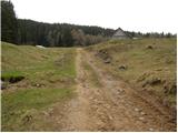 22
22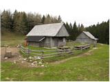 23
23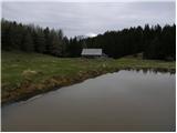 24
24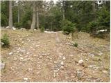 25
25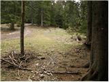 26
26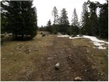 27
27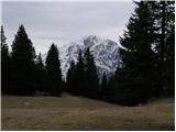 28
28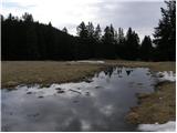 29
29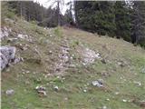 30
30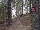 31
31 32
32
Discussion about the trip Grahovše - Bela peč (via Boršt)
|
| plaNinaPirsMajcen12. 03. 2025 20:34:52 |
Hello.
Three days ago we took this path:
https://youtu.be/zyMMciVGvmQ?si=hD9axN-Q-LWSAb1T
Winter and spring hand in hand ❄️🌸
The path is well marked, fresh blazes, only we didn't find the viewpoint "na Boštu". Maybe someone knows where it is? Do you need to go further down the gravel road?
From Planina Spodnja Konjščica onwards a bit of snow, but southern, unsuitable for crampons.
Regards, Nina
|
|
|
|
| cofka13. 03. 2025 00:01:49 |
When you reached the road leading to Konjščica you should have gone a bit down the road. The bench "na Boštu" is on the right side above the road. Nice view of the Košuta ridge.
|
|
|
|
| Kafetarca15. 03. 2025 07:29:23 |
Is the parking in Grahovše now paid, by any chance?
|
|
|
|
| cofka15. 03. 2025 09:55:55 |
|
|
|
To post a comment you must log in:
If you do not yet have a username, you must first
register.