Starting point: Povlje (710 m)
| Latitude/Longitude: | 46,3296°N 14,3768°E |
| |
Walking time: 2 h 45 min
Difficulty: easy marked way
Elevation gain: 1005 m
Elevation difference along the route: 1010 m
Map: Karavanke - osrednji del 1:50.000
Recommended equipment (summer): helmet
Recommended equipment (winter): helmet, ice axe, crampons
Views: 9.511
 | 1 person like this post |
Access to starting point:
a) From the Ljubljana - Jesenice motorway, take the Brnik exit; when reaching the Mengeš - Kranj road, continue left towards Kranj. Drive along the main road towards Kranj to the first roundabout, from which take the first right exit towards Šenčur. Continue through Šenčur along the main road, then, upon reaching the Kranj - Zgornje Jezersko road, turn right towards Jezersko. Upon arriving in Preddvor, leave the main road and continue left towards the centre of the said place; from there, follow the signs to the Bašelj settlement. Just beyond the Bašelj settlement, the road descends to the Milka stream and crosses it over a bridge. Here, a road first branches right to the villages Babni, Vrt, and some 100 m further to the village Povlje. Continue along the ascending road towards Povlje and park in the small parking area above the village. At the starting point is a small junction, several hiking signposts and a large information board for the Trstenik walking-educational trail "path under Storžič".
b) From the Jesenice - Ljubljana motorway, take the Kranj west exit, then continue towards Golnik. Upon arriving in Tenetiše, leave the main road to Golnik and continue right towards Trstenik. Approximately 1 km beyond the Trstenik settlement, reach a small junction, turning left towards the village Povlje. Continue along the ascending road towards Povlje and park in the small parking area above the village. At the starting point is a small junction, several hiking signposts and a large information board for the Trstenik walking-educational trail "path under Storžič".
Route description:
From the parking lot, take the left road towards Velika and Mala Poljana (the path between the two roads leads to Planina Javornik, also Dolenčeva pot to Velika Poljana). The road soon turns left, passing a water reservoir and a quarry. Further on, the road becomes a cart track, which ascends more steeply for a while. Shortly after the cart track levels off and turns right into the forest, a marked footpath branches further right from it; continue the ascent along it. Briefly ascend beside a torrent bed, then the path turns left, ascending across the slope, in the final part over a somewhat collapsed gully. At the top of the gully, reach a sort of ridge between two streams, where the path from the villages Goriče and Zalog joins from the left. Follow a short ascent along the panoramic ridge to a marked junction, from which take the lower left path towards Mala Poljana (right to Velika Poljana).
Continue along the path, which after a few more steps leads into a forest-covered valley. The increasingly faint trail ascends further through this valley, which narrows and gradually becomes a ravine. Continue ascending on the barely visible trail between two steep slopes. The path, mostly covered in leaves and exposed to falling rocks in places, leads higher to an initially quite eroded cart track; after a few minutes along it, exit the forest onto the lower part of Mala Poljana. Continuing the ascent along the cart track, after a few more minutes reach the hunting hut on Mali Poljani.
From Mala Poljana, where paths from Velika Poljana and Dom pod Storžičem join, continue left towards Tolsti vrh along a path that traverses up to the western edge of the pastureland. Higher, the path enters the forest, continuing (except for a few small clearings) to the ridge, where the path from Gozd joins.
Continue right along the ascending path through sparse, mostly spruce forest to the summit treeless slope of Tolsti vrh. Follow this increasingly panoramic path, which ascends relatively steeply along the southern ridge, to the top of this scenic peak.
Starting point - Gmajna 0:25, Gmajna - Mala Poljana 1:20, Mala Poljana - junction below Tolsti vrh 0:40, junction below Tolsti vrh - Tolsti vrh 0:20.

Photos:
 1
1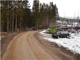 2
2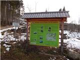 3
3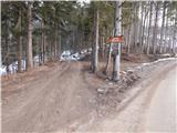 4
4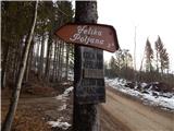 5
5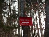 6
6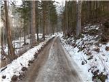 7
7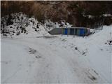 8
8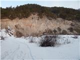 9
9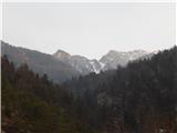 10
10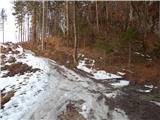 11
11 12
12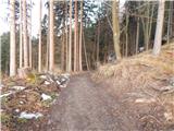 13
13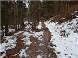 14
14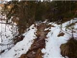 15
15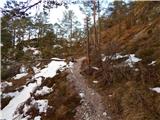 16
16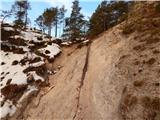 17
17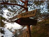 18
18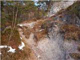 19
19 20
20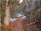 21
21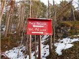 22
22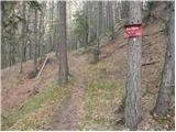 23
23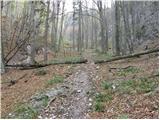 24
24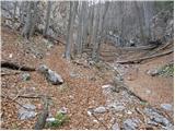 25
25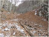 26
26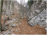 27
27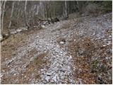 28
28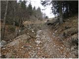 29
29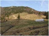 30
30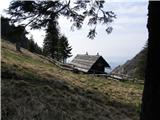 31
31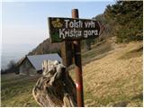 32
32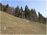 33
33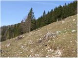 34
34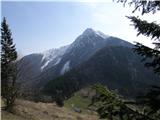 35
35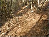 36
36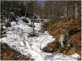 37
37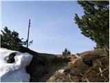 38
38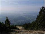 39
39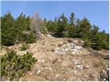 40
40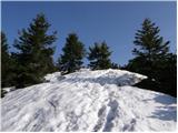 41
41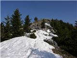 42
42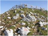 43
43 44
44
Discussion about the trip Povlje - Tolsti vrh
|
| tango30. 12. 2018 |
From Povelje to Mala Poljana, continuation to Tolsti vrh and return via Velika Poljana back to the start. Conditions prima, only from the path junction from Gozd to the top it's icy here and there, so caution is necessary, especially on descent, otherwise you can quickly end up on your butt.
|
|
|
|
| tango5. 05. 2023 16:49:58 |
A beautiful day and the view through the window gave the impulse. With my wife we went to Mala Poljana, from there to Tolsti vrh, continued to Kriško, from Kriško to Gozd and then along the traverse back to the starting point. It added up to almost 14 km. The path excellent, from Tolsti towards Kriško you can still see a little snow, more mud, otherwise beautiful. Some hikers from Kriško towards Tolsti, more from Gozd to Kriško, while from Povlje to M. Poljana there was no one.
|
|
|
|
| Kafetarca6. 05. 2023 21:33:47 |
Which is this path "along the traverse"?
|
|
|
|
| tango7. 05. 2023 07:42:06 |
If you go from Gozd along the path to Zalog, at the remnant of the post with the mark continue left, not right down to Zalog. The path ascends and when you reach the edge of the forest there is a feeding spot for game, then simply continue along the track. When you reach the monument to the fallen fighters at Kozjek, there the path goes left uphill to Poljana, cross the stream and go along the track that leads left and follow it all the way to the parking lot at Povlje.
|
|
|
To post a comment you must log in:
If you do not yet have a username, you must first
register.