Starting point: Laze (850 m)
| Latitude/Longitude: | 46,1513°N 14,0753°E |
| |
Walking time: 2 h
Difficulty: easy marked way
Elevation gain: 712 m
Elevation difference along the route: 725 m
Map: Škofjeloško in Cerkljansko hribovje 1:50.000
Recommended equipment (summer):
Recommended equipment (winter):
Views: 31.788
 | 1 person like this post |
Access to starting point:
a) From Škofja Loka we drive towards Gorenja vas and further to Hotavlje, where we turn right in the direction of the village Leskovica. The road soon brings us to the village Kopačnica, behind which it starts to ascend more steeply and brings us higher to the village Leskovica. From Leskovica we continue towards SC Cerkno, and we follow the road only to the next village Laze, where signs for apartment Ribič and Blegoš direct us to the right towards the mentioned village. We park over 100 m higher, by the sports field ŠD Gamsi Laze.
Route description:
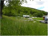
Just a few meters before the sports field we notice the beginning of the marked path that leads to Blegoš. We head onto the mentioned path, which starts to ascend moderately on a wide cart track. Higher up, the cart track narrows and passes into a dense forest, where after a few minutes of further walking it brings us to an unmarked junction.
We continue slightly to the right (slightly left to Črni vrh on an unmarked path) and continue the ascent on the marked cart track. A little further ahead, the cart track temporarily flattens, then starts to ascend steeply on the slopes of Kovk. Higher up, the cart track turns into a footpath, which quickly brings us out of the forest onto grassy slopes, where it turns right and flattens out completely. This is followed by crossing a larger meadow, then the path returns to the forest, where it ascends gently to the right. The path further leads us past a small spring, then after a few minutes of further walking through the forest it joins the paths from the village Leskovica and Volaka. A short diagonal ascent follows and the path brings us to a small saddle, where we temporarily step out of the forest.
On the saddle, where there is a marked junction, we continue right in the direction of the hut Koča na Blegošu (left Črni vrh, straight Črni Kal) along a poor road, by which we ascend to Koča na Blegošu in a few minutes.
From the hut Koča na Blegošu we continue on an initially gentle path that ascends over a panoramic grassy slope. The path soon starts to ascend more steeply and brings us to the edge of the forest, where it then ascends along a narrow unvegetated strip. The steepness soon eases and the path brings us to the panoramic ridge of Blegoš, along which we ascend to the summit in a few minutes.

Photos:
 1
1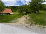 2
2 3
3 4
4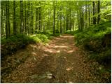 5
5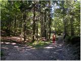 6
6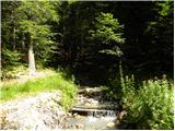 7
7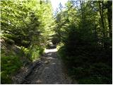 8
8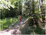 9
9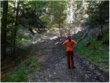 10
10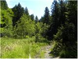 11
11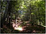 12
12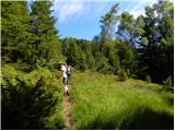 13
13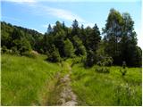 14
14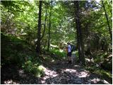 15
15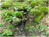 16
16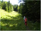 17
17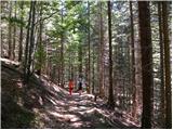 18
18 19
19 20
20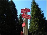 21
21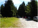 22
22 23
23 24
24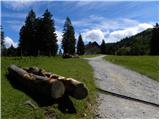 25
25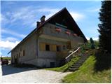 26
26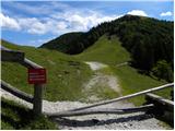 27
27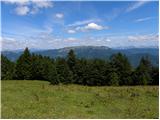 28
28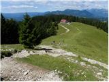 29
29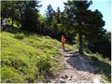 30
30 31
31 32
32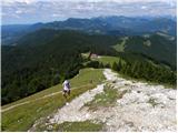 33
33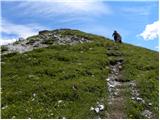 34
34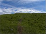 35
35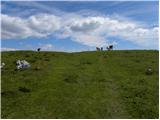 36
36 37
37
Discussion about the trip Laze - Blegoš
|
| bo_zl3. 05. 2020 |
Path in initial section up to fork on meadow (picture no. 14) poorly marked. Markings faded, many new tracks, missed twice. From meadow onwards perfectly marked.
|
|
|
|
| Jernej9683. 07. 2020 |
I suggest the author also adds a description of the access to the starting point from the Primorska side, i.e. from the direction of Cerkno.
|
|
|
|
| Tadej3. 07. 2020 |
Thanks for the suggestion, I've added it.
|
|
|
|
| ločanka28. 01. 2024 06:31:36 |
No more parking at the sports field (motorhomes), for hikers the parking lot a bit lower, at the start of the trail, picture two. There is also a parking sign there.
At picture 10 you can also choose the left branch for the path to Blegoš, through the beautiful Slugova dolina and rejoin the marked trail at Slugov grič. Or there again choose the unmarked path over the Špehovš ridge. Best to take one variant for ascent, the other for descent ! !
|
|
|
To post a comment you must log in:
If you do not yet have a username, you must first
register.