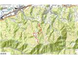
 | Gozd - Tolsti vrh (via Ježa)
Tolsti vrh, located west of Storžič, is at 1715 metres also the highest peak of the Kriška gora range, which rises steeply above central Gorenjsk...
2 h 15 min |
 | Hibje - Dobrča (by road)
Dobrča is a 1634-metre mountain located between Begunje and Tržič. From the summit, which has a registration box with a stamp, the view opens onl...
1 h 45 min |
 | Leskovica - Blegoš
Blegoš is a 1,562-metre-high mountain located between the Selška Sora and Poljanska Sora rivers. From the grassy summit, where there is a stamp a...
2 h 5 min |
 | Čabrače - Blegoš
Blegoš is a 1,562-metre-high mountain located between the Selška Sora and Poljanska Sora rivers. From the grassy summit, where there is a stamp a...
2 h |
 | Tuškov Grič - Blegoš (via Črni vrh)
Blegoš is a 1,562-metre-high mountain located between the Selška Sora and Poljanska Sora rivers. From the grassy summit, where there is a stamp a...
2 h 45 min |
 | Laze - Blegoš
Blegoš is a 1,562-metre-high mountain located between the Selška Sora and Poljanska Sora rivers. From the grassy summit, where there is a stamp a...
2 h |
 | Petrovo Brdo - Možic (via Vrh Bače)
Možic is a 1,602 m high peak located west of Soriška Planina. At the very summit there is an old military bunker bearing the name of the peak and...
2 h 30 min |
| Petrovo Brdo - Možic (via Lajnar)
Možic is a 1,602 m high peak located west of Soriška Planina. At the very summit there is an old military bunker bearing the name of the peak and...
2 h 30 min |
 | Petrovo Brdo - Porezen
Porezen is a 1,630 m high mountain situated between Davča and Baška Grapa. From the summit, where a large Partisan monument stands, a beautiful v...
2 h 30 min |
 | Preval Vrh Ravni - Porezen
Porezen is a 1,630 m high mountain situated between Davča and Baška Grapa. From the summit, where a large Partisan monument stands, a beautiful v...
2 h 30 min |
 | Preval Vrh Ravni - Porezen (via Dom na Poreznu)
Porezen is a 1,630 m high mountain situated between Davča and Baška Grapa. From the summit, where a large Partisan monument stands, a beautiful v...
2 h 35 min |
 | Petrovo Brdo - Slatnik (northwestern peak) (via Lajnar)
Slatnik is a panoramic mountain located west of the Soriška Planina ski resort. From its grassy summit there is a beautiful view of the Škofjeloš...
2 h 15 min |
 | Rateče - Ofen/Peč (by road)
Peč (also known as Tromeja; in Italian Monte Forno, in German Dreiländereck or Ofen) is a 1508 m high peak located at the tripoint between Sloven...
2 h |
 | Rateče - Ofen/Peč (footpath)
Peč (also known as Tromeja; in Italian Monte Forno, in German Dreiländereck or Ofen) is a 1508 m high peak located at the tripoint between Sloven...
1 h 40 min |
 | Fusine Laghi - Ofen/Peč
Peč (also known as Tromeja; in Italian Monte Forno, in German Dreiländereck or Ofen) is a 1508 m high peak located at the tripoint between Sloven...
2 h 15 min |
 | Rateče - Ofen/Peč (eastern path, past bivouac and on footpath)
Peč (also known as Tromeja; in Italian Monte Forno, in German Dreiländereck or Ofen) is a 1508 m high peak located at the tripoint between Sloven...
1 h 45 min |
| Rateče - Ofen/Peč (eastern path, past bivouac and on mule track)
Peč (also known as Tromeja; in Italian Monte Forno, in German Dreiländereck or Ofen) is a 1508 m high peak located at the tripoint between Sloven...
1 h 50 min |
 | Zgornje Jezersko - Virnikov Grintovec
Virnikov Grintovec is a 1654 m high mountain located north of Jezersko on the border ridge between Slovenia and Austria. From the summit, which h...
2 h 15 min |
| Trögern - Virnikov Grintovec
Virnikov Grintovec is a 1654 m high mountain located north of Jezersko on the border ridge between Slovenia and Austria. From the summit, which h...
2 h 15 min |
 | Grahovše - Bela peč (via Boršt)
The mountain, known mainly among climbers, is located north of Storžič on the slopes of Konjščica. From the summit there is a beautiful view of t...
2 h 30 min |
 | Grahovše - Bela peč (via rot)
The mountain, known mainly among climbers, is located north of Storžič on the slopes of Konjščica. From the summit there is a beautiful view of t...
2 h 30 min |
 | Grahovše - Bela peč (via Rekar)
The mountain, known mainly among climbers, is located north of Storžič on the slopes of Konjščica. From the summit there is a beautiful view of t...
2 h 30 min |
 | Na kopiš - Bela peč (via Spodnja and Zgornja Konjščica)
The mountain, known mainly among climbers, is located north of Storžič on the slopes of Konjščica. From the summit there is a beautiful view of t...
2 h |
 | Petrovo Brdo - Kobla
The summit is located in the Lower Bohinj Mountains between Črna prst and Soriška planina. Directly below it is a railway tunnel connecting Bohin...
2 h 15 min |
 | Javorje - Stari vrh (via Koča na Starem vrhu)
Stari Vrh is a 1,217-metre-high mountain located above the ski resort of the same name. There is no view from the summit itself due to the forest...
1 h 35 min |
 | Zgornja Sorica - Lajnar
Lajnar is a 1,549-metre-high mountain located north of Soriška Planina. From the summit, which is also the highest point of the ski resort, a bea...
1 h 40 min |
 | Petrovo Brdo - Lajnar
Lajnar is a 1,549-metre-high mountain located north of Soriška Planina. From the summit, which is also the highest point of the ski resort, a bea...
2 h |
 | Petrovo Brdo - Šavnik
Šavnik is a grassy peak situated between the ski resorts of Soriška Planina and Kobla. From the summit, which has a registration box with a stamp...
2 h 15 min |
 | Javorje - Koprivnik (via Brdo)
Koprivnik is a 1393-meter-high mountain located between Blegoš and Mladi vrh. From the summit, which has a registration box and a stamp, the view...
2 h 20 min |
 | Hunting cottage Vojkovo - Vojkova koča na Nanosu
The Vojkova koča mountain hut is located on the southern edge of the Nanos plateau, directly next to Pleša, a peak clearly visible from the highw...
1 h 45 min |
 | Razdrto - Vojkova koča na Nanosu (gentle path)
The Vojkova koča mountain hut is located on the southern edge of the Nanos plateau, directly next to Pleša, a peak clearly visible from the highw...
2 h 20 min |
 | Veliko Ubeljsko - Vojkova koča na Nanosu
The Vojkova koča mountain hut is located on the southern edge of the Nanos plateau, directly next to Pleša, a peak clearly visible from the highw...
1 h 45 min |
| Strane - Vojkova koča na Nanosu
The Vojkova koča mountain hut is located on the southern edge of the Nanos plateau, directly next to Pleša, a peak clearly visible from the highw...
2 h 15 min |
 | Bele Vode (Rebršak) - Smrekovec
Smrekovec is a mountain of volcanic origin on the eastern edge of the Smrekovec mountain range. The wide grassy summit features a pyramid with a ...
2 h 5 min |
 | Ljubenske Rastke (Vrnivšek) - Smrekovec
Smrekovec is a mountain of volcanic origin on the eastern edge of the Smrekovec mountain range. The wide grassy summit features a pyramid with a ...
2 h |
| Ljubenske Rastke (Kumprej) - Smrekovec
Smrekovec is a mountain of volcanic origin on the eastern edge of the Smrekovec mountain range. The wide grassy summit features a pyramid with a ...
2 h 10 min |
 | Predmeja - Kucelj (on Čaven)
Kucelj is located on the southern slopes of the Trnovski Forest, northwest of the Vipava Valley. From the bare summit, where a cross stands, ther...
2 h |
| Predmeja (tunnels) - Kucelj (on Čaven) (via Koča na Čavnu)
Kucelj is located on the southern slopes of the Trnovski Forest, northwest of the Vipava Valley. From the bare summit, where a cross stands, ther...
2 h 15 min |
 | Predmeja - Veliki Modrasovec
Veliki Modrasovec is located on the southern part of the Trnovski Forest near Predmeja. On the summit stands an old military building, which we m...
1 h 40 min |
| Predmeja (tunnels) - Veliki Modrasovec
Veliki Modrasovec is located on the southern part of the Trnovski Forest near Predmeja. On the summit stands an old military building, which we m...
1 h 55 min |
 | Koča Edmunda Čibeja v Tihi dolini - Mali Golak
Mali Golak is the highest of the Golaki. It did not get its name because it is supposed to be the smallest, but because it had the smallest mount...
2 h |
| Predmeja (Gorjanka) - Mali Golak
Mali Golak is the highest of the Golaki. It did not get its name because it is supposed to be the smallest, but because it had the smallest mount...
2 h 25 min |
 | Gorenje pri Zrečah - Rogla
Rogla is a peak in the middle of the eponymous ski resort. The peak is forested with a small clearing on which stands a lookout tower. The tower ...
2 h 35 min |
 | Brneško sedlo - Velika Kopa
Velika Kopa is a 1542-meter-high peak located between Grmovškov dom and the nearby Mala Kopa. From the top, which is only 1 meter lower than the ...
1 h 50 min |
| Koča Planinc - Velika Kopa
Velika Kopa is a 1542-meter-high peak located between Grmovškov dom and the nearby Mala Kopa. From the top, which is only 1 meter lower than the ...
1 h 50 min |
 | Petrovo Brdo - Krevl
Krevl is a 1515-meter-high peak situated south of the Kobla ski area, more precisely between the Kobla peak and Kravja Črna gora. From the summit...
2 h 30 min |
 | Ravne - Krevl
Krevl is a 1515-meter-high peak situated south of the Kobla ski area, more precisely between the Kobla peak and Kravja Črna gora. From the summit...
2 h 20 min |
 | Dom na Paškem Kozjaku - Basališče (Paški Kozjak)
Basališče is the highest peak of Paški Kozjak. A bench and a summit register have been placed on the summit. However, due to the forest, there is...
2 h |
 | St. John the Baptist on Ojstrica - Huhnerkogel/Košenjak (via Bivak Piramida)
Košenjak is located north of Dravograd and the Drava River on the border with neighbouring Austria. Access to Košenjak is possible on foot or by ...
2 h |
 | Avsa - Monte Mataiur/Matajur
Matajur is a panoramic mountain located on the border between Slovenia and Italy. From the summit there is a beautiful view of Kobariški or Bregi...
2 h 30 min |
 | Avsa - Monte Mataiur/Matajur (old path)
Matajur is a panoramic mountain located on the border between Slovenia and Italy. From the summit there is a beautiful view of Kobariški or Bregi...
2 h 30 min |
 | Plajberški graben / Bleiberger Graben - Sinacher Gupf / Psinski vrh
Sinski vrh (mostly marked as Psinski vrh on maps) / Sinacher Gupf is a peak north of the main Karawanks ridge, more precisely north of Stol and V...
1 h 35 min |
 | Windisch Bleiberg / Slovenji Plajberk - Singerberg / Žingarica
Žingarica / Singerberg is a peak on the Austrian side of the Karawanks above the village of Slovenji Plajberk / Windisch Bleiberg. From the summi...
2 h |
 | Slovenji Plajberk / Windisch Bleiberg - Singerberg / Žingarica (via saddle Albink / Halbingsattel)
Žingarica / Singerberg is a peak on the Austrian side of the Karawanks above the village of Slovenji Plajberk / Windisch Bleiberg. From the summi...
2 h 20 min |
| Plajberški graben / Bleiberger Graben - Singerberg / Žingarica
Žingarica / Singerberg is a peak on the Austrian side of the Karawanks above the village of Slovenji Plajberk / Windisch Bleiberg. From the summi...
2 h 20 min |
 | Trojane - Črni vrh (Čemšeniška planina)
Črni vrh is the highest peak of Čemšeniška planina and, at 1,204 m, the second-highest peak in Posavsko hribovje. The summit has a logbook box bu...
2 h 45 min |
 | Črni vrh - Javornik above Črni vrh (via Šajsna Ravan)
Javornik is a forested peak located southeast of Črni Vrh. In 1972, a lookout tower was erected on the summit, rising above the treetops to provi...
2 h 30 min |
| Kampelc - Javornik above Črni vrh
Javornik is a forested peak located southeast of Črni Vrh. In 1972, a lookout tower was erected on the summit, rising above the treetops to provi...
2 h 15 min |
 | Podkraj - Javornik above Črni vrh
Javornik is a forested peak located southeast of Črni Vrh. In 1972, a lookout tower was erected on the summit, rising above the treetops to provi...
2 h 30 min |
 | Jeršiče - Veliki Javornik (Javorniki)
Veliki Javornik is a 1,268-meter-high peak of the forested hills named Javorniki. The extensive Javorniki forests stretch from Postojna to Cerkni...
2 h 20 min |
 | Brezje - Galetovec
Galetovec is an indistinct peak on the southeastern part of the Pokljuka plateau. From the summit, which has a logbook, there is a nice view of t...
2 h |
 | Zakojca - Kojca
Kojca is a panoramic peak rising south of Baška grapa. From the summit, where there is a haystack, fine views extend over the Lower Bohinj Mounta...
1 h 45 min |
 | Orehek - Kojca
Kojca is a panoramic peak rising south of Baška grapa. From the summit, where there is a haystack, fine views extend over the Lower Bohinj Mounta...
1 h 55 min |
| Jesenica - Kojca
Kojca is a panoramic peak rising south of Baška grapa. From the summit, where there is a haystack, fine views extend over the Lower Bohinj Mounta...
1 h 45 min |
 | Koča na Starem vrhu - Mladi vrh (via Stari vrh)
Mladi vrh is the higher neighbor of the better-known Stari vrh, separated from it by a saddle. Covered in sparse beech forest, the summit offers ...
1 h 40 min |
 | Javorje - Mladi vrh (via Prehodi)
Mladi vrh is the higher neighbor of the better-known Stari vrh, separated from it by a saddle. Covered in sparse beech forest, the summit offers ...
1 h 45 min |
| Preval - Mladi vrh
Mladi vrh is the higher neighbor of the better-known Stari vrh, separated from it by a saddle. Covered in sparse beech forest, the summit offers ...
2 h |
 | Javorje - Mladi vrh (western path)
Mladi vrh is the higher neighbor of the better-known Stari vrh, separated from it by a saddle. Covered in sparse beech forest, the summit offers ...
2 h 5 min |
 | Col - Križna gora (Hrušica)
Križna gora is a 1162 m high peak located north of the village Podkraj. From the summit, where a lookout tower stands, there are fine views over ...
2 h 20 min |
 | Col - Sveti Duh (Hrušica)
The Church of the Holy Spirit is located just a few meters below the summit of Sveti Duh on the slopes of the forested Hrušica, in the range betw...
2 h 15 min |
 | Strane - Suhi vrh (Nanos) (steep way)
Suhi Vrh (1313 m) is the highest peak of the karst Nanos Plateau. From the summit, which has a logbook box and a stamp (stamp currently unusable ...
2 h 15 min |
 | Strane - Suhi vrh (Nanos) (gentle path)
Suhi Vrh (1313 m) is the highest peak of the karst Nanos Plateau. From the summit, which has a logbook box and a stamp (stamp currently unusable ...
2 h 30 min |
 | Jesenice (Ukova) - Španov vrh (Čez sedem grabnov)
Španov vrh is a 1,334 m high mountain located between Javorniški Rovt and Planina pod Golico. From the summit, accessible by the eponymous cable ...
2 h 30 min |
 | Prtovč - Gladki vrh (Ratitovec) (via Razor)
Gladki vrh (Ratitovec), at 1,667 meters, is the most visited peak in the Ratitovec range. From its bare summit, which features a panorama board, ...
1 h 35 min |
| Prtovč - Gladki vrh (Ratitovec) (via Po(v)den)
Gladki vrh (Ratitovec), at 1,667 meters, is the most visited peak in the Ratitovec range. From its bare summit, which features a panorama board, ...
1 h 35 min |
 | Bitenjska planina - Gladki vrh (Ratitovec)
Gladki vrh (Ratitovec), at 1,667 meters, is the most visited peak in the Ratitovec range. From its bare summit, which features a panorama board, ...
2 h 25 min |
 | Prtovč - Altemaver (Ratitovec) (via Razor)
Altemaver (Ratitovec), at 1,678 meters, is the highest peak of Ratitovec. From its grassy summit, there is a beautiful view of the Julian Alps, J...
1 h 50 min |
| Prtovč - Altemaver (Ratitovec) (via Po(v)den)
Altemaver (Ratitovec), at 1,678 meters, is the highest peak of Ratitovec. From its grassy summit, there is a beautiful view of the Julian Alps, J...
1 h 50 min |
| Bitenjska planina - Altemaver (Ratitovec)
Altemaver (Ratitovec), at 1,678 meters, is the highest peak of Ratitovec. From its grassy summit, there is a beautiful view of the Julian Alps, J...
2 h 30 min |
 | Rotek - Altemaver (Ratitovec)
Altemaver (Ratitovec), at 1,678 meters, is the highest peak of Ratitovec. From its grassy summit, there is a beautiful view of the Julian Alps, J...
2 h 30 min |
| Podkraj - Srednja gora (Hrušica) (west path)
Srednja gora is a 1,275 m high peak in the central part of forested Hrušica. Although the summit is wooded, just a few minutes' walk east from th...
1 h 45 min |
 | Zrmanja Railway Station - Poštak
Poštak (also "Kečina kosa") is a scenic mountain at the junction of Lika and Dalmatia. It belongs to the Lička Plješivica range as an extension, ...
2 h 30 min |
 | 18th hairpin turn of road on Strma Reber - Cerk
Cerk, at 1,192 meters, is the highest peak of Borovška gora, a range situated between the Kolpa River valley and Goteniški Snežnik. From the summ...
2 h 40 min |
 | Jeršiče - Mali Javornik (Javorniki)
Mali Javornik is a 1219 m high mountain located in the forested ridge of Javorniki. There is no view from the summit itself due to the forest, bu...
1 h 50 min |
 | Rotek - Kremant (Ratitovec)
Kremant is a 1,654 m high peak located on the western part of Ratitovec. From the summit, where a stamp is attached to a metal pole, a nice view ...
2 h 30 min |
 | Tuškov Grič - Medrce (by road)
Medrce is a 1,410-meter-high peak located between Porezen and Hum. From the summit, which features an old bunker, there are nice views of Kojca, ...
2 h 20 min |
 | Poče - Medrce (steep path)
Medrce is a 1,410-meter-high peak located between Porezen and Hum. From the summit, which features an old bunker, there are nice views of Kojca, ...
2 h |
| Poče - Medrce (winter way)
Medrce is a 1,410-meter-high peak located between Porezen and Hum. From the summit, which features an old bunker, there are nice views of Kojca, ...
2 h 40 min |
| Poče - Medrce (via Labinjske lehe)
Medrce is a 1,410-meter-high peak located between Porezen and Hum. From the summit, which features an old bunker, there are nice views of Kojca, ...
2 h 30 min |
 | Poče - Kopa (Cimprovka) (winter way)
Kopa is a 1360 m high peak or panoramic promontory from which a nice view opens up on Cerkno, the hills surrounding it, Ratitovec, Trnovski gozd,...
2 h 25 min |
 | Fusine Laghi - Monte Coppa
Kopa (Kopje on some maps), or Monte Coppa in Italian, is a 1496-meter-high peak on the Italian side of the Karawanks. The old Rapallo border once...
2 h |
 | Petrovo Brdo - Slatnik (southeastern peak) (via Lajnar)
Slatnik (southeastern peak) is a panoramic mountain that rises steeply above Baška grapa on one side and descends more gently toward Soriška plan...
2 h 5 min |
 | Žabnice / Camporosso in Valcanale - Florjanka / Monte Florianca
Florjanka is a 1,653-meter-high mountain on the Italian side of the Julian Alps. At or just below the summit is a reservoir for snowmaking on the...
2 h 30 min |
 | Rute (Zavrh) / Bärental - Mačenski vrh / Matschacher Gupf (via 668)
Mačenski vrh / Matschacher Gupf is a panoramic peak above Rož / Rosental. The peak has a summit register box with a logbook....
2 h 15 min |
| Rute (Zavrh) / Bärental - Mačenski vrh / Matschacher Gupf (over saddle Mrzla raven / Gipssattel)
Mačenski vrh / Matschacher Gupf is a panoramic peak above Rož / Rosental. The peak has a summit register box with a logbook....
2 h 15 min |
 | Kuna Konavoska - Ilijin vrh
Ilijin vrh, also known as Sveti Ilija, is the main peak of the Sniježnica Konavoska mountain ridge, which is also the southernmost mountain ridge...
2 h 30 min |
 | Veliko Tinje - Veliki vrh (on Pohorje)
Veliki vrh is a 1344-meter-high peak located above the RTC Jakec - Trije kralji ski slope. The highest point of the peak is in the forest, but ju...
2 h 30 min |
| Kebelj - Veliki vrh (on Pohorje)
Veliki vrh is a 1344-meter-high peak located above the RTC Jakec - Trije kralji ski slope. The highest point of the peak is in the forest, but ju...
2 h 10 min |
| Šmartno na Pohorju - Veliki vrh (on Pohorje)
Veliki vrh is a 1344-meter-high peak located above the RTC Jakec - Trije kralji ski slope. The highest point of the peak is in the forest, but ju...
2 h 45 min |
 | Parking Rote Wand (Tyrnau) - Rote Wand (via saddle Bucheben)
Rote Wand is a 1,505-meter-high mountain in the Graz Mountains in Styria, Austria. The name "Rote Wand" (red wall) comes from its southeast-facin...
2 h |
 | Mönichkirchen - Steinerne Stiege
Steinerne Stiege is a less prominent peak in the Wechsel range....
1 h 35 min |
| Mariensee - Steinerne Stiege (red trail)
Steinerne Stiege is a less prominent peak in the Wechsel range....
2 h 25 min |
 | Mönichkirchen - Niederwechsel (via Steinerne Stiege)
Niederwechsel is a panoramic peak in the Wechsel massif. From the summit, fine views extend far in all directions, since there are no higher peak...
2 h 25 min |
 | Rettenegg - Grazer Stuhleck (via Schwarzriegel)
Grazer Stuhleck is a 1,635-meter-high peak located southwest of Stuhleck, the highest summit of the Fischbacher Alpen mountain group. Numerous wi...
2 h 40 min |
 | Rettenegg - Geiereck (past Roseggerhaus)
Geiereck is a panoramic peak located northeast of the Roseggerhaus hut and southeast of the Geiereckalm alpine pasture....
2 h 25 min |
| Rettenegg - Geiereck (via Schwarzriegel)
Geiereck is a panoramic peak located northeast of the Roseggerhaus hut and southeast of the Geiereckalm alpine pasture....
2 h 55 min |
 | Rettenegg - Peter-Bergner-Warte (Pretul) (past Roseggerhaus)
The Peter-Bergner-Warte viewpoint is located on the 1,656-meter-high Pretul summit above the settlement of Rettenegg....
2 h 15 min |
 | Rettenegg - Amundsenhöhe (past Roseggerhaus)
Amundsenhöhe is a 1,666-meter-high panoramic peak in the Fischbacher Alpen mountain group. From the summit there is a nice view of the hill count...
2 h 25 min |
 | Sankt Ilgen (Der Bodenbauer) - Buchbergkogel
Buchbergkogel is a 1,700-meter panoramic mountain above the Häuslalmhütte hut and the Joseralm and Heinzleralm pastures. A cross stands on the su...
2 h 30 min |
 | Seetal - Voisthalerhütte
The Voisthalerhütte mountain hut is situated on a scenic rise at the beginning of the Obere Dullwitz valley. From the hut, beautiful views open u...
2 h 50 min |
 | Alpl (Waldschulle Alpl) - Teufelstein
Teufelstein is a 1,498-meter-high mountain in the Fischbacher Alpen group. At the summit there is a cross with a summit logbook, and slightly bel...
2 h 30 min |
 | Nechnitz - Gerlerkogel (via Gschaidberg)
Gerlerkogel is a 1324-meter-high peak situated in the Almenland nature park. From the grassy peak, a beautiful view opens up of the surrounding m...
2 h 15 min |
 | Gasen - Plankogel (by learning trail)
Plankogel is a 1531-meter-high mountain situated in the Almenland nature park. From the panoramic summit, where a cross stands, a beautiful view ...
2 h 35 min |
 | Laufnitzgraben - Bei den drei Pfarren
Bei den drei Pfarren ("At the Three Parishes") is a crossroads from which a stunning panoramic view opens towards the south and west, all the way...
2 h 30 min |
 | Niklasdorfgraben (parking lot Mugel) - Mugel
Mugel is a 1630 m high mountain on the Gleinalpe (Glinska planina) above the village of Niklasdorf in Styria.A cross stands on the summit, and th...
2 h |
 | Mazinski preval - Kremen
Kremen is a scenic peak in Lika, located north of Gračac. It is the highest peak in Zadar County. The summit features a geodetic pillar, along wi...
2 h 30 min |
 | Unternberg - Kampstein
Kampstein is a 1,467-meter-high mountain situated above the settlement of St. Corona am Wechsel. At the summit there is a cross and a few benches...
2 h |
 | St. Corona am Wechsel - Kampstein (mimo Kampsteiner Schwaig)
Kampstein is a 1,467-meter-high mountain situated above the settlement of St. Corona am Wechsel. At the summit there is a cross and a few benches...
2 h 5 min |