Dom na Paškem Kozjaku - Basališče (Paški Kozjak)
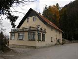
Starting point: Dom na Paškem Kozjaku (960 m)
| Latitude/Longitude: | 46,3843°N 15,1883°E |
| |
Walking time: 2 h
Difficulty: easy marked way
Elevation gain: 312 m
Elevation difference along the route: 500 m
Map: Pohorje 1:50.000
Recommended equipment (summer):
Recommended equipment (winter): ice axe, crampons
Views: 59.042
 | 3 people like this post |
Access to starting point:
From the road Velenje - Slovenj Gradec between villages Paka pri Velenju and Zgornji Dolič at the road sign between 5.5 and 6 km to the right (from the Slovenj Gradec direction, left) a road branches off towards the quarry. We go on this road, which before the quarry turns left and then ascends to the mountain hut Dom na Paškem Kozjaku, where we park.
Route description:
From the mountain hut, we continue on the road ahead in the direction of Sveti Jošt. After a minute of walking blazes point us to the left upwards on a cart track. Further, we are ascending on a cart track which after approximately 15 minutes brings us on the road. Only a few meters ahead we notice a chapel where we continue right in the direction of the peak of Basališče. The path then goes into the forest, where it is at first ascending gently. The path soon brings us on a ridge on which the path continues. The path on the ridge several times ascends and then descends again, and meanwhile it crosses some peaks among which the highest is Ostrica. A gentle descent follows to a wide meadow, which we cross with light walking. On the other side, we notice two hunting observatories. We go towards the one on the left side and next to it we notice signposts for Basališče. To there we have approximately half an hour of walking.
The path ahead again continues on the ridge, which is mostly ascending through the forest (on one part a nice view opens up on Pohorje). The path then brings us on overgrown secondary peak on which stands the monument to the fallen partisans. The path ahead runs on an overgrown ridge slightly downwards, all the way to the spot, where from the right side joins the path from the farm Jernejc. There follows only 5 minutes of ascent through the forest to the top.

Along the route: Sveti Jošt (1063m), Ostrica (1184m)
Photos:
 1
1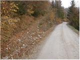 2
2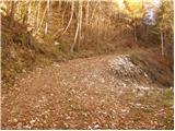 3
3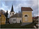 4
4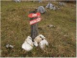 5
5 6
6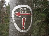 7
7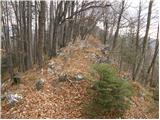 8
8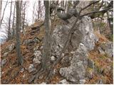 9
9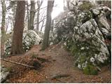 10
10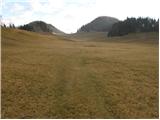 11
11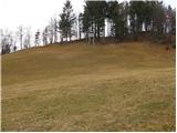 12
12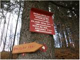 13
13 14
14 15
15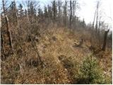 16
16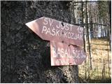 17
17 18
18
Discussion about the trip Dom na Paškem Kozjaku - Basališče (Paški Kozjak)
|
| darh16. 03. 2011 |
We covered most of this described trail section during our circular tour of Paški Kozjak from Dobrna. From the starting point we climbed via Visoki to the hut. We then followed the path described here, which was still snowy on the north side and thus required more caution, via Ostrica to the meadow, across which we descended directly to the Jernejc farm and from there continued down to Dobrna. Despite snow remnants, the atmosphere was already fully spring-like on a sunny Saturday. Read a more detailed description of our path here.
|
|
|
|
| Valuk1. 08. 2011 |
Basališče. Does anyone perhaps know the explanation of this name, which is completely foreign to me?.
|
|
|
|
| Matjaz_6520. 11. 2011 |
some of my photos from the trail hut ... Špik ... Basališče 
|
|
|
|
| s57mbboris21. 11. 2011 |
Basališče: Basanje means loading, and according to my sources, the British during WWII dropped food and weapons on this meadow. From this, the area supposedly got the name Basališče...
|
|
|
|
| rade745. 09. 2013 |
On Sunday I set off from the Dom na Paškem Kozjaku towards Basališče, I have to tell you that at the beginning of the ridge the path is poorly marked. Otherwise it's quite demanding for a recreational hiker like me. It's interesting because it constantly descends and ascends. The most beautiful part of the path is the beautiful pasture with two observation hides on the edge of the forest. The weather was cloudy and windy, so probably also because of that the path wasn't to my liking. When walking along the ridge, you have to be very careful not to slip or to stick your foot somewhere between the rocks.
|
|
|
|
| nejcf25. 02. 2021 |
Last weekend we went along this path to the highest peak of Paški Kozjak. At some points on the ridge (between Jošt and Ostrica) it was icy on the northern side, it might be different now. On the way back, we turned left at the clearing and descended to the road, which then took us back to the starting point. Quickly I also jumped onto Špik and descended along a partially marked path (poorly maintained in places), which ends right in front of the hut.
|
|
|
|
| seinfeld12. 07. 2021 10:42:22 |
On Saturday via this path. Very nice, easy, a walk and really wonderful meadow. Views aplenty too. Round trip 9km and 650m elevation gain.
When emerging from the forest, best to stick to the left side of the meadow, especially since the second observation post is already quite hidden among trees.
|
|
|
To post a comment you must log in:
If you do not yet have a username, you must first
register.