Jeršiče - Mali Javornik (Javorniki)
Starting point: Jeršiče (650 m)
| Latitude/Longitude: | 45,7748°N 14,2305°E |
| |
Walking time: 1 h 50 min
Difficulty: easy marked way
Elevation gain: 569 m
Elevation difference along the route: 580 m
Map: Snežnik 1:50.000
Recommended equipment (summer):
Recommended equipment (winter): ice axe, crampons
Views: 2.530
 | 1 person like this post |
Access to starting point:
A) From the Koper - Ljubljana highway we head to the Postojna exit, then drive towards the center of Postojna. In the mentioned place we will notice signs for Pečno reber and railway station, which direct us to the right, then approximately 200 m before the railway station we turn left (the crossroad is not marked) onto the road which soon leads over the highway. On the other side of the highway we come to a crossroad, where a road towards Stara vas branches off to the right, and we continue in the direction of Javornik and Sveta Trojica. A little further, by the NOB monument, the road towards Pečna reber branches off to the left, and here at an appropriate place we park.
B) From the Ljubljana - Koper highway we head to the Unec exit, then continue driving towards Unec and Cerknica. In the settlement Unec we leave the main road towards Cerknica and continue driving right in the direction of Postojna. Further on, we drive on a somewhat narrower road, which runs parallel to the highway. When after a few kilometers through the underpass we arrive on the other side of the highway, at the first crossroad we continue straight. When we return to the original side of the highway, at the crossroads we continue left, i.e. in the direction of Pečna reber and Sveta Trojica. When we soon arrive at a crossroad, where the road towards Pečna reber branches off to the left, and to the right the road continues towards Sveta Trojica, we will notice the NOB monument between both roads. We park at an appropriate place near the crossroad.
Route description:
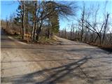
From the starting point by a smaller NOB memorial park, we continue on the slightly right road in the direction of Sveta Trojica. We continue on a macadam road, from which soon a marked path branches off slightly to the right, initially the road towards Sveta Trojica, and we continue on the upper road which leads along the foot of the Javorniki. Further on, for quite some time we walk on a slightly ascending road, which after some time brings us to a marked crossroad, where to the left branches the road and marked path towards Javorniki.
We continue on the mentioned road, then at the first left bend we continue right into the forest on a marked footpath, which starts to ascend moderately to steeply. During the ascent, at a few smaller junctions we follow the blazes, then we return to the road and follow it to the right. For a few minutes we walk on the road, then the signs for Mali Javornik direct us left, initially on a cart track which starts to ascend moderately. After a short ascent on the cart track the blazes direct us left onto a marked path, which due to the glaze ice in December 2014 is damaged or covered with branches. When we push through the strip of fallen trees, we step out of the forest, where the path leads past a smaller bench, from which a nice view opens onto the surrounding hills. A little after the bench the path turns right, then in a gentle ascent quickly brings us to the mostly forested summit.
Description and pictures refer to the condition in 2015 (December).

Photos:
 1
1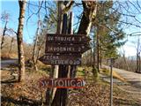 2
2 3
3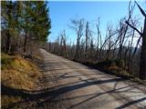 4
4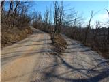 5
5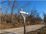 6
6 7
7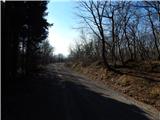 8
8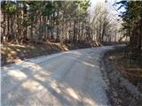 9
9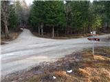 10
10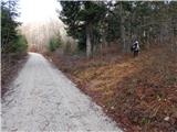 11
11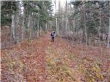 12
12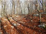 13
13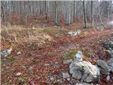 14
14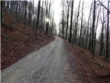 15
15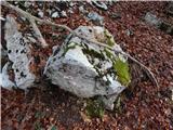 16
16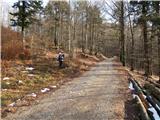 17
17 18
18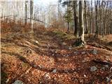 19
19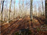 20
20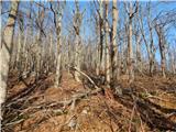 21
21 22
22 23
23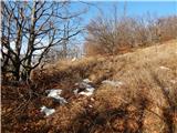 24
24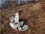 25
25 26
26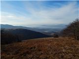 27
27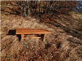 28
28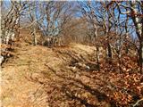 29
29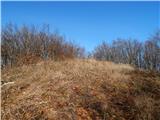 30
30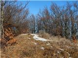 31
31 32
32
Discussion about the trip Jeršiče - Mali Javornik (Javorniki)
|
| bizgo9322. 04. 2021 13:29:14 |
Nice hike. As mentioned above, the path drags on with a gentle ascent along a gravel road (about 4 km). However, right after the junction leading to Mali and Veliki Javornik, it steeply ascends into the forest, levels out a bit when reaching the gravel again, and then steeply ascends again 500 m below the summit (straight ahead would be towards V. Javornik).
There are no major views along the path due to the mighty forest (mostly beech, maple, spruce, and fir), but the excursion is still special due to the shelter (especially in summer). No bear was in sight (no tracks either). Below the summit, there are also large fields of wild garlic, which due to the higher elevation has only started sprouting now.
From the summit marked with a stone (no logbook or stamp), the view extends towards the Javorniki ridge; through the forest, now that there are no leaves yet, part of Cerkniško polje is faintly visible. The best view is from the meadow about 100 m below the summit, from which a beautiful view opens towards Snežnik, Volovja reber, Postojna and Pivka basin, Sveta Trojica, Vremščica, Čičarija, and Nanos.
Very interesting excursion.
|
|
|
To post a comment you must log in:
If you do not yet have a username, you must first
register.