Starting point: Brezje (600 m)
| Latitude/Longitude: | 46,3494°N 14,0565°E |
| |
Walking time: 2 h
Difficulty: easy marked way
Elevation gain: 665 m
Elevation difference along the route: 665 m
Map: TNP 1:50.000
Recommended equipment (summer):
Recommended equipment (winter):
Views: 11.663
 | 1 person like this post |
Access to starting point:
From the highway Ljubljana - Jesenice we go to the exit Lesce and follow the road towards Bled and further towards Bohinjska Bistrica. 1 km after Bled we come to the junction, where we turn right towards Bohinjska Bela. We follow this road only a short time because only a little behind the church the road branches off to the right to Brezje (Brezje above Bohinjska Bela). We park on the parking lot by the road at the end of the village.
Route description:
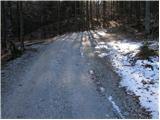
From the parking lot, we continue on the road which a little higher brings us to a junction, where we continue right. The road, which runs through the forest, brings us higher to the lower slopes of Slamniki. Here we first bypass the cottage on the left side, and then the path brings us to a junction, where we continue left in the direction of Galetovec and Slamniki. The path ahead crosses a strip of forest and then brings us to the panoramic slope of Slamniki on which some houses stand. The road then goes into the forest and brings us to a poorer junction, where we continue right. We soon leave this road because poorly visible blazes direct us left into the forest. Further on, we ascend quite steeply along the ruined path (fallen trees) through the forest. When the path passes from deciduous to coniferous forest, the fallen trees also end. The ascent ahead is much easier than among the fallen trees. A little higher, the path brings us to a forest road, which we follow to the left. After a few minutes of walking along the road, we come to a junction, where we continue sharply left in the direction of Galetovec. We leave the road we are walking on at the spot where the signs for Galetovec direct us left across the meadow, first downhill then uphill. The path then goes into the forest, where it runs all the way to the last meters below the summit from which a beautiful view opens up.

Along the route: Slamniki (950m)
Photos:
 1
1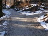 2
2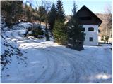 3
3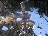 4
4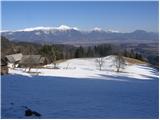 5
5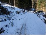 6
6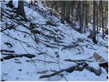 7
7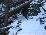 8
8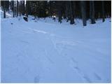 9
9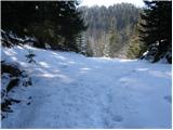 10
10 11
11 12
12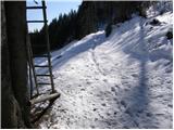 13
13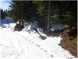 14
14 15
15 16
16
Discussion about the trip Brezje - Galetovec
|
| Breda28. 06. 2010 |
Galetovec can also be reached from Pokljuka, which is shorter. Take the road from Mrzli studenec towards Gorjuše. Turn left to Belska planina (sign) or left across Kranjska dolina (sign). I went via Kranjska dolina. 45 minutes walk. Great panorama from the top.
|
|
|
|
| darh24. 04. 2011 |
Last Sunday we followed approximately this route on the ascent to Galetovec, except we left the car in Bohinjska Bela and climbed to Brezje via Iglice. We walked much less on roads though. At the bend in the first picture we continued straight through the forest, at the junction in the second picture we turned left and rejoined the described road just before Slamniki. There we turned left again and rejoined the next road just above the spot in the sixth picture. Afterwards we followed the described route, and descended to the valley via the western path past Planina za Jamo. A more detailed description of our route with pictures can be found here.
|
|
|
|
| karlin6. 12. 2017 |
On Monday I walked this path - trodden, nicely passable.
|
|
|
To post a comment you must log in:
If you do not yet have a username, you must first
register.