Plajberški graben / Bleiberger Graben - Sinacher Gupf / Psinski vrh
Starting point: Plajberški graben / Bleiberger Graben (1000 m)
| Latitude/Longitude: | 46,4895°N 14,2166°E |
| |
Walking time: 1 h 35 min
Difficulty: easy marked way
Elevation gain: 577 m
Elevation difference along the route: 577 m
Map: Karavanke - osrednji del 1:50.000
Recommended equipment (summer):
Recommended equipment (winter): ice axe, crampons
Views: 5.626
 | 3 people like this post |
Access to starting point:
We drive via the Ljubelj border crossing into Austria, at the Mali Ljubelj pass we continue left towards the Poden / Bodental valley. There follows some more ascent, then we arrive at the settlement Slovenji Plajberk / Windisch Bleiberg, just beyond the mentioned settlement the road turns left. In the middle of the left turn we continue right onto the side road towards the settlement Strugarje / Strugarjah. We then drive through Plajberški graben - Bleiberger Graben, we follow the road to the intersection, where at an interesting sign the road branches off to the right towards the Vranjica / Orienzasattel saddle and Psinski vrh / Sinacher Gupf hill. We park at a suitable place near the intersection.
Route description:
At the end of the parking lot, signs direct us to the right road, which gently ascends a grassy slope. While walking along the road, we can notice our destination on the left side, which we will reach after an hour and a half of walking. The road then brings us to the chapel in a few minutes, where there is also a sign prohibiting further driving. The road, which then ascends somewhat less gently, brings us after 20 minutes of walking to the path junction on the Vranjica / Orienzasattel saddle.
Here we continue on the left road, which we leave after a few steps. From the road, a marked footpath branches off to the left upwards, leading to our destination. The path then approaches a large forest clearing along which we ascend for some time. From the top of this clearing, a nice view opens up on part of the Drava valley. The path then ascends for some time on and along a wide forested ridge, which is not too steep. When the path moves from the ridge to steep slopes, it starts to ascend steeply towards the mountain summit. Just a few steps below the summit, we step out of the forest and see a cross in front of us, located on the mountain summit.

Along the route: Sedlo Vranjica / Orienzasattel (1122m)
Photos:
 1
1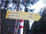 2
2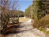 3
3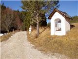 4
4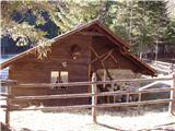 5
5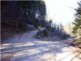 6
6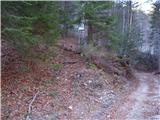 7
7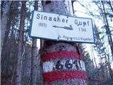 8
8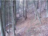 9
9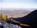 10
10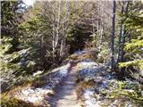 11
11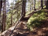 12
12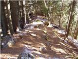 13
13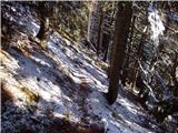 14
14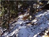 15
15 16
16
Discussion about the trip Plajberški graben / Bleiberger Graben - Sinacher Gupf / Psinski vrh
|
| Fulcrum15. 11. 2019 |
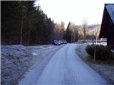
Starting point (picture 1) is located about 1.5 km further from Slovenji Plajberk. From the same starting point you can also go to the neighboring Žingarica; paths separate at the Vranica saddle (picture 6).
|
|
|
To post a comment you must log in:
If you do not yet have a username, you must first
register.