 | Leskovica - Blegoš
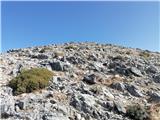
Blegoš is a 1,562-metre-high mountain located between the Selška Sora and Poljanska Sora rivers. From the grassy summit, where there is a stamp a...
2 h 5 min |
 | Čabrače - Blegoš
Blegoš is a 1,562-metre-high mountain located between the Selška Sora and Poljanska Sora rivers. From the grassy summit, where there is a stamp a...
2 h |
 | Tuškov Grič - Blegoš (via Črni vrh)
Blegoš is a 1,562-metre-high mountain located between the Selška Sora and Poljanska Sora rivers. From the grassy summit, where there is a stamp a...
2 h 45 min |
 | Laze - Blegoš
Blegoš is a 1,562-metre-high mountain located between the Selška Sora and Poljanska Sora rivers. From the grassy summit, where there is a stamp a...
2 h |
 | Hunting cottage Plehanov laz - Krim
Krim is a 1,107-metre-high mountain rising south of the Ljubljana Marsh. From the summit, where a mountain hut and several transmitters stand, th...
2 h 15 min |
 | Petrovo Brdo - Možic (via Vrh Bače)
Možic is a 1,602 m high peak located west of Soriška Planina. At the very summit there is an old military bunker bearing the name of the peak and...
2 h 30 min |
| Petrovo Brdo - Možic (via Lajnar)
Možic is a 1,602 m high peak located west of Soriška Planina. At the very summit there is an old military bunker bearing the name of the peak and...
2 h 30 min |
 | Brezje - Slivnica
Slivnica is an 1114-meter-high peak located north of Cerknica Polje. From the summit, where there is a summit register box, the view is quite lim...
2 h 15 min |
 | Petrovo Brdo - Slatnik (northwestern peak) (via Lajnar)
Slatnik is a panoramic mountain located west of the Soriška Planina ski resort. From its grassy summit there is a beautiful view of the Škofjeloš...
2 h 15 min |
 | Rateče - Ofen/Peč (by road)
Peč (also known as Tromeja; in Italian Monte Forno, in German Dreiländereck or Ofen) is a 1508 m high peak located at the tripoint between Sloven...
2 h |
 | Fusine Laghi - Ofen/Peč
Peč (also known as Tromeja; in Italian Monte Forno, in German Dreiländereck or Ofen) is a 1508 m high peak located at the tripoint between Sloven...
2 h 15 min |
 | Grahovše - Bela peč (via Boršt)
The mountain, known mainly among climbers, is located north of Storžič on the slopes of Konjščica. From the summit there is a beautiful view of t...
2 h 30 min |
 | Grahovše - Bela peč (via rot)
The mountain, known mainly among climbers, is located north of Storžič on the slopes of Konjščica. From the summit there is a beautiful view of t...
2 h 30 min |
 | Grahovše - Bela peč (via Rekar)
The mountain, known mainly among climbers, is located north of Storžič on the slopes of Konjščica. From the summit there is a beautiful view of t...
2 h 30 min |
 | Črnivec - Lepenatka
Lepenatka is a grassy peak located south of the 1557-metre-high Rogatec. From the summit, which has a summit register box and stamp, there is a b...
3 h 15 min |
 | Petrovo Brdo - Kobla
The summit is located in the Lower Bohinj Mountains between Črna prst and Soriška planina. Directly below it is a railway tunnel connecting Bohin...
2 h 15 min |
 | Petrovo Brdo - Lajnar
Lajnar is a 1,549-metre-high mountain located north of Soriška Planina. From the summit, which is also the highest point of the ski resort, a bea...
2 h |
 | Petrovo Brdo - Šavnik
Šavnik is a grassy peak situated between the ski resorts of Soriška Planina and Kobla. From the summit, which has a registration box with a stamp...
2 h 15 min |
 | Preval - Koprivnik
Koprivnik is a 1393-meter-high mountain located between Blegoš and Mladi vrh. From the summit, which has a registration box and a stamp, the view...
3 h 15 min |
| Javorje - Koprivnik (via Brdo)
Koprivnik is a 1393-meter-high mountain located between Blegoš and Mladi vrh. From the summit, which has a registration box and a stamp, the view...
2 h 20 min |
 | Razdrto - Vojkova koča na Nanosu (gentle path)
The Vojkova koča mountain hut is located on the southern edge of the Nanos plateau, directly next to Pleša, a peak clearly visible from the highw...
2 h 20 min |
 | Strane - Vojkova koča na Nanosu
The Vojkova koča mountain hut is located on the southern edge of the Nanos plateau, directly next to Pleša, a peak clearly visible from the highw...
2 h 15 min |
 | Bele Vode (Rebršak) - Smrekovec
Smrekovec is a mountain of volcanic origin on the eastern edge of the Smrekovec mountain range. The wide grassy summit features a pyramid with a ...
2 h 5 min |
 | Ljubenske Rastke (Vrnivšek) - Smrekovec
Smrekovec is a mountain of volcanic origin on the eastern edge of the Smrekovec mountain range. The wide grassy summit features a pyramid with a ...
2 h |
| Ljubenske Rastke (Kumprej) - Smrekovec
Smrekovec is a mountain of volcanic origin on the eastern edge of the Smrekovec mountain range. The wide grassy summit features a pyramid with a ...
2 h 10 min |
 | Predmeja - Kucelj (on Čaven)
Kucelj is located on the southern slopes of the Trnovski Forest, northwest of the Vipava Valley. From the bare summit, where a cross stands, ther...
2 h |
| Predmeja (tunnels) - Kucelj (on Čaven) (via Koča na Čavnu)
Kucelj is located on the southern slopes of the Trnovski Forest, northwest of the Vipava Valley. From the bare summit, where a cross stands, ther...
2 h 15 min |
 | Predmeja (tunnels) - Veliki Modrasovec
Veliki Modrasovec is located on the southern part of the Trnovski Forest near Predmeja. On the summit stands an old military building, which we m...
1 h 55 min |
 | Koča Edmunda Čibeja v Tihi dolini - Mali Golak
Mali Golak is the highest of the Golaki. It did not get its name because it is supposed to be the smallest, but because it had the smallest mount...
2 h |
| Predmeja (Gorjanka) - Mali Golak
Mali Golak is the highest of the Golaki. It did not get its name because it is supposed to be the smallest, but because it had the smallest mount...
2 h 25 min |
 | Gorenje pri Zrečah - Rogla
Rogla is a peak in the middle of the eponymous ski resort. The peak is forested with a small clearing on which stands a lookout tower. The tower ...
2 h 35 min |
 | Petrovo Brdo - Krevl
Krevl is a 1515-meter-high peak situated south of the Kobla ski area, more precisely between the Kobla peak and Kravja Črna gora. From the summit...
2 h 30 min |
 | Ravne - Krevl
Krevl is a 1515-meter-high peak situated south of the Kobla ski area, more precisely between the Kobla peak and Kravja Črna gora. From the summit...
2 h 20 min |
 | Dom na Paškem Kozjaku - Basališče (Paški Kozjak)
Basališče is the highest peak of Paški Kozjak. A bench and a summit register have been placed on the summit. However, due to the forest, there is...
2 h |
 | St. John the Baptist on Ojstrica - Huhnerkogel/Košenjak (via Bivak Piramida)
Košenjak is located north of Dravograd and the Drava River on the border with neighbouring Austria. Access to Košenjak is possible on foot or by ...
2 h |
 | Windisch Bleiberg / Slovenji Plajberk - Singerberg / Žingarica
Žingarica / Singerberg is a peak on the Austrian side of the Karawanks above the village of Slovenji Plajberk / Windisch Bleiberg. From the summi...
2 h |
 | Slovenji Plajberk / Windisch Bleiberg - Singerberg / Žingarica (via saddle Albink / Halbingsattel)
Žingarica / Singerberg is a peak on the Austrian side of the Karawanks above the village of Slovenji Plajberk / Windisch Bleiberg. From the summi...
2 h 20 min |
| Plajberški graben / Bleiberger Graben - Singerberg / Žingarica
Žingarica / Singerberg is a peak on the Austrian side of the Karawanks above the village of Slovenji Plajberk / Windisch Bleiberg. From the summi...
2 h 20 min |
 | Trojane - Črni vrh (Čemšeniška planina)
Črni vrh is the highest peak of Čemšeniška planina and, at 1,204 m, the second-highest peak in Posavsko hribovje. The summit has a logbook box bu...
2 h 45 min |
 | Podmeja - Črni vrh (Čemšeniška planina)
Črni vrh is the highest peak of Čemšeniška planina and, at 1,204 m, the second-highest peak in Posavsko hribovje. The summit has a logbook box bu...
3 h 30 min |
| Dom pod Reško planino - Črni vrh (Čemšeniška planina)
Črni vrh is the highest peak of Čemšeniška planina and, at 1,204 m, the second-highest peak in Posavsko hribovje. The summit has a logbook box bu...
3 h |
 | Slovenska vas - Sveta Trojica
Sveta Trojica is a panoramic peak located southwest of the Javorniki. From the summit, where well-preserved ruins of a former church stand, there...
2 h 15 min |
 | Jeršiče - Sveta Trojica
Sveta Trojica is a panoramic peak located southwest of the Javorniki. From the summit, where well-preserved ruins of a former church stand, there...
2 h 40 min |
 | Črni vrh - Javornik above Črni vrh (via Šajsna Ravan)
Javornik is a forested peak located southeast of Črni Vrh. In 1972, a lookout tower was erected on the summit, rising above the treetops to provi...
2 h 30 min |
| Kampelc - Javornik above Črni vrh
Javornik is a forested peak located southeast of Črni Vrh. In 1972, a lookout tower was erected on the summit, rising above the treetops to provi...
2 h 15 min |
 | Podkraj - Javornik above Črni vrh
Javornik is a forested peak located southeast of Črni Vrh. In 1972, a lookout tower was erected on the summit, rising above the treetops to provi...
2 h 30 min |
 | Col - Javornik above Črni vrh
Javornik is a forested peak located southeast of Črni Vrh. In 1972, a lookout tower was erected on the summit, rising above the treetops to provi...
3 h |
 | Rakov Škocjan - Veliki Javornik (Javorniki)
Veliki Javornik is a 1,268-meter-high peak of the forested hills named Javorniki. The extensive Javorniki forests stretch from Postojna to Cerkni...
2 h |
 | Jeršiče - Veliki Javornik (Javorniki)
Veliki Javornik is a 1,268-meter-high peak of the forested hills named Javorniki. The extensive Javorniki forests stretch from Postojna to Cerkni...
2 h 20 min |
 | Bohinjska Bela (Podklanec) - Galetovec (western way)
Galetovec is an indistinct peak on the southeastern part of the Pokljuka plateau. From the summit, which has a logbook, there is a nice view of t...
2 h |
| Brezje - Galetovec
Galetovec is an indistinct peak on the southeastern part of the Pokljuka plateau. From the summit, which has a logbook, there is a nice view of t...
2 h |
 | Orehek - Kojca
Kojca is a panoramic peak rising south of Baška grapa. From the summit, where there is a haystack, fine views extend over the Lower Bohinj Mounta...
1 h 55 min |
 | Preval - Mladi vrh
Mladi vrh is the higher neighbor of the better-known Stari vrh, separated from it by a saddle. Covered in sparse beech forest, the summit offers ...
2 h |
 | Javorje - Mladi vrh (western path)
Mladi vrh is the higher neighbor of the better-known Stari vrh, separated from it by a saddle. Covered in sparse beech forest, the summit offers ...
2 h 5 min |
 | Ljubenske Rastke - Bezovec
Bezovec is a lesser-known peak located in Smrekovško pogorje. From the summit, where a hunting observatory stands, a nice view opens up mainly on...
2 h 15 min |
 | Gotenica - Goteniški Snežnik
At 1,289 meters, Goteniški Snežnik is the highest peak of Goteniška gora. The forested summit offers a somewhat obstructed view. It has a logbook...
2 h 45 min |
| Kočevska Reka - Goteniški Snežnik
At 1,289 meters, Goteniški Snežnik is the highest peak of Goteniška gora. The forested summit offers a somewhat obstructed view. It has a logbook...
2 h 45 min |
 | Col - Križna gora (Hrušica)
Križna gora is a 1162 m high peak located north of the village Podkraj. From the summit, where a lookout tower stands, there are fine views over ...
2 h 20 min |
 | Col - Sveti Duh (Hrušica)
The Church of the Holy Spirit is located just a few meters below the summit of Sveti Duh on the slopes of the forested Hrušica, in the range betw...
2 h 15 min |
 | Predmeja - Veliki Rob
Veliki Rob is a panoramic peak situated between Kuclj (1237 m) and Čaven (1185 m). From the summit, where there is a cross, there is a nice view ...
3 h |
 | Strane - Suhi vrh (Nanos) (steep way)
Suhi Vrh (1313 m) is the highest peak of the karst Nanos Plateau. From the summit, which has a logbook box and a stamp (stamp currently unusable ...
2 h 15 min |
 | Strane - Suhi vrh (Nanos) (gentle path)
Suhi Vrh (1313 m) is the highest peak of the karst Nanos Plateau. From the summit, which has a logbook box and a stamp (stamp currently unusable ...
2 h 30 min |
| Hunting cottage Vojkovo - Suhi vrh (Nanos) (gentle path)
Suhi Vrh (1313 m) is the highest peak of the karst Nanos Plateau. From the summit, which has a logbook box and a stamp (stamp currently unusable ...
3 h 25 min |
| Hunting cottage Vojkovo - Suhi vrh (Nanos) (steep path)
Suhi Vrh (1313 m) is the highest peak of the karst Nanos Plateau. From the summit, which has a logbook box and a stamp (stamp currently unusable ...
3 h 10 min |
 | Jesenice (Ukova) - Španov vrh (Čez sedem grabnov)
Španov vrh is a 1,334 m high mountain located between Javorniški Rovt and Planina pod Golico. From the summit, accessible by the eponymous cable ...
2 h 30 min |
 | Montemaggiore - Punta di Montemaggiore
Breški Jalovec, or Punta di Montemaggiore in Italian, is a 1613-meter-high mountain located above the source of the Nadiža River, specifically on...
3 h |
 | Zrmanja Railway Station - Poštak
Poštak (also "Kečina kosa") is a scenic mountain at the junction of Lika and Dalmatia. It belongs to the Lička Plješivica range as an extension, ...
2 h 30 min |
 | Bezgovica - Cerk
Cerk, at 1,192 meters, is the highest peak of Borovška gora, a range situated between the Kolpa River valley and Goteniški Snežnik. From the summ...
2 h 55 min |
| 18th hairpin turn of road on Strma Reber - Cerk
Cerk, at 1,192 meters, is the highest peak of Borovška gora, a range situated between the Kolpa River valley and Goteniški Snežnik. From the summ...
2 h 40 min |
 | Tuškov Grič - Medrce (by road)
Medrce is a 1,410-meter-high peak located between Porezen and Hum. From the summit, which features an old bunker, there are nice views of Kojca, ...
2 h 20 min |
 | Poče - Medrce (steep path)
Medrce is a 1,410-meter-high peak located between Porezen and Hum. From the summit, which features an old bunker, there are nice views of Kojca, ...
2 h |
| Poče - Medrce (winter way)
Medrce is a 1,410-meter-high peak located between Porezen and Hum. From the summit, which features an old bunker, there are nice views of Kojca, ...
2 h 40 min |
| Poče - Medrce (via Labinjske lehe)
Medrce is a 1,410-meter-high peak located between Porezen and Hum. From the summit, which features an old bunker, there are nice views of Kojca, ...
2 h 30 min |
 | Poče - Kopa (Cimprovka) (winter way)
Kopa is a 1360 m high peak or panoramic promontory from which a nice view opens up on Cerkno, the hills surrounding it, Ratitovec, Trnovski gozd,...
2 h 25 min |
 | Fusine Laghi - Monte Coppa
Kopa (Kopje on some maps), or Monte Coppa in Italian, is a 1496-meter-high peak on the Italian side of the Karawanks. The old Rapallo border once...
2 h |
 | Petrovo Brdo - Slatnik (southeastern peak) (via Lajnar)
Slatnik (southeastern peak) is a panoramic mountain that rises steeply above Baška grapa on one side and descends more gently toward Soriška plan...
2 h 5 min |
 | Kuna Konavoska - Ilijin vrh
Ilijin vrh, also known as Sveti Ilija, is the main peak of the Sniježnica Konavoska mountain ridge, which is also the southernmost mountain ridge...
2 h 30 min |
 | Rehabilitation center St. Radegund at Graz - Schöckl (hiking path)
Schöckl, often also spelled Schöckel, is a 1,445-meter-high hill above St. Radegund near Graz and the southernmost of the popular peaks in the Gr...
2 h 15 min |
 | Parking Rote Wand (Tyrnau) - Rote Wand (via saddle Bucheben)
Rote Wand is a 1,505-meter-high mountain in the Graz Mountains in Styria, Austria. The name "Rote Wand" (red wall) comes from its southeast-facin...
2 h |
 | Mariensee - Steinerne Stiege (red trail)
Steinerne Stiege is a less prominent peak in the Wechsel range....
2 h 25 min |
 | Zelovo - Svilaja (past Umac)
Svilaja is a 1509-meter grassy peak above Peručko Lake, north of the town of Sinj. The summit features a cross and a concrete pillar. From the to...
3 h |
 | St. Corona am Wechsel - Arabichl
Arabichl is a panoramic peak situated above the eponymous ski lift. From the summit, a splendid view opens up of the Wechsel group, Stuhleck, and...
3 h 15 min |
 | Alpl (Waldschulle Alpl) - Teufelstein
Teufelstein is a 1,498-meter-high mountain in the Fischbacher Alpen group. At the summit there is a cross with a summit logbook, and slightly bel...
2 h 30 min |
 | Nechnitz - Gerlerkogel (via Gschaidberg)
Gerlerkogel is a 1324-meter-high peak situated in the Almenland nature park. From the grassy peak, a beautiful view opens up of the surrounding m...
2 h 15 min |
 | Gasen - Plankogel (by learning trail)
Plankogel is a 1531-meter-high mountain situated in the Almenland nature park. From the panoramic summit, where a cross stands, a beautiful view ...
2 h 35 min |
 | Laufnitzgraben - Bei den drei Pfarren
Bei den drei Pfarren ("At the Three Parishes") is a crossroads from which a stunning panoramic view opens towards the south and west, all the way...
2 h 30 min |
 | Mazinski preval - Kremen
Kremen is a scenic peak in Lika, located north of Gračac. It is the highest peak in Zadar County. The summit features a geodetic pillar, along wi...
2 h 30 min |
 | Kosmadei - Zastano (Samos) (no. 11 / 10)
Zastano (Gr. Ζάστανο), also Zestani (Gr. Ζεστάνι), is at 1,206 m the second-highest mountain on the Greek island of Samos. It is located in the K...
3 h 10 min |
 | Alpl (Waldschulle Alpl) - Steinriegel
Steinriegel is a panoramic peak with a cross and a wind power plant, located in the hills east of the Mur....
3 h 10 min |
 | Unternberg - Kampstein
Kampstein is a 1,467-meter-high mountain situated above the settlement of St. Corona am Wechsel. At the summit there is a cross and a few benches...
2 h |
 | St. Corona am Wechsel - Kampstein (mimo Kampsteiner Schwaig)
Kampstein is a 1,467-meter-high mountain situated above the settlement of St. Corona am Wechsel. At the summit there is a cross and a few benches...
2 h 5 min |