Ljubenske Rastke - Bezovec
Starting point: Ljubenske Rastke (547 m)
| Latitude/Longitude: | 46,3851°N 14,8464°E |
| |
Walking time: 2 h 15 min
Difficulty: easy marked way
Elevation gain: 779 m
Elevation difference along the route: 779 m
Map: Kamniške in Savinjske Alpe 1:50.000
Recommended equipment (summer):
Recommended equipment (winter): ice axe, crampons
Views: 5.840
 | 1 person like this post |
Access to starting point:
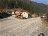
From the Ljubljana–Maribor motorway, take the Šentrupert exit and follow the road ahead towards Logarska dolina. In the village Ljubno ob Savinji, the signpost for Smrekovec directs us right. The road then takes us through the center of the village, where we turn left again following the signs for Smrekovec. The road then brings us to Ljubenske Rastke, where we park on the parking lot near the church.
Route description:
From the parking lot, we continue on the left road in the direction of Travnik and Komna (straight to Dom na Smrekovcu). After a few steps of walking, we will notice on the right side next to the outbuilding a pole of the electricity line and on it a hiking signboard, which directs us left onto a footpath that ascends over a short grassy slope. The path then goes quickly into the forest, where it continues in a traverse ascent. Already after a few minutes of walking, a wide cart track joins us from the left side, on which we continue the ascent. Only a little further, the mentioned cart track turns sharply right, and we continue straight (this part of the path is poorly marked). The partly rocky cart track on which we are ascending then makes a slight left turn and brings us out of the forest, where we will notice a decaying chapel on the right side.
Behind the chapel the footpath disappears, and we continue across the meadow to the cart track, which we follow to the right to a smaller abandoned hamlet. At the hamlet, the cart track turns left and only a few steps further the marks direct us right onto a footpath, which starts to ascend more steeply through the forest. Higher, the path passes out of the forest onto grassy slopes over which we ascend to an asphalt road (possible access also by road).
Further, we ascend gently along the asphalt road, which at the junctions we follow in the direction of Komna. Higher, the road brings us to a junction by which we notice signs for Komen, which direct us onto a road closed to traffic. We follow this road only a short time, as we will soon notice a faded directional sign, which directs us right into the forest. After a few steps of ascent through the forest, the path brings us to the NOB monument.
We continue the ascent in the direction of the hospital on the path, which soon brings us to a marked junction. We continue slightly right in the direction of Komna (slightly left: hospital Celje and Travnik) on the path, which higher brings us to a forest road which we follow to the left, but only a short time, as then the marks direct us right onto a footpath. The moderately steep path, which runs through the forest, then brings us to a smaller cross, where an unmarked path from the valley of the stream Žep joins from the left. We continue on the path, which ascends transversely through the forest, and when it comes out of the forest, it turns sharply left, where it bypasses the summit of Bezovec on which a hunting observatory is located.
To the hunting observatory on the summit of Bezovec we ascend in less than a minute of walking on an unmarked path which branches off to the right from the marked path.

Photos:
 1
1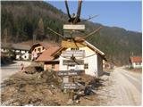 2
2 3
3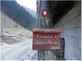 4
4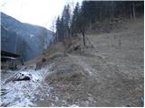 5
5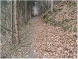 6
6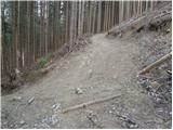 7
7 8
8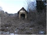 9
9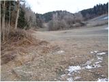 10
10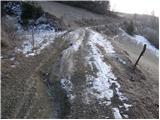 11
11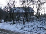 12
12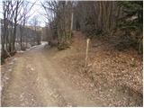 13
13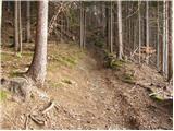 14
14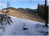 15
15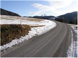 16
16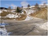 17
17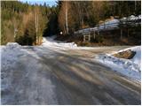 18
18 19
19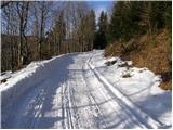 20
20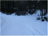 21
21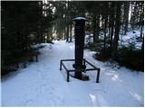 22
22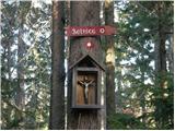 23
23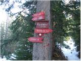 24
24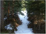 25
25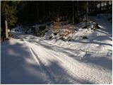 26
26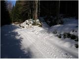 27
27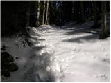 28
28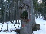 29
29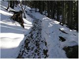 30
30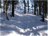 31
31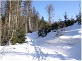 32
32 33
33
Discussion about the trip Ljubenske Rastke - Bezovec
|
| Hribolazec8111. 04. 2024 23:44:36 |
Greetings fellow hikers, for Saturday I'm planning a hike, what would be a circular path connection, and how is it marked so as not to get lost (or if you recommend another starting point and path for these two peaks and the hut on Travnik - doesn't have to be circular, but nicer if it is);
Ljubenske Rastke - Bezovec - Veliki Travnik - koča na Travniku - Ljubenske Rastke
|
|
|
|
| rokeg12. 04. 2024 10:37:52 |
It is possible to do it circularly. Only, if you descend Komen the path is not marked. From Bezovec it's more sensible to go via Komen to Veliki Travnik, then descend as per the path description here to the valley of the Žep stream via Počko planina. Then you have another good 2 km walk along the road to Ljubenske Rastke.
If you skip Komen, from Bezovec you have to descend along the road, then along the road around the "gorge" and then back to the ridge Komen - Travnik.
|
|
|
|
| Enka13. 04. 2024 13:34:00 |
Does anyone know if the road to Ljubenske Rastke and the paths around there are OK now after last year's floods? On PZS, the first part of this path is still marked as closed. Same for the lower part of the path via Počka planina.
|
|
|
To post a comment you must log in:
If you do not yet have a username, you must first
register.