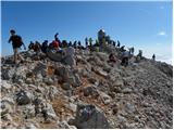
 | Ravenska Kočna - Mrzla gora (Slovenian way)
This hard-to-reach mountain is located on the border with Austria in the Kamnik and Savinja Alps. From the top you can enjoy a beautiful view of ...
5 h 45 min |
| Belska Kočna - Mrzla gora
This hard-to-reach mountain is located on the border with Austria in the Kamnik and Savinja Alps. From the top you can enjoy a beautiful view of ...
5 h 40 min |
| Ravenska Kočna - Mrzla gora (via Žrelo)
This hard-to-reach mountain is located on the border with Austria in the Kamnik and Savinja Alps. From the top you can enjoy a beautiful view of ...
5 h 45 min |
| Ravenska Kočna - Mrzla gora (hunting path)
This hard-to-reach mountain is located on the border with Austria in the Kamnik and Savinja Alps. From the top you can enjoy a beautiful view of ...
6 h |
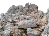
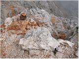
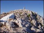
 | Suhadolnik - Kalški greben
Kalški greben is 2224 m high and is the highest peak of the eponymous ridge. The summit, which has a registration box and a stamp, offers a beaut...
4 h 15 min |
 | Belopeška jezera - Zadnja Ponca / Ponza di Detro
Zadnja Ponca is a 2242m high peak located on the narrow and precipitous Ponc ridge. The summit, which is not accessible to everyone, offers a bea...
4 h 30 min |
 | Koča pod slapom Rinka - Turska gora (via Kotliči)
The mountain is located above the Logarska Valley and the Kamniška Bistrica Valley. From the top there is a beautiful view towards the neighbouri...
4 h 30 min |
| Jermanca - Turska gora (via Kamniško sedlo)
The mountain is located above the Logarska Valley and the Kamniška Bistrica Valley. From the top there is a beautiful view towards the neighbouri...
4 h 45 min |
 | Suhadolnik - Turska gora
The mountain is located above the Logarska Valley and the Kamniška Bistrica Valley. From the top there is a beautiful view towards the neighbouri...
6 h 15 min |
 | V Koncu - Brana (via Turska gora)
Brana is a mountain above Kamnik saddle. The view from the spacious summit, which has a registration box and a small cross, is very beautiful. Pl...
5 h 45 min |
 | Dom v Planici - Mala Mojstrovka (via Grlo)
Mala Mojstrovka is one of the most visited peaks in the Julian Alps due to the relatively high altitude of the starting point. From the summit, w...
4 h 45 min |
 | Zadnja Trenta (Flori) - Bavški Grintavec (via Kanski preval)
Bavški Grintavec is a mighty mountain rising steeply above the valleys of Bavšica, Zadnja Trenta and Soča. All the approaches to the summit are l...
4 h 45 min |
| Zadnja Trenta (Flori) - Bavški Grintavec (direct way)
Bavški Grintavec is a mighty mountain rising steeply above the valleys of Bavšica, Zadnja Trenta and Soča. All the approaches to the summit are l...
4 h 30 min |
 | Reißkofelbad - Reißkofel (via bivouac)
Reißkofel is a 2371 metre high mountain in the Zilj Alps. The summit on which the cross stands also has a registration box. The view from the top...
4 h 30 min |
 | Koča pod slapom Rinka - Štajerska Rinka (via Turski žleb)
Štajerska Rinka is a 2374 m high mountain rising steeply above Okrešl, more precisely to the east of the more visited Koroška Rinka. From the top...
4 h 45 min |
 | Ravenska Kočna - Štajerska Rinka (Slovenska pot)
Štajerska Rinka is a 2374 m high mountain rising steeply above Okrešl, more precisely to the east of the more visited Koroška Rinka. From the top...
4 h 30 min |
| Ravenska Kočna - Štajerska Rinka (via Žrelo)
Štajerska Rinka is a 2374 m high mountain rising steeply above Okrešl, more precisely to the east of the more visited Koroška Rinka. From the top...
4 h 30 min |
| Ravenska Kočna - Štajerska Rinka (hunting path)
Štajerska Rinka is a 2374 m high mountain rising steeply above Okrešl, more precisely to the east of the more visited Koroška Rinka. From the top...
4 h 45 min |
 | Aljažev dom v Vratih - Cmir (via Prag)
The mountain is located between two Alpine valleys between Vrata and the lesser-known Za Cmirom valley. From the top you can enjoy a beautiful vi...
6 h 30 min |
| Aljažev dom v Vratih - Cmir (Tominšek route)
The mountain is located between two Alpine valleys between Vrata and the lesser-known Za Cmirom valley. From the top you can enjoy a beautiful vi...
6 h 25 min |
 | Aljažev dom v Vratih - Visoka Vrbanova špica (via Prag)
Visoka Vrbanova špica, is located at the extreme south-western part of the ridge rising above the Kot and Vrata valleys, and higher up between th...
4 h 50 min |
 | The Kot Valley - Visoka Vrbanova špica (Lojze Rekar route)
Visoka Vrbanova špica, is located at the extreme south-western part of the ridge rising above the Kot and Vrata valleys, and higher up between th...
5 h |
| Aljažev dom v Vratih - Visoka Vrbanova špica (Tominšek route)
Visoka Vrbanova špica, is located at the extreme south-western part of the ridge rising above the Kot and Vrata valleys, and higher up between th...
4 h 45 min |
 | Ruski križ - Križ
Križ is a 2140 m high mountain located north-east of the Kriški Podi. From the top, where there is a registration box with a stamp, you have a be...
4 h 45 min |
| Pišnica - Križ
Križ is a 2140 m high mountain located north-east of the Kriški Podi. From the top, where there is a registration box with a stamp, you have a be...
5 h 20 min |
 | Gozdec - Črni Vogel
...
5 h 30 min |
 | Koča pod slapom Rinka - Koroška Rinka
Koroška Rinka (also Križ) is a 2433 m high mountain rising steeply above Lediny and Okrešlje. From the top, which has a registration box and a st...
5 h |
 | Koča pod slapom Rinka - Koroška Rinka (via Turski žleb)
Koroška Rinka (also Križ) is a 2433 m high mountain rising steeply above Lediny and Okrešlje. From the top, which has a registration box and a st...
5 h |
| Ravenska Kočna - Koroška Rinka (Slovenska pot)
Koroška Rinka (also Križ) is a 2433 m high mountain rising steeply above Lediny and Okrešlje. From the top, which has a registration box and a st...
4 h 15 min |
| Belska Kočna - Koroška Rinka
Koroška Rinka (also Križ) is a 2433 m high mountain rising steeply above Lediny and Okrešlje. From the top, which has a registration box and a st...
4 h 45 min |
| Ravenska Kočna - Koroška Rinka (via Žrelo)
Koroška Rinka (also Križ) is a 2433 m high mountain rising steeply above Lediny and Okrešlje. From the top, which has a registration box and a st...
4 h 15 min |
| Ravenska Kočna - Koroška Rinka (hunting path)
Koroška Rinka (also Križ) is a 2433 m high mountain rising steeply above Lediny and Okrešlje. From the top, which has a registration box and a st...
4 h 30 min |
 | Sella Nevea - Vrh Krnice
Vrh Krnice is a 2441 m high peak located north-west of Visoki Kanin. From the summit, where the usually empty registration box stands, you can en...
5 h 15 min |
 | Gozdec - Vrh Laške Planje
Vrh Laške Planje (Lasca Plagna) is a 2,448-metre-high peak located on the border ridge between Itali and Slovenia. From the top, you can enjoy a ...
5 h |
 | Coot Parking Lot - Vrh Laške Planje
Vrh Laške Planje (Lasca Plagna) is a 2,448-metre-high peak located on the border ridge between Itali and Slovenia. From the top, you can enjoy a ...
5 h 45 min |
 | Koča pod slapom Rinka - Kranjska Rinka (via Turski žleb)
Kranjska Rinka is the highest of all Markets. From the top, which has a registration book, you have the best view towards Skuti. The rest of the ...
5 h 5 min |
| Koča pod slapom Rinka - Kranjska Rinka (via Koroška Rinka)
Kranjska Rinka is the highest of all Markets. From the top, which has a registration book, you have the best view towards Skuti. The rest of the ...
5 h 20 min |
| Ravenska Kočna - Kranjska Rinka (Slovenska pot)
Kranjska Rinka is the highest of all Markets. From the top, which has a registration book, you have the best view towards Skuti. The rest of the ...
4 h 35 min |
| Belska Kočna - Kranjska Rinka
Kranjska Rinka is the highest of all Markets. From the top, which has a registration book, you have the best view towards Skuti. The rest of the ...
5 h 5 min |
| Ravenska Kočna - Kranjska Rinka (via Žrelo)
Kranjska Rinka is the highest of all Markets. From the top, which has a registration book, you have the best view towards Skuti. The rest of the ...
4 h 35 min |
| Ravenska Kočna - Kranjska Rinka (hunting path)
Kranjska Rinka is the highest of all Markets. From the top, which has a registration book, you have the best view towards Skuti. The rest of the ...
4 h 50 min |
 | Ruski križ - Planja (via Kriška stena)
The summit is located between two Alpine valleys. On the northern side is the Mlinarica valley and on the southern side is the Zadnjica valley. F...
6 h 55 min |
 | Aljažev dom v Vratih - Begunjski vrh (via Prag)
Begunjski vrh is a 2461 m high mountain located in the heart of the highest mountains in the Julian Alps. From the top, which has a registration ...
5 h |
| Aljažev dom v Vratih - Begunjski vrh (Tominšek route)
Begunjski vrh is a 2461 m high mountain located in the heart of the highest mountains in the Julian Alps. From the top, which has a registration ...
4 h 55 min |
 | Rifugio Cercena - Cima Montanel
Cima Montanel is a 2,461-metre-high peak overloking the Piave Valley in the Carnioan Pre-Alps. The summit on which the cross is erected is a rema...
4 h 40 min |
 | Ruski križ - Špik (via Koča v Krnici)
Špik is a 2,472 m high mountain located in the heart of the Martuljek Mountains. From the top, which is clearly visible from the road leading thr...
5 h |
| Pišnica - Špik (via Koča v Krnici)
Špik is a 2,472 m high mountain located in the heart of the Martuljek Mountains. From the top, which is clearly visible from the road leading thr...
5 h 30 min |
 | V Koncu - Dolgi hrbet (via Kokrsko sedlo)
Dolgi Hrbet is located between Grintovec and Skuta. The precipitous peak offers a beautiful view of the heart of the Kamnik and Savinja Alps. Dol...
5 h |
 | Ravenska Kočna - Dolgi hrbet (past the cableway and on Frischaufova pot)
Dolgi Hrbet is located between Grintovec and Skuta. The precipitous peak offers a beautiful view of the heart of the Kamnik and Savinja Alps. Dol...
5 h |
| Ravenska Kočna - Dolgi hrbet (umik Žrela and on Frischaufova pot)
Dolgi Hrbet is located between Grintovec and Skuta. The precipitous peak offers a beautiful view of the heart of the Kamnik and Savinja Alps. Dol...
5 h 5 min |
| Ravenska Kočna - Dolgi hrbet (via Štularjeva planina and on path Frischaufova pot)
Dolgi Hrbet is located between Grintovec and Skuta. The precipitous peak offers a beautiful view of the heart of the Kamnik and Savinja Alps. Dol...
5 h |
 | Ruski križ - Stenar (via Križ)
Stenar is a 2501 m high peak rising steeply above the Vrata valley. From the spacious summit, where there is a registration box and a stamp, we h...
6 h 15 min |
| Pišnica - Stenar (via Križ)
Stenar is a 2501 m high peak rising steeply above the Vrata valley. From the spacious summit, where there is a registration box and a stamp, we h...
6 h 50 min |
 | Aljažev dom v Vratih - Triglavski dom na Kredarici (Tominšek route)
Triglavski dom na Kredarici is Slovenia's highest mountain hut. It is open all year round but only on an emergency basis out of season. From the ...
4 h 55 min |
| Aljažev dom v Vratih - Triglavski dom na Kredarici (via Prag)
Triglavski dom na Kredarici is Slovenia's highest mountain hut. It is open all year round but only on an emergency basis out of season. From the ...
5 h |
 | Ravenska Kočna - Kokrska Kočna (past the cableway and on Kremžarjeva pot)
Kokrska Kočna is a scenic and vast mountain between Jezersko and Suhadolnik. From the top, which has a registration box, there is a very nice vie...
5 h 30 min |
 | Suhadolnik - Kokrska Kočna (via Grdi graben)
Kokrska Kočna is a scenic and vast mountain between Jezersko and Suhadolnik. From the top, which has a registration box, there is a very nice vie...
4 h 45 min |
| Suhadolnik - Kokrska Kočna (via Kokrsko sedlo)
Kokrska Kočna is a scenic and vast mountain between Jezersko and Suhadolnik. From the top, which has a registration box, there is a very nice vie...
5 h 45 min |
| V Koncu - Kokrska Kočna
Kokrska Kočna is a scenic and vast mountain between Jezersko and Suhadolnik. From the top, which has a registration box, there is a very nice vie...
5 h 30 min |
| Ravenska Kočna - Kokrska Kočna (umik Žrela and on Kremžarjeva pot)
Kokrska Kočna is a scenic and vast mountain between Jezersko and Suhadolnik. From the top, which has a registration box, there is a very nice vie...
5 h 35 min |
 | Ravenska Kočna - Kokrska Kočna (via Štularjeva planina and on path Kremžarjeva pot)
Kokrska Kočna is a scenic and vast mountain between Jezersko and Suhadolnik. From the top, which has a registration box, there is a very nice vie...
5 h 30 min |
 | Sella Nevea - Foronon del Buinz / Špik nad Nosom (via Forcella Lavinal dell Orso)
Foronon del Buinz is a 2531 m high mountain located in the mountain ridge between Jôf di Montasio and Viš. The rocky peak offers a view of the Vi...
6 h |
 | The Kot Valley - Rjavina (climbing way)
Rjavina is located between two Alpine valleys. The two valleys are Kot and Krma. From the summit, which has a registration book, there is a very ...
5 h |
 | Aljažev dom v Vratih - Rjavina (via Prag)
Rjavina is located between two Alpine valleys. The two valleys are Kot and Krma. From the summit, which has a registration book, there is a very ...
6 h 30 min |
| Aljažev dom v Vratih - Rjavina (Tominšek route)
Rjavina is located between two Alpine valleys. The two valleys are Kot and Krma. From the summit, which has a registration book, there is a very ...
6 h 25 min |
 | Ravenska Kočna - Skuta (past the cableway and over Dolgi hrbet)
Skuta is a 2532 m high mountain located in the heart of the Kamink Savinja Alps. From the top, where there is a registration box and a stamp, we ...
5 h 45 min |
 | Koča pod slapom Rinka - Skuta (via Turski žleb)
Skuta is a 2532 m high mountain located in the heart of the Kamink Savinja Alps. From the top, where there is a registration box and a stamp, we ...
5 h 15 min |
| Ravenska Kočna - Skuta (umik Žrela and over Dolgi hrbet)
Skuta is a 2532 m high mountain located in the heart of the Kamink Savinja Alps. From the top, where there is a registration box and a stamp, we ...
5 h 50 min |
| Ravenska Kočna - Skuta (via Štularjeva planina and Dolgi hrbet)
Skuta is a 2532 m high mountain located in the heart of the Kamink Savinja Alps. From the top, where there is a registration box and a stamp, we ...
5 h 45 min |
 | Klammbrückl - Weittalspitze (Allmaier Toni Weg)
Weittalspitze is a 2,539-metre-high peak in the Lienz Dolomites. The summit is located south of the mountain pasture Kerschbaumeralm. From the su...
4 h 30 min |
| Ravenska Kočna - Jezerska Kočna (past the cableway and on Kremžarjeva pot)
Jezerska Kočna is located west of Grintovec. From the top there is a very nice view towards Grintovec. Karawanks and the Gorenjska plain are also...
5 h |
| Ravenska Kočna - Jezerska Kočna (Frischauf way)
Jezerska Kočna is located west of Grintovec. From the top there is a very nice view towards Grintovec. Karawanks and the Gorenjska plain are also...
6 h 30 min |
 | Suhadolnik - Jezerska Kočna (via Grdi graben and Dolci)
Jezerska Kočna is located west of Grintovec. From the top there is a very nice view towards Grintovec. Karawanks and the Gorenjska plain are also...
5 h 15 min |
| Suhadolnik - Jezerska Kočna (via Kokrsko sedlo and Dolci)
Jezerska Kočna is located west of Grintovec. From the top there is a very nice view towards Grintovec. Karawanks and the Gorenjska plain are also...
6 h 15 min |
| V Koncu - Jezerska Kočna (via Dolci)
Jezerska Kočna is located west of Grintovec. From the top there is a very nice view towards Grintovec. Karawanks and the Gorenjska plain are also...
6 h |
 | V Koncu - Jezerska Kočna (via Kokrska Kočna)
Jezerska Kočna is located west of Grintovec. From the top there is a very nice view towards Grintovec. Karawanks and the Gorenjska plain are also...
6 h |
| Suhadolnik - Jezerska Kočna (via Grdi graben and Kokrska Kočna)
Jezerska Kočna is located west of Grintovec. From the top there is a very nice view towards Grintovec. Karawanks and the Gorenjska plain are also...
5 h 15 min |
| Suhadolnik - Jezerska Kočna (via Kokrsko sedlo and Kokrska Kočna)
Jezerska Kočna is located west of Grintovec. From the top there is a very nice view towards Grintovec. Karawanks and the Gorenjska plain are also...
6 h 15 min |
| Ravenska Kočna - Jezerska Kočna (umik Žrela and on Frischaufova pot)
Jezerska Kočna is located west of Grintovec. From the top there is a very nice view towards Grintovec. Karawanks and the Gorenjska plain are also...
6 h 35 min |
| Ravenska Kočna - Jezerska Kočna (via Štularjeva planina and on path Frischaufova pot)
Jezerska Kočna is located west of Grintovec. From the top there is a very nice view towards Grintovec. Karawanks and the Gorenjska plain are also...
6 h 30 min |
| Ravenska Kočna - Jezerska Kočna (umik Žrela and on Kremžarjeva pot)
Jezerska Kočna is located west of Grintovec. From the top there is a very nice view towards Grintovec. Karawanks and the Gorenjska plain are also...
5 h 5 min |
| Ravenska Kočna - Jezerska Kočna (via Štularjeva planina and on path Kremžarjeva pot)
Jezerska Kočna is located west of Grintovec. From the top there is a very nice view towards Grintovec. Karawanks and the Gorenjska plain are also...
5 h |
 | Aljažev dom v Vratih - Kredarica (via Prag)
Kredarica is a 2541-metre-high peak located between Triglav and Ržja. From the top, we have a beautiful view towards Triglav and the surrounding ...
5 h 5 min |
| Aljažev dom v Vratih - Kredarica (Tominšek route)
Kredarica is a 2541-metre-high peak located between Triglav and Ržja. From the top, we have a beautiful view towards Triglav and the surrounding ...
5 h |
 | Koča na Gozdu - Prisank / Prisojnik (Hanzova pot)
Prisank is a 2547 m high mountain located above the valleys of Mlinarica, Krnica and Suha Pišnica. From the top of the peak, where the registrati...
5 h |
 | V Koncu - Grintovec (via Kokrsko and Mlinarsko sedlo)
Grintovec is the highest peak in the Kamnik and Savinja Alps. It is located above the valley of Kamniška Bistrica, Suhi dol and above the valley ...
5 h 30 min |
| Suhadolnik - Grintovec (via Kokrsko and Mlinarsko sedlo)
Grintovec is the highest peak in the Kamnik and Savinja Alps. It is located above the valley of Kamniška Bistrica, Suhi dol and above the valley ...
5 h 45 min |
| Ravenska Kočna - Grintovec (past the cableway and on Frischaufova pot)
Grintovec is the highest peak in the Kamnik and Savinja Alps. It is located above the valley of Kamniška Bistrica, Suhi dol and above the valley ...
5 h 15 min |
 | Ravenska Kočna - Grintovec (past the cableway and on Kremžarjeva pot)
Grintovec is the highest peak in the Kamnik and Savinja Alps. It is located above the valley of Kamniška Bistrica, Suhi dol and above the valley ...
5 h 15 min |
| Ravenska Kočna - Grintovec (umik Žrela and on Frischaufova pot)
Grintovec is the highest peak in the Kamnik and Savinja Alps. It is located above the valley of Kamniška Bistrica, Suhi dol and above the valley ...
5 h 20 min |
| Ravenska Kočna - Grintovec (umik Žrela and on Kremžarjeva pot)
Grintovec is the highest peak in the Kamnik and Savinja Alps. It is located above the valley of Kamniška Bistrica, Suhi dol and above the valley ...
5 h 20 min |
| Ravenska Kočna - Grintovec (via Štularjeva planina and on path Frischaufova pot)
Grintovec is the highest peak in the Kamnik and Savinja Alps. It is located above the valley of Kamniška Bistrica, Suhi dol and above the valley ...
5 h 30 min |
| Ravenska Kočna - Grintovec (via Štularjeva planina and on path Kremžarjeva pot)
Grintovec is the highest peak in the Kamnik and Savinja Alps. It is located above the valley of Kamniška Bistrica, Suhi dol and above the valley ...
5 h 30 min |
 | Gozdec - Mali Kanin (Alta Via Resiana)
Mali Kanin is the neighbouring mountain of the better known Visoki Kanin. The summit has a beautiful view of the Kanin mountain range and the pea...
6 h 40 min |
 | Gozdec - Visoki Kanin (via Zadnji dol)
Visoki Kanin is the highest peak of the Kanin Mountains. From the summit on which the cross stands, you have a beautiful view of the western Juli...
6 h |
 | Sella Nevea - Visoki Kanin (Via ferrata Rosalba Grasselli)
Visoki Kanin is the highest peak of the Kanin Mountains. From the summit on which the cross stands, you have a beautiful view of the western Juli...
6 h 15 min |
 | Sella Nevea - Visoki Kanin (Via ferrata Divisione Julia)
Visoki Kanin is the highest peak of the Kanin Mountains. From the summit on which the cross stands, you have a beautiful view of the western Juli...
4 h 45 min |
 | Gozdec - Visoki Kanin (via Dom Petra skalarja na Kaninu)
Visoki Kanin is the highest peak of the Kanin Mountains. From the summit on which the cross stands, you have a beautiful view of the western Juli...
6 h 50 min |
 | Gozdec - Visoki Kanin (Alta Via Resiana)
Visoki Kanin is the highest peak of the Kanin Mountains. From the summit on which the cross stands, you have a beautiful view of the western Juli...
7 h |
 | Aljažev dom v Vratih - Dolkova špica (eastern way)
Dolkova špica is a 2,591 m high mountain situated between Stenar and Škrlatica. From the summit, where the summit register box is located, a beau...
5 h 30 min |
| Ruski križ - Dolkova špica (via Kriška stena)
Dolkova špica is a 2,591 m high mountain situated between Stenar and Škrlatica. From the summit, where the summit register box is located, a beau...
5 h 45 min |
| Pišnica - Dolkova špica (via Kriška stena)
Dolkova špica is a 2,591 m high mountain situated between Stenar and Škrlatica. From the summit, where the summit register box is located, a beau...
6 h 20 min |
 | Aljažev dom v Vratih - Razor (via Sovatna)
The summit lies above the alpine valley of Mlinarica. Though not spacious, it offers a very beautiful view. All the peaks above Kriški podi are c...
6 h 30 min |
| Ruski križ - Razor (via Kriška stena)
The summit lies above the alpine valley of Mlinarica. Though not spacious, it offers a very beautiful view. All the peaks above Kriški podi are c...
7 h 10 min |
 | Parking Alpspitzbahn - Alpspitze (Alpspitz Ferrata)
Alpspitze is a 2628 m high peak in the Wetterstein mountain group. The summit, on which the 1946 cross stands, offers a very beautiful view of th...
6 h 15 min |
 | Railway station Hochzirl - Kleiner Solstein (on Höttinger Schützensteig)
Kleiner Solstein is the highest peak of the famous Nordkette ridge barrier, which hides the central part of the Karwendel from the valley and cre...
6 h |
 | Zadnja Trenta (Flori) - Jalovec (via Jalovška škrbina)
At 2,645 m, Jalovec is the sixth highest mountain in Slovenia. The summit, which drops steeply towards three alpine valleys (Loška Koritnica, Tam...
6 h |
| Zadnja Trenta (Flori) - Jalovec (via zavetišče pod Špičkom)
At 2,645 m, Jalovec is the sixth highest mountain in Slovenia. The summit, which drops steeply towards three alpine valleys (Loška Koritnica, Tam...
6 h |
 | Dom v Tamarju - Jalovec (via Kotovo sedlo)
At 2,645 m, Jalovec is the sixth highest mountain in Slovenia. The summit, which drops steeply towards three alpine valleys (Loška Koritnica, Tam...
5 h 15 min |
| Dom v Tamarju - Jalovec (via Jalovška škrbina)
At 2,645 m, Jalovec is the sixth highest mountain in Slovenia. The summit, which drops steeply towards three alpine valleys (Loška Koritnica, Tam...
5 h 45 min |
| Loška Koritnica - Jalovec (via zavetišče pod Špičkom)
At 2,645 m, Jalovec is the sixth highest mountain in Slovenia. The summit, which drops steeply towards three alpine valleys (Loška Koritnica, Tam...
7 h 30 min |
| Dom v Tamarju - Jalovec (on scree and over Kotovo sedlo)
At 2,645 m, Jalovec is the sixth highest mountain in Slovenia. The summit, which drops steeply towards three alpine valleys (Loška Koritnica, Tam...
5 h 15 min |
 | parking lot Stupfer in Gaistal - Hohe Munde - western peak (on climbing path via western ridge)
Hohe Munde is a peak in the Mieming Mountains west of Innsbruck and the home mountain of the town of Telfs, overloked by an imposing rock fortres...
6 h 15 min |
 | Loška Koritnica - Mangart
Mangart (also Mangrt; both spellings are grammatically correct) is a mountain that attracts a very large number of visitors in summer. The approa...
7 h |
 | Pri Mlinču - Mangart (slovenska pot)
Mangart (also Mangrt; both spellings are grammatically correct) is a mountain that attracts a very large number of visitors in summer. The approa...
4 h 45 min |
 | Klammbrückl - Spitzkofel
Spitzkofel is a 2,717-metre-high mountain in the Lienz Dolomites. From the top, where a large cross stands, you have a very nice view of the whol...
5 h |
 | Aljažev dom v Vratih - Mali Triglav (via Prag)
Mali Triglav is an inconspicuous peak on the main ridge of Triglav. Despite its considerable height, few hikers choose it as an independent desti...
5 h 45 min |
| The Kot Valley - Mali Triglav
Mali Triglav is an inconspicuous peak on the main ridge of Triglav. Despite its considerable height, few hikers choose it as an independent desti...
5 h 50 min |
| Aljažev dom v Vratih - Mali Triglav (Tominšek route)
Mali Triglav is an inconspicuous peak on the main ridge of Triglav. Despite its considerable height, few hikers choose it as an independent desti...
5 h 35 min |
| The Krma Valley - Mali Triglav (via Kredarica)
Mali Triglav is an inconspicuous peak on the main ridge of Triglav. Despite its considerable height, few hikers choose it as an independent desti...
5 h 40 min |
| The Krma Valley - Mali Triglav (mimo Doma Planika pod Triglavom)
Mali Triglav is an inconspicuous peak on the main ridge of Triglav. Despite its considerable height, few hikers choose it as an independent desti...
5 h 25 min |
| Uskovnica (Razpotje) - Mali Triglav (via Planika and Mali Triglav)
Mali Triglav is an inconspicuous peak on the main ridge of Triglav. Despite its considerable height, few hikers choose it as an independent desti...
5 h 55 min |
 | Aljažev dom v Vratih - Škrlatica
Škrlatica is the second highest mountain in Slovenia. A cross stands at the summit, making the peak easily recognisable from neighbouring mountai...
6 h |
 | Ruski križ - Škrlatica (via Kriška stena)
Škrlatica is the second highest mountain in Slovenia. A cross stands at the summit, making the peak easily recognisable from neighbouring mountai...
7 h 30 min |
 | Planina Zajzera - Jôf di Montasio/Montaž (Via Amalia)
Jôf di Montasio is one of the most majestic mountains in the Julian Alps and with its 2753m it is the second highest. The authentic Slovenian nam...
6 h 45 min |
 | Aljažev dom v Vratih - Triglav (Tominšek route)
Triglav is a 2,864 m high mountain located in the heart of the Julian Alps. It is the highest mountain in Slovenia and also the highest peak in t...
6 h 10 min |
| Aljažev dom v Vratih - Triglav (via Prag)
Triglav is a 2,864 m high mountain located in the heart of the Julian Alps. It is the highest mountain in Slovenia and also the highest peak in t...
6 h 20 min |
 | Aljažev dom v Vratih - Triglav (via Plemenice)
Triglav is a 2,864 m high mountain located in the heart of the Julian Alps. It is the highest mountain in Slovenia and also the highest peak in t...
6 h 30 min |
| The Kot Valley - Triglav
Triglav is a 2,864 m high mountain located in the heart of the Julian Alps. It is the highest mountain in Slovenia and also the highest peak in t...
6 h 25 min |
| The Krma Valley - Triglav (via Kredarica)
Triglav is a 2,864 m high mountain located in the heart of the Julian Alps. It is the highest mountain in Slovenia and also the highest peak in t...
6 h 15 min |
| The Krma Valley - Triglav (via Planika and Mali Triglav)
Triglav is a 2,864 m high mountain located in the heart of the Julian Alps. It is the highest mountain in Slovenia and also the highest peak in t...
6 h |
 | The Krma Valley - Triglav (via Planika and Triglavska škrbina)
Triglav is a 2,864 m high mountain located in the heart of the Julian Alps. It is the highest mountain in Slovenia and also the highest peak in t...
5 h 55 min |
| Uskovnica (Razpotje) - Triglav (via Planika and Mali Triglav)
Triglav is a 2,864 m high mountain located in the heart of the Julian Alps. It is the highest mountain in Slovenia and also the highest peak in t...
6 h 30 min |
 | Planina Blato - Triglav (Za Kopico)
Triglav is a 2,864 m high mountain located in the heart of the Julian Alps. It is the highest mountain in Slovenia and also the highest peak in t...
7 h 45 min |
| Uskovnica (Razpotje) - Triglav (via Triglavska škrbina)
Triglav is a 2,864 m high mountain located in the heart of the Julian Alps. It is the highest mountain in Slovenia and also the highest peak in t...
6 h 25 min |
| Uskovnica (Lom) - Triglav (via Triglavska škrbina)
Triglav is a 2,864 m high mountain located in the heart of the Julian Alps. It is the highest mountain in Slovenia and also the highest peak in t...
6 h 30 min |
 | Parkplatz Innerfragant - Alteck (via Fraganter Scharte)
Alteck is a 2942 metre high peak rising steeply above the Hochwurtenspeicher lake at the Mölltaler Glacier ski resort. From the summit, on which ...
7 h |
 | Obermoos - Zugspitze (Stopselziehersteig)
At 2962 metres, Zugspitze is the highest peak in the Wetterstein mountain group and the highest peak in Germany. The mountain is located south of...
5 h |
 | Parkplatz Innerfragant - Schareck (via Fraganter Scharte)
Schareck is a 3123-metre peak above the Wurtenkees Glacier in the Goldberg Group. The summit is very well visited due to the proximity of the cab...
7 h 20 min |