Aljažev dom v Vratih - Cmir (Tominšek route)
Starting point: Aljažev dom v Vratih (987 m)
| Lat/Lon: | 46,4128°N 13,8466°E |
| |
Name of path: Tominšek route
Time of walking: 6 h 25 min
Difficulty: very difficult marked way
Altitude difference: 1406 m
Altitude difference po putu: 1610 m
Map: Triglav 1:25.000
Recommended equipment (summer): helmet, self belay set
Recommended equipment (winter): helmet, self belay set, ice axe, crampons
Views: 21.328
 | 3 people like this post |
Access to the starting point:
Leave the Gorenjska motorway at the Hrušica exit and follow the road towards Kranjska Gora. Just before the village of Dovje, the road branches off to the left and leads to Mojstrana (Vrata, Kot and Krma). Follow the road in the direction of the Vrata valley and follow it to the large parking lot near the Aljaž's home.
Path description:
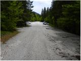
From the parking lot, continue along the macadam road, which after a 3-minute walk leads to the crossroads at Aljaževem dom. Continue straight ahead in the direction of Triglav, Luknja and Pogačnik's home (right Škrlatica) along the wide path that goes behind the chapel (on the right) and Aljaž's home (on the left) into the lane of a forest. The wide tourist-walking path leads us past the winter bivouac out of the forest, where we see the famous wedge (a monument dedicated to the fallen partisan mountaineers) in front of us. Here, the mountain marker for the Tominšek trail directs us to the left and leads us over lane of rubble into the forest. The well-worn path begins to climb upwards through the forest. As the path through the forest is quite steep in places, some steps have been placed on the path to make walking easier. After an hour and a half of walking, the forest becomes thinner and the path leads to the start of the climbing part of the trail. During the ascent of the climbing part, we are helped by the fixed safety gear, which are in good condition (restored in 2006). The path continues to get steeper and steeper and ascends steeply along the northern walls of Begunjski vrh. As the climbing part of the route is exposed to falling rocks, helmets are compulsory! After a good three hours of walking, the steepness eases and the route joins the normal route over the Threshold. Just a few steps further along the trail, you will see a nice little spring where you can rest. The way forward soon leads us to the next crossroads, where we continue to the left in the direction of Staničev's home (Kredarica on the right). The way forward is through a karst world full of cracks and potholes (be careful). Higher up, the path crosses a shorter scree slope and then ascends to a plateau-like world where we can already see the home of Valentin Stanič in front of us, which is only a few 10 steps of easy walking away.
From the house, continue left in the direction of Begunjski vrh, Visoka Vrbanova špica and Cmira. After a few minutes of further walking, the rather gently sloping path leads us to Begunjski Preval, where the path to Vrbanove Špice branches off to the right. Continue straight on the path, which soon splits into two parts. Continue straight ahead (left Begunjski vrh) on the path which crosses the north-eastern slopes of Begunjski vrh (possible snowfields in early summer) and leads to a small saddle behind the summit. Here we have a fine view of the Vrata valley and the surrounding mountains. The path then turns right and crosses a well-protected smooth rock slab. The path then climbs steeply and leads to a very scenic ridge, which you follow north-eastwards. The pleasant scenic route is then stopped by a steep rock step, after which we descend vertically (10m) on a well protected path. The path, which is then slightly easier, descends for a while and then starts to climb towards Rjavčev head. After a few minutes' ascent, we reach the summit, from which the path starts to descend on a steep grassy slope (danger of slipping). The path continues on a moderate ascent to a narrow and exposed ridge, from which it descends into the stubble below the main peak Cmira. On the other side, the trail turns slightly to the left and starts to climb steeply up the top slope of the mountain. After about 15 minutes of steep climbing, you reach the top of Cmira, which offers a very nice view.
Vrata - Staničev dom 4:20, Staničev dom - Cmir 2:00.

Pictures:
 1
1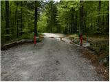 2
2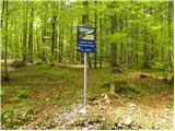 3
3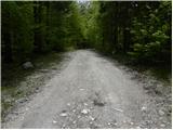 4
4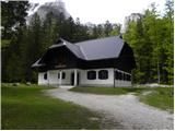 5
5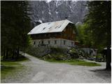 6
6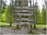 7
7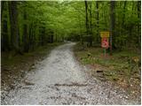 8
8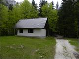 9
9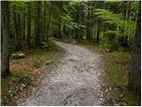 10
10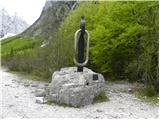 11
11 12
12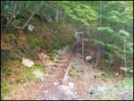 13
13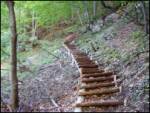 14
14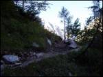 15
15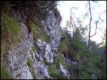 16
16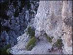 17
17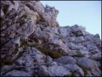 18
18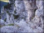 19
19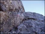 20
20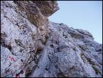 21
21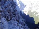 22
22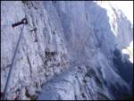 23
23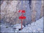 24
24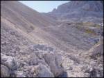 25
25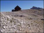 26
26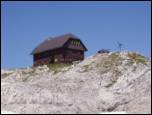 27
27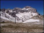 28
28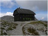 29
29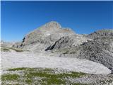 30
30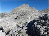 31
31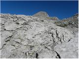 32
32 33
33 34
34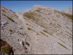 35
35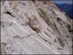 36
36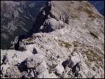 37
37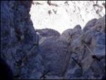 38
38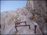 39
39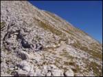 40
40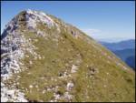 41
41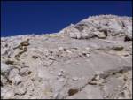 42
42 43
43
Discussion about the trail Aljažev dom v Vratih - Cmir (Tominšek route)
|
| Daaam10. 09. 2012 |
Pot prehodil v soboto. Po Tominškovi gor, od exstudenca do razcepa za Staničevo kočo je bil bolnica  (beri kolone ljudi, ki so se matrali čez Prag gor, nekateri so zgledali že precej bogo  ) Pri koči mal pavze, potem pa naprej blažen mir!! Srečala sva samo še tri osebe ob vračanju proti vznožju Begumjskega vrha. Sestopila sva po brezpotju za Cmirom direktno pred avto v Turkov rovt. (mal sreče glede na to da sva šla prvič za Cmirom dol  ) Bi pa samo še dal komentar na težavnost poti na Cmir, glede na to da se šteje pot od Staničeve koče do vrha kot zahtevna, bi vseen opozoril da skok, ki je sicer odlično zavarovan le ni tako nedolžen in bi verjetno zaradi tistih 20-ih? metrov v globino ocena bila lahko komot zelo zahtevno. Nama sicer ni povzročal težav, za nevajenega jeklenic pa bi bilo lahko kar malo delikatno.
|
|
|
|
| Ornitolog27. 07. 2013 |
Je na tej poti še kaj snega? Gre čez z letno opremo?
|
|
|
|
| lipko27. 07. 2013 |
Na poti ni snega (pot prehojena 27.7.2013 prav do Cmira)
|
|
|
|
| spet_jaz31. 08. 2017 |
Krasna pot, sploh izpod Begunjskega vrha do Cmira - res razgledi za bogove! Spust pa po dolini Za Cmirom - z možici označeno brezpotje. Več fotografij pa na povezavi
|
|
|
|
| Planinka7427. 07. 2018 |
Je se kaksno snezisce na poti od Stanicevega doma do Cmira? In na brezpotju za Cmirom do Turkovega Rovta? Hvala za informacijo.
|
|
|