Ruski križ - Planja (via Kriška stena)
Starting point: Ruski križ (1036 m)
| Lat/Lon: | 46,4444°N 13,7746°E |
| |
Name of path: via Kriška stena
Time of walking: 7 h 5 min
Difficulty: very difficult marked way
Altitude difference: 1417 m
Altitude difference po putu: 1850 m
Map: TNP 1:50.000
Recommended equipment (summer): helmet, self belay set
Recommended equipment (winter): helmet, self belay set, ice axe, crampons
Views: 7.359
 | 2 people like this post |
Access to the starting point:
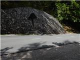
First drive to Kranjska Gora, then continue driving towards the Vrh Leh pass just before the 3rd serpentine of the Ruska or vršiška road, you will see the Russian Cross on the right and a small parking lot on the left, where you park. As the parking lot is relatively small and quickly full, you can also park a little higher up in the larger parking lot just above the 4th serpentine (in this case we have to descend a little to our starting point at the Russian Cross).
The starting point can also be reached from the coastal side via the Vršič Pass.
Path description:
Just before the 3rd serpentine of the Ruska cesta, we will notice the mountain signs for Koča v Krnici along the road, which direct us slightly to the left to the wide cart track, which immediately starts to descend moderately. After a few minutes of descending through the forest, the path is laid and leads us to the dry Pišnica riverbed. Just after crossing the stream, the path turns slightly to the left and leads us out of the forest onto the vast grassy slopes of the mountain pasture in Klin, where we see a secluded hut on the right and the small memorial park of Mali Tamar on the left. The path ahead is completely laid out and then joins the forest road coming from the former Hotel Erika or the bridge over the Velika Pišnica. Continue right here and follow the relatively steep forest road all the way to Koča v Krnici, which is reached after about 20 minutes of further walking.
From the hut, where there is a pleasant shade, continue straight ahead towards the Kriška Stena, following the valley Cirque, gently at first and then steeply upwards. The path soon emerges from the forest, where a fine view of the nearby cliffs opens up. Next, cross the rubble brought by storms from the surrounding ravines. The path ahead becomes steeper and still leads us in the same direction. The last trees are already behind us and we are slowly crossing the scree below the walls of the Kriška Stena. In the upper part of the scree, the path turns slightly to the left to the entrance to the Kriška wall. Here the climbing part of the route begins, where you put on your helmet. The path turns left at the start of the wall and climbs steeply. In the wall, the route is mostly along natural passages, and in some places we are helped by fixed safety gear, but we should also take care not to break any rocks! After a bad hour of climbing the wall, which is quite difficult in places, we get off. A few steps of walking follow to the crossroads, where we continue right up in the direction of Križa and the path which passes on a wide ridge, quickly leads us to Bovška vratica, from which we have a view of the Kriška Pods, where we can see the highest lying Slovenian lake. Continue straight down towards Pogačnik's home (left Križ for 10 minutes) along the broken rocks. During the descent, Šplevta (a mountain with the outline of an Indian) can be seen on the right, which adds variety to the trip. The descent, which is slightly difficult, leads us with the help of a few wedges to a small saddle between Križ and Kriškim edge. The latter is bypassed on the left, where we cross steep slopes (the most difficult part is guarded). Here you can observe Zgornje Kriško jezero for a while, and then the path starts to descend through the karst world of the Kriški Podi. After a descent of about one hour, the path leads to a crossroads near Pogačnik's home. Continue right towards the top of Razor (left Pogačnikov dom for 3 minutes) along the path which crosses the slopes to the north-west. The path even descends slightly here, and then a rock jump stops the path. Climb it using fixed safety gear and at the top of the jump continue left on a slightly exposed rock slab. On the other side of this slab, you will find yourself on scree again. Continue towards the Planja saddle, where the path from Vršič joins. Continue left in the direction Planja (Razor on the right) along the path which ascends in a transverse ascent using the fixed safety gear to the summit slope of the mountain. Here the steepness eases and the increasingly scenic route leads us to the vast summit in a few further steps.
Starting point - Koča v Krnici 45 minutes, Koča v Krnici - Pogačnikov dom 4:25, Pogačnikov dom - Planja 1:45.

Pictures:
 1
1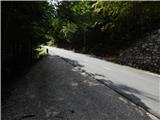 2
2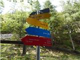 3
3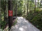 4
4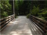 5
5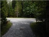 6
6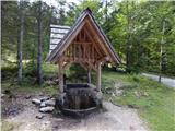 7
7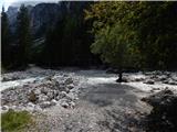 8
8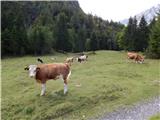 9
9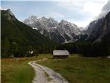 10
10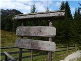 11
11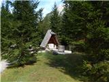 12
12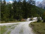 13
13 14
14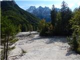 15
15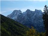 16
16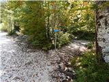 17
17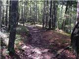 18
18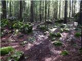 19
19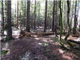 20
20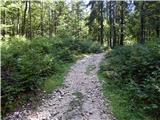 21
21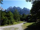 22
22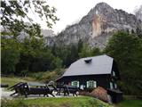 23
23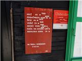 24
24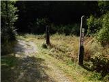 25
25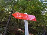 26
26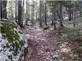 27
27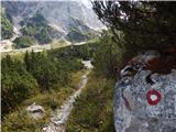 28
28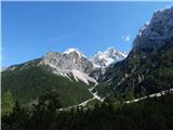 29
29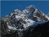 30
30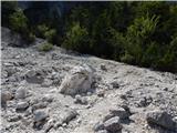 31
31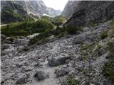 32
32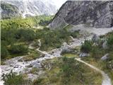 33
33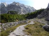 34
34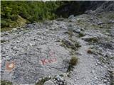 35
35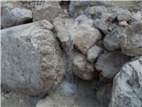 36
36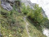 37
37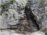 38
38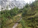 39
39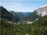 40
40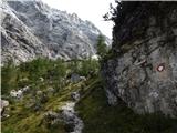 41
41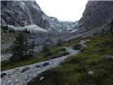 42
42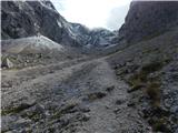 43
43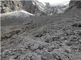 44
44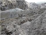 45
45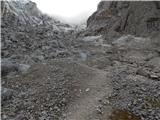 46
46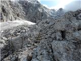 47
47 48
48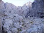 49
49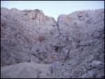 50
50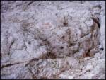 51
51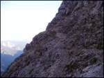 52
52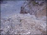 53
53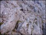 54
54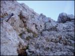 55
55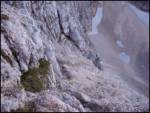 56
56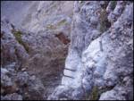 57
57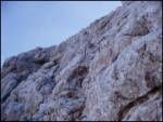 58
58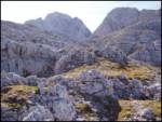 59
59 60
60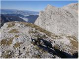 61
61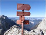 62
62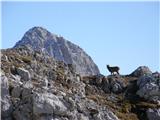 63
63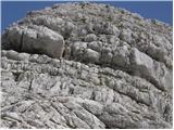 64
64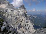 65
65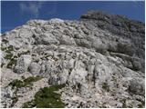 66
66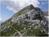 67
67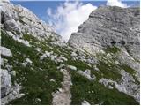 68
68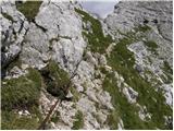 69
69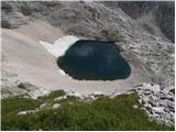 70
70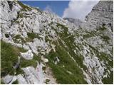 71
71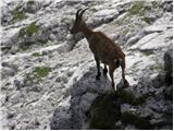 72
72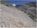 73
73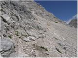 74
74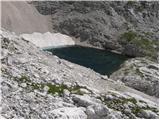 75
75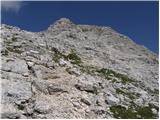 76
76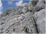 77
77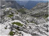 78
78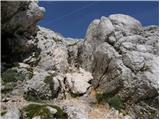 79
79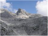 80
80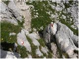 81
81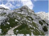 82
82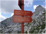 83
83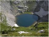 84
84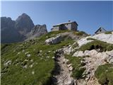 85
85 86
86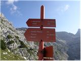 87
87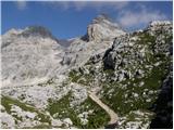 88
88 89
89 90
90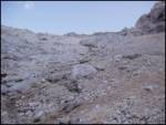 91
91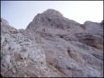 92
92 93
93 94
94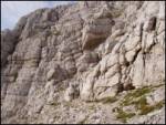 95
95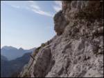 96
96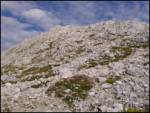 97
97 98
98
Discussion about the trail Ruski križ - Planja (via Kriška stena)
|
| metod15. 08. 2012 |
Utrujeni stolp na poti na Planjo se še ni spočil. Je še kar naslonjen na Planjo  .
|
|
|