NC Planica - Mala Mojstrovka (via Grlo)
Starting point: NC Planica (931 m)
| Lat/Lon: | 46,476°N 13,7241°E |
| |
Name of path: via Grlo
Time of walking: 4 h 35 min
Difficulty: very difficult marked way
Altitude difference: 1401 m
Altitude difference po putu: 1500 m
Map: Kranjska Gora 1:30.000
Recommended equipment (summer): helmet, self belay set
Recommended equipment (winter): helmet, self belay set, ice axe, crampons
Views: 19.302
 | 2 people like this post |
Access to the starting point:
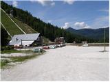
Leave the Gorenjska motorway at exit Jesenice - West (Hrušica), then continue to Kranjska Gora and on to Rateče. Just 100 m before the Rateče border crossing, turn left and continue in the direction of Planica. After a short climb, the road leads to the ski jumps in Planica, and we park here in one of several large car parks.
Path description:
From the parking lot in Planica, you can "walk" almost to Dom v Tamarju by footpath or road (40 minutes).
Only about 100 m before the lodge, the mountain direction signs for Slemenova špica, Mala Mojstrovka and Vršič direct us to the left on a path which, after a few steps, leads us out of the woods onto the vast gravel. The path continues to climb gently to the left to the source of the mighty ravine that we see in front of us. The path then leads us right into the ravine along which the path continues. Continue up the ravine, looking for the passages which are elsewhere after each heavi rain. The path along the ravine is marked but many of the markings are upside down and where there is a marking it is often almost impossible to cross. The entire 45-minute walk through the ravine is also exposed to falling rocks. The climb up the ravine is difficult but nowhere exposed. Exit the gully at saddle Grlo, where we join a barely visible unmarked trail from the Mala Pišnica valley.
Continue right in the direction of Slemenova špica and Vršiča. The path crosses a short lane of a forest and leads us slightly higher to the scree slopes, which the path crosses in a slight ascent to the steep slopes. Here the path climbs steeply and we are helped by a few wedges and a steel cable. Continue up the moderately overgrown slope quite steeply to where the Vršič - Slemenova špica trail joins.
Here continue left towards Vršiča (right Slemenova špica) and follow a pleasant path through a sparse larch forest. The path then climbs gently for a short time, and within a few minutes of further walking leads to the Vratca Preval, where there is a crossroads of marked and unmarked paths.
Continue right in the direction of Mojstrovka (left unmarked path to Prednje Robičje, straight down Vršič) along the path that passes under the walls of Šitna glave. After a few 10 steps of further walking, the Hanzo trail to Mala Mojstrovka (straight Slemenova špica on the unmarked trail) branches off to the left upwards. The way ahead climbs steeply with the help of many wedges and leads us higher to the first rocks, which are then our "permanent" companion. The perfectly protected path continues to lead us steeply upwards along exposed ledges and ravines. The path, which is exposed to falling rocks, gradually lays down and we are joined on the left by the unmarked path from Šitna glave. After a few more minutes, the steepness eases further and the path leads us to a flatter world, which we go around on the right hand side. Next, the path approaches the ridge and we see Mangart and Jalovec in front of us. Here the path turns slightly left and leads us to a steep part. With the help of a few pegs, but mainly without fixed safety gear, we climb the steep summit slope of Mala Mojstrovka to its viewpoint.

Pictures:
 1
1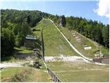 2
2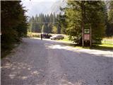 3
3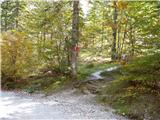 4
4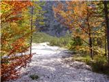 5
5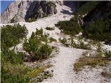 6
6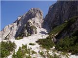 7
7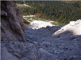 8
8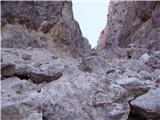 9
9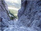 10
10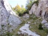 11
11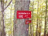 12
12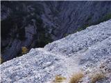 13
13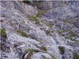 14
14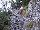 15
15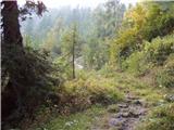 16
16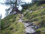 17
17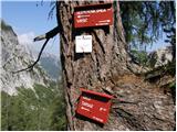 18
18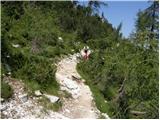 19
19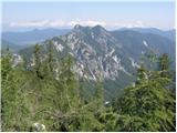 20
20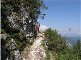 21
21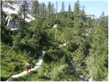 22
22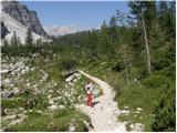 23
23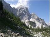 24
24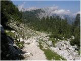 25
25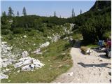 26
26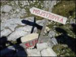 27
27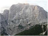 28
28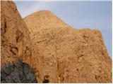 29
29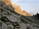 30
30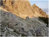 31
31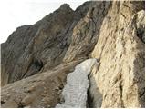 32
32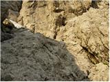 33
33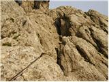 34
34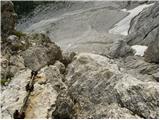 35
35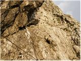 36
36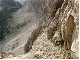 37
37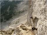 38
38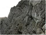 39
39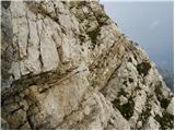 40
40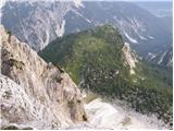 41
41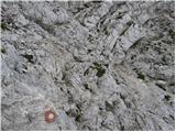 42
42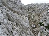 43
43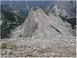 44
44 45
45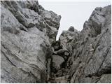 46
46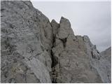 47
47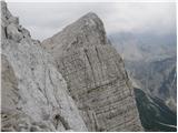 48
48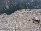 49
49 50
50 51
51
Discussion about the trail NC Planica - Mala Mojstrovka (via Grlo)