Rio Bianco - Viš/Jof Fuart (Sentiero del Centenario)
Starting point: Rio Bianco (980 m)
| Lat/Lon: | 46,4095°N 13,536°E |
| |
Name of path: Sentiero del Centenario
Time of walking: 6 h
Difficulty: very difficult marked way
Ferata: B/C
Altitude difference: 1686 m
Altitude difference po putu: 1900 m
Map: Julijske Alpe - zahodni del 1:50.000
Recommended equipment (summer): helmet, self belay set, lamp
Recommended equipment (winter): helmet, self belay set, ice axe, crampons, lamp
Views: 36.527
 | 1 person likes this post |
Access to the starting point:
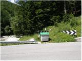
From Kranjska Gora, take the Rateče border crossing to Trbiž / Tarvisio. In Trbiz, turn left towards Bovec and follow the road to the crossroads near Lake Rabeljsko. Here, turn right towards Nevea Pass / Sella Nevea. Follow this road, which climbs for the most part, until you reach a bridge where, at a left-hand bend, the road crosses the White Water stream / Rio Bianco. On the left side of the road you will see a few small car parks.
From Bovec, drive to the Predel border crossing, from which you descend to the Italian side. Just after Lake Rabelj, you will reach a crossroads where you turn left towards the Neveje Pass / Sella Nevea. Continue as described above.
Path description:
From the signs at the beginning of the trail (before the bridge on the right side of the road), continue through the forest on the right side of the Rio Bianco stream, which will take you uphill for some time. The valley of the White Water (Italian: Riobianco) is named after the stream. The path then turns left and crosses small streams several times. Later, the path turns slightly to the right again and there is a short climb in the keys to the abandoned Brunner hut, where there is no view due to the forest. At the hut, where there is also a fork in the trail, continue straight ahead along trail 625 towards the Gorizia bivouac. The path then soon emerges from the forest and climbs along the stream through dwarf pines. Later the path turns left and leads to a crossroads. We continue on the left path towards the Gorizia bivouac, and the path branches off to the right towards the White Water notch (ital. Forca di Rio Bianco). Dwarf pines then soon ends and the path starts to climb a little steeper. When the path flattens out a little again, the inscription on the rock directs us to the left towards the bivouac, which is about 50 metres away, and to the right is a direct path towards the Krnic notch (ital. Forcella del Vallone).
From the bivouac, continue southwards and start climbing quite steeply up the rubbly slope towards the Alta di Rio Bianco (2150m). At the stump the path turns right and climbs for a short time on slightly cobbly terrain before leading to a series of switchbacks along which we climb quite steeply. The most difficult part of the route follows, where you have to descend vertically into a narrow notch. Self-balancing is highly recommended in this part. From the stubble you then climb up a vertical ladder and then slightly flatter slopes lead you to a narrow ridge. The path along the ridge is secured by a cable. Later, the path turns left and there is a short descent over rough terrain and then along a ropeway to the entrance to the tunnel. There are also bends and ladder descents on the way through the tunnel, so use of a torch is compulsory. Once out of the tunnel, there is a short crossing of a steep slope to Krniška stub, where an easier path from the Gorizia bivouac joins from the right. From the stubble, there is a descent on scree and then on increasingly grassy terrain, which leads to a crossroads. Turn right on route 627, and to the left the path leads to the Corsi hut, which is about 15 minutes' descent away. After a short climb, you reach the crossroads again, where you go left (direction Jof Fuart), and to the right is route 627, which leads to the Forcella di Riofreddo. The path then turns slightly to the left and leads you to the entrance to a slightly more difficult part of the route. Here the trail turns right uphill and some easy rock climbing is required. The path then turns slightly to the right and leads us to the slightly more difficult part of the route again. Here the path turns left uphill and starts to climb along the steel cable. There is a slightly low passage through a window and then a climb back up along the steel cable. The path then leads to a crossroads where the Anita Goitan path joins us from the right from the precipitous ledges. After a short climb, you come to a crossroads again, where you go right and the Anita Goitan trail branches off to the left. There follows a moderately steep climb on rocky and somewhat cobbly terrain. Just below the summit, the northeastern Gola Nordest trail joins from the right. From here it is just a short climb to a very scenic summit.

Pictures:
 1
1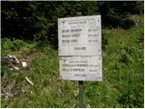 2
2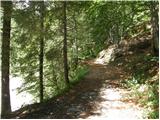 3
3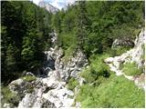 4
4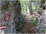 5
5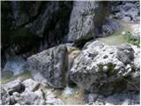 6
6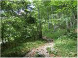 7
7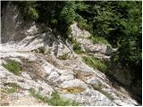 8
8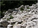 9
9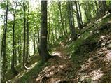 10
10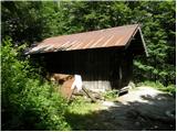 11
11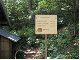 12
12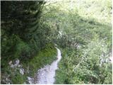 13
13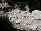 14
14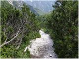 15
15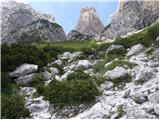 16
16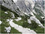 17
17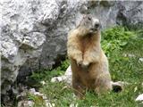 18
18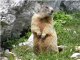 19
19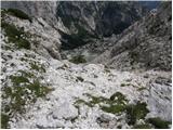 20
20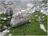 21
21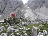 22
22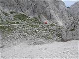 23
23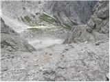 24
24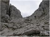 25
25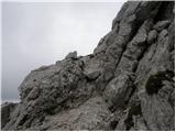 26
26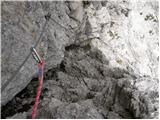 27
27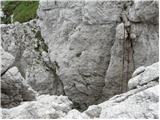 28
28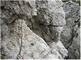 29
29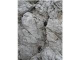 30
30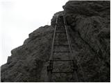 31
31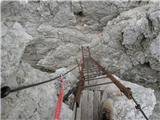 32
32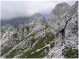 33
33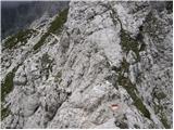 34
34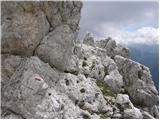 35
35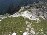 36
36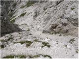 37
37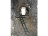 38
38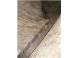 39
39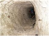 40
40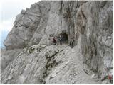 41
41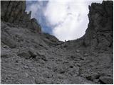 42
42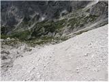 43
43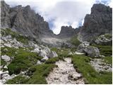 44
44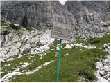 45
45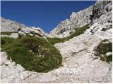 46
46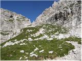 47
47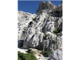 48
48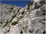 49
49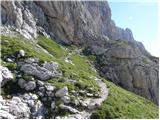 50
50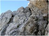 51
51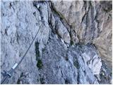 52
52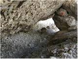 53
53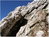 54
54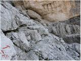 55
55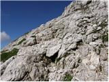 56
56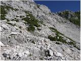 57
57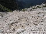 58
58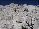 59
59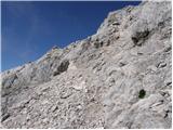 60
60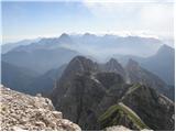 61
61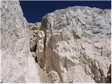 62
62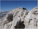 63
63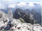 64
64 65
65
Discussion about the trail Rio Bianco - Viš/Jof Fuart (Sentiero del Centenario)
|
| barjus17. 07. 2011 |
Pot je od bivaka zelo slabo označena, oz. na mestih sploh ni. Od bivaka narediš kar velik ovinek po zgornjem opisu, kajti pot je že tako precej dolga. Je pa res, da se vsaj tukaj kaj dogaja, je pa nujna svetilka, ker se drugače lahko samo obrneš. Ko prideš nad kočo Corsi, je zopet loterija, da zadaneš prevo pot, posebno še če ne več kateri vrh je pravi. Res ja da imamo jezik in prašamo, kot sva midva in sva po precej dolgočasnem vrhnem delu dosegla vrh. Varovalnega kompleta pa nisva čisto nič potrebovala.
|
|
|
|
| toneh218. 09. 2012 |
Pot stoletnice - pot od bivaka do škrbine Alta di Rio Bianco (2150m) sploh ni označena. Tudi možici manjkajo (!), le občasni odtisi čevljev potrjujejo, da je obljudeno. Na škrbini opaziš prvo markacijo na trdni skali, od tu naprej pa vse klapa - markacije in varovala.
|
|
|
|
| mary20. 09. 2012 |
Živjo! Zanima me časovnica poti na Viš mimo Krniške škrbine in nato do koče Rif. Corsi, nadaljevanje proti Trbiški Škrbinici na pot Anita Goitan ter na vrh. Sestop proti Škrbini zadnje Špranje mimo Koštrunovih špic, do Škrbine prednje Špranje ( kjer se pot A. G. konča) potem pa naprej ali do koče Rif. Corsi in sestop po poti vzpona čez Krniško škrbino ali pa na Viško Planino in nato po cesti nazaj do izhodišča Bele vode. Bi bila ta pot izvedljiva v enem dnevu s hitrim tempom  ?Vsem poznavalcem najlepša hvala za odgovor! Lp, Mary
|
|
|
|
| IgorZlodej20. 09. 2012 |
Izvedljiva, ampak res zelo, zelo hiter tempo in v kopnem. Sicer z Krniške škrbine ni treba dol do Corsija, ampak je možno prečenje nekoliko višje pod stenami. Vračanje preko Krniške škrbine, hm, hm, jaz bi raje s Prednje špranje kar dol na Viško planino, seveda, če bi imel avto spodaj na parkirišču, sicer pa raje s Prednje Špranje pod Kapno steno na Corsi in po poti čez grape mimo Viške glavice na izhodišče pri izteku Belega potoka, razlike na cesti je borih 500 m.
|
|
|
|
| MarkoKomar3. 08. 2013 |
Zivijo,
Ali ima kdo kaj novejsih podatkov o opisani poti. Kaksne so izkusnje s spanjem v koci Corsi ali na bivaku Gorizia v avgustu (prespala bi iz nedelje na ponedeljek). Hvala za odgovor. Lp, Marko
|
|
|
|
| sabina.76. 08. 2013 |
Midva sva bila v bivaku Gorizia od sobote do ponedeljka. Bivak v redu, ni bilo nikogar razen naju. Cez dan je tu pa tam kaksen sel mimo, ce ne pa sva imela druzbo gamsov, divjih koz in svizcev. Je tudi nekaj snega, tako ce ti zmanjka vode, si ga lahko stalis.Cez dan je bilo toplo, zvecer hladno. Lp S
|
|
|
|
| VanSims11. 08. 2014 |
Od Bivacco Gorizzia se gre samo še naprej in mimo velike skale proti škrbini kjer na desni vidimo ploščo ki označuje vstop v Sentiero Centenario. Pot je direktna in nimaš se kje izgubiti. Je pa res, da ni markacij in se moraš na skalovju znajti sam.
Pri Corsiju pa tudi ni kake loterije kot je nekdo napisal zgoraj. Vse je lepo označeno in tako kot je opisano zgoraj le malo pozoren je treba biti na oznake.
|
|
|
|
| Shime26. 05. 2015 |
Pozdrav;
tijekom ljeta namjeravamo proći put prema gornjem opisu, pa me zanimaju dojmovi iz Rof.Corsi jer tamo namjeravamo spavati. Da li je za komunikaciju potrebno poznavati talijanski ili se može razgovarati na engleski/slovenski/hrvatski?
Također me zanima da li je voda iz izvora kraj doma pitka? Na stranicama od doma piše da postoji izvor, pa bi bilo dobro znati ako je izvor dobar (u slučaju da treba).
Hvala na informacijama! LP
|
|
|
|
| klm26. 05. 2015 |
Shime, može se razgovarati talijanski, engleski ili njemački (hrvatski i slovenski se nemože, posto nisu svijetski jezici ali može se i srbski ) U okolini kuče ima dosta izvora, a voda je takodjer pitka. Ako ima jos kakvih pitanja, samo ih izvucite. lijep pozdrav
|
|
|
|
| Shime28. 05. 2015 |
Hvala, to mi mnogo olakšava sve, od naručivanja pive  do rezervacije spavanja (da sam pravi, naučio bi srpski  ). Imam još jedno pitanje: da li se u Italiji priznaje popust članovima Hrvatskog planinarskog saveza, ili se plaća puna cijena? Još jednom, hvala na informacijama!
|
|
|
|
| jedriličar28. 05. 2015 |
Popust na članske iskaznice HPS-a se priznaje samo u kočama koje su pod ingerencijom (upravljanjem) CAI-a (club alpino italiano), dok se u kočama koje su privatne taj popust ne priznaje (osim ako imaš recimo iskaznicu OEAV ili AAC a koča ima znak za priznavanje popusta). Kada sam zadnji put spavao u Corsiju (prije 6 ili 7 godina, nisam siguran) onda su priznavali popust, a koliko vidim na stranicama Corsija http://www.rifugiocorsi.it/ koča je i dalje pod upravljanjem CAI-a ... Ako ti još šta treba, pitaj ... lp
|
|
|
|
| Robie16. 07. 2016 |
Enkratna pot, izredni razgledi in užitek - ni čudno da za ta del veliko planincev uporabi besedo PLANINSKI RAJ. Ferrata kratka a lepa in vzorno urejena - varovala delujejo nova, malo previdnosti je potrebno v tunelu - rado drsi. Priporočam pot mimo koče Brunner (vode v izobilju nato na Pot stoletnice ter povratek mimo koče Corsi na pot Saškega Kralja, ki se jo lahko skrajša in izpusti nevaren del.
|
|
|
|
| lazo122. 07. 2016 |
Prosil a kdo ve koliko je cena spanja u Rifugio Corsi s iskaznicom? Hvala lepa
|
|
|
|
| smatjaz22. 08. 2022 15:43:50 |
OPOZORILO: opozarjam da se na parkirišču izhodišča za bivak Brunner (gre za peščeno parkirišče, levo od mostu ceste) in tudi za Jerebico, vlamlja v avtomobile. Bodite pozorni, da ne bo imel še kdo tako slabo izkušnjo kot smo jo imeli včeraj mi po povratku z Viša.
|
|
|