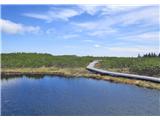
 | Tržič - Dobrča
Dobrča is a 1634-metre mountain located between Begunje and Tržič. From the summit, which has a registration box with a stamp, the view opens onl...
3 h 10 min |
 | Zali Log - Blegoš (via Potok)
Blegoš is a 1,562-metre-high mountain located between the Selška Sora and Poljanska Sora rivers. From the grassy summit, where there is a stamp a...
3 h |
 | Podbrdo - Možic
Možic is a 1,602 m high peak located west of Soriška Planina. At the very summit there is an old military bunker bearing the name of the peak and...
3 h 15 min |
| Podbrdo - Možic (via Lajnar)
Možic is a 1,602 m high peak located west of Soriška Planina. At the very summit there is an old military bunker bearing the name of the peak and...
3 h 25 min |
 | Hudajužna - Porezen
Porezen is a 1,630 m high mountain situated between Davča and Baška Grapa. From the summit, where a large Partisan monument stands, a beautiful v...
3 h 15 min |
 | Podbrdo - Porezen
Porezen is a 1,630 m high mountain situated between Davča and Baška Grapa. From the summit, where a large Partisan monument stands, a beautiful v...
3 h 30 min |
| Podbrdo - Porezen (via Dom na Poreznu)
Porezen is a 1,630 m high mountain situated between Davča and Baška Grapa. From the summit, where a large Partisan monument stands, a beautiful v...
3 h 35 min |
 | Spodnja Kokra - Javorov vrh
Javorov Vrh (recorded in some sources as Javorjev Vrh) is a 1,434 m high mountain northeast of Preddvor. The summit, with its registration box an...
2 h 20 min |
 | Potoče - Javorov vrh (via Potoška gora)
Javorov Vrh (recorded in some sources as Javorjev Vrh) is a 1,434 m high mountain northeast of Preddvor. The summit, with its registration box an...
2 h 45 min |
| Potoče - Javorov vrh (direct way)
Javorov Vrh (recorded in some sources as Javorjev Vrh) is a 1,434 m high mountain northeast of Preddvor. The summit, with its registration box an...
2 h 30 min |
 | Podbrdo - Slatnik (northwestern peak)
Slatnik is a panoramic mountain located west of the Soriška Planina ski resort. From its grassy summit there is a beautiful view of the Škofjeloš...
3 h 15 min |
 | Podbrdo - Slatnik (northwestern peak) (via Lajnar)
Slatnik is a panoramic mountain located west of the Soriška Planina ski resort. From its grassy summit there is a beautiful view of the Škofjeloš...
3 h 10 min |
 | Podbrdo - Kobla
The summit is located in the Lower Bohinj Mountains between Črna prst and Soriška planina. Directly below it is a railway tunnel connecting Bohin...
3 h |
 | Podbrdo - Lajnar
Lajnar is a 1,549-metre-high mountain located north of Soriška Planina. From the summit, which is also the highest point of the ski resort, a bea...
2 h 55 min |
 | Podbrdo - Šavnik
Šavnik is a grassy peak situated between the ski resorts of Soriška Planina and Kobla. From the summit, which has a registration box with a stamp...
3 h |
 | Zali Log - Koprivnik
Koprivnik is a 1393-meter-high mountain located between Blegoš and Mladi vrh. From the summit, which has a registration box and a stamp, the view...
2 h 45 min |
 | Ljubenske Rastke - Komen
At 1684 meters, Komen is the highest peak in the Smrekovec mountain range, which borders between Styria and Carinthia. In good weather, the summi...
3 h 15 min |
 | Vrtovin - Kucelj (on Čaven)
Kucelj is located on the southern slopes of the Trnovski Forest, northwest of the Vipava Valley. From the bare summit, where a cross stands, ther...
2 h 15 min |
 | Vrtovin - Kucelj (on Čaven) (via Koča na Mali gori)
Kucelj is located on the southern slopes of the Trnovski Forest, northwest of the Vipava Valley. From the bare summit, where a cross stands, ther...
3 h |
 | Vrtovin - Veliki Modrasovec
Veliki Modrasovec is located on the southern part of the Trnovski Forest near Predmeja. On the summit stands an old military building, which we m...
3 h 10 min |
 | Zreče (church of St. Egidij) - Rogla (via Gorenje)
Rogla is a peak in the middle of the eponymous ski resort. The peak is forested with a small clearing on which stands a lookout tower. The tower ...
3 h 50 min |
 | Lovrenc na Pohorju - Lovrenška jezera
The Lovrenška jezera are located on a high bog in the middle of Pohorje between Rogla and Ribniško Pohorje. The smaller lakes, which receive wate...
3 h 35 min |
 | Dovže - Črni vrh
Črni vrh is the highest peak of Pohorje. Because it is partly unvegetated, it offers a nice view toward Velika Kopa, Uršlja gora, and in the back...
3 h 45 min |
 | Dovže - Velika Kopa
Velika Kopa is a 1542-meter-high peak located between Grmovškov dom and the nearby Mala Kopa. From the top, which is only 1 meter lower than the ...
3 h 15 min |
 | Podbrdo - Krevl
Krevl is a 1515-meter-high peak situated south of the Kobla ski area, more precisely between the Kobla peak and Kravja Črna gora. From the summit...
3 h 15 min |
 | Bohinjska Bistrica - Krevl (via Planina za Črno goro)
Krevl is a 1515-meter-high peak situated south of the Kobla ski area, more precisely between the Kobla peak and Kravja Črna gora. From the summit...
2 h 55 min |
 | Vitanje - Basališče (Paški Kozjak)
Basališče is the highest peak of Paški Kozjak. A bench and a summit register have been placed on the summit. However, due to the forest, there is...
2 h 30 min |
 | Dravograd - Huhnerkogel/Košenjak (via Ojstrica)
Košenjak is located north of Dravograd and the Drava River on the border with neighbouring Austria. Access to Košenjak is possible on foot or by ...
3 h 15 min |
 | Dravograd - Huhnerkogel/Košenjak (via Goriški Vrh)
Košenjak is located north of Dravograd and the Drava River on the border with neighbouring Austria. Access to Košenjak is possible on foot or by ...
3 h |
 | Slovenj Gradec - Kremžarjev vrh
Kremžarjev vrh is the westernmost thousand-meter peak on Pohorje. It is located northeast of Slovenj Gradec. From the summit, which has a logbook...
2 h 15 min |
 | Vuzenica - Kremžarjev vrh
Kremžarjev vrh is the westernmost thousand-meter peak on Pohorje. It is located northeast of Slovenj Gradec. From the summit, which has a logbook...
3 h 50 min |
 | Bistrica v Rožu / Feistritz im Rosental - Sinacher Gupf / Psinski vrh (west path)
Sinski vrh (mostly marked as Psinski vrh on maps) / Sinacher Gupf is a peak north of the main Karawanks ridge, more precisely north of Stol and V...
3 h 15 min |
| Bistrica v Rožu / Feistritz im Rosental - Sinacher Gupf / Psinski vrh (east path)
Sinski vrh (mostly marked as Psinski vrh on maps) / Sinacher Gupf is a peak north of the main Karawanks ridge, more precisely north of Stol and V...
3 h 15 min |
 | Trnje / Dornach - Singerberg / Žingarica
Žingarica / Singerberg is a peak on the Austrian side of the Karawanks above the village of Slovenji Plajberk / Windisch Bleiberg. From the summi...
3 h 20 min |
 | Jelševica - Črni vrh (Čemšeniška planina)
Črni vrh is the highest peak of Čemšeniška planina and, at 1,204 m, the second-highest peak in Posavsko hribovje. The summit has a logbook box bu...
2 h 45 min |
 | Dolina Zaplaninščice - Črni vrh (Čemšeniška planina)
Črni vrh is the highest peak of Čemšeniška planina and, at 1,204 m, the second-highest peak in Posavsko hribovje. The summit has a logbook box bu...
2 h 30 min |
 | Loke - Črni vrh (Čemšeniška planina) (via Zajčeva koča)
Črni vrh is the highest peak of Čemšeniška planina and, at 1,204 m, the second-highest peak in Posavsko hribovje. The summit has a logbook box bu...
3 h 35 min |
 | Izlake - Črni vrh (Čemšeniška planina)
Črni vrh is the highest peak of Čemšeniška planina and, at 1,204 m, the second-highest peak in Posavsko hribovje. The summit has a logbook box bu...
3 h |
| Izlake - Črni vrh (Čemšeniška planina) (via Razbor pri Čemšeniku)
Črni vrh is the highest peak of Čemšeniška planina and, at 1,204 m, the second-highest peak in Posavsko hribovje. The summit has a logbook box bu...
3 h 10 min |
 | Log - Mariborski razglednik (Cigelnica)
Mariborski razglednik (Cigelnica) is a 1,147-meter-high peak located by the Mariborsko Pohorje ski resort. A lookout tower on the summit offers m...
2 h 50 min |
| Pivola (Reka) - Mariborski razglednik (Cigelnica) (via Petkovo sedlo)
Mariborski razglednik (Cigelnica) is a 1,147-meter-high peak located by the Mariborsko Pohorje ski resort. A lookout tower on the summit offers m...
2 h 40 min |
| Fram - Mariborski razglednik (Cigelnica) (via Petkovo sedlo)
Mariborski razglednik (Cigelnica) is a 1,147-meter-high peak located by the Mariborsko Pohorje ski resort. A lookout tower on the summit offers m...
3 h 25 min |
 | Ruše - Žigartov vrh
Žigartov vrh, at 1,346 meters, is the highest peak in the eastern part of Pohorje. An "observation" tower once stood on the summit, erected solel...
3 h 15 min |
 | Log - Žigartov vrh
Žigartov vrh, at 1,346 meters, is the highest peak in the eastern part of Pohorje. An "observation" tower once stood on the summit, erected solel...
3 h 35 min |
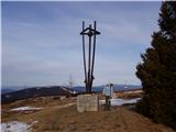
 | Tržič - Šentanski vrh
Šentanski vrh, located in the Dobrča range just five minutes from the main peak, offers a nice view of the central Karawanks, the Storžič group, ...
3 h 15 min |
 | Žekovec - Boskovec (via Verbučeva planina)
Boskovec is with 1587 m the highest peak of the Golte plateau. From the top on which a lookout tower stands, a view opens up on part of Kamnik Sa...
3 h |
 | Žekovec - Boskovec (past Keber and Mozirska koča)
Boskovec is with 1587 m the highest peak of the Golte plateau. From the top on which a lookout tower stands, a view opens up on part of Kamnik Sa...
3 h 20 min |
 | Radegunda (Žekovec) - Boskovec (through Zagradiška puša and on path Severjeva pot)
Boskovec is with 1587 m the highest peak of the Golte plateau. From the top on which a lookout tower stands, a view opens up on part of Kamnik Sa...
3 h 10 min |
| Radegunda (Žekovec) - Boskovec (via Zagradiška puša and Hleviška planina)
Boskovec is with 1587 m the highest peak of the Golte plateau. From the top on which a lookout tower stands, a view opens up on part of Kamnik Sa...
3 h 15 min |
 | Činžat - Klopni vrh (northern path)
From the northwest, Klopni vrh closes off the lower-lying extensive plateau on eastern Pohorje. The horizontal cross-sectional area at 1300 m is ...
2 h 45 min |
| Činžat - Klopni vrh (eastern path)
From the northwest, Klopni vrh closes off the lower-lying extensive plateau on eastern Pohorje. The horizontal cross-sectional area at 1300 m is ...
2 h 45 min |
| Lovrenc na Pohorju - Klopni vrh (via Spodnji trg and on northern path)
From the northwest, Klopni vrh closes off the lower-lying extensive plateau on eastern Pohorje. The horizontal cross-sectional area at 1300 m is ...
3 h 5 min |
| Lovrenc na Pohorju - Klopni vrh (via Spodnji trg and on eastern path)
From the northwest, Klopni vrh closes off the lower-lying extensive plateau on eastern Pohorje. The horizontal cross-sectional area at 1300 m is ...
3 h 5 min |
| Lovrenc na Pohorju - Klopni vrh (via Zgornji trg and on northern path)
From the northwest, Klopni vrh closes off the lower-lying extensive plateau on eastern Pohorje. The horizontal cross-sectional area at 1300 m is ...
2 h 30 min |
| Lovrenc na Pohorju - Klopni vrh (via Zgornji trg and on eastern path)
From the northwest, Klopni vrh closes off the lower-lying extensive plateau on eastern Pohorje. The horizontal cross-sectional area at 1300 m is ...
2 h 30 min |
| Ruše - Klopni vrh (northern path)
From the northwest, Klopni vrh closes off the lower-lying extensive plateau on eastern Pohorje. The horizontal cross-sectional area at 1300 m is ...
3 h 40 min |
 | Ljubenske Rastke - Bezovec
Bezovec is a lesser-known peak located in Smrekovško pogorje. From the summit, where a hunting observatory stands, a nice view opens up mainly on...
2 h 15 min |
 | Gotenica - Goteniški Snežnik
At 1,289 meters, Goteniški Snežnik is the highest peak of Goteniška gora. The forested summit offers a somewhat obstructed view. It has a logbook...
2 h 45 min |
| Kočevska Reka - Goteniški Snežnik
At 1,289 meters, Goteniški Snežnik is the highest peak of Goteniška gora. The forested summit offers a somewhat obstructed view. It has a logbook...
2 h 45 min |
 | Vitovlje - Veliki Rob
Veliki Rob is a panoramic peak situated between Kuclj (1237 m) and Čaven (1185 m). From the summit, where there is a cross, there is a nice view ...
3 h |
 | Vrtovin - Veliki Rob
Veliki Rob is a panoramic peak situated between Kuclj (1237 m) and Čaven (1185 m). From the summit, where there is a cross, there is a nice view ...
2 h 50 min |
| Vitovlje - Veliki Rob (via Vitovlje Lake and over Sekulak)
Veliki Rob is a panoramic peak situated between Kuclj (1237 m) and Čaven (1185 m). From the summit, where there is a cross, there is a nice view ...
3 h 10 min |
 | Zali Log - Gladki vrh (Ratitovec)
Gladki vrh (Ratitovec), at 1,667 meters, is the most visited peak in the Ratitovec range. From its bare summit, which features a panorama board, ...
3 h 5 min |
 | Podrošt - Gladki vrh (Ratitovec)
Gladki vrh (Ratitovec), at 1,667 meters, is the most visited peak in the Ratitovec range. From its bare summit, which features a panorama board, ...
3 h 5 min |
 | Podrošt - Altemaver (Ratitovec)
Altemaver (Ratitovec), at 1,678 meters, is the highest peak of Ratitovec. From its grassy summit, there is a beautiful view of the Julian Alps, J...
3 h 20 min |
 | Trdnjava Kluže - Kota 1313
Kota 1313 was an Austro-Hungarian artillery observation post during World War I. From position 1313, located near the indistinct summit of Veliki...
2 h 20 min |
 | Bezgovica - Cerk
Cerk, at 1,192 meters, is the highest peak of Borovška gora, a range situated between the Kolpa River valley and Goteniški Snežnik. From the summ...
2 h 55 min |
 | Srednja Kanomlja - Hudournik
Hudournik is a 1,148-meter-high peak on the northern edge of the Vojskarska planota plateau, which lies between the valleys of the Idrijca, Kanom...
3 h 45 min |
 | Rakitnica - Rezinski vrh
Rezinski vrh is a 1231 m high mountain located amid the vast forests of Velika gora. The summit has a logbook box and stamp nearby, but offers no...
2 h 40 min |
 | Rakitnica - Turn
Turn is the 1254 m highest peak of the 14 km long Velika gora plateau, rising between Ribniško polje and Liški potok. Despite partial tree cover,...
3 h |
 | Planina Polog - Mrzli vrh above Planina Pretovč
Mrzli vrh is a well-known battlefield from the First World War. Today, the peak is recognised as an open-air museum where numerous caverns, trenc...
2 h 45 min |
 | Dolenji Novaki - Medrce
Medrce is a 1,410-meter-high peak located between Porezen and Hum. From the summit, which features an old bunker, there are nice views of Kojca, ...
3 h 15 min |
| Cerkno - Medrce (via Labinjske lehe)
Medrce is a 1,410-meter-high peak located between Porezen and Hum. From the summit, which features an old bunker, there are nice views of Kojca, ...
3 h 25 min |
 | Podbrdo - Slatnik (southeastern peak)
Slatnik (southeastern peak) is a panoramic mountain that rises steeply above Baška grapa on one side and descends more gently toward Soriška plan...
3 h 25 min |
| Podbrdo - Slatnik (southeastern peak) (via Lajnar)
Slatnik (southeastern peak) is a panoramic mountain that rises steeply above Baška grapa on one side and descends more gently toward Soriška plan...
3 h |
 | Bistriški jarek (border crossing Muta) - Kozji vrh (at Košenjak)
Kozji vrh is a 1,383-meter-high peak located above Pernice; it is also the highest peak in the Municipality of Muta....
2 h 50 min |
| Bistriški jarek (Glasbeni dom) - Kozji vrh (at Košenjak)
Kozji vrh is a 1,383-meter-high peak located above Pernice; it is also the highest peak in the Municipality of Muta....
2 h 45 min |
| Muta (Zgornja Muta) - Kozji vrh (at Košenjak)
Kozji vrh is a 1,383-meter-high peak located above Pernice; it is also the highest peak in the Municipality of Muta....
3 h 45 min |
 | Bled (Velika Zaka) - Berjanca
Berjanca is a 1,264 m high peak above the namesake mountain pasture. An abandoned ski lift from the former Zatrnik ski area used to reach the sum...
3 h 10 min |
| Bohinjska Bela (St. Marjeta) - Berjanca
Berjanca is a 1,264 m high peak above the namesake mountain pasture. An abandoned ski lift from the former Zatrnik ski area used to reach the sum...
2 h 55 min |
 | Oplotnica - Veliki vrh (on Pohorje)
Veliki vrh is a 1344-meter-high peak located above the RTC Jakec - Trije kralji ski slope. The highest point of the peak is in the forest, but ju...
3 h 15 min |
| Zgornja Bistrica (Center Vintgar) - Veliki vrh (on Pohorje) (via Veliko Tinje)
Veliki vrh is a 1344-meter-high peak located above the RTC Jakec - Trije kralji ski slope. The highest point of the peak is in the forest, but ju...
3 h 50 min |
| Zgornja Bistrica (Center Vintgar) - Veliki vrh (on Pohorje) (via Bistriški vintgar)
Veliki vrh is a 1344-meter-high peak located above the RTC Jakec - Trije kralji ski slope. The highest point of the peak is in the forest, but ju...
3 h 45 min |
 | Log - Ledinekov kogel
Ledinekov kogel is a 1,182-meter-high peak located north of Mariborska koča. Just below the summit there is a fenced area with a radar tower....
2 h 40 min |
 | Pivola (Reka) - Ledinekov kogel (eastern path)
Ledinekov kogel is a 1,182-meter-high peak located north of Mariborska koča. Just below the summit there is a fenced area with a radar tower....
2 h 40 min |
| Pivola (Reka) - Ledinekov kogel (western path)
Ledinekov kogel is a 1,182-meter-high peak located north of Mariborska koča. Just below the summit there is a fenced area with a radar tower....
2 h 45 min |
| Fram - Ledinekov kogel (via Petkovo sedlo, eastern way)
Ledinekov kogel is a 1,182-meter-high peak located north of Mariborska koča. Just below the summit there is a fenced area with a radar tower....
3 h 25 min |
| Fram - Ledinekov kogel (via Petkovo sedlo, western way)
Ledinekov kogel is a 1,182-meter-high peak located north of Mariborska koča. Just below the summit there is a fenced area with a radar tower....
3 h 30 min |
 | Frohnleiten - Hochtrötsch (Trötsch)
Hochtrötsch, or simply Trötsch, is a 1,239 m high hill and a popular hiking destination above the town of Frohnleiten in the Graz Mountains. In t...
2 h 15 min |
 | Laufnitzdorf - Schiffall
Schiffall is a 1,221 m high peak in the Graz Mountains. Together with the neighboring Kreuzkogel, it rises above the middle Mur Valley north of F...
2 h 15 min |
 | Zlatten - Hochanger
Brucker Hochanger (Hochanger) is a 1308 m high mountain in the Gleinalpe area. Together with Rennfeld and Madereck, it is one of the three local ...
2 h 30 min |
 | Pernegg an der Mur (railway station) - Rennfeld
Rennfeld is a 1629 m high panoramic peak and the westernmost mountain in the Fischbacher Alpen group in Austria's Upper Styria.The mountain offer...
2 h 45 min |