Dravograd - Huhnerkogel/Košenjak (via Goriški Vrh)
Starting point: Dravograd (362 m)
| Latitude/Longitude: | 46,5891°N 15,0234°E |
| |
Route name: via Goriški Vrh
Walking time: 3 h
Difficulty: easy marked way
Elevation gain: 1160 m
Elevation difference along the route: 1160 m
Map: Koroška, izletniška karta 1:50.000
Recommended equipment (summer):
Recommended equipment (winter):
Views: 20.751
 | 1 person like this post |
Access to starting point:
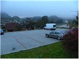
From the highway Ljubljana - Maribor we take the exit Žalec, then we continue driving in the direction of Velenje, Mislinja, Slovenj Gradec and Dravograd. When in Dravograd we cross the bridge over the river Drava we turn left and then we park on one of the marked parking lots in the center of Dravograd.
From Maribor, we can get to Dravograd also on the road which winds through the valley of the river Drava.
Route description:
From the center of Dravograd we continue on the main road towards Austria, then after some 10 meters we notice signs for Ojstrica, which direct us sharply right onto an ascending and still asphalted road. A little further ahead, the marked path splits into two parts. We continue on the left path (right Košenjak over Ojstrica), which steeply ascends past the yards of several houses, then brings us to a road, which we follow briefly to the right. After a short ascent we arrive at a smaller crossroads, where signs for Košenjak direct us onto a steep and narrow road, which higher up levels out and loses the asphalt covering. We continue briefly on the macadam road, then markers direct us left onto a steep footpath, which quickly enters a strip of forest. There follows a short ascent through the forest, then we arrive at a road, which we follow to the remains of the former castle (castle Dravograd or in German Traburg). Here we continue on the right road, which ascends over a panoramic grassy slope, then transitions into the forest, where it moderately ascends for some time. Somewhat higher, the road leads us past the "Sodni stolp" (the tower is less than a minute away from the marked path) and brings us behind it to the next panoramic area.
Further we bypass some houses, then we continue the path left on a cart track, which ascends along the edge of the hay meadow. At the top of the hay meadow the path enters the forest, through which it then moderately to occasionally steeply ascends. Higher we cross a forest road, then we ascend through the forest for some time more, but it ends on a panoramic meadow, on which in springtime Clusius's gentian grows.
On the upper part of the meadow markers lead us back into the forest, and we follow the marked path, which higher up crosses some forest road a few more times, to three or four crosses, behind which stands a larger chapel.
Further we continue briefly on the road, then markers direct us onto a footpath, which further moderately ascends through the forest. We constantly follow the well-marked path, which higher up crosses various forest roads a few more times, in the direction of Košenjak. Higher the cart track changes into a somewhat steeper footpath, and we follow only it to the top of Košenjak, which we reach after a few minutes of further walking.

Along the route: Grad Dravograd / Traburg (450m)
Photos:
 1
1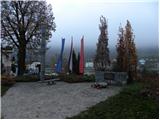 2
2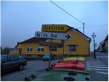 3
3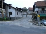 4
4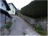 5
5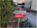 6
6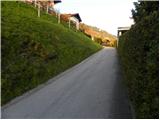 7
7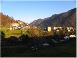 8
8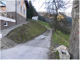 9
9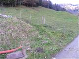 10
10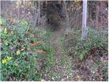 11
11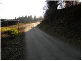 12
12 13
13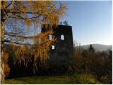 14
14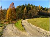 15
15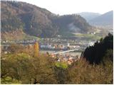 16
16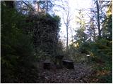 17
17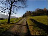 18
18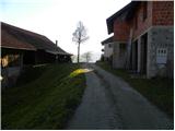 19
19 20
20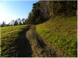 21
21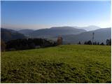 22
22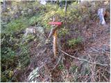 23
23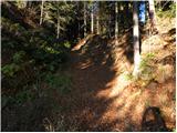 24
24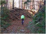 25
25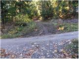 26
26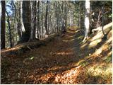 27
27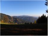 28
28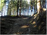 29
29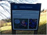 30
30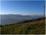 31
31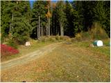 32
32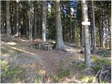 33
33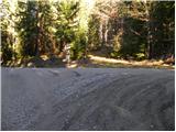 34
34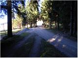 35
35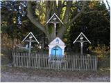 36
36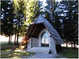 37
37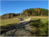 38
38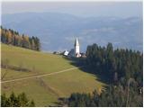 39
39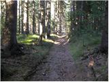 40
40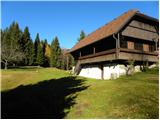 41
41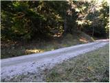 42
42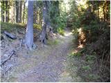 43
43 44
44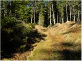 45
45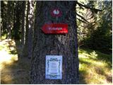 46
46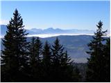 47
47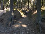 48
48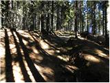 49
49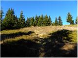 50
50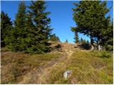 51
51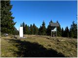 52
52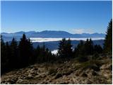 53
53
Discussion about the trip Dravograd - Huhnerkogel/Košenjak (via Goriški Vrh)
|
| Marx10. 07. 2011 |
Very interesting trail, considerable elevation gain, wonderful views.
Went alone for the first time and missed the right path twice. Markings are barely passing grade...
|
|
|
|
| JohnyR20. 09. 2011 |
Nice trail, mostly forest paths, some gravel roads. Steady incline most of the way.
We started directly at Lovski dom. Because we don't like walking through town.
The hut has almost no food available, so you need to bring your own snacks. 
True, the markings are poor, we also missed the trail once and walked about 500 m through bushes before getting back on path.
GPS track: http://www.sports-tracker.com/#/workout/IvanMarkovic/c1uou7ntsnhan9jv
|
|
|
|
| katja8721. 02. 2012 |
On Sunday, 19. 2. 2012, we went to Košenjak. The weather was great, the sun warmed us at the top. There is snow up to half a meter in places.
We walked 7 hours, did a circular tour: Dravograd - Vrh Košenjaka (via Goriški vrh) - Planinski dom Košenjak - Dravograd (via Ojstrico).
You can view the photos on the website of Planinsko društvo Matica Murska Sobota:
http://www.mojalbum.com/pdmaticams/20120219-kosenjak/foto/19447819
|
|
|
|
| _Abuh_7. 02. 2013 |
Hey, is the Košenjak mountain hut open tomorrow?
|
|
|
|
| Marko8315. 08. 2013 |
Hello. Is it possible to go up to the top by bike?
|
|
|
|
| hipi30. 07. 2018 |
The path is now exemplarily marked, the hut however one of the worse ones...
|
|
|
|
| Petra Osterman1. 11. 2018 |
There is quite some fallen timber on the path, but you can get through. The hut was closed despite the holiday  . .
|
|
|
|
| bo_zl30. 05. 2020 |
Super marked, no transversal stamp at the top, only sign of 3 Koroška mountain paths. Also no stamp at the hut, only the stamp holder. And yes, the hut is still closed today.
|
|
|
|
| bo_zl30. 05. 2020 |
Super marked, no transversal stamp at the top, only sign of 3 Koroška mountain paths. Also no stamp at the hut, only the stamp holder. And yes, the hut is still closed today.
|
|
|
|
| NeH5. 04. 2021 18:07:48 |
The path is very nice, quiet and now there's also the transversal stamp at the top.
|
|
|
To post a comment you must log in:
If you do not yet have a username, you must first
register.