Vitovlje (Križišče) - Veliki Rob
Starting point: Vitovlje (Križišče) (400 m)
| Latitude/Longitude: | 45,9411°N 13,7613°E |
| |
Walking time: 3 h
Difficulty: easy marked way
Elevation gain: 837 m
Elevation difference along the route: 900 m
Map: Goriška 1:50.000
Recommended equipment (summer): helmet
Recommended equipment (winter): helmet, ice axe, crampons
Views: 19.921
 | 2 people like this post |
Access to starting point:
From the highway Vipava - Nova Gorica we go to the exit Selo and follow the road ahead in the direction of the villages Črniče and Šempas. When we come to the village Vitovlje we pay attention, because we will in the middle of the village leave the main road and continue to drive in the direction of the farm Maloščevo (turn-off is marked). Further, we drive through the village on a narrow and steep road which higher brings us to the signpost with the inscription »Vitovska krožna pot«. We continue left past the last houses on the more and more steep road which only a little higher changes into a macadam road by which we then park (most appropriate parking spot is between the fourth and fifth station of the Way of the Cross).
Route description:
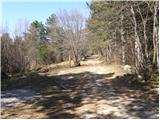
From the starting point, which is called Križišče, we continue on a deteriorating macadam road which already after a few minutes of walking brings us to a well-marked junction, where the marked path towards Trpinovišče, memorial plaque and Vodice branches off to the left. We continue on the right path, which past the stations of the Way of the Cross brings us to the next well-marked junction near the summit Vitovski hrib. We again continue right and follow the increasingly rough road which here finally changes into a cart track to a panoramic summit, on which stands a church.
From the top, we descend back to the junction, then continue the ascent in the direction of Čavna and Sekulak on the old Napoleon path. We soon come to the next junction, where the path to Skozno branches off to the left, and we continue right towards Čavna. The still gentle Napoleon path soon brings us to the steep rocky cliffs of Visoki zid. A wide path then leads us over an artificially carved panoramic ledge (danger of falling rocks) behind which the path returns into the forest and brings us to the spot where the path to Kopitnik branches off to the left.
We continue slightly right in the direction of Čavna and Sekulak on a somewhat narrower path, which first through some smaller clearings brings us to a steeper section. The path ahead ascends more steeply and only a little higher brings us to the next junction, where we continue right in the direction of the vantage point (left Kopitnik). We continue the ascent on a gentle path, which in 5 minutes of further walking brings us to the vantage point Sekulak, from which a view opens up on a larger part of the Vipava valley.
From Sekulak we continue left on the marked path which continues along an initially very panoramic ridge. Higher, the path enters the forest and only shortly after brings us to a small clearing, where the junction is noticeably worse marked.
The path left continues towards Kopitnik, and we continue right, where after a few meters we notice the signs for Veliki Rob. We continue the ascent towards Veliki Rob on an initially somewhat less visible trail. The path higher becomes clearer and after a while brings us to the vantage point, from which a view opens up on the Vipava valley, Trstelj, Gulf of Trieste and Dolomites.
We continue on the marked path, which starts to ascend more steeply, and brings us to the steeper section below the summit of Čavna (1185m). The path then levels out and continues with some shorter descents and ascents towards the east. After a few minutes of further walking we already see the summit of Velika Roba ahead of us. The path ahead from the ridge turns somewhat left and avoids the steep cliffs. This is followed by an ascent through a short stretch of forest and the path brings us to the upper slopes of the mountain, from where we have only a few dozen steps to the summit.

Photos:
 1
1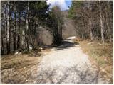 2
2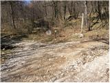 3
3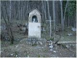 4
4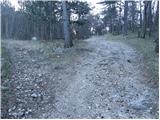 5
5 6
6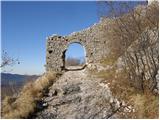 7
7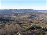 8
8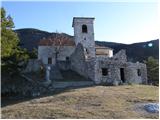 9
9 10
10 11
11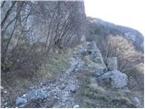 12
12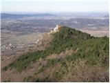 13
13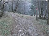 14
14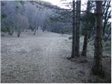 15
15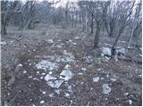 16
16 17
17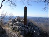 18
18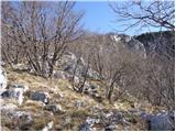 19
19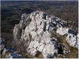 20
20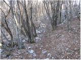 21
21 22
22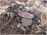 23
23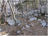 24
24 25
25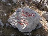 26
26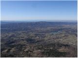 27
27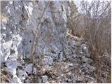 28
28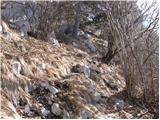 29
29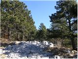 30
30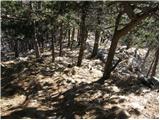 31
31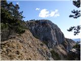 32
32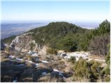 33
33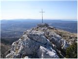 34
34 35
35
Discussion about the trip Vitovlje (Križišče) - Veliki Rob
|
| Tadej16. 03. 2009 |
Nice trip, view even a bit nicer than from neighboring Kuclje.
|
|
|
|
| Lj14. 04. 2009 |
I'm wondering if one can get from Kuclje to Veliki Rob - what is the trail like, how long does it take to walk? Regards
|
|
|
|
| Lj15. 04. 2009 |
Thanks for the information and nice photo!
|
|
|
|
| aina26. 08. 2009 |
Does anyone know the summit Sončarica or something similar, or is that another name for Veliki Rob? 
|
|
|
|
| Biser gora25. 11. 2010 |
I'm wondering if this path is trodden in winter time?
Thanks in advance
|
|
|
|
| hribar_pomidor11. 08. 2011 |
here not much snow falls anyway, so the path is well visible even in winter
|
|
|
|
| soraya4. 08. 2012 |
Two days ago, my colleague and I decided to check how Veliki Rob looks up close. Really nice tour, two and a half hours of normal walking from Vitovlje via Vitovska church. I recommend using the straight direction for ascent when you reach Sekulak, and for descent the forest path straight shortly after the summit. The left direction has quite a nice section of the trail running between stones and rocks in full sun. Well, it's survivable, but in summer the described variant is better. In short, no people anywhere, silence, complete disconnection. 
|
|
|
|
| bagi7. 04. 2015 |
Some impressions from the Vitovska circular path ... Complete peace, warm spring weather on the Vipava side, icy cold on the edge of Trnovski gozd and some snow tongues in farewell. The path led from Vitovska church to the grove of Sv. Lucija, then left towards the hunting hut and Kopitnik and continued along the edge of Trnovski gozd to Visoki rob. From here return right through Čaven and Sekulak and then along Napoleon's *road* with deep cart ruts in the stone back towards Vitovlje. There are still many variants, all well marked. The time is now just right because it's not too hot. And a question for Vipavci ...why is Anton Bavčer's hut called *na Čavnu* when it's kilometers away ???
|
|
|
|
| Zvonček5. 12. 2016 |
At the top of Veliki Rob there is only a summit logbox, no stamp. From the top of Kuclje to Veliki Rob is one hour of walking.
|
|
|
|
| Majdag11. 04. 2017 |
...Nice path and beautiful views...
..http://jelenkamenmajdag.blogspot.si/2017/04/veliki-rob-kucelj-na-cavnu-po-vitovski.html.
|
|
|
|
| Hribovka894. 01. 2019 |
Is the path very steep etc.. Could one go without gear now in January (if there's no snow of course).. thanks for info
|
|
|
|
| margu504. 01. 2019 |
Hribovka, we were there on Wednesday 2.1.2019 beautiful path. We went up via Sekulak. Since there are two signs for Veliki Rob there, we chose the ascending one, which was the right decision, we returned via the other, Sekulak-Vitovlje, which branches off left downward viewed during descent. First steep dry grasses, very careful with them, then along rocky ridges deep into the valley some 300 height meters and then across to Sekulak, where we join the ascent path. Path is marked, beautiful pure enjoyment. Good luck!
|
|
|
To post a comment you must log in:
If you do not yet have a username, you must first
register.