 | Cerknica (Senior citizens home) - Slivnica (Zatrepi - Slivnica)
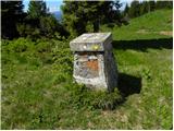
Slivnica is a 1114 m high peak located north of Cerknica polje. The view from the summit, where the entry box is located, is rather limited due t...
1 h 30 min |
 | Planina - Petričev hrib
Petričev hrib is the peak north of Postojna and west of Mountain pasture. From the summit, which has a registration box, there is a beautiful vie...
1 h 30 min |
 | Gorenje - Gora (Sveti Lovrenc) (gentle path)
Gora, or Sveti Lovrenc, is a peak above Studeni. It is a village north of Postojna, which is also a good starting point for climbing to the top o...
1 h 45 min |
 | Jablance - Skalica (Bohor) (via Travni laz)
Skalica is a less known peak in the western part of Bohor. From the summit, which has a registration box, there is a beautiful view to the south ...
2 h |
 | Jablance - Veliki Javornik (Bohor) (via Travni laz)
Veliki Javornik is the highest peak of Bohor at 1023m. Although the peak is unspoilt and there are no higher hills far around, there is no view f...
1 h 40 min |
 | Laze - Črni vrh above Novaki
Črni vrh, the highest point of the popular Cerkno ski centre, is located north-east of Novaky. From the summit, near which an artificial lake has...
2 h |
 | Ravni - Kršičevec
Kršičevec is a lesser known mountain located east of the village Jurišče in the Pivka Basin. From the grassy summit, where there is a registratio...
2 h 30 min |
| Bač - Kršičevec
Kršičevec is a lesser known mountain located east of the village Jurišče in the Pivka Basin. From the grassy summit, where there is a registratio...
2 h 15 min |
 | Bukovo - Kojca (north path)
Kojca is a scenic peak rising south of Baška Grape. The hay pile on the top offers a beautiful view of the Lower Bohinj Mountains, the Škofjelošk...
2 h 15 min |
 | Begunje (Krpin) - Smokuški vrh (on cart track and past sv. Peter)
Smokuški vrh is a scenic mountain located on a ridge between the Završnice valley and the Gorenjska plain. From the top of the hill, where there ...
1 h 50 min |
 | Rodine - Smokuški vrh (via Sankaška koča)
Smokuški vrh is a scenic mountain located on a ridge between the Završnice valley and the Gorenjska plain. From the top of the hill, where there ...
1 h 45 min |
| Begunje (Krpin) - Smokuški vrh (by road)
Smokuški vrh is a scenic mountain located on a ridge between the Završnice valley and the Gorenjska plain. From the top of the hill, where there ...
1 h 35 min |
 | Begunje (Krpin) - Smokuški vrh (through Blatnica Gorge)
Smokuški vrh is a scenic mountain located on a ridge between the Završnice valley and the Gorenjska plain. From the top of the hill, where there ...
1 h 40 min |
 | Hunting lodge below Glavica - Grmada at Slavnik
Grmada is a 998m high peak located northwest of Slavnik. From the top of the peak, where the fire safety observatory is located, you can enjoy a ...
2 h 20 min |
 | Prešnica - Grmada at Slavnik
Grmada is a 998m high peak located northwest of Slavnik. From the top of the peak, where the fire safety observatory is located, you can enjoy a ...
1 h 50 min |
| Povžane - Grmada at Slavnik (via planina Jegno)
Grmada is a 998m high peak located northwest of Slavnik. From the top of the peak, where the fire safety observatory is located, you can enjoy a ...
2 h 20 min |
| Povžane - Grmada at Slavnik
Grmada is a 998m high peak located northwest of Slavnik. From the top of the peak, where the fire safety observatory is located, you can enjoy a ...
2 h 15 min |
| Skadanščina - Grmada at Slavnik (via planina Jegno)
Grmada is a 998m high peak located northwest of Slavnik. From the top of the peak, where the fire safety observatory is located, you can enjoy a ...
2 h 15 min |
| Skadanščina - Grmada at Slavnik (via Planina Jegno)
Grmada is a 998m high peak located northwest of Slavnik. From the top of the peak, where the fire safety observatory is located, you can enjoy a ...
2 h 10 min |
 | Podpeč - Grmada on Mala gora
Grmada (also Grmada nad Ortnek) is an 887 m high peak located above the village of Vrh pri Poljanah in the Mala Gora mountain range. Just a few m...
1 h 35 min |
 | Spodnja Kokra - Baba
Baba is a 1119 m high peak located to the west of Čemšenik. From the summit, where the registration box is located, you can enjoy a beautiful vie...
1 h 35 min |
 | Hunting cottage Vojkovo - Grmada (Nanos)
Grmada is a 1209 m high peak located to the north-west of the better known Plesa. From the summit, where there is a registration box with a stamp...
1 h 35 min |
 | Oblakov Vrh - Hudournik
Hudournik is a 1148 m high peak located on the northern edge of the Vojskar plateau, a plateau situated between the valleys of the Idrijca, Kanom...
1 h 30 min |
 | Smrečje - Goli vrh
Goli vrh, also known as Golni vrh on maps, is a nondescript forested peak located above the scattered settlement of Goli Vrh. There is no view fr...
1 h 30 min |
 | Bohinjska Češnjica - Rudnica
Rudnica is a scenic mountain located between the Lower and Upper Bohinj Valley. From the top, where there is a registration box with a stamp and ...
1 h 30 min |
| Srednja vas (Senožeta) - Rudnica
Rudnica is a scenic mountain located between the Lower and Upper Bohinj Valley. From the top, where there is a registration box with a stamp and ...
1 h 30 min |
 | Nemilje - Sveti Mohor (Zabrekve) (via Prevoje)
The Church of St. Mohor is situated on a 952 m high hill, between Zgornja Besnica and Selce. From the church, or its immediate surroundings, we h...
1 h 35 min |
 | Livek - Kuk (Kolovrat)
At 1243 m, Kuk is the highest peak of the Kolovrat, the mountain range from Livko to Kambreški. The summit, which has several transmitters, offer...
1 h 30 min |
 | Podmeja - Javor
Javor is a 1132 m high peak located between Kisovec and Sveta mountain pasture. There is no view from the top, which is covered with forest, but ...
2 h |
 | Dom pod Reško planino - Javor
Javor is a 1132 m high peak located between Kisovec and Sveta mountain pasture. There is no view from the top, which is covered with forest, but ...
2 h 5 min |
 | Tržič - Veliki vrh above Završnik (Milanova pot)
Veliki vrh above Završnik is a 968 m high mountain located in the Pirmance ridge, north to north-east of Tržič. From the grassy summit, where the...
1 h 40 min |
 | Jeršiče - Baba (at Javorniki)
Baba is a 1085 m high peak located between the Javorniki Ridge and Sveta Trojica. From the grassy summit, we have a beautiful view of the Javorni...
1 h 30 min |
 | Možjanca - Kopa (Partizanski vrh)
Kopa, also Partizanski vrh, is a 1024-metre high mountain located west of the Davovec saddle, which is west to south-west of Krvavec. There is a ...
1 h 30 min |
| Kokra (resting place Kokra-sotočje) - Kopa (Partizanski vrh)
Kopa, also Partizanski vrh, is a 1024-metre high mountain located west of the Davovec saddle, which is west to south-west of Krvavec. There is a ...
1 h 45 min |
 | Bottom station of cableway on Krvavec - Skutman (via Kopa)
Skutman is a lesser-known peak located above the left bank of the Kokra River and north of Štefanje Gora. The summit is marked by a metal sign wi...
1 h 45 min |
| Spodnja Kokra - Skutman (via Kopa)
Skutman is a lesser-known peak located above the left bank of the Kokra River and north of Štefanje Gora. The summit is marked by a metal sign wi...
2 h |
 | Bela Peč - Ojstri vrh (above Prevala) (past peak Seduc)
Ojstri vrh is a 1,197-metre-high mountain located between Seduc Peak and Prevala. From the top, you can enjoy a beautiful view of the surrounding...
1 h 30 min |
 | Bela Peč - Ojstri vrh (above Prevala) (via Ovčje jame)
Ojstri vrh is a 1,197-metre-high mountain located between Seduc Peak and Prevala. From the top, you can enjoy a beautiful view of the surrounding...
1 h 45 min |
 | Leše - Andrejev vrh (via Leše churches and via chapel)
Andrejev vrh is a forested peak located between Mežica and Lesa. There is a bench on the top and a registration box with a registration book....
1 h 35 min |
| Leše - Andrejev vrh (past Leše churches and on cart track)
Andrejev vrh is a forested peak located between Mežica and Lesa. There is a bench on the top and a registration box with a registration book....
1 h 30 min |
 | Podblica - Bela peč (Podbliška gora)
Bela peč is located on the edge of Jelovica above the village of Podblica. From the top of the cliff we have a beautiful view of the village, the...
1 h 30 min |
 | Črna na Koroškem (Mušenik) - Pikov vrh (via Koča na Pikovem)
Pikov vrh is a 1149 m high peak located above Podpeca, more precisely above the Pik homestead, near the Koča na Pikovem. On the top there is a re...
1 h 45 min |
 | Črna na Koroškem (Mušenik) - Veliki vrh (above Mežiška dolina) (via Šumahovo sedlo)
Veliki vrh is a 1165-metre-high peak located between Mežica and Črna na Koroškem. On the summit, there is a registration box with a registration ...
1 h 45 min |
 | Črna na Koroškem (Mušenik) - Šumahov vrh (via Šumahovo sedlo)
Šumahov vrh is a 1155-metre-high peak on which a wooden cross is erected. From the top, which descends steeply towards Žerjav, we have a beautifu...
1 h 45 min |
 | Spodnja Kokra - Škrbina (Slaparjeva gora) (via farm Zajc)
Škrbina is a 1142 m high peak located in the ridge of Slaparjeva gora, which is above the Kokra valley. From the top, we have a beautiful view to...
1 h 40 min |
 | Rodine - Pleče (via Sankaška koča)
Pleče is a 1131-metre-high peak located north of St Peter above Begunje. The summit is covered by forest, but from near the top, we can enjoy som...
1 h 50 min |
| Begunje (Krpin) - Pleče (by ski slope and via Sankaška koča)
Pleče is a 1131-metre-high peak located north of St Peter above Begunje. The summit is covered by forest, but from near the top, we can enjoy som...
1 h 45 min |
| Begunje (PGD Begunje) - Pleče (Petrova pot)
Pleče is a 1131-metre-high peak located north of St Peter above Begunje. The summit is covered by forest, but from near the top, we can enjoy som...
1 h 45 min |
| Begunje (Krpin) - Pleče (by road)
Pleče is a 1131-metre-high peak located north of St Peter above Begunje. The summit is covered by forest, but from near the top, we can enjoy som...
1 h 40 min |
| Begunje (Krpin) - Pleče (through Blatnica Gorge)
Pleče is a 1131-metre-high peak located north of St Peter above Begunje. The summit is covered by forest, but from near the top, we can enjoy som...
1 h 45 min |
 | Bukovo - Črvov vrh
Črvov vrh, also known as Črvov grič, is the highest peak of the Šentviška plateau, rising above the right bank of the Idrijca and the left bank o...
1 h 30 min |
 | Žiri - Krog (Ledinski grič)
Krog is a 940 m high peak located on the western part of the Ledinski grič ridge, which is situated between the Jerešča and Ledinščica watercours...
1 h 50 min |
| Govejk - Krog (Ledinski grič)
Krog is a 940 m high peak located on the western part of the Ledinski grič ridge, which is situated between the Jerešča and Ledinščica watercours...
1 h 45 min |
| Sovodenj - Krog (Ledinski grič)
Krog is a 940 m high peak located on the western part of the Ledinski grič ridge, which is situated between the Jerešča and Ledinščica watercours...
2 h 5 min |
 | Medvodje - Penatca
Penatca is a 1299 m high peak located above the right bank of the Tržiška Bistrica. The peak itself is located in a forest, and a few steps west ...
1 h 40 min |
 | Jelendol (mansion Puterhof) - Primožkovi hribi
Primožkovi hribi is a small ridge above Jelendol, located between the watercourses of the Tržiška Bistrica, Dolžanka and Zalega potok. The highes...
1 h 40 min |
| MHE Zali potok - Primožkovi hribi
Primožkovi hribi is a small ridge above Jelendol, located between the watercourses of the Tržiška Bistrica, Dolžanka and Zalega potok. The highes...
1 h 30 min |
 | Medvodje - Medvodnica (via Tržiška Bistrica)
Medvodnica is a 1202 metre high mountain located between the Košutna and Tržiška Bistrica watercourses. The peak is located in a forest, so there...
1 h 30 min |
| Medvodje - Medvodnica (via Košutnik)
Medvodnica is a 1202 metre high mountain located between the Košutna and Tržiška Bistrica watercourses. The peak is located in a forest, so there...
1 h 25 min |
 | Veliki Boč (Zgornji Kovač) - Možičev vrh (via Žavcarjev vrh)
Možičev vrh is a 926 m high peak located to the west of the better known, but slightly lower, Žavcar Peak. There is a track leading to the summit...
1 h 40 min |
 | Veliko Tinje - Repnikov vrh
Repnikov vrh is a 988 m high peak on Pohorje, located between Mountain pasture below Šumik and Urh. The peak is located in the middle of the fore...
1 h 25 min |
 | Schrems/Frohnleiten (Hautabauer) - Harterberg (Hoaterberg)
...
2 h |
 | Übelbach - Schankkogel
...
1 h 30 min |
 | Übelbach - Schankkogel (steep path)
...
1 h 30 min |