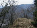
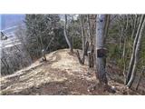
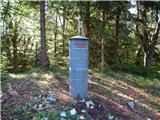
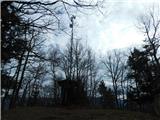
 | Polhov Gradec - Polhograjska Grmada (via Ravnek and via Sveta Uršula)
Polhograjska Grmada is an 898 m high peak located in the heart of the Polhograjski Dolomiti. The summit, which has a registration box with a stam...
1 h 50 min |
 | Gosteče - Osolnik (via Vidmovec)
Osolnik is an 858 m high mountain located south of Škofja Loka and west of Medvode. From the top, where the Church of St. Mohor and Fortunatus st...
1 h 30 min |
 | Sveta Barbara (Nova Hrastnica) - Osolnik
Osolnik is an 858 m high mountain located south of Škofja Loka and west of Medvode. From the top, where the Church of St. Mohor and Fortunatus st...
1 h 50 min |
 | Mlinše - Zasavska Sveta gora
Zasavska Sveta gora is a popular excursion point located between Litija and Izlaki. From the top, where the parish church of the Nativity of the ...
1 h 30 min |
 | Vidrga - Zasavska Sveta gora (on forest footpath)
Zasavska Sveta gora is a popular excursion point located between Litija and Izlaki. From the top, where the parish church of the Nativity of the ...
1 h 30 min |
| Vidrga - Zasavska Sveta gora (on a cart track)
Zasavska Sveta gora is a popular excursion point located between Litija and Izlaki. From the top, where the parish church of the Nativity of the ...
1 h 30 min |
 | Cerknica (Senior citizens home) - Slivnica (Zatrepi - Slivnica)
Slivnica is a 1114 m high peak located north of Cerknica polje. The view from the summit, where the entry box is located, is rather limited due t...
1 h 30 min |
 | Sveta Barbara (Nova Hrastnica) - Sveti Ožbolt (above Zminec)
Sveti Ožbolt is located on a scenic peak in the north of the Polhograjske Dolomites. It has a beautiful view of the Škofjeloško hribovje and part...
1 h 40 min |
 | Dorfarje - Archangel Gabriel (Planica)
Planica is an 824 m high peak located north of Škofja Loka, between Krizna Gora and Planica. From the top, where the Church of St. Gabriel the Ar...
2 h |
 | Hotovlja - Bukov vrh (by road)
Bukov vrh, on which the Church of the Sorrowful Mother of God stands, is located in the north-western part of the Polhograje hills. From the top ...
1 h 30 min |
 | Planina - Petričev hrib
Petričev hrib is the peak north of Postojna and west of Mountain pasture. From the summit, which has a registration box, there is a beautiful vie...
1 h 30 min |
| Planina (Dolnja Planina) - Petričev hrib (via Zavrtniki)
Petričev hrib is the peak north of Postojna and west of Mountain pasture. From the summit, which has a registration box, there is a beautiful vie...
1 h 35 min |
| Planina (Dolnja Planina) - Petričev hrib (via Sv. Duh)
Petričev hrib is the peak north of Postojna and west of Mountain pasture. From the summit, which has a registration box, there is a beautiful vie...
1 h 35 min |
 | Gorenje - Gora (Sveti Lovrenc) (gentle path)
Gora, or Sveti Lovrenc, is a peak above Studeni. It is a village north of Postojna, which is also a good starting point for climbing to the top o...
1 h 45 min |
 | Spodnje Stranice (graves of hundred hostages) - Stolpnik (by road)
At 1012 m, Stolpnik is the highest peak of the Konjiška Gora, a mountain range stretching south-west from Slovenske Konjice. A 25 m high lookout ...
2 h |
 | Selca - Miklavška gora (by road)
Miklavška gora is a lookout located south of Železniki and Selce. From the top of the hill on which the Church of St Nicholas stands, we have a b...
1 h 45 min |
 | Begunje (Krpin) - Smokuški vrh (on cart track and past sv. Peter)
Smokuški vrh is a scenic mountain located on a ridge between the Završnice valley and the Gorenjska plain. From the top of the hill, where there ...
1 h 50 min |
 | Rodine - Smokuški vrh (via Sankaška koča)
Smokuški vrh is a scenic mountain located on a ridge between the Završnice valley and the Gorenjska plain. From the top of the hill, where there ...
1 h 45 min |
| Begunje (Krpin) - Smokuški vrh (by road)
Smokuški vrh is a scenic mountain located on a ridge between the Završnice valley and the Gorenjska plain. From the top of the hill, where there ...
1 h 35 min |
 | Begunje (Krpin) - Smokuški vrh (through Blatnica Gorge)
Smokuški vrh is a scenic mountain located on a ridge between the Završnice valley and the Gorenjska plain. From the top of the hill, where there ...
1 h 40 min |
 | Podpeč - Grmada on Mala gora
Grmada (also Grmada nad Ortnek) is an 887 m high peak located above the village of Vrh pri Poljanah in the Mala Gora mountain range. Just a few m...
1 h 35 min |
| Novi Lazi - Livoldski vrh
Livoldski vrh is a forested peak located in the south-eastern part of Stojna. The summit has a registration box and a stamp....
1 h 10 min |
 | Vitovlje - Hunting cottage below Čaven
The hunting shelter is located on a lookout on the side ridge of the Čavna. The shelter, which serves as an emergency bivouac, offers a beautiful...
1 h 50 min |
 | Zabočevo - Novaška gora
Novaška gora is a forested peak located west of Rakitna....
2 h |
 | Straža (Jesenice) - Jelenkamen (via Kozjek - east path)
Jelenkamen is a peak belonging to the northern Caravan Mountains above Jesenice, interesting especially for local hikers in the mountain pasture,...
1 h 15 min |
 | Jesenice (Ukova) - Jelenkamen (via Dole)
Jelenkamen is a peak belonging to the northern Caravan Mountains above Jesenice, interesting especially for local hikers in the mountain pasture,...
1 h 20 min |
 | Koroška Bela (RC Kres) - Alničje (hunting path)
Alničje is a 1145 m high ridge rising from the SW above the settlements of Koroška bela and Javornik in Jesenik, and running NE in the direction ...
1 h 20 min |
 | Spodnja Kokra - Baba
Baba is a 1119 m high peak located to the west of Čemšenik. From the summit, where the registration box is located, you can enjoy a beautiful vie...
1 h 35 min |
 | Potoče - Baba (via sv. Jakob and source below Potoška gora)
Baba is a 1119 m high peak located to the west of Čemšenik. From the summit, where the registration box is located, you can enjoy a beautiful vie...
2 h 10 min |
 | Razdrto - Grmada (Nanos)
Grmada is a 1209 m high peak located to the north-west of the better known Plesa. From the summit, where there is a registration box with a stamp...
2 h 5 min |
 | Poljana - Smolnik
Smolnik is a steep 1075 m high peak - a solitary peak below Valvasor's house, rising above the Zavrh (Završnica) valley, with a view of Hochstuhl...
1 h 15 min |
 | Polhov Gradec - Mala Grmada (via Ravnek and via Sveta Uršula)
Mala Grmada is an 853 m high peak located south-west of the slightly higher Polhograjska Grmada. From the top, you have a beautiful view over the...
1 h 35 min |
| Polhov Gradec (Božna) - Mala Grmada (via Sveta Uršula)
Mala Grmada is an 853 m high peak located south-west of the slightly higher Polhograjska Grmada. From the top, you have a beautiful view over the...
1 h 10 min |
 | Zazid - Golič (direct way)
Golič is a grassy ridge stretching from Kojnik to the Slovenian-Croatian border and continuing to Žbevnica on the Croatian side. Due to the relat...
1 h 45 min |
 | Nemilje - Sveti Mohor (Zabrekve)
The Church of St. Mohor is situated on a 952 m high hill, between Zgornja Besnica and Selce. From the church, or its immediate surroundings, we h...
1 h 20 min |
 | Selca - Sveti Mohor (Zabrekve)
The Church of St. Mohor is situated on a 952 m high hill, between Zgornja Besnica and Selce. From the church, or its immediate surroundings, we h...
1 h 40 min |
 | Knape - Sveti Mohor (Zabrekve) (via Hudi Laz, Flandrova pot)
The Church of St. Mohor is situated on a 952 m high hill, between Zgornja Besnica and Selce. From the church, or its immediate surroundings, we h...
1 h 40 min |
 | Nemilje - Sveti Mohor (Zabrekve) (via Prevoje)
The Church of St. Mohor is situated on a 952 m high hill, between Zgornja Besnica and Selce. From the church, or its immediate surroundings, we h...
1 h 35 min |
 | Ribenski most - Tolsti vrh (Talež)
Tolsti vrh is an 883 m high hill located south of Bled, above the Talež Hunting Lodge. The summit, which descends steeply towards the Sava Bohinj...
1 h 15 min |
 | Selski most - Tolsti vrh (Talež)
Tolsti vrh is an 883 m high hill located south of Bled, above the Talež Hunting Lodge. The summit, which descends steeply towards the Sava Bohinj...
1 h 15 min |
 | Vitanje - Stenica (via valley of the stream Jez)
Stenica is a 1091 m high peak located between Vitanje, Stranice and Frankolovi. There is no view from the top, which has a stamp with a registrat...
1 h 50 min |
 | Dom pod Reško planino - Javor
Javor is a 1132 m high peak located between Kisovec and Sveta mountain pasture. There is no view from the top, which is covered with forest, but ...
2 h 5 min |
 | Tržič - Veliki vrh above Završnik (Milanova pot)
Veliki vrh above Završnik is a 968 m high mountain located in the Pirmance ridge, north to north-east of Tržič. From the grassy summit, where the...
1 h 40 min |
| Nevlje pri Kamniku - Vovar
An obscure hill in front of the Kamnik mountains. Recently covered by storms, it has been covered with wood harvesting tracks.There is also a sma...
1 h 30 min |
 | Ukova (Jesenice) - Mirca (via Pekova plan'ca)
Mirca (dialect Merca) is one of the peaks of the southern Karavanke mountain range with an altitude of 1025 m. It rises north above the centre of...
1 h 20 min |
 | Murova - Mirca
Mirca (dialect Merca) is one of the peaks of the southern Karavanke mountain range with an altitude of 1025 m. It rises north above the centre of...
1 h 10 min |
 | Jeršiče - Baba (at Javorniki)
Baba is a 1085 m high peak located between the Javorniki Ridge and Sveta Trojica. From the grassy summit, we have a beautiful view of the Javorni...
1 h 30 min |
 | Kokra (resting place Kokra-sotočje) - Kopa (Partizanski vrh)
Kopa, also Partizanski vrh, is a 1024-metre high mountain located west of the Davovec saddle, which is west to south-west of Krvavec. There is a ...
1 h 45 min |
 | Bottom station of cableway on Krvavec - Skutman (via Kopa)
Skutman is a lesser-known peak located above the left bank of the Kokra River and north of Štefanje Gora. The summit is marked by a metal sign wi...
1 h 45 min |
| Spodnja Kokra - Skutman (via Kopa)
Skutman is a lesser-known peak located above the left bank of the Kokra River and north of Štefanje Gora. The summit is marked by a metal sign wi...
2 h |
 | Bele Vode (Kovač) - Sveti Križ above Bele Vode (on south ridge)
Sveti Križ is a scenic mountain located above Beli Voda. From the top, which is home to a number of church buildings and a conversion tower, we h...
1 h 10 min |
 | Poljana - Andrejev vrh (over Volinjak and on cart track)
Andrejev vrh is a forested peak located between Mežica and Lesa. There is a bench on the top and a registration box with a registration book....
1 h 50 min |
| Poljana - Andrejev vrh (via Volinjak and past the chapel)
Andrejev vrh is a forested peak located between Mežica and Lesa. There is a bench on the top and a registration box with a registration book....
1 h 55 min |
| Poljana - Andrejev vrh (past Leše churches and on cart track)
Andrejev vrh is a forested peak located between Mežica and Lesa. There is a bench on the top and a registration box with a registration book....
1 h 50 min |
| Poljana - Andrejev vrh (via Leše churches and via chapel)
Andrejev vrh is a forested peak located between Mežica and Lesa. There is a bench on the top and a registration box with a registration book....
1 h 55 min |
 | Selca - Sleme (Površnica)
Sleme is a scenic peak located between Rudni, Dražgoše and Lajša. The summit, where the transmitters are located, offers a beautiful view of the ...
1 h 35 min |
| Železniki - Sleme (Površnica) (via Štalca)
Sleme is a scenic peak located between Rudni, Dražgoše and Lajša. The summit, where the transmitters are located, offers a beautiful view of the ...
1 h 35 min |
 | Selca - Sveti Križ above Selca
The Sveti Križ above Selca church is situated on a lookout point, which offers a beautiful view over part of the Škofjeloško hribovje....
1 h 15 min |
| Železniki - Sveti Križ above Selca (via Štalca)
The Sveti Križ above Selca church is situated on a lookout point, which offers a beautiful view over part of the Škofjeloško hribovje....
1 h 15 min |
 | Mežica - Jesenik (Jesenikov vrh) (via saddle Vrh šteng)
Jesenik is a 1199 m high forested peak located between Mežica and Podpec....
2 h |
 | Mežica - Jesenik (Jesenikov vrh) (via homestead Jesenik)
Jesenik is a 1199 m high forested peak located between Mežica and Podpec....
2 h 5 min |
 | Mežica - Pikov vrh (via homestead Jesenik)
Pikov vrh is a 1149 m high peak located above Podpeca, more precisely above the Pik homestead, near the Koča na Pikovem. On the top there is a re...
2 h |
| Črna na Koroškem (Mušenik) - Pikov vrh (via Koča na Pikovem)
Pikov vrh is a 1149 m high peak located above Podpeca, more precisely above the Pik homestead, near the Koča na Pikovem. On the top there is a re...
1 h 45 min |
 | Črna na Koroškem (Mušenik) - Veliki vrh (above Mežiška dolina) (via Šumahovo sedlo)
Veliki vrh is a 1165-metre-high peak located between Mežica and Črna na Koroškem. On the summit, there is a registration box with a registration ...
1 h 45 min |
 | Črna na Koroškem (Mušenik) - Šumahov vrh (via Šumahovo sedlo)
Šumahov vrh is a 1155-metre-high peak on which a wooden cross is erected. From the top, which descends steeply towards Žerjav, we have a beautifu...
1 h 45 min |
 | Spodnja Kokra - Škrbina (Slaparjeva gora) (via farm Zajc)
Škrbina is a 1142 m high peak located in the ridge of Slaparjeva gora, which is above the Kokra valley. From the top, we have a beautiful view to...
1 h 40 min |
 | Dravograd (Meža) - Sveti Danijel (above Trbonje)
The Church of St. Danijel is located on the outskirts of the village of St. Danijel, just above Trbonyi. From the church we have a beautiful view...
1 h 30 min |
 | Rodine - Pleče (via Sankaška koča)
Pleče is a 1131-metre-high peak located north of St Peter above Begunje. The summit is covered by forest, but from near the top, we can enjoy som...
1 h 50 min |
| Begunje (Krpin) - Pleče (by ski slope and via Sankaška koča)
Pleče is a 1131-metre-high peak located north of St Peter above Begunje. The summit is covered by forest, but from near the top, we can enjoy som...
1 h 45 min |
| Begunje (PGD Begunje) - Pleče (Petrova pot)
Pleče is a 1131-metre-high peak located north of St Peter above Begunje. The summit is covered by forest, but from near the top, we can enjoy som...
1 h 45 min |
| Begunje (Krpin) - Pleče (by road)
Pleče is a 1131-metre-high peak located north of St Peter above Begunje. The summit is covered by forest, but from near the top, we can enjoy som...
1 h 40 min |
| Begunje (Krpin) - Pleče (through Blatnica Gorge)
Pleče is a 1131-metre-high peak located north of St Peter above Begunje. The summit is covered by forest, but from near the top, we can enjoy som...
1 h 45 min |
 | Grahovo ob Bači (Brelih) - Črvov vrh (via Žrelo)
Črvov vrh, also known as Črvov grič, is the highest peak of the Šentviška plateau, rising above the right bank of the Idrijca and the left bank o...
1 h 50 min |
| Grahovo ob Bači (Brelih) - Črvov vrh (via homestead Pušnik)
Črvov vrh, also known as Črvov grič, is the highest peak of the Šentviška plateau, rising above the right bank of the Idrijca and the left bank o...
1 h 40 min |
 | Grahovo ob Bači (Brelih) - Bukovski vrh (via Žrelo)
Bukovo vrh (918 m) is located above the settlement Bukovo Vrh, more precisely above the homestead at Pircu.From the grassy summit we have a beaut...
1 h 40 min |
 | Ledinica - Krog (Ledinski grič)
Krog is a 940 m high peak located on the western part of the Ledinski grič ridge, which is situated between the Jerešča and Ledinščica watercours...
1 h 15 min |
 | Žiri - Krog (Ledinski grič)
Krog is a 940 m high peak located on the western part of the Ledinski grič ridge, which is situated between the Jerešča and Ledinščica watercours...
1 h 50 min |
 | Hotavlje - Špik (Vranškov grič) (via Bela)
Špik, also known as Vranškov grič on maps, is a 908 m high mountain located west of Hotavlje. The peak is located in a forest, but the grassy for...
1 h 50 min |
| Podgora - Špik (Vranškov grič)
Špik, also known as Vranškov grič on maps, is a 908 m high mountain located west of Hotavlje. The peak is located in a forest, but the grassy for...
1 h 45 min |
 | Hotavlje - Kucelj (above Kopačnica) (via village Studor)
Kucelj is a 920-metre-high peak located above the left bank of the Kopačnica and above the village of the same name. On the top there is a bench,...
2 h 10 min |
| Hotavlje - Kucelj (above Kopačnica) (via Srednje Brdo)
Kucelj is a 920-metre-high peak located above the left bank of the Kopačnica and above the village of the same name. On the top there is a bench,...
1 h 55 min |
 | Bresternica (Spodnji Rušnik) - Možičev vrh (via Žavcarjev vrh)
Možičev vrh is a 926 m high peak located to the west of the better known, but slightly lower, Žavcar Peak. There is a track leading to the summit...
1 h 55 min |
 | Übelbach - Schankkogel
...
1 h 30 min |
 | Übelbach - Schankkogel (strma pot)
...
1 h 30 min |
 | Mixnitz (Parkirišče Bärenschützklamm) - Rannerwandkreuz
...
1 h 45 min |
 | Janževa Gora - Janžev vrh (mimo cerkve sv. Janeza Krstnika)
...
1 h 35 min |
 | Janževa Gora - Kranjčeva pečina (mimo cerkve sv. Janeza Krstnika)
...
2 h 10 min |