Planina (Dolnja Planina) - Petričev hrib (via Sv. Duh)
Starting point: Planina (Dolnja Planina) (458 m)
| Lat/Lon: | 45,8361°N 14,2554°E |
| |
Name of path: via Sv. Duh
Time of walking: 1 h 35 min
Difficulty: easy unmarked way
Altitude difference: 479 m
Altitude difference po putu: 500 m
Map:
Recommended equipment (summer):
Recommended equipment (winter): crampons
Views: 2.153
 | 1 person likes this post |
Access to the starting point:
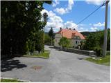
a) From the motorway Ljubljana - Koper, take the exit Unec and then continue driving in the route Mountain pasture. In Mountain pasture, where you join the old road Logatec - Postojna, continue to the left, and we drive along the main road for only a few 10 m, because then just after the parish church of St. Marjeta turn left into the parking lot next to the church.
b) From Logatec or Idrija, drive to Kalce near Logatec, and from there continue along the old road towards Postojna. At the beginning of Mountain pasture, the road from Unec joins from the left, and from here we continue along the main road for only a few more 10 m, because then just after the parish church of St. Marjeta, we turn left into the parking lot next to the church.
c) Take the Postojna, then continue along the old road towards Logatec. At the end of the settlement Mountain pasture you will come to the parish church of St. Marjeta, where you park in the parking lot next to it.
Path description:
From the church, continue along the main road towards Postojna, and we follow it to the first road turning off to the right (we walk along the road for about 100 m, ignoring the access roads to the yard). Strane road splits into two after a few metres, and we continue along the upper left road, which is also the one we are directed to by the yellow arrow painted on the asphalt. The asphalt ends at the last house and we continue on cart track, which turns into a forest. Higher up, cart track is laid and leads us past the abandoned or decaying Church of the Holy Spirit.
From the church, we climb for a short time, barely noticeable, and then at a small crossroads we continue slightly to the right. A little further on, cross a dirt road, after which cart track gradually becomes steeper. In the middle of the left bend, a path joins us from the right via Zavrtnikovi, and at the crossroads, a few steps higher, we continue along the left-hand cart track.
The path then leads us past several signs (small chapels or crosses along the way), and then the path from the quarry joins us from the left.
Here you continue to the right and within a few minutes walk you reach the Church of St Mary on Planinska Gora.
To the west of the church, near the forest road, you can see cart track crossing the slopes to the west. Follow the above-mentioned cart track, which leads us higher out of the forest onto the grassy slopes, where it disappears. Continue ascending along one of the many, mostly less visible, paths leading westwards. The path soon leads to the Petričev hrib lookout (the peak can also be bypassed on the left-hand side), from which you descend to a small, inconspicuous saddle between the two peaks. From the saddle, there is only a short climb up a grassy slope.
In fine weather, despite the many paths, orientation is not particularly difficult, but in fog it is very difficult.

Pictures:
 1
1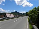 2
2 3
3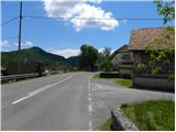 4
4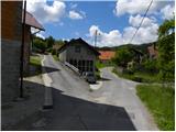 5
5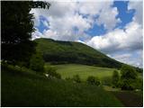 6
6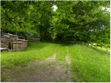 7
7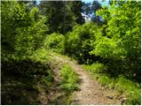 8
8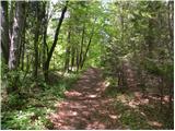 9
9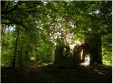 10
10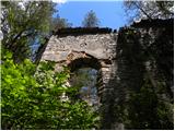 11
11 12
12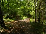 13
13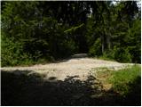 14
14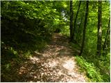 15
15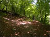 16
16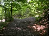 17
17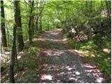 18
18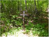 19
19 20
20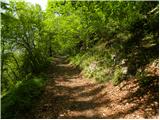 21
21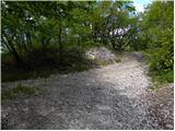 22
22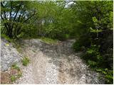 23
23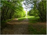 24
24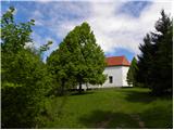 25
25 26
26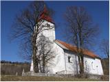 27
27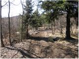 28
28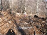 29
29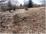 30
30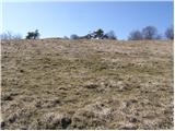 31
31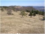 32
32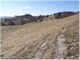 33
33 34
34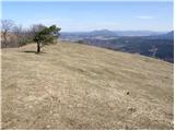 35
35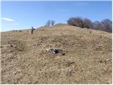 36
36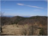 37
37 38
38
Discussion about the trail Planina (Dolnja Planina) - Petričev hrib (via Sv. Duh)