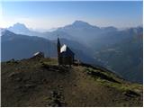
 | Erjavčeva koča na Vršiču - Prisank / Prisojnik (Slovenska pot)
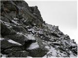
Prisank, also known as Prisojnik, is a 2547 m high mountain located above the valleys of Mlinarica, Krnica and Suha Pišnica. From the summit, whe...
3 h 45 min |
 | end of road on Pokljuka - Triglavski dom na Kredarici
Triglavski dom na Kredarici is Slovenia's highest-serviced mountain hut. It is open all year round, but outside the season only on an emergency b...
5 h |
| Rudno polje - Triglavski dom na Kredarici
Triglavski dom na Kredarici is Slovenia's highest-serviced mountain hut. It is open all year round, but outside the season only on an emergency b...
5 h 25 min |
| Uskovnica (Razpotje) - Triglavski dom na Kredarici (via planina Spodnji Tosc)
Triglavski dom na Kredarici is Slovenia's highest-serviced mountain hut. It is open all year round, but outside the season only on an emergency b...
5 h 30 min |
 | Sella Nevea - Prestreljenik (via Rifugio Gilberti)
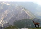
Prestreljenik is a 2499 m high mountain located in the heart of the Kanin Mountains. From the top, where the Aljaž Tower-shaped registration box ...
4 h 15 min |
| Sella Nevea - Prestreljenik (via 636)
Prestreljenik is a 2499 m high mountain located in the heart of the Kanin Mountains. From the top, where the Aljaž Tower-shaped registration box ...
3 h 45 min |
 | End of road on Pokljuka - Begunjski vrh
Begunjski vrh is a 2461 m high mountain located in the heart of the highest mountains in the Julian Alps. From the top, which has a registration ...
5 h 55 min |
 | Planina Podvežak - Planjava (via Srebrno sedlo)
Planjava is a small mountain range east of Kamniško sedlo. It has two peaks, eastern and western. A marked trail leads to the eastern peak, which...
4 h 15 min |
 | Planina Podvežak - Planjava (via Škarje)
Planjava is a small mountain range east of Kamniško sedlo. It has two peaks, eastern and western. A marked trail leads to the eastern peak, which...
4 h 45 min |
| Planina Ravne - Planjava (via Dolga trata and Srebrno sedlo)
Planjava is a small mountain range east of Kamniško sedlo. It has two peaks, eastern and western. A marked trail leads to the eastern peak, which...
5 h 30 min |
| Planina Ravne - Planjava (via Dolga trata and Škarje)
Planjava is a small mountain range east of Kamniško sedlo. It has two peaks, eastern and western. A marked trail leads to the eastern peak, which...
6 h |
 | Kraljev dol - Planjava (via Srebrno sedlo)
Planjava is a small mountain range east of Kamniško sedlo. It has two peaks, eastern and western. A marked trail leads to the eastern peak, which...
4 h 30 min |
 | Ravne - Mittagskogel/Kepa
Kepa, also known as Jepa or Mittagskogel in German, is a panoramic mountain in the western Karawanks, located on the border ridge between Sloveni...
4 h 15 min |
 | Kriška planina - Kalška gora (via Zvoh)
Kalška gora is located between Kalški greben and Kokrsko sedlo. From the top, which is covered with grass, there is a beautiful view towards the ...
4 h 45 min |
| Dom na Gospincu - Kalška gora (via Zvoh)
Kalška gora is located between Kalški greben and Kokrsko sedlo. From the top, which is covered with grass, there is a beautiful view towards the ...
4 h 45 min |
| Planina Jezerca - Kalška gora (via Dom na Krvavcu and Zvoh)
Kalška gora is located between Kalški greben and Kokrsko sedlo. From the top, which is covered with grass, there is a beautiful view towards the ...
5 h |
 | Planina Podvežak - Ojstrica (via Kocbekov dom)
Ojstrica, named after its sharp shape, rises steeply above the Korošica River, the Logar Valley and Robanov Kot. From the top, where the registra...
4 h |
 | Planina Ravne - Ojstrica (via Mala Ojstrica)
Ojstrica, named after its sharp shape, rises steeply above the Korošica River, the Logar Valley and Robanov Kot. From the top, where the registra...
4 h 15 min |
| Planina Ravne - Ojstrica (via Dolga trata and Kocbekov dom)
Ojstrica, named after its sharp shape, rises steeply above the Korošica River, the Logar Valley and Robanov Kot. From the top, where the registra...
5 h 15 min |
| Planina Ravne - Ojstrica (via Dolga trata and Mala Ojstrica)
Ojstrica, named after its sharp shape, rises steeply above the Korošica River, the Logar Valley and Robanov Kot. From the top, where the registra...
4 h 45 min |
| Kraljev dol - Ojstrica (via Mala Ojstrica)
Ojstrica, named after its sharp shape, rises steeply above the Korošica River, the Logar Valley and Robanov Kot. From the top, where the registra...
3 h 45 min |
| Kraljev dol - Ojstrica (via Kocbekov dom)
Ojstrica, named after its sharp shape, rises steeply above the Korošica River, the Logar Valley and Robanov Kot. From the top, where the registra...
4 h 15 min |
 | Planina Zapleč - Krn
At 2244 m, Krn is the highest peak of the Krn Mountains, a mountain range that rises steeply above the central part of the Soča River. From the s...
4 h 30 min |
 | Kriška planina - Kalški greben (via Zvoh)
Kalški greben is 2224 m high and is the highest peak of the eponymous ridge. The summit, which has a registration box and a stamp, offers a beaut...
4 h 10 min |
| Dom na Gospincu - Kalški greben (via Zvoh)
Kalški greben is 2224 m high and is the highest peak of the eponymous ridge. The summit, which has a registration box and a stamp, offers a beaut...
4 h 10 min |
| Planina Jezerca - Kalški greben (via Dom na Krvavcu and Zvoh)
Kalški greben is 2224 m high and is the highest peak of the eponymous ridge. The summit, which has a registration box and a stamp, offers a beaut...
4 h 25 min |
 | End of road on Pokljuka - Visoka Vrbanova špica
Visoka Vrbanova špica, is located at the extreme south-western part of the ridge rising above the Kot and Vrata valleys, and higher up between th...
5 h 45 min |
 | Planina Blato - Veliko Špičje (via Štapce)
Veliko Špičje is the highest peak in the ridge from Travnik to Zasavska hut. From the top there is a very nice view over the plateaus of Komna, t...
5 h 45 min |
 | Plockenpass - Monte Coglians (Hohe Warte) (via Rifugio Marinelli)
At 2780 metres, Monte Coglians is the highest mountain in the Carnic Alps. From the top, where the cross and the bell stand, you have a very nice...
5 h |
| Rifugio Tolazzi - Monte Coglians (Hohe Warte) (via Rifugio Marinelli)
At 2780 metres, Monte Coglians is the highest mountain in the Carnic Alps. From the top, where the cross and the bell stand, you have a very nice...
4 h 25 min |
 | Sella Nevea - Velika Črnelska špica (on ski track)
Velika Črnelska špica is located in the Kanin Mountains on the border between Itali and Slovenia. From the top, you can enjoy a very nice view of...
4 h 30 min |
| Sella Nevea - Velika Črnelska špica (via 636)
Velika Črnelska špica is located in the Kanin Mountains on the border between Itali and Slovenia. From the top, you can enjoy a very nice view of...
4 h 45 min |
 | Göriach - Hochgolling (Normalanstieg)
Hochgolling is a 2863m high peak, according to some data 2862m high, located in the heart of the Schladminger Taueren group. Hochgolling is also ...
4 h |
 | Planina Pecol - Strma peč / Monte Cimone (path 640 via notch Vandul)
Strma peč is located to the west of Jôf di Montasio, specifically between the Reklanica and Dunja valleys. From the summit, where the bivouac onc...
4 h |
 | Planina Pecol - Strma peč / Monte Cimone (path 641 on the slope of Viene)
Strma peč is located to the west of Jôf di Montasio, specifically between the Reklanica and Dunja valleys. From the summit, where the bivouac onc...
4 h 45 min |
 | Erschbaum - Große Kinigat / Monte Cavallino (western way)
Große Kinigat is a 2,689 metre high peak in Carnic Alpsah. The peak is located in the western part of the Carnic Alps and is one of the few in th...
6 h |
 | Ristorante Pietofana - Cima Formenton
Cima Formenton is a 2830 m high peak in the Tofana mountain group. The mountain is located to the north of the better known Tofana di Dentro, and...
3 h 40 min |
 | Passo Campolongo - Col di Lana
Col di Lana also known in Italian as Col di Sangue (Blody Mountain), is a 2,452-metre-high mountain located to the west of the Valparola and Falz...
4 h 20 min |
 | Rifugio Pederü - Croda del Beco / Seekofel
Croda del Beco (German: Seekofel, Ladin: Sass dla Porta) is a 2,810-metre-high mountain rising steeply above Lago di Braies (Pragser Wildsee). It...
3 h 45 min |
| Rifugio Ra Stua - Croda del Beco / Seekofel
Croda del Beco (German: Seekofel, Ladin: Sass dla Porta) is a 2,810-metre-high mountain rising steeply above Lago di Braies (Pragser Wildsee). It...
3 h 35 min |
 | Plockenpass - Cima di Mezzo / Keller Warte (via Rifugio Marinelli)
The Cima di Mezzo (German: Keller Warte) is a 2713-metre-high mountain in Carnic Alps on the border between Austria and Itali. There is a small c...
4 h 35 min |
| Rifugio Tolazzi - Cima di Mezzo / Keller Warte (via Rifugio Marinelli)
The Cima di Mezzo (German: Keller Warte) is a 2713-metre-high mountain in Carnic Alps on the border between Austria and Itali. There is a small c...
4 h |
 | Bergheimat - Dachskofel (via Scharnik)
Dachskofel is a 2373m high mountain in Hohe Tauern in Austria above the city of Irschen and near the Lamnitzsee. A wooden cross is placed on the ...
3 h 50 min |
 | Rudno polje - Kredarica
Kredarica is a 2541-metre-high peak located between Triglav and Ržja. From the top, we have a beautiful view towards Triglav and the surrounding ...
5 h 30 min |
| end of road on Pokljuka - Kredarica
Kredarica is a 2541-metre-high peak located between Triglav and Ržja. From the top, we have a beautiful view towards Triglav and the surrounding ...
5 h 5 min |
 | Cima Sappada - Creta Forata
Creta Forata is a 2462 meter high mountain in a mountain group of the Pesarina Dolomites in the Carnic Alps in Italy, south of a city of Sappada....
4 h |
 | Gschnitz - Kalkwand (western approach from Gschnitza via Pinnisjoch)
Kalkwand is a large mountain in the eastern part of the Habicht group of the central Stubai Alps. Thanks to its attractive views, the low difficu...
3 h 45 min |
 | Sella di Razzo - Bivera (via Forcella Chiansaveit, Monte Clapsavon, Forcella de Bivera)
Monte Bivera is a 2474 m high mountain in Carnic Alps in Italy, and it is situated just short of 1 hour hiking distance to the east from Monte Cl...
4 h |