Planina Ravne - Ojstrica (via Mala Ojstrica)
Starting point: Planina Ravne (1580 m)
| Lat/Lon: | 46,3574°N 14,7002°E |
| |
Name of path: via Mala Ojstrica
Time of walking: 4 h 15 min
Difficulty: difficult marked way
Altitude difference: 770 m
Altitude difference po putu: 1000 m
Map: Kamniške in Savinjske Alpe 1:50.000
Recommended equipment (summer): helmet
Recommended equipment (winter): helmet, ice axe, crampons
Views: 14.331
 | 1 person likes this post |
Access to the starting point:
First drive to Luče, then continue into the Podvolovjek valley (direction Kamnik and Kranjski Rak). At the road marker between 11 and 11. 5 km, you will come to a small crossroads where the road to the right branches off towards Farmer Planinšek and the mountains Podveža, Ravne and Vodole (the branch is marked). Take this initially still asphalted road and follow it at the crossroads in the route mountain pasture Ravne. Following a relatively long and in the upper part also worse macadam road, we will reach mountain pasture Ravne (starting point). We continue a little further, along a sometimes rather bad macadam road, which we then follow to the parking area at the end of the road (11 km from the valley, 10 km of which are macadam).
From Kamnik, drive towards the Črnivec Pass, but only as far as the crossroads where the road to Kranjski Rak turns sharp left (the turn-off is marked and is located only 500 m before the pass). At the crossroads at Kranjski Rak, continue straight ahead on the main road, which starts descending into the Podvolovjek valley. In the valley, just 100 m after the Gams bar, you will reach a crossroads where the road to the left branches off towards the farmer Planinšek and the mountains Podveža, Ravne and Vodole (the branch is marked). Follow the description above.
Path description:
From the parking lot at the end of the road, turn left on cart track, which climbs slightly at first. After only two minutes' walking, cart track turns into a footpath which descends only slightly on an indistinct wide gently sloping ridge. After less than ten minutes' walk, the path with mountain pasture joins Ravne (access is also possible via this route) and turns right. Cross the grazing fence and follow the path, which bypasses a fenced pothole on the left, for only a few dozen steps. Here you come to a crossroads where you continue to the left in the direction of Lučka hut, Korošica and Molička mountain pasture (straight ahead mountain pasture Polšak). The path ahead descends gently into a small valley in which the cold air lingers. At the end of the valley, the path turns slightly right and climbs to a bench by the memorial to the fallen fighters.
The path continues to climb moderately for the most part, only occasionally descending for a short time. Along the ascending path, however, we occasionally get beautiful views of the peaks to the north of the Dleskovská plateau. After a good hour's walk, the path leads us to Sedelce (1840m), where we join the path with mountain pasture Dolga Trata. Continue a few metres further along the path, which descends gently to the marker for Molička mountain pasture and Korošica.
Continue straight ahead in the direction of Korošica and Molička mountain pasture along the path, which occasionally descends slightly and rises again. The path continues round the slopes of the Velika summit and leads to a crossroads where the path to the summit branches off to the right. Here we continue straight on the path, which leads us only slightly further to the Prag preval, where the next crossroads is. Continue straight on (sharp left mountain pasture Podveža) along the marked mountain path, which gradually starts to descend. After a good 10 minutes of descent, the path is laid and leads to a small swamp, after which you reach the next crossroads. Continue slightly left in the direction of Korošice (straight ahead Molička mountain pasture, to the right Robanov kot) along a pleasant mountain path, which begins to climb moderately. Higher up, the trail turns slightly to the left and then joins the trail from mountain pasture Podvežak. Continue right in the direction of Korošice, following the cross-trail, which in a few minutes of further walking ascends to Sedelce (1900 m), where there is a marked crossroads. From Sedelce (1900 m) continue right along the Kocbekova cesta in the direction of Ojstrica and Male Ojstrica (straight down Kocbekov dom na Korošici). From the saddle, the path first descends gently over a pleasant grassy slope, then turns right where it begins to climb steeply eastwards. After a short climb, the path leads to the ridge of Mala Ojstrica (here the path from Molička mountain pasture joins us from the right), where it turns sharply to the left and continues to climb along a very scenic ridge. The path, which continues to climb along the left side of the ridge, leads us in a few more minutes of walking under the undistinguished peak of Mala Ojstrica, which is recognisable by the miniature Aljaž tower (the climb to Mala Ojstrica is only a minute out of the way). The marked path bypasses the above-mentioned peak on the left and leads us just a short distance further on to the ridge again, where we cross steep and slip-prone slopes. Further along the ridge, the path retreats to the left, crosses a short, very steep slope, and then emerges on pleasant grassy slopes. After a few minutes of pleasant walking, you enter a short, crumbly but not to steep part of the path. Next, the path lays down again, crosses another grassy slope, and then, in a moderate ascent over an increasingly rocky slope, leads us under the top slope of Ojstrica. The path ahead begins to climb steeply over the broken rocks and starts to turn increasingly to the left. The path then gently lays down, crosses very steep slopes and then, with the help of wedges, begins to climb steeply again. The path, which offers many (mainly) natural steel cables, soon leads to the base of the summit, from which there is a relatively difficult descent into the notch between the two peaks. From the stubble, there is a short steep climb up a crumbly slope and the increasingly scenic route quickly leads us to the top of Ojstrica.

Pictures:
 1
1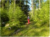 2
2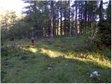 3
3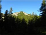 4
4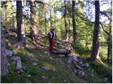 5
5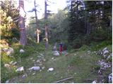 6
6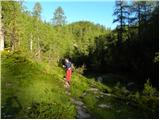 7
7 8
8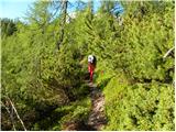 9
9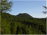 10
10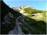 11
11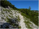 12
12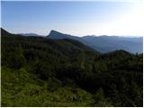 13
13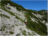 14
14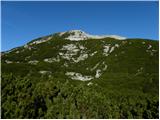 15
15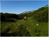 16
16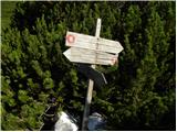 17
17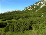 18
18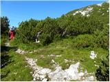 19
19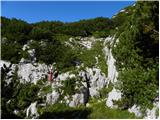 20
20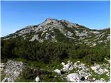 21
21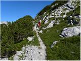 22
22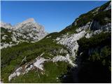 23
23 24
24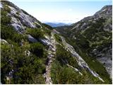 25
25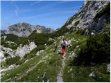 26
26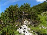 27
27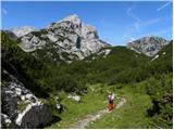 28
28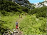 29
29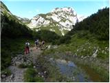 30
30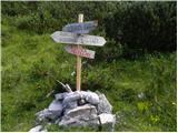 31
31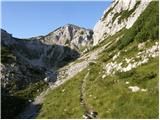 32
32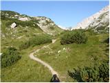 33
33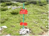 34
34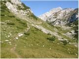 35
35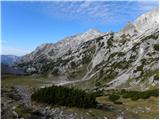 36
36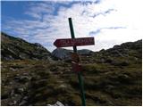 37
37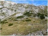 38
38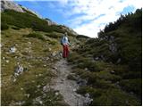 39
39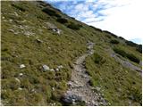 40
40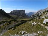 41
41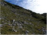 42
42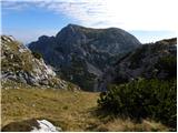 43
43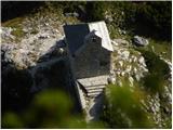 44
44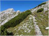 45
45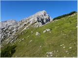 46
46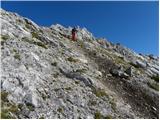 47
47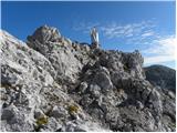 48
48 49
49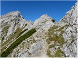 50
50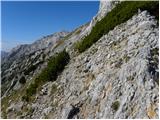 51
51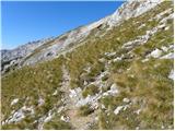 52
52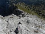 53
53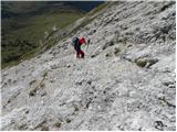 54
54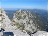 55
55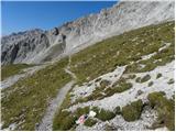 56
56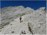 57
57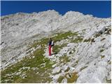 58
58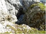 59
59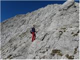 60
60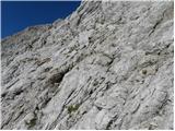 61
61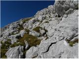 62
62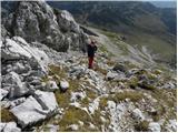 63
63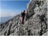 64
64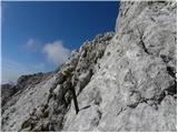 65
65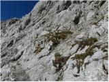 66
66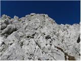 67
67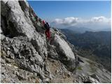 68
68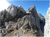 69
69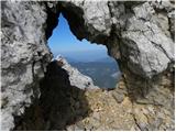 70
70 71
71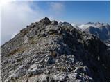 72
72 73
73
Discussion about the trail Planina Ravne - Ojstrica (via Mala Ojstrica)