 | Žlebe - Sveti Jakob (via Turnice)
The Church of St James is located on a hill north of the village of Topol near Medvode. From the top, where there is a registration box with a st...
2 h |
 | Slavkov dom na Golem Brdu - Sveti Jakob
The Church of St James is located on a hill north of the village of Topol near Medvode. From the top, where there is a registration box with a st...
2 h 5 min |
 | Topol - Tošč (direct way)
Tošč, which became the highest peak of Polhograjsko hribovje decades ago when Pasja ravan was lowered by 9 m by the Yugoslav army, is located nor...
2 h |
 | Gabrovo - Lubnik
Lubnik is a 1025 m high mountain rising steeply to the west of Škofja Loka. From the summit, on which the mountain lodge stands, you can enjoy a ...
1 h 30 min |
 | Na Poklonu - Lubnik
Lubnik is a 1025 m high mountain rising steeply to the west of Škofja Loka. From the summit, on which the mountain lodge stands, you can enjoy a ...
2 h 15 min |
 | Vače - Zasavska Sveta gora
Zasavska Sveta gora is a popular excursion point located between Litija and Izlaki. From the top, where the parish church of the Nativity of the ...
2 h |
 | Vače - Zasavska Sveta gora (on a slope)
Zasavska Sveta gora is a popular excursion point located between Litija and Izlaki. From the top, where the parish church of the Nativity of the ...
2 h 30 min |
 | Legastja - Jeterbenk
Jeterbenk is a 774 m high peak located between Slavko's home at Gole Brdo and Katarina (Topol village). From the top, where there is a large cros...
1 h 40 min |
 | Zalog - Polhograjska Gora (Sveti Lovrenc) (gentle path)
Polhograjska Gora, also just Gora or Sveti Lovrenc, is an 824 m high hill located north-west of Polhov Gradec. From the top of the hill, where th...
1 h 30 min |
 | Vrzdenec - Koreno (via Samotorica)
Koreno also Koreno is a 729 m high hill located north of Horjul. From the top, where there is a large cross, the Church of St. Mohorj and Fortuna...
1 h 45 min |
 | Koroška Bela - Ajdna
Ajdna is a peak with a beautiful view of Hochstuhl, Jelovica, Pokljuka and the Julian Alps. Part of the Gornjesavska valley between Žirovnica and...
1 h 30 min |
 | Moravče - Limbarska gora (via Serjuče)
Limbarska gora is located north-east of Moravce. From the top there is a beautiful view of the surrounding peaks and in good weather you can also...
1 h 25 min |
 | Moravče - Limbarska gora (via Gabrje)
Limbarska gora is located north-east of Moravce. From the top there is a beautiful view of the surrounding peaks and in good weather you can also...
1 h 35 min |
 | Blagovica - Limbarska gora
Limbarska gora is located north-east of Moravce. From the top there is a beautiful view of the surrounding peaks and in good weather you can also...
1 h 30 min |
 | Moškrin - Archangel Gabriel (Planica)
Planica is an 824 m high peak located north of Škofja Loka, between Krizna Gora and Planica. From the top, where the Church of St. Gabriel the Ar...
1 h 30 min |
 | Pevno - Archangel Gabriel (Planica)
Planica is an 824 m high peak located north of Škofja Loka, between Krizna Gora and Planica. From the top, where the Church of St. Gabriel the Ar...
1 h 30 min |
 | Volče - Vremščica
Vremščica is a mountain chain, stretching between Senožeče, Pivka and Divača. The highest top is also called Vremščica and the view from it is am...
1 h 30 min |
 | Rovte - Vrh Svetih Treh Kraljev (steep path)
The Church of the Holy Three Kings is situated on a lookout above the village of Vrh Svetih Treh kraljev. From the top, which has an observation ...
1 h 25 min |
| Rovte - Vrh Svetih Treh Kraljev (gentle path)
The Church of the Holy Three Kings is situated on a lookout above the village of Vrh Svetih Treh kraljev. From the top, which has an observation ...
1 h 30 min |
 | Sopot - Vrh Svetih Treh Kraljev
The Church of the Holy Three Kings is situated on a lookout above the village of Vrh Svetih Treh kraljev. From the top, which has an observation ...
1 h 25 min |
 | Zaplana (Prezid) - Koča na Planini nad Vrhniko
Planina above Vrhnika is for hers inhabitants something like Šmarna gora for inhabitants of Ljubljana. It is 733 metres high and is reachable fro...
1 h 40 min |
 | Veliko Trebeljevo - Janče
Janče is a 792-metre-high peak located between the Sava River and the valley of the Besnica Stream. From the top, where the mountain lodge stands...
2 h 15 min |
 | Moravče - Sveti Miklavž above Sava
The Church of St Nicholas is situated on a hill south of Moravče. From the top you can enjoy a beautiful view of the nearby Limbarska gora, and t...
1 h 25 min |
 | Zaplana (Prezid) - Ulovka
Ulovka is the peak between Zaplana and the Shelter at Mountain pasture above Vrhnika. From the top, which is reached by ski lifts, there is a nic...
1 h 45 min |
 | Katarija - Slivna (Pivkelj)
Slivna or Pivkelj (also Pivkelj turn) as this peak is also called is located south of Limbarska Gora. Pivkelj is also the highest point of the Mo...
1 h 55 min |
 | Kandrše (Trata) - Slivna (Pivkelj) (via Sveti Florjan)
Slivna or Pivkelj (also Pivkelj turn) as this peak is also called is located south of Limbarska Gora. Pivkelj is also the highest point of the Mo...
2 h 20 min |
| Kandrše (Trata) - Slivna (Pivkelj) (via GEOSS)
Slivna or Pivkelj (also Pivkelj turn) as this peak is also called is located south of Limbarska Gora. Pivkelj is also the highest point of the Mo...
2 h |
 | Jazne (Lanišar) - Sivka
Sivka is a forested peak located west of Žiri and north of Idrija. On the summit there is a stamp of the Slovenian mountain trail and a registrat...
1 h 30 min |
 | Sovodenj - Sivka
Sivka is a forested peak located west of Žiri and north of Idrija. On the summit there is a stamp of the Slovenian mountain trail and a registrat...
2 h |
 | Zagreben (pri Dikcu) - Malič
Malič is a 936 m high peak located between Celje and Laško, above Spodnja Rečica. There is no better view from the top, where the transmitter, be...
1 h 30 min |
 | Čretvež - Stolpnik (via Hunting cottage Štepih)
At 1012 m, Stolpnik is the highest peak of the Konjiška Gora, a mountain range stretching south-west from Slovenske Konjice. A 25 m high lookout ...
1 h 25 min |
 | Stara Žaga - Skalica (Bohor) (via Možnica)
Skalica is a less known peak in the western part of Bohor. From the summit, which has a registration box, there is a beautiful view to the south ...
1 h 40 min |
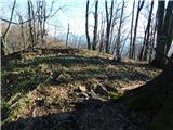
 | Žlebe - Rog (via Turnice)
The Rog is a 798 m high peak located above the village of Topole, just 10 minutes from St Catherine's Church. From the top of the hill, where a l...
1 h 30 min |
| Žlebe - Rog (via Jeterbenk)
The Rog is a 798 m high peak located above the village of Topole, just 10 minutes from St Catherine's Church. From the top of the hill, where a l...
1 h 40 min |
 | Sovodenj - Ermanovec (through Miklavževa grapa)
Ermanovec is a 1026 m high peak located between Cerkno and Gorenjska vasja, specifically above Sovodnje and Trebija. Just a few steps away from t...
1 h 40 min |
 | Sovodenj - Ermanovec (by road)
Ermanovec is a 1026 m high peak located between Cerkno and Gorenjska vasja, specifically above Sovodnje and Trebija. Just a few steps away from t...
1 h 40 min |
 | Hrpelje - Hrpeljska gora
Hrpeljska gora or Mišja šoga is a 737m high peak located south of Hrpelje. The partially vegetated peak offers a beautiful view of the surroundin...
1 h 30 min |
 | Suhi Dol - Sivka (through forest)
Sivka is a grassy peak located in the westernmost part of the Polhograje Hills. In good weather, the peak offers a magnificent view from Snežnik ...
1 h 30 min |
| Suhi Dol - Sivka (by road)
Sivka is a grassy peak located in the westernmost part of the Polhograje Hills. In good weather, the peak offers a magnificent view from Snežnik ...
1 h 40 min |
 | Veliki Boč (Zgornji Kovač) - Žavcarjev vrh
Žavcarjev vrh is a 915m high mountain located north of the River Drava on the slopes of Kozjak. As the peak is completely overgrown, there is no ...
1 h 25 min |
 | Dom pod Reško planino - Sveta planina (Partizanski vrh)
Sveta planina, also Partizanski vrh, is a 1011 m high mountain located between Čemšeniška mountain pasture and Mrzlica. From the top, where a sma...
2 h 5 min |
 | Radeljski prelaz - Kapunar / Kapunerkogel
Kapunar is a 1051 m high peak above Radlje ob Dravi. Just below the peak is an old caravan and border guardhouse, which is now used by radio amat...
1 h 40 min |
 | Sveti Jurij (Remšnik) - Kapunar / Kapunerkogel
Kapunar is a 1051 m high peak above Radlje ob Dravi. Just below the peak is an old caravan and border guardhouse, which is now used by radio amat...
2 h |
 | Stara Fužina - Rudnica (by road)
Rudnica is a scenic mountain located between the Lower and Upper Bohinj Valley. From the top, where there is a registration box with a stamp and ...
1 h 40 min |
 | Jezersko polje - Rudnica
Rudnica is a scenic mountain located between the Lower and Upper Bohinj Valley. From the top, where there is a registration box with a stamp and ...
1 h 45 min |
 | Trojane - Špilk (past the cross Na Kočni)
Špilk is a 956 m high peak located north of Blagovica. On the summit, which is mostly forested, PD Blagovica has built a small bivouac with a ben...
2 h 15 min |
 | Mislinja - Fričev vrh (via Črepič)
Fričev vrh is an 881 m high hill located south of Mislinja Dobrava. There is no view from the top, which has a registration box with a registrati...
1 h 35 min |
 | Mislinja - Fričev vrh (via Završe)
Fričev vrh is an 881 m high hill located south of Mislinja Dobrava. There is no view from the top, which has a registration box with a registrati...
2 h |
 | Mislinja - Sveti Rupert (Završe)
St Rupert's Church is situated on a viewpoint, just south of the Frice Hill. From the church or its immediate surroundings, in fine weather, we h...
1 h 25 min |
 | Sovodenj - Štor (through Miklavževa grapa)
Štor is a 1005 m high peak located directly above the Ermanovec Cottage. The peak itself is covered with forest, but from the meadow, which is on...
1 h 25 min |
| Sovodenj - Štor (razgledna pot)
Štor is a 1005 m high peak located directly above the Ermanovec Cottage. The peak itself is covered with forest, but from the meadow, which is on...
1 h 45 min |
| Sovodenj - Štor (by road)
Štor is a 1005 m high peak located directly above the Ermanovec Cottage. The peak itself is covered with forest, but from the meadow, which is on...
1 h 35 min |
 | Čepulje - Sveti Mohor (Zabrekve)
The Church of St. Mohor is situated on a 952 m high hill, between Zgornja Besnica and Selce. From the church, or its immediate surroundings, we h...
1 h 30 min |
 | Podblica - Sveti Mohor (Zabrekve)
The Church of St. Mohor is situated on a 952 m high hill, between Zgornja Besnica and Selce. From the church, or its immediate surroundings, we h...
1 h 40 min |
 | Zgornja Besnica (Podrovnik) - Špičasti hrib
Špičasti hrib (Špičasti vrh on maps) is an 837 m high peak located to the west of Sveti Jošto above Kranj. There is no view from the top, which h...
1 h 30 min |
 | Spodnja Besnica (fish farm) - Špičasti hrib
Špičasti hrib (Špičasti vrh on maps) is an 837 m high peak located to the west of Sveti Jošto above Kranj. There is no view from the top, which h...
1 h 30 min |
 | Zazid - Lipnik
Lipnik is an 804 m high peak located above the village of Rakitovec on the Slovenian Croatian border. From the top, where there is a cross and a ...
1 h 40 min |
 | Ledinsko Razpotje - Loncmanova Sivka (Mrzli Vrh)
Loncmanova Sivka is a scenic peak located above the village of Mrzli Vrh above Žirmi. From the uncultivated peak, in good weather, we can enjoy v...
1 h 25 min |
 | Sovodenj - Loncmanova Sivka (Mrzli Vrh)
Loncmanova Sivka is a scenic peak located above the village of Mrzli Vrh above Žirmi. From the uncultivated peak, in good weather, we can enjoy v...
2 h |
| Jazne (Lanišar) - Loncmanova Sivka (Mrzli Vrh)
Loncmanova Sivka is a scenic peak located above the village of Mrzli Vrh above Žirmi. From the uncultivated peak, in good weather, we can enjoy v...
1 h 30 min |
 | Šembije - Ahac
Ahac or St. Ahac is a 799 m high peak located east of Ilirska Bistrica. The summit, which is home to a registration box, a cross and the ruins of...
2 h |
 | Planina pri Sevnici - Brest (Bohor) (northern path)
Brest is a peak on Bohor although it loks more like a saddle. It is an important intersection of the Bohor trails. It lies between Oslica, which ...
2 h 20 min |
 | Travnarjev gozd (Hotenjsko podolje) - Šenčurjev vrh
Šenčurjev vrh is a 725-metre-high hill located above the settlement Žibrše, between Logatec, Hotedršica and Rovtami. At the top, which offers a b...
1 h 50 min |
 | Col - Podrta gora above Ajdovščina
Podrta gora above Ajdovščina, also called the Broke Mountain above Šturje, is a mountain rising above the Vipava valley. Some time ago, a large c...
1 h 45 min |
 | Col - Kraguljc
Kraguljc is a mountain located between Podrto gora and Sončnica. A trigonometric point is located on the lookout point, which offers a beautiful ...
1 h 35 min |
 | Sovodenj - Planinska koča Mrzl'k
Planinska koča Mrzl'k is located just a few metres below the summit of Mrzlik. The hut offers a beautiful view of the neighbouring Mrzli vrh (Lon...
1 h 40 min |
| Ledinsko Razpotje - Planinska koča Mrzl'k
Planinska koča Mrzl'k is located just a few metres below the summit of Mrzlik. The hut offers a beautiful view of the neighbouring Mrzli vrh (Lon...
1 h 25 min |
 | Zalog - Planica (Paragliding site Gozd)
Planica is a 926-metre-high peak located above the village of Gozd. From the top, where the JPK Kriška gora hut is located, we have a beautiful v...
1 h 30 min |
 | Dolina Radeljskega potoka (Razdevšek) - Sveti Trije Kralji (above Radlje ob Dravi)
The Church of the Three Kings is situated on an 820-metre-high hill rising above the right bank of the Radlje Stream. The church offers a beautif...
1 h 30 min |
 | Janževski Vrh (Uran) - Klančnik (Glančnik) (via Brabar and Hudej)
Klančnik, also known as Glančnik on some maps, is an 877-metre-high peak located above the right bank of the Drava River, just a few minutes away...
1 h 35 min |
 | Zreče (Terme Zreče) - Golek
Golek is a 769-metre-high peak located north-west of Zreče. At the top there is a registration box with a registration book, a stamp and a bench,...
1 h 25 min |
| Zreče (Terme Zreče) - Golek (via Bork)
Golek is a 769-metre-high peak located north-west of Zreče. At the top there is a registration box with a registration book, a stamp and a bench,...
1 h 30 min |
| Zreče (Terme Zreče) - Golek (via Tourist farm Ančka)
Golek is a 769-metre-high peak located north-west of Zreče. At the top there is a registration box with a registration book, a stamp and a bench,...
1 h 35 min |
 | Prelaz Vrhe - Maceljska gora (via source of Sotla)
...
1 h 50 min |
 | Marno - Vrhe (pri Gorah)
...
1 h 25 min |
 | Kirchdorf - Predigtstuhl
...
1 h 30 min |
 | Rein - Pfaffenkogel
...
1 h 30 min |
 | Straßengel - Generalkogel
...
1 h 30 min |