Starting point: Zazid (390 m)
| Lat/Lon: | 45,4994°N 13,9315°E |
| |
Time of walking: 1 h 40 min
Difficulty: easy marked way
Altitude difference: 414 m
Altitude difference po putu: 414 m
Map: Slovenska Istra - Čičarija, Brkini in Kras 1:50.000
Recommended equipment (summer):
Recommended equipment (winter):
Views: 15.580
 | 1 person likes this post |
Access to the starting point:
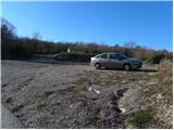
From the motorway Ljubljana - Koper take the exit Črni Kal. From Črni Kal, continue along the old road towards the sea, and we take it only as far as the next slightly larger crossroads, where we turn left towards Border crossing Sočerga. We drive along the road for a short time, and then the signs for Predloka, Loka, Bezovica, Podpeč, Zanigrad, Zazid and Rakitovec direct us to the left onto a slightly narrower local road. Continue to Bezovica, where at a small crossroads in the middle of the village, turn left towards Podpeči. Continue through Podpeč (the road through the village is very narrow) to the village of Zazid, where you park in the parking lot next to the sports ground.
Path description:
From the sports ground, walk to the village, where you will come to an unmarked crossroads with a bench and a water tap. Here, turn right and follow the gently ascending road to the upper part of the village, where you will see the first signs for Golič and Lipnik . Turn right again and continue climbing along the asphalted road leading to the nearby water reservoir. A few 10 m before the water reservoir, you will come to the next unmarked crossroads, where you will continue along a dirt road on the right. The dirt road then leads to a small crossroads, at which the next water trough is located. This time, continue along the wider road on the left, where you will quickly see a sign. Continue along the minor road for a short distance and then a marked shortcut forks off to the right. The path quickly returns to the road and after a few steps splits into two parts again. Wherever you continue, the path will quickly lead you to the railway line and the dilapidated Zazid railway station. Carefully cross the railway line leading to Pula, and we will arrive at a marked crossroads on the other side (it takes about 20 minutes to get here).
Continue to the right in the direction of Lipnika and Goliča (Brežec and Kraški rim on the left) and follow the gently sloping cart track, which ascends crosswise to the right. Higher up, beautiful views of the sea and Istria begin to open up, and we continue along the gently sloping path, which returns to the forest and leads us to a marked crossroads.
Continue to the right in the direction Lipnik (Golič and the Karst Edge to the left) and follow the path through the lane of bushes. Once out of the scrub, the path leads to a large grassy "plain", which offers a fine view of Lipnik . Walk across the 'plain' for some time, and then the direction sign for Lipnik points you left into the forest. The path climbs steeply and then turns slightly to the right, where it climbs in a moderate ascent over the steep grade of the Kraško Edge. Beyond the edge, the path lays down and leads to a marked crossroads where you continue left towards the summit of Lipnik (straight ahead the memorial, right Kavčič and Golič). Continue along the gently sloping and very scenic path, which takes 5 minutes of further walking to reach the summit.

Pictures:
 1
1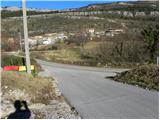 2
2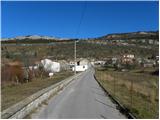 3
3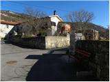 4
4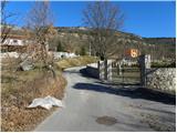 5
5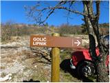 6
6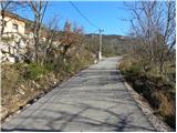 7
7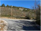 8
8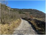 9
9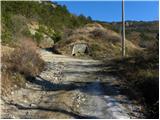 10
10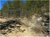 11
11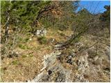 12
12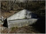 13
13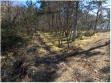 14
14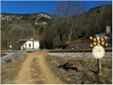 15
15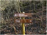 16
16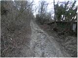 17
17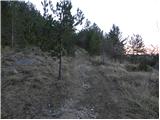 18
18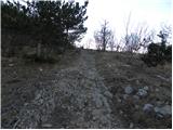 19
19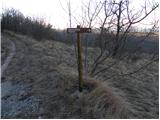 20
20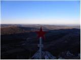 21
21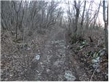 22
22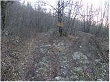 23
23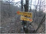 24
24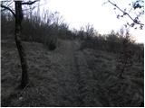 25
25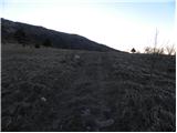 26
26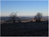 27
27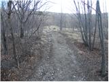 28
28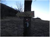 29
29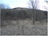 30
30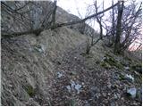 31
31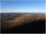 32
32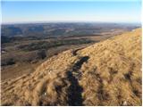 33
33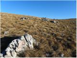 34
34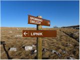 35
35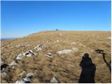 36
36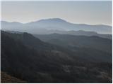 37
37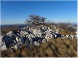 38
38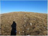 39
39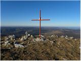 40
40 41
41
Discussion about the trail Zazid - Lipnik
|
| B218. 04. 2012 |
Žiga ni nikjer, razen na Kojniku... Vsaj v času mojega obiska lani, ga tudi na Kojniku ni bilo!
|
|
|
|
| B218. 04. 2012 |
Pot in narave je pa čudovita, posebno v konec maja in v začetku junija, ko tu vse cveti - tudi ogromno narcis...
|
|
|
|
| gdbl4. 11. 2012 |
Eden lepših izletov na tem koncu. Na vrhu je žig. Hvala za izčrpen opis poti, saj je pot slabo markirana - označena  Z vrha smo se vračali po grebenu proti zahodu, dokler nismo dosegli poti, ki vodi na Golič. Je pa ta pot "neudobna" zaradi ostrih kamnov.
|
|
|
|
| grega_p14. 11. 2014 |
Naredimo lahko tudi lepo krožno turo, če štartamo v vasici Rakitovec. Najprej gremo zlagoma navzgor po lepem kolovozu nad vasjo v smeri Zazida in se višje priključimo omenjeni poti. Z vrha lahko nadaljujemo še proti Kavčiču in se čez Ubred vrnemo nazaj k izhodišču (glej zemljevid).
Zanimivi konci, zelo odmaknjeni in svojevrstni...
|
|
|
|
| Dejan321. 07. 2016 |
Na vrhu je žig in vpisna knjiga, če žiga ni bilo med vašim obiskom je zato, ker je bil odtujen. Spomladi 2015 je bil žig ponovno prinešen na vrh.
Vaščani Zazida smo pot tudi na novo označili s smerokazi.
Vsekakor priporočamo ta izlet, še posebej spomladi ko je polno cvetlic in ozeleni lipov gozd.
|
|
|
|
| serafina197421. 05. 2019 |
Ali travniki okoli Rakitovca še/že cvetijo?
|
|
|