Kandrše (Trata) - Slivna (Pivkelj) (via GEOSS)
Starting point: Kandrše (Trata) (473 m)
| Lat/Lon: | 46,1331°N 14,8395°E |
| |
Name of path: via GEOSS
Time of walking: 2 h
Difficulty: easy marked way
Altitude difference: 407 m
Altitude difference po putu: 430 m
Map:
Recommended equipment (summer):
Recommended equipment (winter): crampons
Views: 612
 | 1 person likes this post |
Access to the starting point:
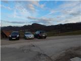
a) Leave the Štajerska motorway at exit Krtina, then follow signs for Moravče and Zagorje ob Savi. Just after the road sign marking the beginning of Kandrše, you will reach a pass near the hamlet of Trata, where you turn left and park in the gravel parking lot opposite the company Strip's, elektrotehnika - elektronika, d. o. o.
b) Drive to Izlake (to get here take Trojane or Zagorje ob Savi, then continue driving in the direction of Moravce. In Kandrše, at Strip's, elektrotehnika - elektronika, d. o. o. , turn right and park in the gravel parking lot by the mountain direction signs.
Path description:
From the parking lot, first carefully cross the main road and continue along the side road in the direction of GEOSS and Vač. The way forward leads past the fire house of the fire brigade PGD Kandrše and Napoleon's Stone, and at the sign for the beginning of the municipality Litija, turn left off the asphalt road onto cart track. Follow cart track until you enter the forest, then signs point you to the right (straight unmarked path to Slemšek), where you climb through lane of the forest. After a short climb, we return to the asphalt road and follow it up to a nearby crossroads, where we leave the road towards Vače and GEOSS and continue right on a side road, which leads to a small hamlet where the road ends. Pass all the houses on the left and continue along the cart track, which descends gently at first and then ascends gently across the meadow to the hamlet of Strmca. Here, rejoin the road and climb past houses and a sign to a less well-marked crossroads, where you go left (right down the marked path to St Florian). There is some quite steep walking, passing a sign, before beginning a cross-climb. After a few minutes you reach a crossroads where you join the "main" road leading to GEOSS and follow it to the right (Vače and Kandrše on the left).
The path then continues along the asphalt road, crossing the slopes to the right. A little further on you reach the village of Spodnja Slivna, where you go left in the middle of the village by the Vrabec Inn towards GEOSS.
Continue in the direction of GEOSS, which can be reached in a few minutes on an asphalt road.
From GEOSS, go back to the Vrabec Inn, and from there continue left (straight ahead Zgornja Gora and St Florjan) and start climbing crosswise. At the end of the right-hand bend, leave the asphalt road and turn left onto a marked footpath that begins to climb through the forest. At the chapel, continue left and climb up to the abandoned Dom na Slivni, where you rejoin the asphalt.
From here you can climb in a minute to the nearby church of St. Neže, which offers a nice view, otherwise continue to the right and walk along the road for a short distance. The road soon turns off to the left onto the wide, marked cart track (do not follow the road leading to the nearby transmitters), which you can continue to climb, following the signs at the crossroads. Higher up, a marked but unmarked trail from the hamlet Vrtače joins us from the left, and we continue slightly to the right, where we quickly reach the next crossroads.
From the crossroads continue left in the direction of Pivklja (straight ahead, bypassing the summit), which can be reached in 5 minutes of further walking.
Kandrše - GEOSS 1:00, GEOSS - Dom na Slivna 0:30, Dom na Slivna - Pivkelj 0:30.
Description and pictures refer to the situation in December 2018 and March 2020.

Pictures:
 1
1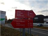 2
2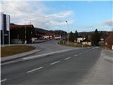 3
3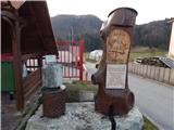 4
4 5
5 6
6 7
7 8
8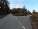 9
9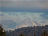 10
10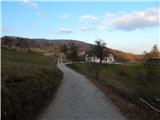 11
11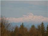 12
12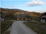 13
13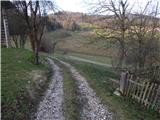 14
14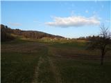 15
15 16
16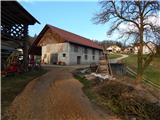 17
17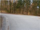 18
18 19
19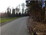 20
20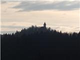 21
21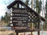 22
22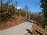 23
23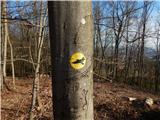 24
24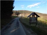 25
25 26
26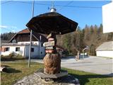 27
27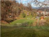 28
28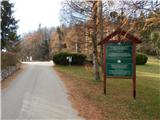 29
29 30
30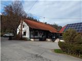 31
31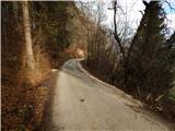 32
32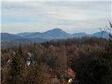 33
33 34
34 35
35 36
36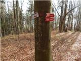 37
37 38
38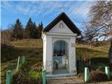 39
39 40
40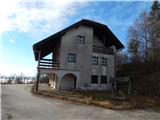 41
41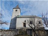 42
42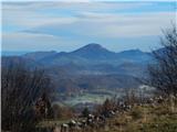 43
43 44
44 45
45 46
46 47
47 48
48 49
49 50
50
Discussion about the trail Kandrše (Trata) - Slivna (Pivkelj) (via GEOSS)