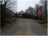
 | Polhov Gradec - Polhograjska Grmada (via Ravnek and via Sveta Uršula)
Polhograjska Grmada is an 898 m high peak located in the heart of the Polhograjski Dolomites. From the summit, which has a registration box with ...
1 h 50 min |
 | Rakovnik - Sveti Jakob (via Breznik)
The Church of St James is located on a hill north of the village of Topol near Medvode. From the top, where there is a registration box with a st...
1 h 50 min |
 | Gosteče - Osolnik (via Vidmovec)
Osolnik is an 858 m high mountain located south of Škofja Loka and west of Medvode. From the top, where the Church of St. Mohor and Fortunatus st...
1 h 30 min |
 | Hosta - Osolnik
Osolnik is an 858 m high mountain located south of Škofja Loka and west of Medvode. From the top, where the Church of St. Mohor and Fortunatus st...
2 h 10 min |
 | Sveta Barbara (Nova Hrastnica) - Osolnik
Osolnik is an 858 m high mountain located south of Škofja Loka and west of Medvode. From the top, where the Church of St. Mohor and Fortunatus st...
1 h 50 min |
 | Mlinše - Zasavska Sveta gora
Zasavska Sveta gora is a popular excursion point located between Litija and Izlaki. From the top, where the parish church of the Nativity of the ...
1 h 30 min |
 | Vidrga - Zasavska Sveta gora (on forest footpath)
Zasavska Sveta gora is a popular excursion point located between Litija and Izlaki. From the top, where the parish church of the Nativity of the ...
1 h 30 min |
| Vidrga - Zasavska Sveta gora (on a cart track)
Zasavska Sveta gora is a popular excursion point located between Litija and Izlaki. From the top, where the parish church of the Nativity of the ...
1 h 30 min |
 | Mala voda - Kožljek
Kožljek is a 788 m high peak located to the west of Koreno, specifically above the village of Samotorica. From the top, where there are a few ben...
1 h 15 min |
 | Sveta Barbara (Nova Hrastnica) - Sveti Ožbolt (above Zminec)
Sveti Ožbolt is located on a scenic peak in the north of the Polhograjske Dolomites. It has a beautiful view of the Škofjeloško hribovje and part...
1 h 40 min |
 | Dorfarje - Archangel Gabriel (Planica)
Planica is an 824 m high peak located north of Škofja Loka, between Krizna Gora and Planica. From the top, where the Church of St. Gabriel the Ar...
2 h |
 | Hotovlja - Bukov vrh (by road)
Bukov vrh, on which the Church of the Sorrowful Mother of God stands, is located in the north-western part of the Polhograje hills. From the top ...
1 h 30 min |
 | Planina - Petričev hrib
Petričev hrib is the peak north of Postojna and west of Mountain pasture. From the summit, which has a registration box, there is a beautiful vie...
1 h 30 min |
| Planina (Dolnja Planina) - Petričev hrib (via Zavrtniki)
Petričev hrib is the peak north of Postojna and west of Mountain pasture. From the summit, which has a registration box, there is a beautiful vie...
1 h 35 min |
| Planina (Dolnja Planina) - Petričev hrib (via Sv. Duh)
Petričev hrib is the peak north of Postojna and west of Mountain pasture. From the summit, which has a registration box, there is a beautiful vie...
1 h 35 min |
 | Divje jezero - Hleviška planina (via Strug)
Hleviška planina (also Hleviška planina) is a slightly overgrown but still very scenic peak. From the top, which is the house mountain of Idrija,...
1 h 45 min |
 | Spodnje Stranice (graves of hundred hostages) - Stolpnik (by road)
At 1012 m, Stolpnik is the highest peak of the Konjiška Gora, a mountain range stretching south-west from Slovenske Konjice. A 25 m high lookout ...
2 h |
 | Jablance - Skalica (Bohor) (via Travni laz)
Skalica is a less known peak in the western part of Bohor. From the summit, which has a registration box, there is a beautiful view to the south ...
2 h |
 | Jablance - Veliki Javornik (Bohor) (via Travni laz)
Veliki Javornik is the highest peak of Bohor at 1023m. Although the peak is unspoilt and there are no higher hills far around, there is no view f...
1 h 40 min |
 | Slavkov dom na Golem Brdu - Rog
The Rog is a 798 m high peak located above the village of Topole, just 10 minutes from St Catherine's Church. From the top of the hill, where a l...
1 h 40 min |
 | Selca - Miklavška gora (by road)
Miklavška gora is a lookout located south of Železniki and Selce. From the top of the hill on which the Church of St Nicholas stands, we have a b...
1 h 45 min |
 | Prešnica - Grmada at Slavnik
Grmada is a 998m high peak located northwest of Slavnik. From the top of the peak, where the fire safety observatory is located, you can enjoy a ...
1 h 50 min |
| Povžane - Grmada at Slavnik
Grmada is a 998m high peak located northwest of Slavnik. From the top of the peak, where the fire safety observatory is located, you can enjoy a ...
2 h 15 min |
| Skadanščina - Grmada at Slavnik (via planina Jegno)
Grmada is a 998m high peak located northwest of Slavnik. From the top of the peak, where the fire safety observatory is located, you can enjoy a ...
2 h 15 min |
| Skadanščina - Grmada at Slavnik (via Planina Jegno)
Grmada is a 998m high peak located northwest of Slavnik. From the top of the peak, where the fire safety observatory is located, you can enjoy a ...
2 h 10 min |
 | Podpeč - Grmada on Mala gora
Grmada (also Grmada nad Ortnek) is an 887 m high peak located above the village of Vrh pri Poljanah in the Mala Gora mountain range. Just a few m...
1 h 35 min |
 | Vitovlje - Hunting cottage below Čaven
The hunting shelter is located on a lookout on the side ridge of the Čavna. The shelter, which serves as an emergency bivouac, offers a beautiful...
1 h 50 min |
 | Zgornja Rečica (Maček) - Govško brdo (past shepherd's chapel)
Govško brdo is an 811m high hill located west of the village of Huda jama above Laško. From the top of the hill, where the registration box and s...
1 h 35 min |
 | Zabočevo - Novaška gora
Novaška gora is a forested peak located west of Rakitna....
2 h |
 | Source of Ljubljanica (Močilnik) - Ljubljanski vrh
Ljubljanski vrh is an 819 m high hill located south of Vrhnika. The army has a radar observatory on the top, so it is not possible to climb to th...
2 h |
 | Polhov Gradec - Mala Grmada (via Ravnek and via Sveta Uršula)
Mala Grmada is an 853 m high peak located south-west of the slightly higher Polhograjska Grmada. From the top, you have a beautiful view over the...
1 h 35 min |
 | Spodnja Idrija - Cerkovni vrh
Cerkovni vrh is a broadleaved stump above Spodnja Idrija. From the top we have beautiful views of local peaks such as Kobalove mountain pasture, ...
1 h 15 min |
 | Zazid - Golič (direct way)
Golič is a grassy ridge stretching from Kojnik to the Slovenian-Croatian border and continuing to Žbevnica on the Croatian side. Due to the relat...
1 h 45 min |
 | Nemilje - Sveti Mohor (Zabrekve)
The Church of St. Mohor is situated on a 952 m high hill, between Zgornja Besnica and Selce. From the church, or its immediate surroundings, we h...
1 h 20 min |
 | Selca - Sveti Mohor (Zabrekve)
The Church of St. Mohor is situated on a 952 m high hill, between Zgornja Besnica and Selce. From the church, or its immediate surroundings, we h...
1 h 40 min |
 | Knape - Sveti Mohor (Zabrekve) (via Hudi Laz, Flandrova pot)
The Church of St. Mohor is situated on a 952 m high hill, between Zgornja Besnica and Selce. From the church, or its immediate surroundings, we h...
1 h 40 min |
 | Nemilje - Sveti Mohor (Zabrekve) (via Prevoje)
The Church of St. Mohor is situated on a 952 m high hill, between Zgornja Besnica and Selce. From the church, or its immediate surroundings, we h...
1 h 35 min |
 | Brezovica - Sveti Primož in Felicijan (Jamnik)
The Church of St. Primož and Felicijan on Jamnik, is situated on a scenic grassy ridge rising between Kropa and Podblica. From the church or its ...
1 h 20 min |
| Češnjica pri Kropi - Sveti Primož in Felicijan (Jamnik) (via Berigla)
The Church of St. Primož and Felicijan on Jamnik, is situated on a scenic grassy ridge rising between Kropa and Podblica. From the church or its ...
1 h 20 min |
 | Cerkno - Veliki vrh (Lajše) (on unmarked path)
Veliki vrh is an almost 900 m high peak rising south of Cerkno. From the top, where there are several television and radio transmitters covering ...
1 h 40 min |
 | Cerkno - Škofje (on unmarked path)
Škofje is a 973 m high peak located above the villages of Čeplez, Planina pri Cerknem and Podpleče. The peak itself, on which stands a small conc...
1 h 45 min |
 | Ribenski most - Tolsti vrh (Talež)
Tolsti vrh is an 883 m high hill located south of Bled, above the Talež Hunting Lodge. The summit, which descends steeply towards the Sava Bohinj...
1 h 15 min |
 | Selski most - Tolsti vrh (Talež)
Tolsti vrh is an 883 m high hill located south of Bled, above the Talež Hunting Lodge. The summit, which descends steeply towards the Sava Bohinj...
1 h 15 min |
 | Tržič - Veliki vrh above Završnik (Milanova pot)
Veliki vrh above Završnik is a 968 m high mountain located in the Pirmance ridge, north to north-east of Tržič. From the grassy summit, where the...
1 h 40 min |
| Nevlje pri Kamniku - Vovar
An obscure hill in front of the Kamnik mountains. Recently covered by storms, it has been covered with wood harvesting tracks.There is also a sma...
1 h 30 min |
 | Žiri - Javorč
Javorč is a 901-metre-high peak located to the north-east of Žiri. The summit, where the registration box with the registration book is located, ...
1 h 15 min |
 | Jamce - Sončnica (Reber)
Sončnica is a paragliding airstrip on the outskirts of the Gora plateau or Reber Ridge. There are a few benches, an automatic weather station Kov...
1 h 45 min |
 | Jamce - Podrta gora above Ajdovščina
Podrta gora above Ajdovščina, also called the Broke Mountain above Šturje, is a mountain rising above the Vipava valley. Some time ago, a large c...
1 h 20 min |
 | Jamce - Kraguljc
Kraguljc is a mountain located between Podrto gora and Sončnica. A trigonometric point is located on the lookout point, which offers a beautiful ...
1 h 30 min |
 | Kokra (resting place Kokra-sotočje) - Kopa (Partizanski vrh)
Kopa, also Partizanski vrh, is a 1024-metre high mountain located west of the Davovec saddle, which is west to south-west of Krvavec. There is a ...
1 h 45 min |
 | Spodnja Kokra - Skutman (via Kopa)
Skutman is a lesser-known peak located above the left bank of the Kokra River and north of Štefanje Gora. The summit is marked by a metal sign wi...
2 h |
 | Mežica - Andrejev vrh (by cart track)
Andrejev vrh is a forested peak located between Mežica and Lesa. There is a bench on the top and a registration box with a registration book....
1 h 15 min |
| Mežica - Andrejev vrh (past the chapel)
Andrejev vrh is a forested peak located between Mežica and Lesa. There is a bench on the top and a registration box with a registration book....
1 h 20 min |
| Poljana - Andrejev vrh (over Volinjak and on cart track)
Andrejev vrh is a forested peak located between Mežica and Lesa. There is a bench on the top and a registration box with a registration book....
1 h 50 min |
| Poljana - Andrejev vrh (via Volinjak and past the chapel)
Andrejev vrh is a forested peak located between Mežica and Lesa. There is a bench on the top and a registration box with a registration book....
1 h 55 min |
| Poljana - Andrejev vrh (past Leše churches and on cart track)
Andrejev vrh is a forested peak located between Mežica and Lesa. There is a bench on the top and a registration box with a registration book....
1 h 50 min |
| Poljana - Andrejev vrh (via Leše churches and via chapel)
Andrejev vrh is a forested peak located between Mežica and Lesa. There is a bench on the top and a registration box with a registration book....
1 h 55 min |
| Leše - Andrejev vrh (via Leše churches and via chapel)
Andrejev vrh is a forested peak located between Mežica and Lesa. There is a bench on the top and a registration box with a registration book....
1 h 35 min |
| Leše - Andrejev vrh (past Leše churches and on cart track)
Andrejev vrh is a forested peak located between Mežica and Lesa. There is a bench on the top and a registration box with a registration book....
1 h 30 min |
 | Selca - Sleme (Površnica)
Sleme is a scenic peak located between Rudni, Dražgoše and Lajša. The summit, where the transmitters are located, offers a beautiful view of the ...
1 h 35 min |
| Železniki - Sleme (Površnica) (via Štalca)
Sleme is a scenic peak located between Rudni, Dražgoše and Lajša. The summit, where the transmitters are located, offers a beautiful view of the ...
1 h 35 min |
| Nemilje - Sleme (Površnica) (via Prevoje)
Sleme is a scenic peak located between Rudni, Dražgoše and Lajša. The summit, where the transmitters are located, offers a beautiful view of the ...
2 h 5 min |
 | Selca - Sveti Križ above Selca
The Sveti Križ above Selca church is situated on a lookout point, which offers a beautiful view over part of the Škofjeloško hribovje....
1 h 15 min |
| Železniki - Sveti Križ above Selca (via Štalca)
The Sveti Križ above Selca church is situated on a lookout point, which offers a beautiful view over part of the Škofjeloško hribovje....
1 h 15 min |
 | Senično - Planica (Paragliding site Gozd) (gentle path)
Planica is a 926-metre-high peak located above the village of Gozd. From the top, where the JPK Kriška gora hut is located, we have a beautiful v...
1 h 15 min |
| Pristava - Planica (Paragliding site Gozd)
Planica is a 926-metre-high peak located above the village of Gozd. From the top, where the JPK Kriška gora hut is located, we have a beautiful v...
1 h 20 min |
 | Rudnik pri Radomljah - Tolsta gora
Tolsta gora is a 734-metre-high mountain located above Vrhpolje near Kamnik. From the top, where cairn stands, there is no better view, thanks to...
1 h 25 min |
| Pravdan - Tolsta gora (via Čeh)
Tolsta gora is a 734-metre-high mountain located above Vrhpolje near Kamnik. From the top, where cairn stands, there is no better view, thanks to...
1 h 45 min |
 | Rudnik pri Radomljah - Vrtače (via Lancar)
Vrtače is a 758-metre-high peak located above the village of Zgornje Palovče. The peak is covered with forest, but the clearing slightly below th...
1 h 30 min |
| Pravdan - Vrtače (via Zgornje Palovče)
Vrtače is a 758-metre-high peak located above the village of Zgornje Palovče. The peak is covered with forest, but the clearing slightly below th...
1 h 45 min |
 | Libeliče - Pokeržnikov vrh
Pokeržnikov vrh is a 1,055-metre-high peak located above the village of Strojna in the municipality of Ravne na Koroškem. From the top, where the...
2 h 15 min |
 | Dravograd (Meža) - Sveti Danijel (above Trbonje)
The Church of St. Danijel is located on the outskirts of the village of St. Danijel, just above Trbonyi. From the church we have a beautiful view...
1 h 30 min |
 | Škofja Loka - Vrh soteske (Križna gora)
Vrh soteske is a 735 m high peak located in the south-western part of Križna Gora. There is no better view from the top, which is covered by fore...
1 h 25 min |
| Vešter - Vrh soteske (Križna gora)
Vrh soteske is a 735 m high peak located in the south-western part of Križna Gora. There is no better view from the top, which is covered by fore...
1 h 15 min |
 | Grahovo ob Bači (Brelih) - Črvov vrh (via Žrelo)
Črvov vrh, also known as Črvov grič, is the highest peak of the Šentviška plateau, rising above the right bank of the Idrijca and the left bank o...
1 h 50 min |
| Grahovo ob Bači (Brelih) - Črvov vrh (via homestead Pušnik)
Črvov vrh, also known as Črvov grič, is the highest peak of the Šentviška plateau, rising above the right bank of the Idrijca and the left bank o...
1 h 40 min |
 | Grahovo ob Bači (Brelih) - Bukovski vrh (via Žrelo)
Bukovo vrh (918 m) is located above the settlement Bukovo Vrh, more precisely above the homestead at Pircu.From the grassy summit we have a beaut...
1 h 40 min |
 | Hotavlje - Vrh Slajke
Vrh Slajke is a 790-metre-high hill located above Hotavlje, on the right bank of the Kopačnice River. From the top, where the antenna tower stand...
1 h 15 min |
| Hotavlje - Vrh Slajke (via Bela)
Vrh Slajke is a 790-metre-high hill located above Hotavlje, on the right bank of the Kopačnice River. From the top, where the antenna tower stand...
1 h 30 min |
 | Ledinica - Krog (Ledinski grič)
Krog is a 940 m high peak located on the western part of the Ledinski grič ridge, which is situated between the Jerešča and Ledinščica watercours...
1 h 15 min |
 | Žiri - Krog (Ledinski grič)
Krog is a 940 m high peak located on the western part of the Ledinski grič ridge, which is situated between the Jerešča and Ledinščica watercours...
1 h 50 min |
 | Hotavlje - Kucelj (above Kopačnica) (via village Studor)
Kucelj is a 920-metre-high peak located above the left bank of the Kopačnica and above the village of the same name. On the top there is a bench,...
2 h 10 min |
| Hotavlje - Kucelj (above Kopačnica) (via Srednje Brdo)
Kucelj is a 920-metre-high peak located above the left bank of the Kopačnica and above the village of the same name. On the top there is a bench,...
1 h 55 min |
 | Bresternica (Spodnji Rušnik) - Možičev vrh (via Žavcarjev vrh)
Možičev vrh is a 926 m high peak located to the west of the better known, but slightly lower, Žavcar Peak. There is a track leading to the summit...
1 h 55 min |
 | Zreče (Terme Zreče) - Golek (steep path)
Golek is a 769-metre-high peak located north-west of Zreče. At the top there is a registration box with a registration book, a stamp and a bench,...
1 h 20 min |
 | Ožbalt (dam on stream Črmenica) - Grilov vrh (on cart track)
...
1 h 40 min |
 | Mixnitz (parking lot Bärenschützklamm) - Rannerwandkreuz
...
1 h 45 min |
 | Deutschfeistritz - Parmaseggkogel (via Kugelberg)
...
1 h 15 min |
 | Selnica ob Dravi - Janžev vrh
...
1 h 35 min |
| Janževa Gora - Janžev vrh (past church of St. Janez Krstnik)
...
1 h 35 min |
 | Muta (Zgornja Muta) - Napečnikov vrh
...
2 h 10 min |
 | Šentjanž pri Dravogradu - Selovec (Gruberjev vrh) (on southeastern ridge)
...
2 h |
| Šentjanž pri Dravogradu - Selovec (Gruberjev vrh) (past Čubej and Rudof)
...
1 h 45 min |
| Šentjanž pri Dravogradu - Selovec (Gruberjev vrh) (past Napotnik and Rudof)
...
1 h 45 min |