Bresternica (Spodnji Rušnik) - Možičev vrh (via Žavcarjev vrh)
Starting point: Bresternica (Spodnji Rušnik) (350 m)
| Lat/Lon: | 46,5918°N 15,5554°E |
| |
Name of path: via Žavcarjev vrh
Time of walking: 1 h 55 min
Difficulty: easy unmarked way
Altitude difference: 576 m
Altitude difference po putu: 600 m
Map: Pohorje 1:50.000
Recommended equipment (summer):
Recommended equipment (winter): ice axe, crampons
Views: 384
 | 1 person likes this post |
Access to the starting point:
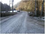
From the road Maribor - Dravograd, in Bresternica (Brestrnica on some maps) you will see signs for the village of Gaj, which will direct you to the right (from the route of Dravograd, to the left). After a few metres, at a poorly marked crossroads, continue to the left and follow the road through the village to the chapel, where you will continue to the left. The ascending road leads us higher up to the crossroads at which we see the mountain direction signs for Tojzlov vrh. We continue to the left here and follow the road for about 1 km to the next mountain signs (this time for Žavcarjev vrh) at which we park in one of several small parking areas along the road.
Path description:
From the starting point, follow the macadam road in the direction of Žavcarjevje vrh. The road initially leads us along a stream, then turns right and climbs steeply. Follow this road, which mainly passes through a forest, to a small hamlet, where it turns into a wide cart track. The ascent continues along the above-mentioned cart track, which leads us higher up past the homestead and then leads us to a forest road, which we only cross.
We continue our ascent along the cart track, which climbs transversely through the forest, and we follow it only as far as the place where the signs direct us to the right onto a footpath.
The path widens higher up to cart track and then to a road, which we quickly leave as the markings lead us back to the footpath. Higher up, the path joins the road, which we continue to climb for the next few minutes.
Soon we will see the following markings for Žavcarjev vrh, which direct us to cart track, which will take us up to the mountain hut in a few minutes.
Go around the hut on the left, and at the chapel go straight into the forest on the path to Žavcarjev vrh, where you walk along a well-trodden path through the forest. After a few minutes of ascent, take the slightly left-hand cart track, which quickly leads to the 915 m high summit.
Go around the entry box on the left and then start descending through the forest on an unmarked path. At a lower level, we join the cart track, and we follow it straight ahead. A little further on, the path stops descending, and at a fork in the track we take the one that starts climbing again. During the ascent, keep to the left, so that the undistinguished summit is reached along the equally undistinguished east ridge.
Starting point - Koča na Žavcarjevem vrhu 1:30, Koča na Žavcarjevem vrhu - Žavcarjev vrh 0:10, Žavcarjev vrh - Možičev vrh 0:15.

Pictures:
 1
1 2
2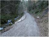 3
3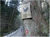 4
4 5
5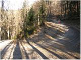 6
6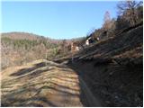 7
7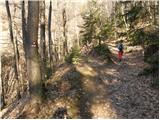 8
8 9
9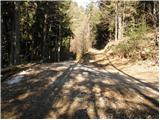 10
10 11
11 12
12 13
13 14
14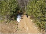 15
15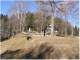 16
16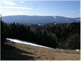 17
17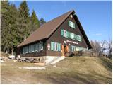 18
18 19
19 20
20 21
21 22
22 23
23 24
24 25
25 26
26 27
27 28
28 29
29 30
30 31
31 32
32 33
33 34
34 35
35
Discussion about the trail Bresternica (Spodnji Rušnik) - Možičev vrh (via Žavcarjev vrh)