 | Povodje - Šmarna gora
Šmarna gora is a 669 m high peak located north-west of the capital of Slovenia. The summit, which has a restaurant and a church, offers a beautif...
1 h 30 min |
 | Povodje - Šmarna gora (via Sedlo)
Šmarna gora is a 669 m high peak located north-west of the capital of Slovenia. The summit, which has a restaurant and a church, offers a beautif...
1 h 35 min |
 | Šmartno - Šmarna gora (path around Šmarna gora)
Šmarna gora is a 669 m high peak located north-west of the capital of Slovenia. The summit, which has a restaurant and a church, offers a beautif...
1 h 30 min |
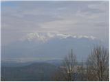 | Povodje - Šmarna gora (Partizanska steza)
Šmarna gora is a 669 m high peak located north-west of the capital of Slovenia. The summit, which has a restaurant and a church, offers a beautif...
1 h 45 min |
 | Skaručna - Šmarna gora
Šmarna gora is a 669 m high peak located north-west of the capital of Slovenia. The summit, which has a restaurant and a church, offers a beautif...
1 h 30 min |
 | Skaručna - Šmarna gora (via Sedlo)
Šmarna gora is a 669 m high peak located north-west of the capital of Slovenia. The summit, which has a restaurant and a church, offers a beautif...
1 h 35 min |
 | Skaručna - Šmarna gora (Partizanska steza)
Šmarna gora is a 669 m high peak located north-west of the capital of Slovenia. The summit, which has a restaurant and a church, offers a beautif...
1 h 45 min |
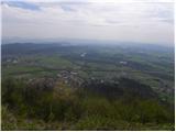 | Vikrče - Šmarna gora (Mazijeva steza)
Šmarna gora is a 669 m high peak located north-west of the capital of Slovenia. The summit, which has a restaurant and a church, offers a beautif...
1 h 35 min |
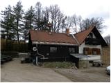 | Ljubljana (Šentvid) - Toško Čelo
Toško Čelo is a 590 m high hill above the village of the same name. From the top, or slightly lower down, you have a beautiful view of part of Lj...
1 h 45 min |
 | Vrzdenec - Koreno (via Samotorica)
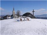
Koreno also Koreno is a 729 m high hill located north of Horjul. From the top, where there is a large cross, the Church of St. Mohorj and Fortuna...
1 h 45 min |
 | Polhov Gradec - Koreno
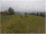
Koreno also Koreno is a 729 m high hill located north of Horjul. From the top, where there is a large cross, the Church of St. Mohorj and Fortuna...
1 h 45 min |
 | Povodje - Grmada
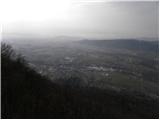
Grmada is a 676 m high mountain located to the west of the much more visited Šmarna Gora. From the top, where there is a small airstrip, we have ...
1 h 50 min |
 | Skaručna - Grmada
Grmada is a 676 m high mountain located to the west of the much more visited Šmarna Gora. From the top, where there is a small airstrip, we have ...
1 h 50 min |
 | Moravče - Sveti Miklavž above Sava
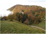
The Church of St Nicholas is situated on a hill south of Moravče. From the top you can enjoy a beautiful view of the nearby Limbarska gora, and t...
1 h 25 min |
 | Podvin pri Polzeli - Gora Oljka (upper path)
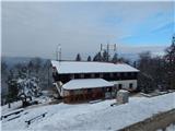
Gora Oljka is a hill located east of Šmartno ob Paki. On the top stands the Church of the Holy Cross, which was built in the mid-18th century. Ju...
1 h 35 min |
 | Podvin pri Polzeli - Gora Oljka (lower path)
Gora Oljka is a hill located east of Šmartno ob Paki. On the top stands the Church of the Holy Cross, which was built in the mid-18th century. Ju...
1 h 30 min |
 | Črni hribi - Trstelj
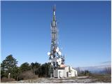
Trstelj is the highest peak in the Black Hills ridge. The view from the vast summit, where the TV transmitters stand, is split in half. From the ...
2 h |
 | Pedrovo - Trstelj
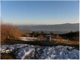
Trstelj is the highest peak in the Black Hills ridge. The view from the vast summit, where the TV transmitters stand, is split in half. From the ...
2 h |
 | Slovenske Konjice - Skala (gentle path)
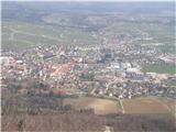
Skala is a viewpoint on the eastern part of Konjiška Gora. From the viewpoint, which has a table, bench and a registration box, there is a beauti...
1 h 30 min |
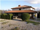 | Lokev - Kokoš
Koča na Kokoši is located at the top of Jirmanec, just 5 minutes away from the forested Kokoša. The summit, located south of the Lokavsko polje a...
1 h 30 min |
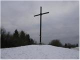 | Blečji vrh - Gradišče (via Kucelj)
Gradišče is a lesser-known peak located north of Višnja gora. From the top of the hill, where a large cross stands, there is a beautiful view of ...
1 h 30 min |
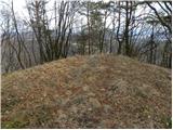 | Pristavlja vas - Pristava above Stična
Pristava above Stična is a small village located on a scenic hill north of Stična. A little above the village, by the Partisan House, there is a ...
1 h 45 min |
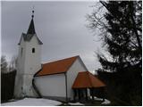 | Pristavlja vas - Sveti Lambert
Sveti Lambert is located on an inconspicuous peak near the village of Pristava above Stično. From the top of the hill, where the castle of the Du...
1 h 45 min |
 | Divje jezero - Zagrebenc
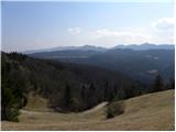
Zagrebenc on some maps also Čekovnik is a 763 m high peak located between Hleviška planina and the valley of the Idrijca River. The grassy peak, ...
1 h 30 min |
| Tourist farm Žurej - Žusem (Panoramska pot - stara trasa)
Žusem is a 669-metre-high hill with a colourful history and great potential for the future. It represents the northern edge of the Kozjansko regi...
1 h 40 min |
 | Turistična kmetija Žurej - Žusem (Panoramska pot)
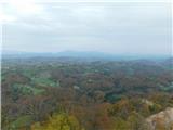
Žusem is a 669-metre-high hill with a colourful history and great potential for the future. It represents the northern edge of the Kozjansko regi...
1 h 40 min |
 | Travnarjev gozd (Hotenjsko podolje) - Šenčurjev vrh
Šenčurjev vrh is a 725-metre-high hill located above the settlement Žibrše, between Logatec, Hotedršica and Rovtami. At the top, which offers a b...
1 h 50 min |
 | Planinski dom Milana Šinkovca - Šenturška Gora
Šenturška Gora is a settlement located between the Tunji Hills and Krvavec. From the church, the village or the nearby agritourism, we have a bea...
2 h 15 min |
 | Planinski dom Milana Šinkovca - Šenturška Gora (via Zaloški rob)
Šenturška Gora is a settlement located between the Tunji Hills and Krvavec. From the church, the village or the nearby agritourism, we have a bea...
2 h 15 min |
 | Zalog pri Cerkljah - Šenturška Gora
Šenturška Gora is a settlement located between the Tunji Hills and Krvavec. From the church, the village or the nearby agritourism, we have a bea...
2 h |
 | Bridge over Dušica - Bajturn (Zaplaški hrib) (on north slope)
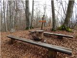
At 609 metres, Bajturn or Zaplaz Hill is the highest peak in the municipality of Trebnje. At the top there is a nice bench with a table, a box wi...
1 h 30 min |
 | Okrog (Lazar) - Bajturn (Zaplaški hrib) (on ridge)
At 609 metres, Bajturn or Zaplaz Hill is the highest peak in the municipality of Trebnje. At the top there is a nice bench with a table, a box wi...
1 h 30 min |
 | Okrog (Lazar) - Bajturn (Zaplaški hrib) (on north slope)
At 609 metres, Bajturn or Zaplaz Hill is the highest peak in the municipality of Trebnje. At the top there is a nice bench with a table, a box wi...
1 h 40 min |
 | Višnja Gora - Sveti Duh (Polževo)
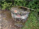
The Church of the Holy Spirit is located 630 metres above sea level, on a hill above the Polževo Hotel. The stamp is located some 10 metres away,...
1 h 30 min |
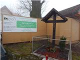 | Gorjuša - Sveta Trojica (above Dob) (via Dobovlje)
Sveta Trojica is a village located southeast of Dob at Domžale, and the Church of the Holy Trinity stands on the upper part of the village, on a ...
1 h 50 min |
 | Radlje ob Dravi - Sveti Anton na MP Radelj / St. Anton am Radlpaß (via old castle)
The Church of St Anton at Border crossing Radelj / St Anton am Radlpaß is located on the Austrian side of the Kozjak Mountains, on a 720-metre-hi...
2 h 15 min |
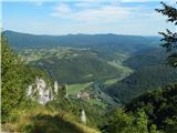 | Predgrad - Kozice (by road)
Kozice is a 741-metre-high peak with an RTV transmitter located above the left bank of the Kolpa River. From the lookout point on the southern pe...
1 h 30 min |
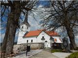 | Brezno - Sveti Jurij (Remšnik) (along Remšniški potok)
The Church of St George is situated on a lookout point in the settlement Remšnik, which is on the slopes of Kozjak. Opposite the church, next to ...
1 h 35 min |
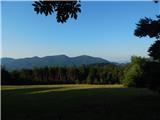 | Zreče (Terme Zreče) - Golek
Golek is a 769-metre-high peak located north-west of Zreče. At the top there is a registration box with a registration book, a stamp and a bench,...
1 h 25 min |
 | Zreče (Terme Zreče) - Golek (via Bork)
Golek is a 769-metre-high peak located north-west of Zreče. At the top there is a registration box with a registration book, a stamp and a bench,...
1 h 30 min |
 | Zreče (Terme Zreče) - Golek (via Tourist farm Ančka)
Golek is a 769-metre-high peak located north-west of Zreče. At the top there is a registration box with a registration book, a stamp and a bench,...
1 h 35 min |
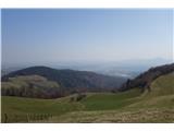 | Center Vintgar - Lookout point at Ančnikovo gradišče (via Bistriški vintgar)
The viewing platform is located close to Ančnik's hillfort. The platform offers a beautiful view. We can see the place Slovenska Bistrica and it...
1 h 30 min |
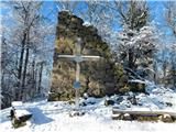 | Bad Gleichenberg (Eichgraben Weg) - Gleichenberger Kogel (via Steinriegel)
The Gleichenberger Kogel is a 598-metre-high volcanic mountain located above Bad Gleichenberg in Styria, Austria....
1 h 55 min |
 | Prelaz Vrhe - Maceljska gora (via source of Sotla)
...
1 h 50 min |
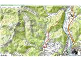 | Rein - Pfaffenkogel
...
1 h 30 min |
 | Vuzenica - Sveti Janez Krstnik (Šentjanž nad Dravčami)
...
1 h 25 min |
 | Vuzenica - Sveti Primož (Sveti Primož na Pohorju)
...
1 h 30 min |
 | Straßengel - Generalkogel
...
1 h 30 min |