Starting point: Črni hribi (400 m)
| Lat/Lon: | 45,8643°N 13,6646°E |
| |
Time of walking: 2 h
Difficulty: easy marked way
Altitude difference: 243 m
Altitude difference po putu: 400 m
Map: Goriška 1:50.000
Recommended equipment (summer):
Recommended equipment (winter):
Views: 19.902
 | 1 person likes this post |
Access to the starting point:
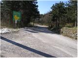
From the expressway Razdrto - Nova Gorica take the exit Vogrsko and continue towards the village Volčja Draga. From Volčja Draga, continue towards Bilje, but only as far as Bukovica, where you turn left towards Renče. In Renče, turn right after the church and then drive straight towards the village of Temnica. When the road stops climbing, you will see the information board of the municipality Miren - Kostanjevica on your left. Park in the parking lot near the sign.
From the Novogorica side, you can also reach the village Volčja Draga by passing Šempeter.
Path description:
From the sign near where we parked, continue along the asphalted road for about 50m, then the signs for Trstelj direct us left into the forest. After the first climb, the quite overgrown path leads us to Vrtovka. From the top, the path descends and then leads us partly on fotpaths, tracks and roads.
The well-marked path, which mostly passes through the forest, takes us over the aforementioned Vrtovka, Lešenjak, Stolovec and the Chair, with a few drops and climbs, and after two hours of walking leads to Trstelj, from which we have a beautiful view.
Pictures:
 1
1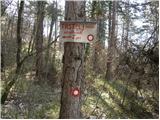 2
2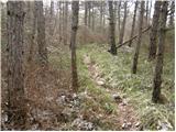 3
3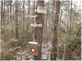 4
4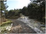 5
5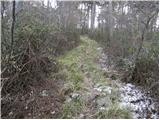 6
6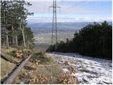 7
7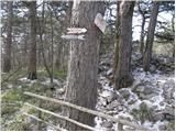 8
8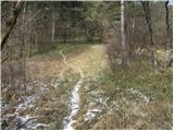 9
9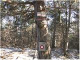 10
10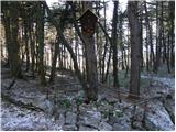 11
11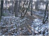 12
12 13
13
Discussion about the trail Črni hribi - Trstelj
|
| krsto712. 12. 2011 |
Videti je zanimiva pot...A obstaja še kakšna pot (mogoče krožna) z drugim izhodiščem, ki bi zajemala navedene vrhove ?
|
|
|
|
| mirank3. 12. 2011 |
Poti je vse polno tam okoli, tako da ni nobenega problema. Tudi teren je tako pregleden, da z orientacijo ne boste imeli nobenih težav pa tudi če boste šli na "celo", saj je vse lahko prehodno
|
|
|
|
| krsto713. 12. 2011 |
Super, hvala za pojasnila...Katero izhodišče pa je najbolše za obisk Trstelja, Stola in Stolovca, Vrtovke? Opisana pot mi je sicer zanimiva in všeč za zimski pohod, vendar se mi ne da po isti poti gor in dol, tako, da bi rad obiskal vse vrhove in naredil krožno pot. Izhodišče pa bi si izbral nekje med Trsteljem in izhodiščem, ki je omenjeno v opisu poti...
|
|
|
|
| wolphgang4. 12. 2011 |
ce bi radi krozno turo, vam svetujem, da pustite avtomobil pri lovski koci nad rencami (cesta rence-temnica), na ovinku pred koco se od ceste odcepi oznacena pot. Ko pridete na vrh, pa naredite celo precenje, ki ga omenjate. ko pridete na asfaltno cesto se pa po njej desno, spustite do izhodisca. hoje po cesti je za priblizno 15min, cesta je pa malo prometna
|
|
|
|
| krsto715. 12. 2011 |
Hvala za pojasnila, bom to varianto poskusil, v vsakem primeru se mi zdi krožna pot bolj zanimiva, kot pa po isti gor in dol... Hvala.
|
|
|
|
| ales505. 12. 2011 |
tukaj so treskale granate in vse težjih kalibrov,kjer so bili avstrijski položaji med soško fronto,sedaj je pa trava in težko prehoden teren skozim gozd
|
|
|
|
| anazala19. 10. 2017 |
Črni hribi so fantastična pot. Za mlajše otroke in starejše odrasle. Ni zahtevna pot. Uživali boste. Razgleda je tudi nekaj. Na vsakem hribu se vidi v dolino. 
|
|
|
|
| Anči114. 01. 2026 21:10:41 |
Super pohod,po 4h vrhovih pridete do koče,prijazno osebje,super vzdušje,lahko plačate s kartico. Slabi dve urci pocasne hoje,nazaj smo šli po cesti. 
|
|
|